
| Red Centre Walking |
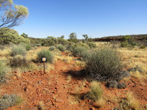
Rainbow Valley (2 km) |
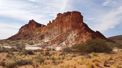
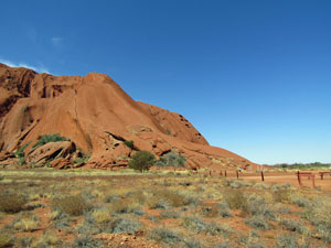
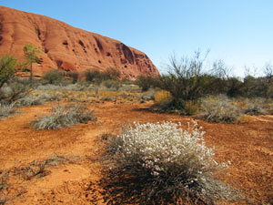
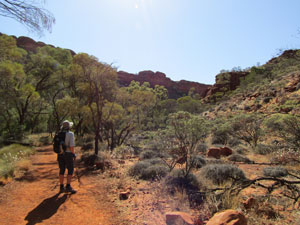
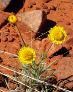
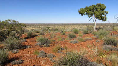
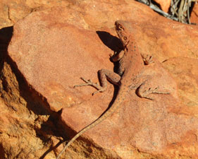
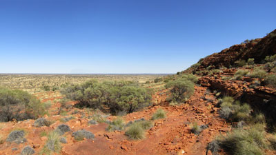
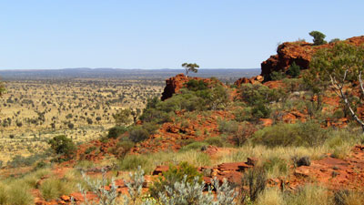
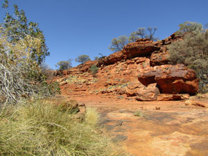
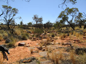
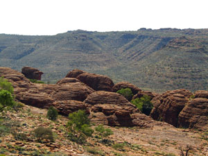
We stopped at Rainbow Valley, 100km south of Alice Springs and 23km of dirt road in from the highway, on the way to Uluru. It is more a flatland than a valley, with some large pinkish-grey coloured claypans surrounded by red sand-dunes and backed by a heavily eroded band of sandstone rock in a tapestry of ochre colours - a very pretty sight. We arrived late afternoon, to pitch our tent and set up our deckchairs to watch the sun set over the colourful red, yellow and white rock formations of Rainbow Valley, until the chill drove us early to bed. |
|||
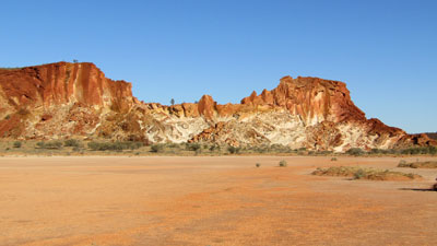 The sandstone outcrop and claypan at Rainbow Valley |
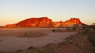 Sunset over Rainbow Valley |
||
 |
 |
 |
 |
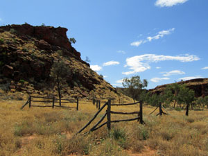
Initially, the plan was to spend two nights here, as I had hoped to extend the short marked walk to follow a gap through a nearby range and reach the dry sandy bed of the Hugh River. That was not to be, as we discovered that people are asked not to walk beyond the designated areas for cultural reasons - a fence reinforced this request. In addition, a sharp cold front had reached the area and cold gusty southerly winds chilled the bones and flapped the tent overnight and in the morning. |
|
|
|
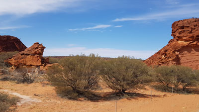
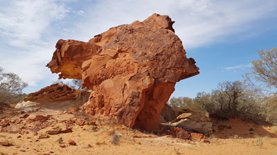
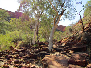
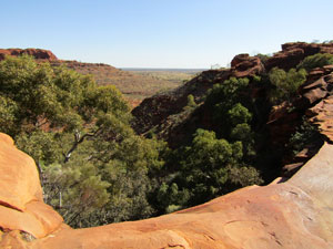
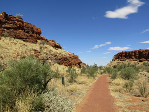
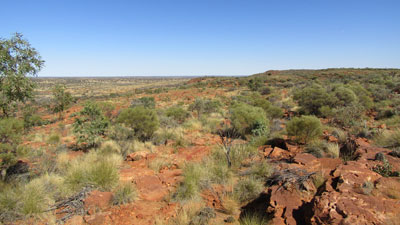
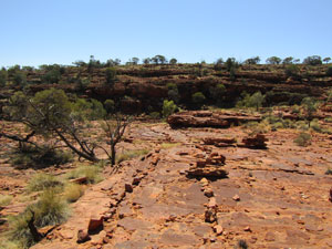
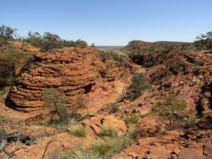
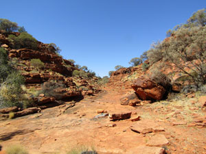
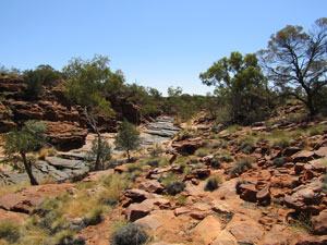
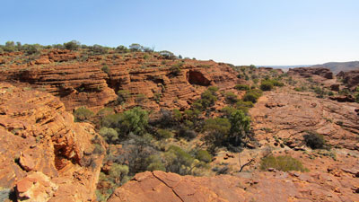
Thus we abandoned the 2-night stay and packed up after a short morning walk over the dunes, past the coloured cliff face to reach mushroom rock - a curiously eroded sandstone outcrop. A smooth hollow in the rock attested to past visitation over the millenia, as here seed had been ground into flour by generations of the traditional owners. This was as far as walking is allowed, so we followed the path back alongside the claypan to reach the car, hopped in and headed of to Uluru. |
|
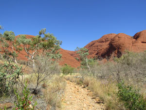
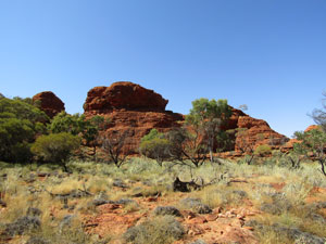
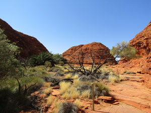
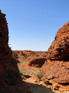
Uluru Base Walk (11.5 km - 10m ascent - 10m descent) |

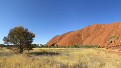
Twenty-eight years seems a long time. It was 28 years since we last visited Uluru and it was interesting to see what has changed - mainly big additions to the tourist infrastructure, but for the moment, strangely quiet. Covid-19 has seen to that - no influx of tourists from Asia, backpackers from Europe, or even local tourists from the locked down big cities of the south-east, but just a small subset of covid escapees such as ourselves. It is a strange new world. The one thing that hasn't changed is the rock itself - still that magnificent imposing monolith rising from the desert floor. It was good to be back here to see it it again, for which we must thank Covid-19. With our home city and surrounds locked down, we choose to stay away. We have become wanderers - free but homeless. It is comforting to visit a place that has a past connection. |
||
 |
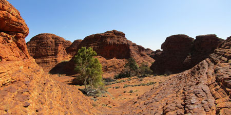
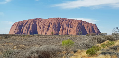 Uluru |
 |
When we were here all that time ago, we did two things - one is now impossible. We climbed the rock and we walked around its base. Since 2019, the climb is no longer permitted for cultural reasons - the local Anangu people hold Uluru to be sacred and for people to to climb it causes them distress. The closure is a good thing - in hindsight we regret our insensitivity. All attention is now placed on the Base Walk, an 11 km circumnavigation of Uluru and a chance to appreciate its different facets and learn a little of the culture attached to it. We pitched our tent for the next three nights at Yulara Campground. A cold air stream was still blowing through and night time temperatures fell quickly. Luckily, we had both our summer and 3 season sleeping bags .... double-bagging kept us cosy and once the sun rose, temperatures quickly warmed up. |
||
|
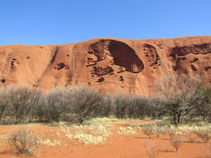
 View of the north face of Uluru from Mala Trailhead |
|
After a lazy breakfast, we drove to the Mala Trailhead to start our walk. Looking up, we could see the scar of the hundreds of thousands of feet that over the last century had climbed to the top - the easiest way to ascend, but still a steep 45° pitch on bare red rock. It had claimed its fair share of victims over the years - perhaps another good reason to halt the climbing. |
||
 The old ascension spur when climbing was allowed |
 |
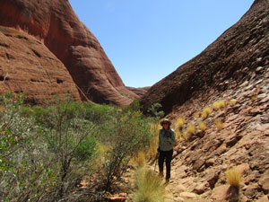
 Heading off on the base walk |
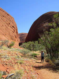
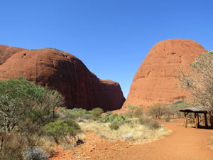
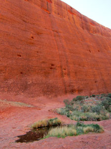
The base walk has been greatly improved, a well-formed flat track all the way. From Mala, we headed west to do an anti-clockwise circuit. The track at first hugged the base of the rock, giving changing views of its walls towering above on the left. Not long after we passed the first of the sensitive areas - sacred sites where the traditional owners request no photos be taken. This is because the image is part of the lore being taught here and should not be viewed apart from it in other media. Thus, we rounded the impressive cavern and huge stone of Pulari, the place of women's business. |
||
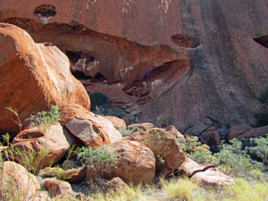 Bouldery rockscape near Pulari |
 |
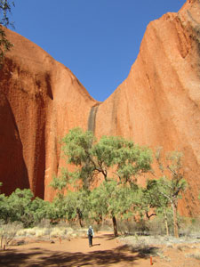
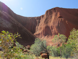 The southern face of Uluru |
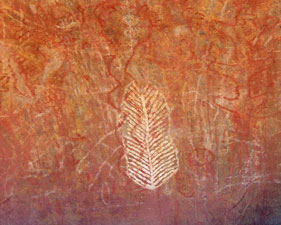
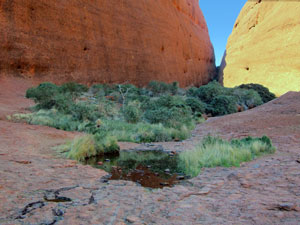
We were now on the southern side of Uluru, shaded and with denser vegetation. Here, a short detour led us into the cleft housing some rock art and the Mutitjulu waterhole. Above, the dark lines of past water-flows stained the pocked red rock, while signs explained how different rock features symbolised the dreamtime story of python lady and snake man. |
|||
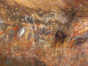 Rock art at the Mutitjulu shelter |
 |
 |
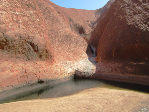 Mutitjulu Waterhole |
As we crossed the southern side, the track drifted out into the woodlands, giving a different perspective of the changing face of Uluru. |
|
 View towards Mutitjulu |
 On the Kuniya Walk (southern side of Uluru) |
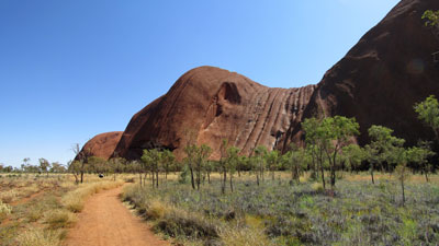
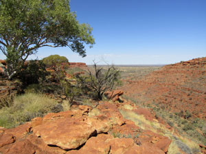
At the south-east corner, we reached Kuniya Piti, the site of secret men's business and time to put the camera away again. Here, the track veered well away from the base of Uluru into the flat mulga-covered plain to avoid the culturally sensitive sites of Taputji, Tjukatjapi and Warayuki. However, the perspective of distance showed the enormity of the rock, with its honeycombed faces and channelled slopes. |
||
 Landscape north of Uluru |
 Honey-combed northern face of Uluru |
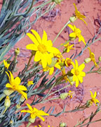
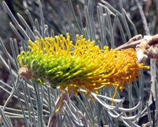
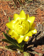
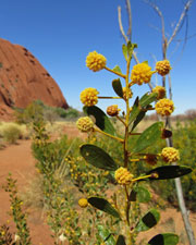
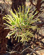
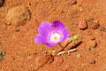
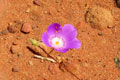
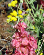
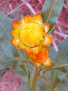
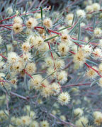
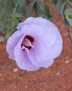
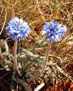
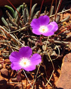
 Uluru wildflowers |
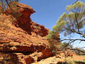
The path, now a dusty 4WD track, drifted back to join the vehicle road and, for a brief period, followed it, before making a bee-line towards the face of Uluru. On reaching the base, we turned left to follow the Kantju Gorge Walk, This led us past some shallow, but impressively curved overhangs - the underbelly of Uluru, remarked the fair Nello. Here, over the millenia, women cooked or ground seed into flour, old men sat and waited while ceremonies were performed and young boys were taught the skills to become a hunter. |
||
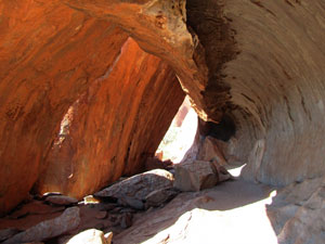 Overhang once used for shelter |
 |
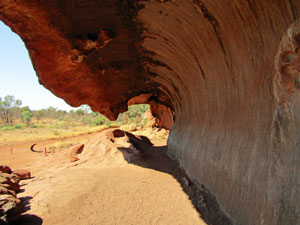 Wave formation overhang |
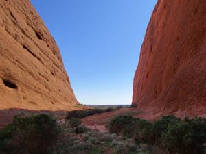
The track led to a shady glen at the base of a near-vertical red rock wall. A thin black stripe showed where water pours down when it rains to fill the waterhole at its base. You could see why this was a special place. |
 In Kantju Gorge |
|
 Route to Kantju Gorge |
 Uluru rock art near Kantju |
|
We retraced our steps to the junction and continued on the short distance to Mala - our circumnavigation was complete. Twenty-eight years is a long time, but it does not diminish the awe that Uluru evokes. It was good to be back.
That evening, we did the classic tourist thing and drove out to the sunset viewing area to rug up with a cold beer and watch the setting sun turn Uluru into a fiery desert beacon. |

|
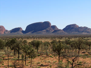
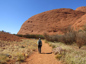
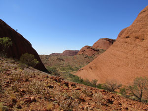
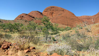
Kata Tjuta Walks (10.5 km - 430m ascent -430m descent) |
Valley of the Winds Walk |
We walked part of the Valley of the Winds 28 years ago, and were impressed with the majestic landscapes of Kata Tjuta (probably better known as The Olgas at that time). Now was the time to finish the job and do the whole loop.
|
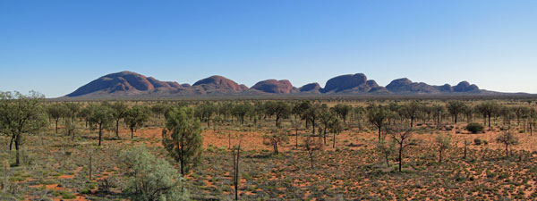
We drove the 45 km out to Kata Tjuta mid-morning - the cold desert nights were still not conducive to an early morning rise. After a brief stop at a red sand dune to view the length of Kata Tjuta's assortment of monolithic domes across the she-oak dotted plain, we headed on to the car park and start of the walk. |
||
 View across the she-oak plains |
 View across the dunes to Uluru |
 Kata Tjuta from the west |
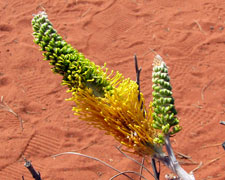
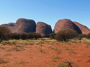
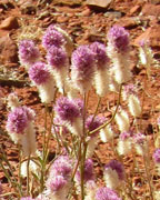
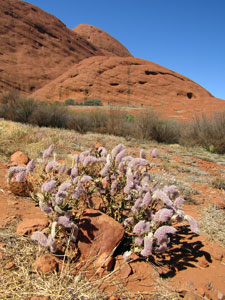
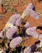
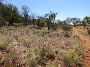
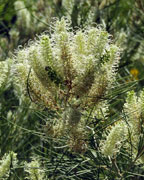
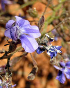
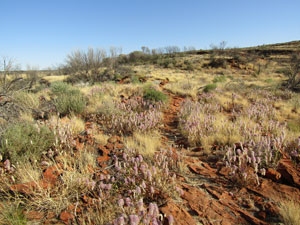
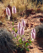
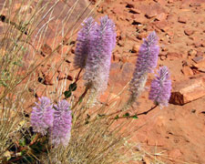
It had turned out a superb day - the wind had eased to a cooling breeze and the sky was a clear desert blue. The track started in front of a group of towering red conglomerate monoliths and the well-formed and well-used path led us slowly up to a broad gap. On either side, the mauve, white and purple flower spikes of Ptilotus added a dash of alternate colour to the red and maroon of the rock. |
|
|
 Heading off towards the rock domes of KataTjuta |
 |
|
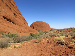
Soon we reached Karu, the first lookout of this walk and a place where many people turn around. Karu offered views down into the heartland of Kata Tjuta - a tree-filled valley beyond and a series of rock domes tapering off to the south. |
||
 View to the east from Karu Pass |
 |
 View to the west from Karu Pass |
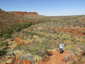
Continuing on, the track was less manicured, as it descended the sloping and crumbling rock into the valley to reach a junction and the start of the loop section of the walk. To our right, the walls of Kata Tjuta's dome glowed red in the sun. We turned towards them to follow the tree-lined creek into a narrower cleft between opposing rock domes. A ribbon of green led up into the cleft, rock walls towering on either side and in front of us. |
||
 The lovely setting of Valley of the Winds |
 |
 Climbing up between the rock domes |
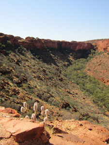
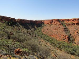
It wasn't obvious where the exit was until the track veered left to climb steeply up into an even narrower gap between the almost sheer walls of two adjacent monoliths. A short steep climb brought us to Karingana, the second lookout. The views from here were simply stunning - the sheer rock walls of this gap focussed the views to the rear and to the front. Behind, the even higher domes of Kata Tjuta imposed their redness on the field of view. Ahead, we could see the tree-covered plain below backed by the more distant outer domes of this massive rock formation. It was a place to stop for a bit of contemplation. |
||
 View to the west from Karingana Pass |
 View to the east from Karingana Pass |
 Descending the pass |
It was also the furthest we got 28 years ago, so now was the time to explore new terrain. A steep descent quickly brought us to the edge of the plain. Here the track wandered away from rock formations to give a taste of the open country and the dry creeks that flowed through it. The beautiful display of fluffy Ptilotus flowerheads was a feature all along this track. |
||
 A curious dome in the valley |
 |
 Southern walls of the central valley at Kata Tjuta |
Crossing this open landscape, we climbed a stony track up a drier hill within this broad bowl. Even here you could not escape the presence of the massive domed rocks of Kata Tjuta. |
 The flower-carpeted floor ..... |
 .... stony hills .... |
 .... and gravelly creekbeds of Valley of the Winds |
Descending the hill, we picked up a stony 4WD track that led us back to the track junction - the loop part was completed and all that remained was to retrace our steps back up to Karu Lookout and then down to the car park. The Valley of the Winds Walk was finally completed 28 years on, and we voted it one of the Great Short Walks - packing in a majestic scale of landscape in just a few kilometres. |
||
Walpa Walk |
There is a second walk in the Kata Tjuta area - the Walpa Walk - which is a 2.5 kilometre linear in-out walk that takes you up the deepest cleft in Kata Tjuta. We crossed the rough red base rock to enter the gorge, keeping to the right of the narrow band of dense vegetation that marked the water-course. |
||
 The entry of Walpa Gorge |
 |
 Looking back towards the entry of Walpa Gorge |
New infrastructure in the way of short footbridges was being installed as we walked, making this even easier than before. Eventually we reached a series of small waterholes and the track's end, where a new viewing platform allows you to look up to the end of the gorge, a steep and narrow cleft filled with impenetrable vegetation. |
||
 |
 The colours and reflections of Walpa Gorge |
 |
 Walpa Waterhole high up the gorge |
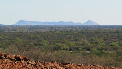 View westwards towards the Petermann Ranges |
Here, the point is to look upwards at the height of these almost sheer red walls and appreciate the scale of these monoliths in the landscape of Kata Tjuta and take that thought with you, as you descend to look out across the broad flat plains to the silhouettes of even more distant ranges on the horizon. |
|
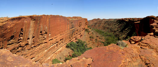
Kings Canyon Rim Walk (8 km - 260m ascent - 260m descent) |
Kings Canyon was another return to the past - we had camped here with our daughter 28 years ago and walked the Rim Walk, but the memory of it was fading. It was time to do this iconic short walk again. The cold weather had passed and the hot weather had not yet returned - in fact, with a few clouds in the sky, a gentle breeze and pleasant temperatures, it was ideal walking weather. We based ourselves in a cabin at Kings Canyon Resort, a few kilometres from the canyon itself, but set in the she-oak grasslands with pleasant views of the George Gill Range. |
|
 View from our cabin at Kings Canyon Resort |
 George Gill Range across the desert she-oaks |
 |
 Kings Canyon sunset |
 |
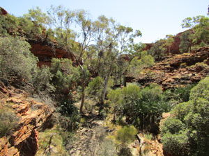
Setting out from the carpark, we headed off to do this loop walk in a clockwise direction. In fact, it is a loop walk with three side-tracks, and the first junction arrived quickly - a stroll on a paved path along Kings Creek and up inside the canyon. It was a delight to wander alongside the bouldery bed of the creek with its statuesque red gums. |
||
 Stony bed of Kings Creek |
 Heading up the canyon floor |
 Ghost gums lining the creek |
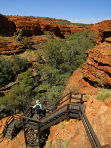
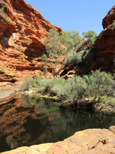
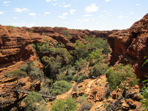
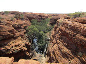
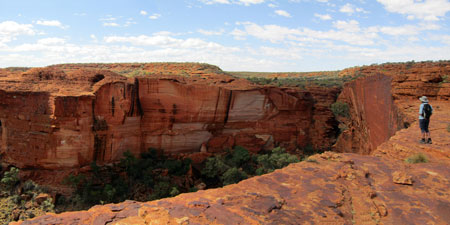
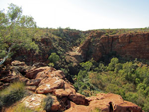
On either side the red walls of the canyon rose higher as we pushed deeper in, until we reached the end-point and a well-constructed viewing platform. From here, we could admire the walls of the canyon above us and see the little stick figures crossing Cotterills Bridge, part of the rim walk that crosses a deep fissure. Soon we would be there. |
||
 Looking up at Cotterills Bridge from the creek |
|
 On the canyon rim |
Retracing our steps down the verdant canyon floor, we reached the track junction and resumed the Rim Walk. Around 450 uneven stone steps later, we emerged onto the top of the range and a superb view down the length of Kings Creek. |
||
 View down into Kings Creek |
 Sandstone formations on the plateau |
 View down the next creek system |
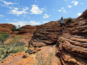
The climbing was far from over, as we continued to ascend into the layered domes of the Mereenie Sandstone. After a brief glimpse into the next gorge system to the west, we began to meander our way through these weathered beehive domes - a bizarre world of distorted red rock. |
|||
 Mereenie Sandstone formation |
 |
 |
 Sandy flat between the rock domes |
|
At times, the track brought us to the edge of the canyon for superb views across the gap to the sheer polished red and maroon walls of its southern side. |
|
 |
 Looking down over the rim into Kings Creek |
|
On reaching a second junction, we headed out across the beehive domes and across the footbridge we had seen from below to reach Cotterills Lookout. Here were the most spectacular of the views from the North Rim, a vista in red down the length of the canyon. As a bonus, we could also look down into the Upper Canyon and its waterholes and rich vegetation - the Garden of Eden - our next destination. |
 |
 Panorama of Kings Canyon from Cotterills Lookout |
 |
Retracing our steps back to the junction, we crossed more of the red domed rocky landscape to reach a set of wooden ladders that took us down to a point where we could cross the Upper Canyon on a footbridge. Here lay the third junction and, from it, we headed down into the Upper Canyon, sidling next to a long waterhole, lined with trees, shrubs and grasses - a haven for the birds and wildlife. Garden of Eden seems an apt name for this oasis in an otherwise bare landscape. |
||
 Descending the wooden steps to the upper creek |
 Waterhole in the Garden of Eden |
 Pool in upper Kings Creek |
It was the perfect place to enjoy our lunch, shaded by the rocks around the deep waterhole, where waterpennies skated across the surface in the sunlight and small birds twittered in the trees. Framing the waterhole, the red walls of the canyon rose steeply to create a narrow gap from which a waterfall flows down into the Lower Canyon after heavy rains. This is such an inspiring place that, when we were here 28 years ago, we met a Swiss visitor who was so roused by its beauty, he felt the need to yodel his praise. It actually seemed appropriate, though this time we just enjoyed the sounds of silence. |
||
 |
 Some aspects of Upper Kings Canyon |
 |
Retracing our steps to the junction, we climbed up a second set of wooden ladders to reach the Southern Rim and enjoy the equally spectacular views of the canyon walls from its edge. Here the sweeping vertical curve of the South Wall stands out. |
|
 The rusty-red beauty of Kings Canyon |
 View from Kestrel Falls |
The track now deviated away from the rim to follow a watercourse down through the Mereenie Sandstone domes and reach the top of the now dry Kestrel Falls in the gorge system to the south. Kings Canyon's neighbours have their own rugged red beauty on display. |
||
 On the pancake sandstone domes |
 |
 Loking over the dry lip of Kestrel Falls |
Finally we reached the long stepped path that led us down the spur of the South Rim. Ahead, the views expanded over the plains beyond these rugged ranges and, all too soon, we reached the bottom and the end of the walk. Without a doubt, along with the previously described Valley of the Winds Walk in Kata Tjuta, the Kings Canyon Rim Walk features high on our list of Greatest Short Walks. |
|
Giles Track and Kathleen Springs (22 km - 380m ascent - 400m descent) |
I have lumped these together because they both start from the same point at the entry to Kathleen Springs. The first is a 22 km ridge walk along the range tops to Kings Canyon, and is recommended as a 2-day hike. The second is a 2.5 km in-out walk along a paved flat track that meanders up an S-shaped valley to the actual Kathleen Spring. These are two very different walks and we did the second as a leg-stretcher near the end of a 300 km drive from Uluru to Kings Canyon Resort. It was an interesting walk, as mentioned, winding its way through flat straw coloured grasslands along the dry course of Kathleen Creek and edged by low rugged red-rocked cliffs. There was a scattering of wildflowers amongst the grass, but the real interest was the ruins of stockyards and water tanks from the days of the cattle run here. |
Kathleen Springs |
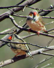
A little later, a sign explained that this place was a part of the Carpet Snake Dreaming - a sacred site for the Luritja people. This is a small valley, but one with a big clash in cultural usage. Towards the end, the vegetation became denser around small pools of water in the creek. These pools attracted flocks of chirping finches and other birds. |
|
|
 Old stockyard at Katleen Springs |
 Track into Kathleen Springs |
|

Crossing a reedy section on some modern boardwalk, we arrived at the end of the walk, where a dark-surfaced waterhole lay at the base of the converging cliffs. It would be a peaceful spot to reflect on the nature and culture of this site if you arrived alone, but a large and talkative group had beaten us. We left quickly, to retrace our steps and head on to Kings Canyon Resort. Tonight, we abandoned camping for a room in the lodge, where we could sit out on the verandah and sip a beer, while appreciating the sound and sight of desert she-oaks scattered amongst the pale yellow grasslands. It had been a good day. |
Giles Track |
Two days later, the fair Nello drove me back to Kathleen Springs to drop me off at the start of the Giles Track. Her knees were playing up, so a long day-walk on rough tracks was not a good idea, except that now I had someone to drop me at one end and pick me up at the other. Although recommended as an overnight walk, the track can be done in a long day and, with cooler temperatures and a shortage of time, this seemed the best option. |
||
 |
 The Giles Track, named after the explorer Ernest Giles who explored here in 1872 |
 |
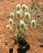
At 9am the fair Nello dropped me at the Kathleen Springs trackhead and I set off. The route up to the top of the George Gill Range here was a gentle spur and, with the wind at my back, I quickly climbed up through an arid landscape of scattered low shrubs. The trackside flowerheads of ptilotus brightened up the landscape. |
||
 Wildflowers on the climb up from Kathleen Springs |
 |
 Looking in to the gorge of Kathleen Springs |
Folllowing the orange markers, I wandered northwards on the rocky track to skirt the edge of the small gorge containing Kathleen Creek. From the rim, I could see the waterhole that I had visited two days ago and, beyond it, the dry stone bed of the upper gorge. The track now turned west to lead me through a flatter region where many shrubs seemed to be recovering from a recent fire - re-shooting from their bases. After a while, it began to descend slowly into the catchment of Wanga Creek, a grassy region backed by a band of red rock. |
||
 Marker on the Giles Track |
 |
 The rocky bed of Wanga Creek |
|
|
Crossing the bouldery bed of the creek, an attractive spot set within a low sandstone gulch, I began to climb back up onto the flat top of the range. The vegetation here was denser, with groves of hill mulga and other taller shrubs. In the cool of the morning it was pleasant walking and glimpses of the plain to the south appeared though the gaps, as did views toward the large basin in the interior of this range. The stony beds of Waru Creek and Hill Mulga Creek, with their picturesque river gums, were crossed quickly - I was making good time. |
||
 Waru Creek |
 |
 Now that's a good camouflage |
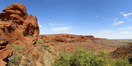
After crossing Hill Mulga Creek, the track followed its rocky bed upstream for a while, before climbing up a sandstone face and once again reaching the top of the range. Here, the range was becoming higher and more rugged, presenting a craggy rock face to the plains beyond. The path crossed to the southern side to follow a route along a rock shelf at mid-level. Red rock below, red rock above and the vaste plain of spinifex and desert she-oaks stretching out beyond - it was very pleasant walking. |
|
 Traversing the southern slopes of the George Gill Range |
 Panorama of range and plains |
At the end of this rock face, the track crossed a small gorge to begin the long descent of Tjinjit Tjinjit Spur, steeply across broken rock shelf at first, then gently through shrublands to almost reach the base of the range. Arriving at a junction, one route continued down towards the Lilla Trackhead, the other turned back up to cross the spur. I followed it, but no sooner had it reached the top of the spur, than it descended sharply to cross a deep rock gully that separated the spur from the main range (you can assume by now that all gullies and creek beds at the edge of this range are rocky). |
||
 A few rocks to guide you across the slabs |
 Lunch spot in the gorge of Rocky Creek |
 The winding course of Rocky Creek |
A steep climb led up onto the range, only to descend again once it reached Rocky Creek. This creek has formed an impressive mini-gorge through the red sandstone as it wound its way down to the plain beyond - it was a good place for a break. A second steep climb led me higher up onto the range. It was almost all on rock and it became necessary to keep a close lookout for the next orange marker or row of aligned stones to stay on track. Once on top, the landscape reverted to the now familiar flatter shrublands. As it neared the edge of the range, you could look down on to the houses of the Lilla Community where the traditional owners lived. |
||
 Heading back up to the top of the range |
 |
 Open land on the plateau |
A little further on, I reached Reedy Creek - reedy by name, rocky by nature - crossing at another ruggedly beautiful mini-gorge whose moister microclimate sheltered cypress pine and red gum. A few hundred metres up Reedy Creek lies the campsite for the overnight hike - it must be one of the few places you can pitch a tent in this incredibly rocky terrain. I didn't go there, as I was on a mission to complete the walk in one hit. I did stop for lunch though in the shade of an overhang. |
||
 Reedy Creek |
  |
 Climbing Reedy Bluff |
The next section of the walk was a highlight. Leaving Reedy Creek, the track headed up and over a shrubby rise. At the top, I was greeted with the view of a cluster of sandstone domes, with their beehive layering of red and black. This was the route up to Reedy Bluff and I quickly crossed over a small basin to meander my way up though the formations and reach the top of the Bluff. The track did not approach the edge, but offered an expansive view of more lines of distant red ranges to the north. |
|
 Route through the sandstone domes of Reedy Bluff |
 View across the plateau to the northern ranges |
Descending gradually off Reedy Bluff, I found myself crossing yet another long section of flattish, terrain - rock plates, gravel and red sand, tall shrubs and spinifex - for the first time I began to wish this section would end as the track commenced a steady climb up to Watarrka Lookout. Reaching the lookout quickly changed my mood, as I found myself looking down on the southern side of Kings Canyon - an immense field of Mereenie sandstone domes and the plain disappearing in the distance beyond. |
||
|
|
|


I could also see the descent route across the large rock bowl. The only problem was that the route to it detoured around the bowl, first heading north to contour along a rocky platform that formed part of the cliffs of Watarrka Head. The moving panorama of red rock cliffs and formations was magnificent, as I traversed. After crossing the top of a dry waterfall, the track eventually found a route down and turned for home along a stony creek. |
|
 Looking back towards Watarrka Head |
 In the heart of the Mereenie sandstone domes |
|
The next section was an amazing meander amongst the domes - up, down, around, over, through - to reach a junction with the Kings Canyon Rim Walk. I really had to keep an eye out for those orange markers on this plate rock surface. The Giles Track now merged into the Rim Walk, and all that was left was to follow my route of the day before and descend the southern spur of the canyon to the carpark and trail head below, where the fair Nello was waiting to drive me back to Kings Canyon Resort for a celebratory beer. |
|

It had taken 6h30 to walk the 22 km from Kathleen Springs to Kings Canyon and, although the track is not difficult, the surface is very hard and uneven - I confess that the soles of my feet were feeling very sore at the end. Perhaps I need a new pair of boots. Still, as the fair Nello remarked "it's not bad for a 71 year-old". |
|
