Flight over Lake Eyre and The Painted Hills (360 km) |

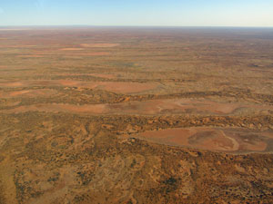
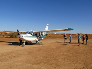
The time to head homewards had arrived. We set off from Kings Canyon to rejoin the Stuart Highway and head south. Crossing in to South Australia from the Northern Territory was easy enough, but this is the desert and the covid control point lay further south in the tiny village of Marla. The covid-19 outbreak in the Territory had rattled the South Australians and it took 30 minutes in a queue to have our permits checked and be allowed entry. This pandemic is certainly changing the way we travel. We had a bit of a diversion planned for South Australia, something we wouldn't normally do - take a tourist flight over Kati Thandi (Lake Eyre), Australia's largest salt lake and, at 15m below sea level, the lowest point on the continent. After overnighting in an underground motel at the opal mining town of Coober Pedy, we cut across the desert lands on a rough gravel road to reach William Creek, which comprised a pub, a campground and an airstrip. We had a beer at the pub, stayed in a cabin at the campground and, next morning, flew out of the airstrip in a GA8 Caravan, with our pilot, Elody, and four other passengers for our flight to Kati Thandi. |
||
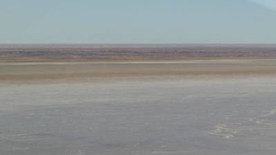
 Desert landscape east of William Creek |
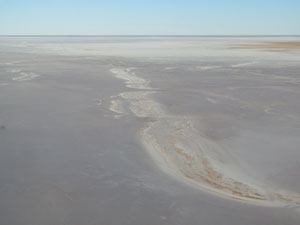
 Saline clay flats near the lake's edge |
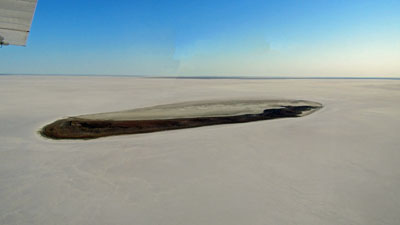
 Peninsula jutting into the lake |
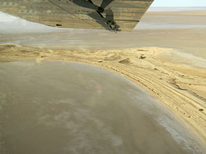
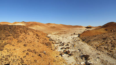
We took off soon after sunrise, in the still morning air and clear skies. We had been fortunate as yesterday the strong winds had made flying in the 8-seater plane a bumpy and not so pleasant affair. Our flight was going to be a smooth one. Elody flew us in a bee-line towards the lake, across the arid landscape, with its dry creekbeds, empty pink claypans and low bleached hills. After 30 minutes, we could see the edge of the lake appearing - Elody took us down to 500 feet (has aviation not been metricated?) for a low flight over the Belt Bay region of the lake, with its tinted salt crust and small dark islets that serve as roosting spots for the waterbirds that flock here when the lake fills. It had not rained in the catchment for some time now and there was no free water for us to see ... just a couple of freshwater springs in the middle of the salted surface - fascinating. |
|
|
|

 Kati Thandi saltscape |
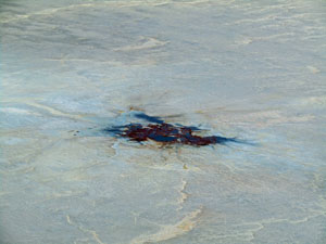 Fresh water spring in the salt crust |
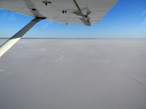 The white expanse of the salt crust |
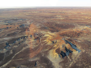
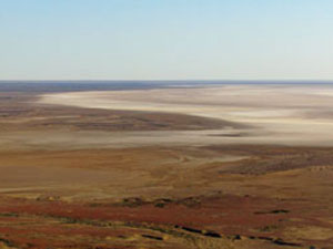
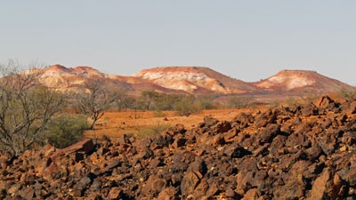
After a big loop over the Belt Bay area, from where we could see the salt crust vanishing into the eastern horizon, Elody tok the plane back up to cruising altitude and headed southwest to cross the red gibber plains and pink claypans of Anna Creek Station, a cattle property of 24000 sq km. Our bearing was to The Painted Hills, the remnants of an ancient landscape accessible only by air. |
||
 Leaving Kati Thandi |
 Claypan country |
 Red gibber plains |
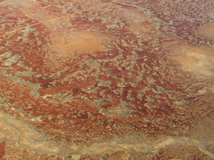
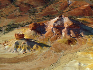
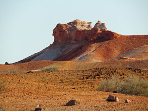
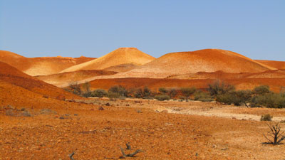
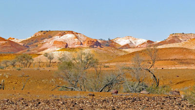
The Painted Hills are crumbling formations of brittle light shales in yellow, white and orange, occasionally cut through by dry sandy tree-lined creekbeds. After a low and slow fly over to take in this surreal landscape, Elody lined up the relatively new dirt airstrip and landed us on a flat area next to the hills. It was time for the highlight of the trip, a short wander on foot through a part of this ochre-paletted region. |
|
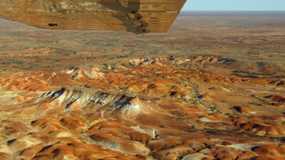 Painted Hills flyover .... |
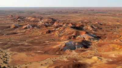 ... with their amazing colours and eroded shapes |
 |
 |
 |
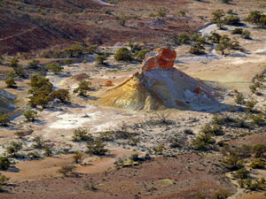
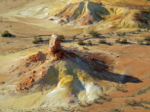
The geology was even more amazing from the ground. Elody led us on a wander up a gravelly creek bed past crumbling shale slopes of varying iron-leeched hues, to see remnants of fossilised trees, intrusions of volcanic basalt and granite boulders split into perfect yin-yang shapes by the heat and cold of the desert, as well as beds of stromatolites, those ancient generators of oxygen in our atmosphere. |
||
 Landing at The Painted Hills |
 |
 One of the more spectacular hills |
|
|
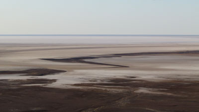
All to quickly the walk was over and we were back on board the GA8 caravan for the flight back to William Creek. There was time to have a cup of coffee in the quaint old pub before heading off on the road again - a long trip on the rough gravel surface of the Oodnadatta Track. We made one brief stop to have a look at the edge of Lake Eyre South, a basin separated from the main lake by a narrow channel and one which sees water even less frequently than the larger northern bowl of the lake. |
||
 |
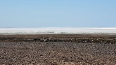 Salt Crust of South Lake Eyre |
|
|