
| Eastern MacDonnells |
Getting There |
It was a two day drive to get from Katherine to Alice Springs, with an overnight stop in Tennant Creek. In fact, we were lucky to make it .... when we pulled in to a roadhouse on the Stuart Highway 3 hours after leaving Katherine, we heard that the town was about to go into lock-down for a week, as a covid infection was detected there. That was a narrow escape .... we were starting to feel a bit like Pacman, with the virus nipping at our heels. |
|
 The Devils Marbles - a rock formation near Tennant Creek |
 On the Stuart Highway heading south |
The object of the exercise was to visit the East MacDonnell Ranges. Alice Springs lies in the middle of the MacDonnell Ranges and we had been here in 1994 for a camping trip that included the West MacDonnells, and again in 2014, when the fair Nello and walked the Larapinta Trail from Alice Springs Telegraph station to Mt Sonder - one of the truly great desert walks. It could be said that we know the West MacDonells fairly well. It could also be said that we don't know the East MacDonnells and this trip was to correct that.
|

There are no multi-day walks on this end of the range, so we opted for a series of day-walks to cover as much as we could of the rugged hills, gaps, gorges and waterholes that feature here. To do this, we based ourselves at Ross River Homestead, an erstwhile cattle property and now tourist resort, set pleasantly on the grassy Ross River flats beneath the red rock slopes of the ranges. It was a nice place to come back to for a cold beer watching the sun set. |
|


Yeperenye Track (8 km - 80m ascent - 80m descent) |

The Yeperenye Track is one of the newest walking tracks in Australia. Only opened a month ago, it was designed and built as a dual-use track (walking and cycling) by the Eastern Arerrnte traditional owners of this country, to raise awareness of the cultural significance of the region. It connects two sacred site, Anthwerrke (Emily Gap) and Atherke (Jessie Gap), which form part of the Caterpillar Dreaming songline. Anthwerrke and Atherke are two gaps in the Eastern MacDonnell Ranges, where water has cut through the hard rock, leaving a sandy creek bed lined by imposing rock faces. Both places have rock art sites depicting images of the Caterpillar Dreaming, but photography of these and of the inner gaps is not permitted - such is the sanctity held by the people for them. |
||
 Anthwerrke (Emily Gap) |
 |
 The bed of Emily Creek |
When I planned this trip, Ididn't know about the walk, but now that we are here it is a must do. The only problem is that it is one-way, not a circuit. However, wonderful person that she is, after we had looked at the rock art in Anthwerrke, the fair Nello offered to leave me at Emily Gap so that I could do the walk, while she drove on to Jessie Gap and read a book in the shade. I set out, heading quickly eastwards on a well-formed track - compacted red earth and stonework in some parts made for easy walking, as I strolled with the range on my left and the arid plain on my right. |
||
 Yeperenye track - looking back to Anthwerrke |
 |
 A couple of nice hill mulga |
 The lower slopes have scatterings of low shrubs |
 A curious mesa formation south of the range |
The track tended to follow a contour at the base of the range, before veering away to climb a small reddish hill and circle its top. This offered an excellent panorama of the Eastern McDonells back to the west as well as to the east, along with the vista out over the dry woodlands and spinifiex plains beyond. Checking the prints in the red dust, I could see that track was being used - several sets of boot prints, two mountain bike tracks and a couple of goanna trails. |
|
 The MacDonnell Ranges stretching eastward |
 To the south the landscape is very flat |
Heading back towards the ranges, the track slowly climbed up through the shrub-covered slope to reach a higher contour not far below the base of the rock-faces that guarded the top of the range - this section highlighted the ruggedness of these ancient rocks. The track meandered along this contour, passing through shrublands and thickets of silver-leafed mulga, steep-walled ranges on one side, open plains on the other. |
|
|
 Heading east on the Yeperenye Track |
 |
|
 Climbing up higher into the range
From this height, the views over woodland and spinifex beyond were even more impressive. |
|
 Looking back at the track skirting the base of the range |
 Panorama of the spinifex plains |
Ahead, I could pick out the indent in the range that marked Jessie Gap. It signalled a steady descent down to the shady visitor area, where the fair Nello was waiting - time for lunch and a quick visit to the Atherke rock art site in the gap. |
|||
|
 |
 |
 |

The local community has done a great job in opening this country up to the visitor - the landscapes here rival those of the better known Western MacDonnells and I appreciated the opportunity to get up close to them. Moreover, it is an easy track that can be walked by the less experienced (though don't forget your water). PS can anyone tell me why wild budgerigars would come and sit on your car when you are in it and stay, completely indifferent to your presence. It was one of our stranger wildlife encounters. |
|


Trephina Gorge - Ridge and Chain of Ponds Trails (12 km - 410m ascent - 410m descent) |
After finishing the Yeperenye Track, we drove eastwards along the southern flank of the East MacDonnells, stopping briefly at Corroboree Rock (a sacred men's site for the Eastern Arrernte people), before heading to Ross River Homestead. This would be our base for the next few days, as we explored the spectaclular gorges of this range. |
|
|
|


|
Trephina Gorge Conservation Park has a number of marked trails and can be walked as a long circuit, which unfortunately means walking 8 km on a dusty road. We chose to explore both ends separately - doing a longer partial circuit from John Hayes Rockhole and then driving to the north to do a smaller circuit in Trephina Gorge itself. Thus, on arriving at the park, we turned to drive the 4km down a single-lane 4WD track to the rockhole. It was arguably the roughest track I have driven on and required the occasional 4-letter words of encouragement to get through. Had I known the state of the track, I doubt that I would have come here - I'm really glad I didn't know, as the walk was superb. |
|
 Heading up the slope from John Hayes campsite |
 |
 The redrock hills surrounding John Hayes Rockhole |

We set out From John Hayes campsite to follow the nicely formed Ridge Track up the side of an arid, but shrub-covered hill. Already, views were opening out over the broader MacDonnells landscape to the east. |
|
Rounding the back of the hill, the track approached the edge of a dark red rock gorge, offering superb views into its interior. We took note, as this was to be our return route. Ahead, the rugged ridgeline of the main range towered above us. |
|
 |
 Sandy creekbed above the gorge |
|

 View towards the promontory of Turners Lookout |
 Ascending the eastern flank of the ridge |
 Nearing the lower ridge |
From the viewpoint, the track descended to a gum tree-lined sandy creek bed and we turned to follow it, before climbing up and over a low saddle in the shade of thickets of hill mulga. Descending into the next catchment, we crossed a stony creek-bed, before commencing the long climb up to the ridge line. Gentle at first, the track meandered through the scrubby trees to commence a series of long switchbacks that took us up into the lower slopes of the range. |
||
|
 View eastwards from the faux-ridge |
 |
After a few more switchbacks on good track, the route began to assault the ridge-line more directly and we scrambled our way over the rocks and boulders of the steeper mid-slopes. I think the soles of my boots are wearing a bit thin - I was starting to feel the pointiness of the rocks. |
||
 |
 View south from the ridge |
|
The climb up to the ridge was hot work and a couple of false crests did not help, but finally we emerged on to the top, to be greeted by a pleasantly cool breeze. |
|
 The colour of the MacDonnells |
 Vista to the west from the ridge |
We stood at a track junction - straight onwards the Ridge Track continued all the way to Trephina Gorge several more kilometres away, while a short detour headed out 400m to the left across the relative flat, spinifex- dotted tops to Turners Lookout. |
|
|
|


It was a huge panorama that greeted us - the lookout is at the end of a bluff protruding out from the range and offered 360° views over the plains to distant ranges, down on gaps and curious arid hillocks and striated maroon / green lines of range. We took our time to appreciate it all before retracing our steps down the rocky slopes, along the switchbacks, through the catchments back to the sandy creekbed and another track junction. |
||
 The sandy bed of John Hayes Creek .... |
 ... cuts in through the red rock .... |
 .... to form an impressive gorge |
The creek was in fact the top of John Hayes Creek and the route ahead was part of the Chain of Ponds Loop, which followed the creek back down, from the top of a gorge to its end near John Hayes Rockhole and the campsite. |
 Chain of Ponds Gorge |
 |
 A shady spot for lunch in the gorge |
It was a superb walk, firstly strolling the sandy, boulder-dotted creek between low hills to reach the beginnings of the gorge and watch its chiselled red-rock walls grow and change shape as we descended. |
||
The floor of the gorge was now mainly slabs of maroon and pink rock, which stepped gradually down. At one point we reached a small sandy waterhole, a great place for lunch in the shade of the clffs, watching finches, honeyeaters and budgerigars coming in for a drink. |
||
 |
 |
 |
|
As we continued on after lunch, the gorge became deeper and more adventurous - the bouldery drops higher, with some nice ledge-walking to get around the deeper waterholes.
|
|


We were enjoying it so much, it was a bit of a disappointment when we reached a very narrow and deep point that was completely blocked by large waterholes, and we had to clamber up the side and cross a dry spinifex-covered rise to reach the campsite and end of the walk. A bit anticlimactic, but still the gorge descent was the highlight of the day. Now, if only we can successfully drive out that gnarly, pot-holed, stony 4WD track, it will be perfect. |
|


Trephina Gorge Short Circuit (1.5 km - 40m ascent - 40m descent) |
Well, we did successfully re-negotiate the very rough 4WD track after we finished our walk at John Hayes Waterhole. Having done so, we turned left to take the gravel road that led to Trephina Gorge itself. Trephina is an S-shaped gorge that cuts through the Eastern MacDonnell Ranges. Here, we planned a short 2km circuit to see the gorge from above and below. |
||
 The end of a long spur near Trephina |
 |
 Climbing up to the gorge rim |
The track led down from the carpark to the sandy bed of Trephina Creek, but, instead of folllowing the creek, we turned left to climb up an inclined rock slab that formed the western wall of the gorge. On reaching the top, the views opened out ove rthe gorge and the ranges beyond. Down below lay a wide sandy creek bed scattered with river red gums and constrained by sheer red rock walls. |
||
 Looking down into Trephina Gorge |
 A small side-gorge near Trephina |
 View down the gorge to a spur of the MacDonnell Ranges |
We followed the path along the gorge perimeter, before dropping down to cross a narrow side-gorge iwth extensive views out towards the north face of the ranges. Then, we reached another tilted rock slab that marked the geological forces at play. This one became our route down into the gorge. We emerged on the broad sandy bed of Trephina Creek, and headed for the shade of the western cliff-face. The view down the gorge was spectacular, dark rock walls lining the side and an immense red-rock bluff rising above the river gums at the end of the gorge. |
||
 Sandy bed of Trephina Creek |
 Shady side of Trephina Gorge |
 The East MacDonnells block the southern end of the gorge |
 Time to go |
We passed another rock art site, again of the Caterpillar Dreaming, before reaching the junction and completing the circuit. Trephina was a very different gorge to Chain of Ponds, both in scale and form, and the two complemented each other well. Before heading back to Ross River Homestead for the obligatory end-of-walk beer and clean up, we made a short detour to see The Ghost Gum, at 33m the biggest of its species in Australia, its brilliant white bark glowing in the late afternoon sun. |
 The largest ghost gum in the country |
It had been a really great day of walking and we came away convinced that the landscapes of the Eastern MacDonnles are every bit as good as those of their better known western counterpart. |
|
N'dhala Gorge short hike (3 km - 40m ascent - 40 descent) |
N'dhala Gorge lies 10km south of Ross River Homestead on a corrugated 4WD track that crosses the Ross River six times. However, compared to the rough and narrow track to John Hayes Rockhole that we drove yesterday, it was a wide and easy highway. We headed down to visit the gorge, which is famed for the petroglyphs carved into rock faces up to 10,000 years ago by ancestors of the Eastern Arerrnte people - a cultural wonderland. |
|
|
|


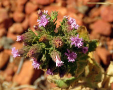
The track started at the campsite, heading quickly into a gorge framed by red rock walls. The opening at this eastern end was broad and we quickly followed the track through long grass and purple flowering herbs to reach the first rock of interest. Here, images of the Caterpillar Dreaming had been pecked, using a heavier rock to hammer a sharpened rock into the artwork rock-face (petroglyphs are all about rock). For up to 10,000 years, people have been coming to N'dhala for food, water and shelter and to mark their passing with these works of art - amazing. |
||
 |
 Rock shelter and petroglyphs |
 |
|
 Lower gorgescape |

The track led us deeper into the gorge, past dried waterholes, rock shelters and further petroglyphs - circular patterns and animal tracks. |
||
 |
 Some of the many petroglyphs |
 |
As we probed deeper, the rock walls of the gorge closed in, until we reached the end of the marked track to look up a stony creek bed. This narrow section of gorge was still in deep shade, but, further up, I spied a patch of sunlight that marked its western opening. It seemed an appropriate point to aim for in our exploration of N'dhala. |
|
 The western exit of N'dhala Gorge |
 Walking through the upper gorge |
We followed the stony bed of the creek up, occasionally clambering over the bigger boulders that blocked it, to reach the end. Beyond lay a deep valley with rounded hills. Here we sat for a while, looking back down the shady gorge, contemplating its tranquility and history. For over 300 generations, people have been visiting this place, which has changed little in the period - it puts our brief sojourn on this planet in perspective. |
||
 |
 Some of the big boulders used for petroglyphs |
 |
Musing over, we retraced our route home and drove back to Ross River. We arrived in time for a much more recent cultural experience (see box), which again emphasised how different the worlds are that collided when Europeans colonised Australia. |
Fish's Run |
|
|
On the way to Ross River, we passed a memorial to "Fish" - an orange Harley Davidson set on a rock. Fish was a well-known Alice Springs bikie who, sadly, was killed in 1998 when he rounded a corner on his Harley and ran into a feral camel at this location. Every year, the Alice Springs bikies do "Fish's Run", a charity event at Ross River held over two days. Over the years it has raised over $200,000 for charity. We just happened to be there when they rode into the homestead and celebrated his memory with slow races, burn-outs, bike barrel rolls and a party. It was a modern-day cultural experience. |
|
|


|


