
| Nahuel Huapi Traverse(Part 1) |
Introduction
Day 1 - Colonia Suiza to Refugio Italia (through the forest) |
|
The showers of the previous night vanished and a fine sunny day dawned for the start of our first trek. Nahuel picked us up from the hosteria for the 20km drive from Bariloche to Colonia Suiza, where our walk commenced, stopping only to get some bread for lunch and take in one of the panoramic views across the convoluted reaches of Lake Nahuel Huapi. We stopped on the side of a small dirt road, where a set of pink ribbons marked the beginning of the track, sorted out our packs and followed Rosanna into the thick forest of conifers of the lower Goye Valley. At first the track climbed steeply, following a narrow dirt road deeper into the forest. Suddenly a hare ran down the road towards us, before veering into the bushes, closely followed by a pair of dogs. Seeing us they soon lost interest in the rabbit and decided to join our adventure; these friendly fellows would be our compañeros de route for the rest of the climb up to the refugio and that one would follow us all the way to Pampa Linda. |
|
 Heading off through the conifers |
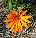
 Amancay |
 Reina Mora |
 Violet amarillo |
 Nello and Rosanna benath an impressive coihue (beech) |
|
||||
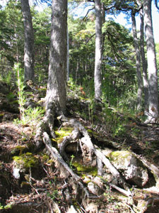 The gnarly roots of a ciohue |
 The cold clear waters of Arroyo Goye |
 A clearing in the beech forest |
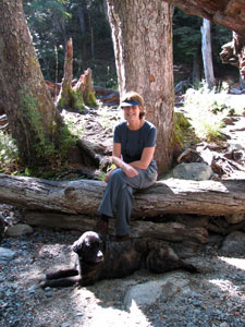 Time for a break |
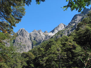 The sheer walls of Cerros Marino, Manolo and Magnatt appearing through the forest |
Slowly the darker-green of the coihue gave way to the light-green of the lenga, their leaves luminous in the light of the midday sun. The walls of the valley now started to narrow in on us, and we found ourselves walking beneath the dark shape of Pico Magnatt. The play of light in the canopy of the beech forest was superb, as we wandered through an understorey of bamboo, with the occasional patch of the giant-leaved nalca. |
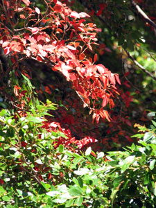 The first colours of autumn |
 View up the stony bed of Arroyo Goye |
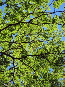 The luminous green of the beech canopy |
 Rosanna climbing up through the bamboo understorey |
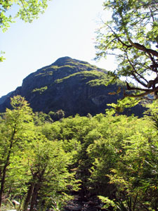 The dark shape of 1869m Pico Magnatt above the lenga forest |
|
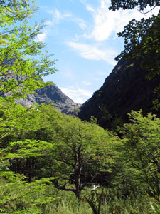 Looking up from Rancho Manolo |
||
|
|
|
|
 A small cascade in the Arroyo Negro |
The path from Rancho Manolo climbed quickly alongside a set of cascades tumbling down through the forest. A little while later we crossed the stream, realizing that the tall lengas of the forest below were now just shrubby plants of a few metres in height - altitude was beginning to have its effect. The other side of the river brought us to a long set of zig-zags that wended their way up the slope of ever-shrinking lengas. It was a hard slog with a full pack, but the views across the valley made it worthwhile. The dark silhouettes of Cerro Gordo and Cerro Negro dominated the foreground, and contrasted with the light tan colours of Cerro Navidad at the head of the valley beneath them. To the right the silvery thread of a 300m waterfall streamed down the rockface from the invisible Laguna Negra above us. |
|
|
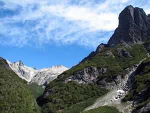 The distant light peak of Cerro Navidad (2089m) and the dark massif of Cerro Negro (1960m) |
|
 Refugio Italia on the shore of Laguna Negra (can you find it?) |
Several other trekkers arrived from different directions and that night we all enjoyed a hearty meal of pasta prepared by the refugio's guardian; a good way to restore the energy burnt during our 800m ascent. |
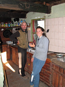 Rosanna enjoying a yerba mate with the guardian of the refugio |
 Our small compañero |
|
|
After a comfortable night in the refugio, we loaded up our packs for what Rosanna warned us would be the hardest day. Our two canine companions had waited for us all night and greeted us as long lost friends when we emerged from the refuge. Clearly we would not be trekking alone - nothing would discourage them from following us. We picked our way around the rocky northern shore line of Laguna Negra - at one point a short steep descent proved too great an obstacle for the shorter of the two dogs - the other still followed us, ignoring the ever distant barks of his short-legged companion. I guess that not everyone looks after their little mate (in-joke for Australians!). |
|
|
|
 |
 |
||
 Rosanna and Nello take in the views |
At the far end of the lake we emerged into the sunshine and began the first and easiest of three steep climbs for the day, up to the saddle between Cerros Negro and Bailey Willis. As the slope steepened, the terrain changed from a rocky herbfield to a herby rockfield, before breaking out on to the boulder-strewn ridge. |
 Looking back down our path from Laguna Negra |
|
 The way forward - looking across the valley to the ridge line of Cerros Cuernos de Diablo and Tres Valles, with Laguna de CAB in its wooded basin and distant Tronador |
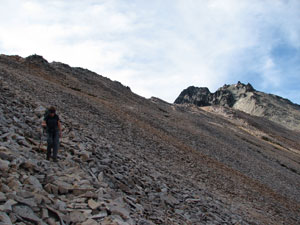 Nello picking her way down the loose scree slope |
|
|
 The steep dusty track down the lenga slope |
Finally, 650m of knee-jarring descent below the saddle, we reached a rocky alpine stream; time for a short break to let our knees recover before crossing to follow its babbling course down a much gentler slope through the colihue (a tall native bamboo) understorey of the forest. We soon emerged at the junction of this stream and the larger Arroyo La Chata. Crossing its rocky bed, we found ourselves in a dense thicket of colihue. Bamboo grows quickly and little-used paths through them risk disappearing - after a bit of good-old fashioned bush-bashing through the thickets, Rosanna picked up the path and we were off again. |
 Arroyo La Chata |
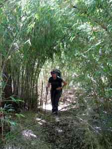 Tunnelling through a dense stand of colihue bamboo |
 Crossing the hot upper slopes of alpine meadow |
Ahead lay our second climb of the day - a steep 400m climb, passing first through bamboo and lenga forest which morphed into stunted lenga thickets, before entering an area of open grassland and herbs. The sun shone hotly on us as we traversed the higher part of the slope, looking back over the steep descent that we had just made with some degree of satisfaction. |
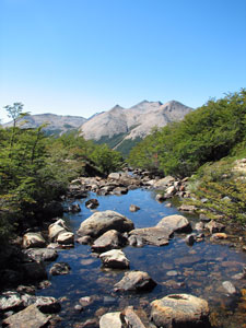 The outlet of Laguna de CAB |
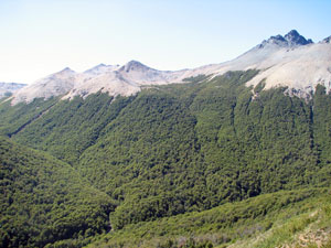 View back over our 600m descent from the saddle to the river |
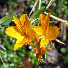 Amancay |
|
 Mutisia |
|
 A meandering creek beneath the pink granite walls of Cerro Tres Valles |
|
 Skirting the lenga-lined edge of Laguna de CAB |
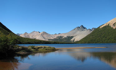 View back across the laguna from its western end |
|
|
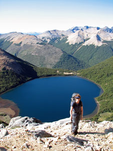 Almost at the top of the climb from Laguna de CAB |
|
 Rosanna leading us up the face of 1901m Cerro CAB |
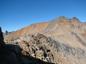 The barren rocky ridge that we just crossed |
|
 Looking south across the valley of Arroyo Claro to the 1911m point of Cerro Cumpleaños and 2342m Cerro Bonete |
Far below us lay the flat open wetlands of Mallin de los Vueltas and at the far end a small grove of lengas - our campsite for the night. The traverse down the last rock face and stroll across the welcome flat of the wetland passed quickly. |
 Crossing our first snowdrift |
 The eastern face of Tronador getting closer |
 Crossing the wetlands of Mallin de las Vueltas |
We reached our campsite at 7pm with the sun low in the sky and Rosanna found a pleasant sheltered spot next to a quietly running stream to pitch tents. Dark was soon upon us and the hot rice dish was just what we needed as the temperature dropped rapidly. |
 Finally, a chance to sit and rest |
|
      |
Day 3 - Mallin de las Vueltas to Laguna Ilon (across the tops)
|
|
||
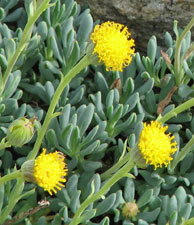 |
 White chaura/manzanilla berries (yum!) |
 Botellitas |
|
|
|||
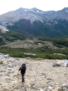 Once more a steep climb to start the day |
Soon we started a traverse across an area of large pink and tan granite slabs, the fissures and cleavages a testimony to the harsh Andean climate; the gap between the slabs colonised by the hardy alpine herbs and shrubs. One more sharp ascent and we reached the top of the spur, with impressive views back along our route and south towards Cerro Cumpleaños. |
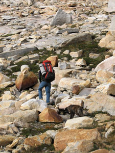 Rosanna leading us across the granite slabs |
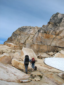 The pinkish-tan granite of 1968m Cerro Cristales |
 Looking up a drift to the peak of Cerro Cristales |
|
|
 Crossing the southern face of Cerro Cristales to reach the saddle |
 Why Cerro Cristales is so named |
|
 Looking down on Laguna Creton |
|
 Time for a break to admire the views |
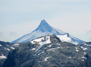 The volcanic plug of 2190m Cerro Puntiagudo across the Chilean border |
 Start of the steep descent down the scree slope of the saddle |
Unfortunately, what goes up often needs to come down and such was our fate today. The route down was direct, descending the western wall of the ridge down a very steep and tortuous track through the loose scree and soil of the slope. We dropped 300m in half a kilometre to eventually reach a grassy alpine meadow. A short traverse across this meadow soon saw us descending steeply once again, this time down the spongy green verge of a babbling alpine brook. At the bottom, we passed through a small grove of stunted lengas to reach a broad flat area of alpine bog - how pleasant it was to walk on the flat, even if the ground below squelched as you did. |
 A stroll across the wetlands below Laguna Creton |
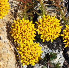
 Plant communities of the granite slabs |
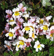 |
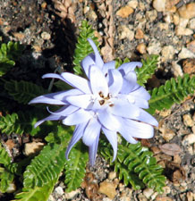
 Quinchamali |
 |
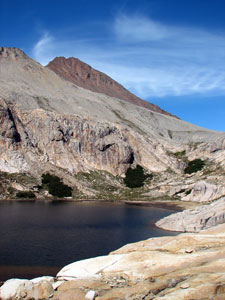 Laguna Creton and 2242m Cerro Bonete |
|
||||
Once more a magnificent spectacle unfolded before us: far below us to the south, the brilliantly blue waters of Laguna Azul, lined by the sheer rock walls of Cerros Bonete and Punta Negra; to the north, a perfectly formed glacial valley, its base covered in the bright green lenga forest, dropping down to a distant arm of Lago Nahuel Huapi. |
 The brilliant sapphire blue colour of Laguna Azul in its glacial bowl |
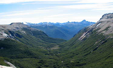 The perfect glacial valley beneath Laguna Creton |
Continuing to climb slowly along this narrow spur, we passed a small unnamed lake, before dropping down to cross the creek spilling out of Laguna Jujuy, another small glacial lake surrounded by rock walls and snowdrifts.
|
 The 2039m peak of Punta Negra |
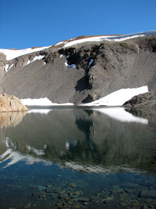 Reflections in Laguna Jujuy |
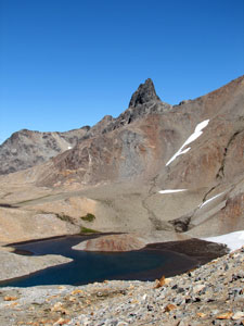 Looking back over Laguna Jujuy to Punta Negra |
 Looking down towards a long arm of Lago Nahuel Huapi |
|
|
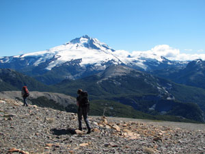 At last, from here on its all downhill! |
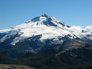 The dominance of Montedor Tronador |
|
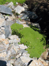
 Cushion plants on the edge of a mountain stream |
|
 View over Mallin de Ricardo towards Tronador |
|
 |
 |
||
Dropping even further off the ridge, we passed through a grove of stunted lenga to reach the wetlands of Mallin de Ricardo. Welcoming the flat terrain, we criss-crossed a small stream as it drained the flat green sponge of the Mallin through a meandering channel of rich red rocks and soil. All the while the views of Tronador changed in aspect and setting, as we strolled along enjoying the warm afternoon sun. |
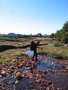 One crosssing of the red rocky stream through the wetlands |
 Stream draining the wetlands toward the northwest |
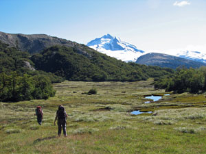 Crossing the spongy flat wetlands of Mallin de Ricardo |
 Once more in the dappled shade of the lenga forest |
 The tiny refugio at Laguna Ilon (yes the log is propping it up) |
|
 View from our campsite on Laguna Ilon |
 Late afternoon on the beach at our campsite |
What a day it had been - it was hard to decide the highlight - was it the glinting granite slabs of Cerro de las Cristales, the amazing blue of Laguna Azul, the perfect form of the green-clad glacial valleys, the richness of the wetlands, the great vistas of Tronador glistening in the sun - was today better than yesterday? - did it really matter? - tonight we would have some very pleasant dreams. |
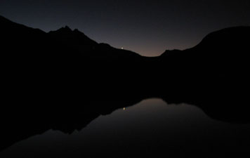 Venus setting over Laguna Ilon |
![]()


![]()
Day 4 - Laguna Ilon to Pampa Linda (return to civilisation)
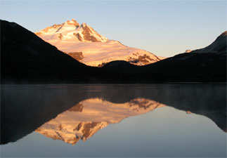 Dawn alpenglow on Tronador reflected in the still waters of Laguna Ilon |
I was up just before sunrise - it was -1ºC and the frost had formed a curious honeycomb pattern on the sandy beach. Mists drifted off the surface of Laguna Ilon as bubbles rose from its bed and sent out soft circles of ripples, while a small flotilla of ducks paddled by. The sun had just caught the top of the icy peaks of Tronador and, as I watched, illuminated the mountain in a pale alpenglow. There are moments that are too good to describe and this clear cold morning was one of them. The reflections of snowy peak and green forested ridges in the still lake waters changed continuously as the sun rose higher, until it finally burst upon our campsite with a welcome warmth. |
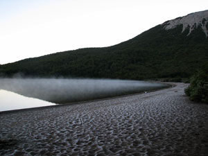 Ilon before dawn;frosty beach and misty lake |
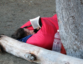 How the well-equipped guide spends a frosty morning |
 Panorama of Tronador and the shore of Laguna Ilon in the early morning light |
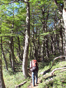 Setting off for the last time |
Rosanna had promised us an easy last day and we dallied at this special spot until 11am before finally setting off. No hard climbs today, at first just a pleasant stroll along a gently undulating and meandering track, either in the dappled shade of the lenga forest or across sunny grass clearings. Soon we reached an area of wetland and started a gentle descent; Tronador had reappeared and its icy gaze would overlook the rest of our descent to Pampa Linda, over 500m below. |
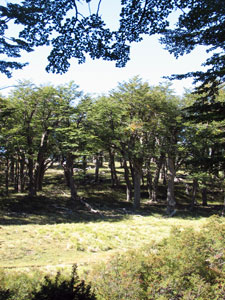 Clearing in the forest |
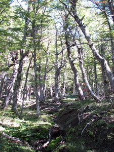 Dappled shade of the beech forest |
 Another high wetland traverse in the warm autumn sunshine |
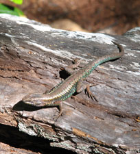 One of the locals basking in the sun |
 Looking across the valley to the glaciers of Tronador |
|
||
|
Finally the track flattened out and led us to the swift flowing grey-green waters of the Rio Castaño Overa. Only a few kilometres down from its glacial source, the water was icy, a fact of which we became painfully (literally) aware as we waded across to the other side; time for one last picnic lunch in a shaded grassy clearing on a warm Andean autumn day. |
|
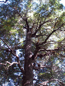 The canopy of a big coihue |
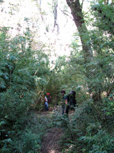 Dense understorey of the coihue forest |
|
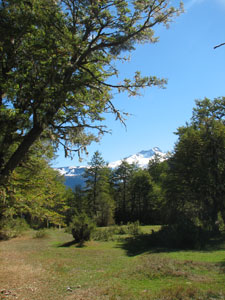 The beautiful flats of Pampa Linda |
All that remained was a short stroll along the rivers edge and through a grove of ñire (the third beech species of this region) before we four compañeros emerged into a clearing and the welcome sight of Pampa Linda Hosteria and Albergue. |
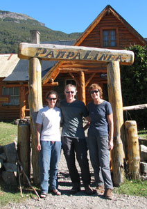 The end of brilliant crossing! |
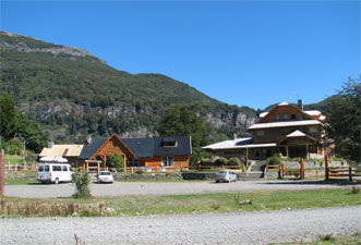 The Albergue and Hosteria at Pampa Linda |
 |
For three days we had walked without encountering another soul and now our traverse of the Nahuel Huapi National Park was over - it was good to sit on the verandah of the Albergue with Rosanna, tired but satisfied, a refreshing cold beer in our hands, taking in the quiet beauty of this place. Our only concern was for the future of our loyal canine friend, Compa, who had followed us for over 40 km across the majestic wilderness of the Nahuel Huapi mountains. We left her in the care of the National Park ranger - would she ever find her way back to Colonia Suiza or would she find a pleasant life with the horses and other inhabitants of beautiful Pampa Linda? We could only hope for the one or the other. Never give a dog a name if you cannot keep it - with it comes an emotional attachment that is cruel to break! |
 |
|