| Walk 24 - Milford Track 'Great Walk' |
|
 |
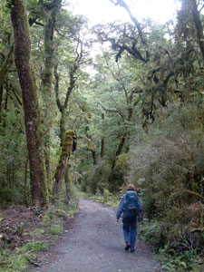
Day 1: Glade Wharf to Clinton Hut 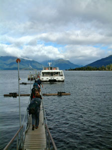 Filing on to the ferry at Te Anau Downs |
|
|
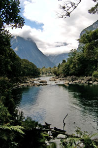
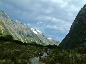
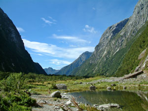
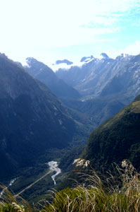
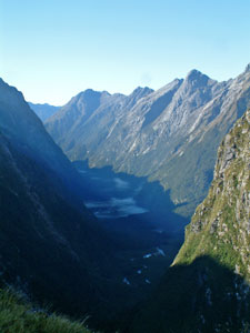
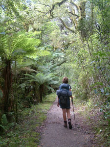
 Looking towards the Fiordland mountains and the start of the track Looking towards the Fiordland mountains and the start of the track |
 Finally the Milford |
|
|
|
|
|
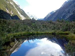
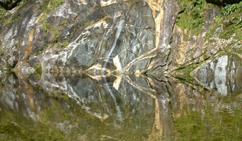
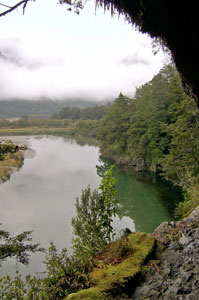
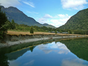 Clinton River reflections across the glade |
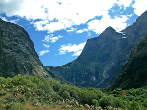
 Looking toward Dole Pass in the Earle Mountains |
|
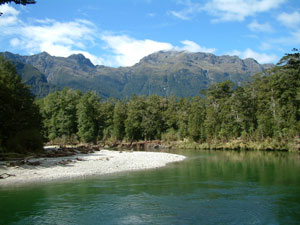
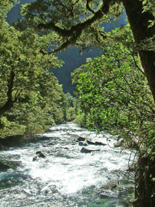
 Bottle green pool in the Clinton |
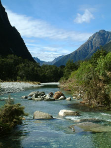
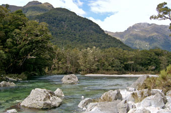
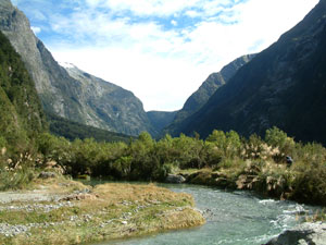
 Clinton riverscape |
The voracious sandflies, however, had other ideas and soon chased us back to the hut, where we spent a long, lazy afternoon enjoying the best weather we had had since the day on the Cascade Saddle. |
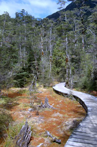 Boardwalk across the sphagnum bog |
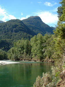
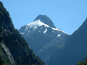
 Mt Anau (1958m) and the Earle Mountains |
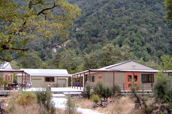 Clinton Hut complex |
 Nice swimming spot - shame about the sandflies! |
Day 2: Clinton Hut to Mintaro Hut Content with a huge bowl of porridge and mug of hot tea, we headed down to rejoin the main track and follow it upstream along the edge of the Clinton River under a canopy of tall open beech. The steep valley walls kept us in a cold shade for much of the morning, as we wandered past rocky rapids and deep green pools in the river. Eventually, we emerged into a small clearing where we had our first glimpse of distant Mackinnon Pass. Leaving this, the track took us by a swampy area, whose still, dark waters reflected the nearby mountains and provided a home for some large languid eels. |
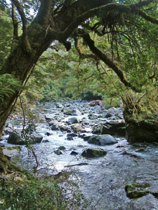 Rocky section of the Clinton |
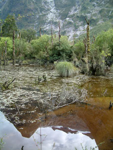 Reflections in the swamp |
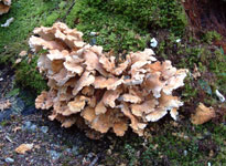 . .Coral fungi |
 Sunlit wall, deep shaded valley |
Hirere Shelter provided a good resting place to admire the nearby falls of the same name and top up with energy food, before we pushed on through some more beautiful sections of the river, overhung with lichen-covered tree branches. After a while, we again emerged into a clearing, the larger Prairie Flat, and passed several small swamp pools, their dark mirror surfaces providing perfect reflections of the mountains around us. The larger Hidden Lake lay nearby, flush against the rock face of the valley walls. |
 Clinton Valley mirrored in a swamp pool |
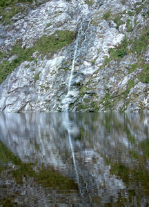 Small waterfall flowing into Hidden Lake |
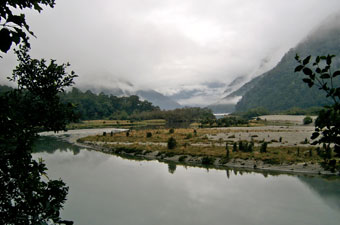
 Looking back down the Clinton Valley from Prairie Lake |
Clinton River in The Prairie |
|
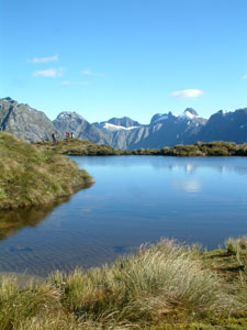
 Strange reflections at Prairie Lake - can you spot the moths? |
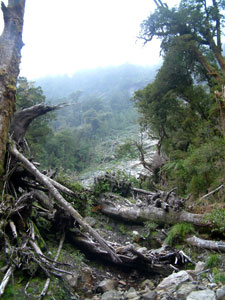
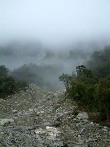
Leaving the lake, we soon reached the part of the Prairie where the Clinton River had decided to change course three days earlier, removing a large section of track in the process. The flood damage was evident by flattened vegetation, bridges shifted from their footings and a new channel. Yesterday they had been transporting trampers across this section by helicopter, but not for us; the Milford machine cannot be blocked for too long and DOC staff had already "ribboned" a new path and dropped in new bridges to re-open the track. Their efficiency in keeping the Milford Track going is to be admired. We walked on through without even getting our feet wet. |
 Mackinnon Pass from The Prairie |
 Ribbonwood forest near Mackinnon Pass |
 The Bus Stop shelter (no need for it today) |
At the end of The Prairie the track started to climb slowly; beech forest changing to ribbonwood, with its clusters of white flowers, as we got higher. Passing the Bus Stop Shelter and the guided walkers' Pompolona Hut, we crossed the first of a several swingbridges over rocky sidestreams. Waterfalls tumbled off the rock face of The Castle, 1500m above us. Once again the forest slowly changed as we made a short steep climb up into lichen-draped beech trees, finally reaching the short sidetrack that took us into Mintaro Hut, our accommodation for the night. One really nice aspect of the forest in the upper Clinton Valley was the amount of bird life; it was one of the few times in New Zealand that we had heard an ongoing chorus of birds rather than the occasional calls of one or two species. |
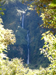 St Quintin Falls |
 Rocky stream bed |
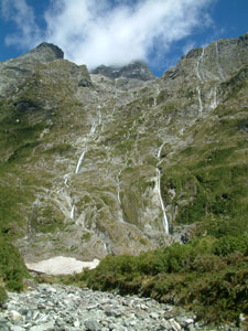 Waterfalls pouring off Castle Mountain (2150m) |
 Beech forest near Mintaro Hut |
 The route up to the pass |
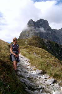 Nearing the top (Mt Balloon in the background) |
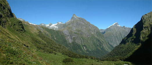
So, after a long lunch, we headed off for a pack-free 500m climb up the steep head of the valley, passing through beech then shrub then tussock grass, to to take in the magnificent views in the afternoon sunshine; Mt Balloon and Mt Elliot to the north, Mt Hart and the large glacier-capped cirque to the south and the panorama of the Fiordland mountains to the east from the lookout at The 12-Second Drop - magic! |
 Lookind down th Arthur Valley from Mackinnon Pass |
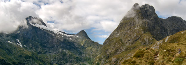 Mt Elliot (2203m), the Jervois Glacier and and Mt Balloon (1853m) from the pass |
 1000m walls of the cirque below Mt Forlorn |
 The Fiordland mountains from Mackinnon Pass |
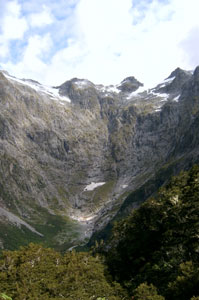
 Looking down onto Mintaro Lake beneath Castle Mountain |
|
Day 3: Mintaro Hut to Dumpling Hut - over the pass |
|
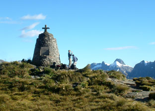 Monument to Quintin Mackinnon on the pass |
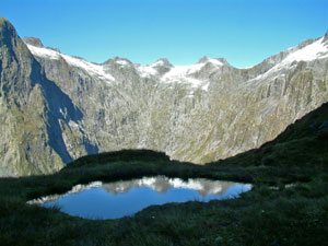 Reflections in a shady tarn |
 Tarn on Mackinnon Saddle |
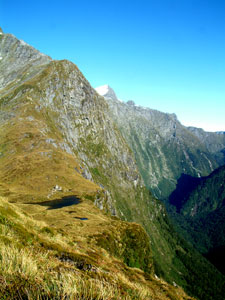 The steep western face of the Mackinnon Pass |
Looking back from time to time, the sheer walls of the western face of Mackinnon Pass became increasingly apparent as we climbed to the high point of 1154m. The short descent to Pass Hut for a quick visit to the "loo with a view" looking down the Clinton Canyon, and we were on our way down the 950m descent into the Arthur Valley. |
 One last look back down shade-filled Clinton Valley |
 Changing vegetation on the western face of the pass - Mt Hart (182m) in the centre |
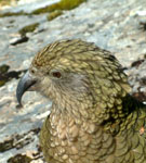
The track sidled across the massive walls of Balloon Peak, leaving the snowgrass to enter a zone of low shrubs and curving slowly around the base of Mt Elliott, far below the Jervois Glacier. A rocky platform seemed to offer a good spot for a break; obviously others thought the same as a kea soon appeared to check us out and see if we had anything worth eating, stealing or tearing to pieces. |
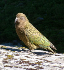 So what have you got for me, eh? |
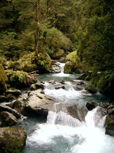
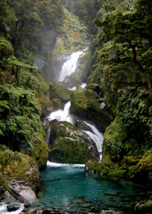
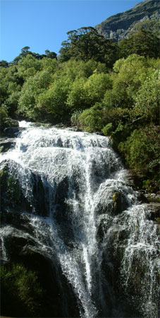 Top cascade of Roaring Burn |
Leaving the kea to amuse the newly arrived, we continued our descent, entering a low forest of ribbon wood and stubby beech. Soon we arrived at a set of wooden steps which took us down quickly beside Roaring Burn, as it tumbled down through the water-smoothed grey-white striped bedrock in a series of beautiful cascades. |
||
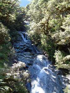 One of the many cascades on the burn |
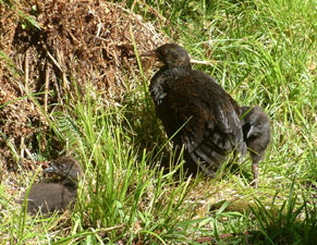 Weka and two chicks |
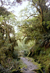
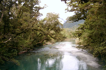
 Mossy beech forest on the way to Sutherland Falls |
|
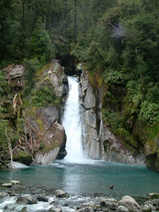
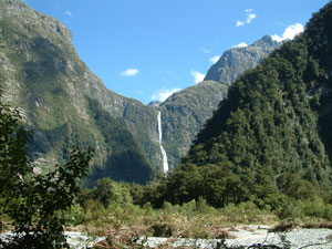
The track became rockier and more uneven as it continued to descend into taller beech forest, finally emerging at the junction to Quintin Hut (guided walkers only). Here, after a bite of lunch, we dropped our packs at the adjacent shelter and headed up for the one hour sidetrip to Sutherland Falls. Just after the shelter, a weka and her two chicks wandered out from the bush to bid us good day, while the bird chorus in the upper Arthur Valley seemed as rich as that in the upper Clinton - it seems that the DOC program to control stoats is producing good results. The track took us through low ribbonwood/mahoe forest and across a rocky knoll with patches of moss-covered beech, from where the sound of the falls became increasingly apparent. Turning a corner, they appeared through a gap in the canopy, all 580m plunging from the glacier fed Lake Quill in three mighty leaps to the valley floor before surging away in the silver stream of the Arthur River. Sutherland Falls is the fifth highest permanent waterfall in the world - what more can you say. The falls are an incredible spectacle; as we approached the wind generated by them became stronger till we reached a point where we stood in a refreshing stream of fine mist, blasted horizontally in every direction by the force of the 580m drop; any closer and we would have been saturated. |
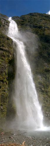 The Sutherland Falls - all 580m of them! |
||
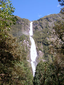 First glimpse of the Sutherland Falls |
 Sunlight on the Arthur River just below the falls |
 Looking back up to Mt Balloon and the route down from Mackinnon Pass |
|
 Lady of the Snows (1832m) |
Returning to the shelter, we put our packs back on and headed off, following the Arthur River downstream, stopping at a small clearing for one last lingering view of Sutherland Falls and the massive rock face of Mt Hart. After a while, we reached a section of boardwalk fixed to the side of a rock bluff and at the end of it lay Dumpling Hut, nestled into the northern base of Mt Elliot. There was just enough time to rush down to a nearby pool in the Arthur River for a quick skinnydip and clean up in its icy water before we were joined by lots more of our fellow trampers. However, if the cold hadn't chased us from the water, the sandflies would have. |
 The top part of the Sutherland Falls between Mt Hart and Mt Mackenzie |
|
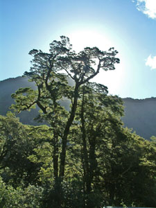 Hot Fiordland sun shining through a beech tree |
|
 The Arthur River and Valley |
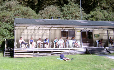 Old trampers taking in the sun at Dumpling Retirement Village |
|
Day 4: Dumpling Hut to Sandfly Point
|
|
We headed out along the well-formed even track, following the edge of the Arthur River through the valley forest. As we passed over a couple of wide slips, the piles of broken dead trees at their bases attested to the powerful forces still shaping this landscape.
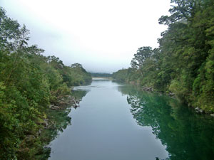
Soon we reached "The Boatshed", where we crossed over the Arthur on a sturdy bridge, the still green waters at this point providing a mirror for the trees along its edge. A series of high boardwalks took us over a swampy section bringing us to Mackay Creek, with its clear blue-green waters tumbling out of a mossy forest setting over the river boulders. Even more spectacular were the Mackay Falls just upstream, where the foaming waters plunged into a deep turquoise pool. Pushing on, we followed the left bank of the Arthur down, the flattened grasses and trapped debris giving an indication of the torrent that had raged through here a week earlier; and here we were following a clear, shallow river, softly tinkling its way over its stoney bed. The track moved closer to the steep rock face of the valley wall, where we passed under the path of several tree avalanches (the soil on the rocky slopes is very thin and, if too dry or too wet, a tree might topple bringing down every tree below it to leave a long narrow scar and pile of dead wood at the bottom) |
|
||
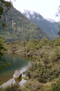
The river gradually became stiller and the valley floor swampier; we were approaching the upper end of Ada Lake, formed when a large slip dammed the Arthur River. As we rounded the edge of the lake, we could see glimpses of its perfectly still quiet waters through the beech trees, reflecting the misty walls of the valley. The forest was changing character as we moved further down the valley and tree-ferns were becoming increasingly common along the track. An interesting passage around bluff, where the track had been handcut into the rock by pick, and we arrived at Giant's Gate in time for an early lunch at the shelter with some of our fellow trampers. |
 View form the Rock Cutting |
|
 Mists in the Arthur Valley near Ada Lake |
 A tree lined sidestream at Giant's Gate |
|
|
Nearby was the impressive spectacle of Giant's Gate Falls, where a sidestream plunged out of a gap in the grey rockface and flowed down to the lake in a crystal-clear pale blue stream. As we ate, the clouds began to finally lift and fade away, revealing one last sunny look at the Arthur Valley and its glacial setting. Our trip was almost over. Soon the sounding of water tumbling over rocks indicated that we had passed the barrage of Ada Lake and were back alongside the downstream part of the Arthur River. The path became broader and flatter and, almost unexpectedly, the outline of the Sandfly Shelters appeared out of the forest; so-called freedom walkers to the shelter on the left, guided walkers to the shelter on the right - never the twain shall mix. |
|
|
 Almost there - the track becomes a tree-fern lined footpath |
 The end of the track |
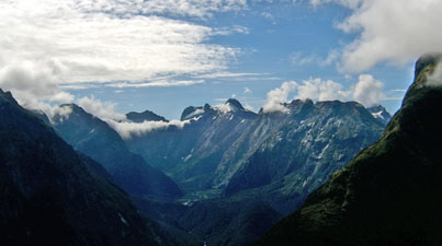
The enclosed shelter was welcome as Sandfly Point is most aptly named, but we did not have to wait long until the red shape of our boat chugged slowly up the reach to take us all back to Milford Sound and a waiting bus. We climbed on board; the boat pulled out and we looked back one last time up to the sun shining on the distant peaks at the far end of the steeply-walled Arthur Valley. Our journey on the Milford Track was over. |
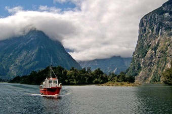 The red boat arrives to ferry trampers back to Milford Sound |
 Farewell to the Milford Track - One last look up the (now) sun-filled Arthur Valley |
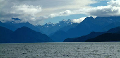
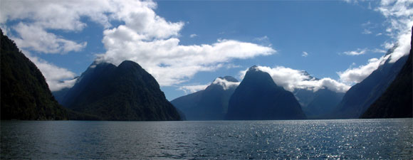 Blue on blue - Milford Sound silhouettes |
|
 |