| Stage 2 - Crossing the Shoalhaven River to Jervis Bay |
About |
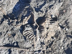
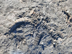
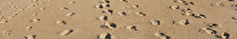
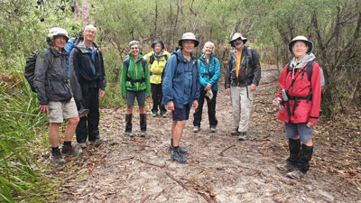
Our group of 10 (including the support driver) drove down from Canberra to our starting point at Ulladulla to camp overnight, with the chance to explore the fossil-rich rock platform of Ulladulla Headland in the warm afternoon sun. It seemed a good idea to make the most of the sunshine, as the weather forecast for the week ahead was looking a bit grim. Next morning, with just our daypacks, we travelled by maxi-taxi to Gerroa - to the footbridge over the Crooked River, to be exact, as it was at this spot that we officially ended Stage 1. |
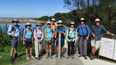 Start of The Great South Coast Walk Stage 2 at Gerroa |
|
Day 1 - Seven Mile Beach (12 km - 10m ascent- 10m descent) |
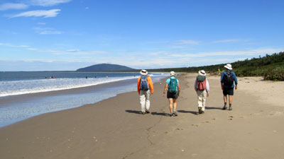
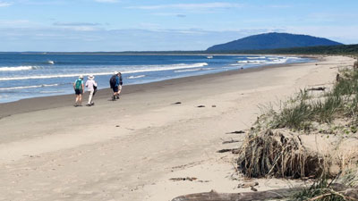
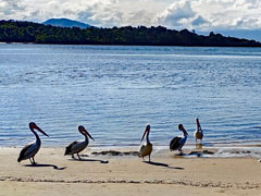
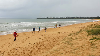
After posing for the standard start-of-walk group photo, we turned and head across the footbridge over the Crooked River to reach the northern end of Seven Mile Beach, looking down its length towards the rounded dome of Coolangatta Mountain. We were immediately struck by the huge amount of timber, branches, kelp and assorted debris washed up onto the beach. The locals had even used the timber to build a series of pole tipis. |
|
 Reflections on the Crooked River |
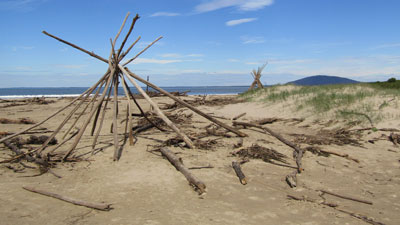 Tipi created from storm-dumped timber |
We are currently in a La Niña weather pattern, characterised by increased rainfall, and the big storms of a week ago had washed huge amounts of debris out of the Shoalhaven River to the south. Currents and swells had brought it northwards to be dumped on the beach here. As well, the storm-driven big seas had eaten away the foredunes. It was an impressive lesson on the power of nature, as we wandered southwards in a warm sun and gentle breeze - ideal walking conditions and ideal for contemplation. |
|
 Heading down Seven Mile Beach towards Coolangatta Mountain |
 Looking back towards Gerroa and The Escarpment |
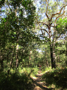
No matter how pleasant it is to walk along an isolated beach, with the sound of the surf and the invigoration of negative ions, it was still a nice change to head inland after a few kilometres and parallel the beach along the Sand Track, which meandered beneath the canpy of endangered Bangalay sand forest in Seven Mile Beach National Park. |
|
|
 Track through the coastal heath from beach to forest (Photo: J & P Gatenby) |
 |
|
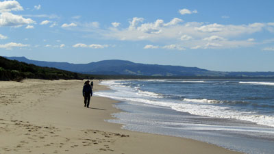
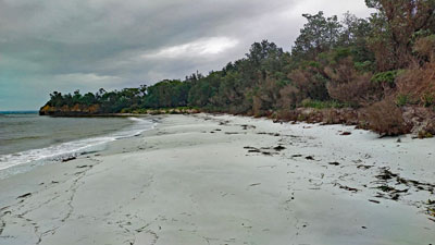
At the next junction, we regained the beach. The southern part of Seven Mile Beach had been spared the storm damage and its isolated golden sand made for very pleasant walking. It led us to the resort village of Shoalhaven Heads, where we headed inland to find our campsite at the local camping ground. |
||
|
 Heading down the southern end of Seven Mile Beach (photo J & P Gatenby) |
|

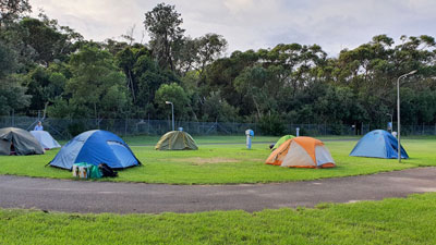 Campsite - Shoalheven Heads |
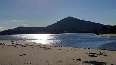 Late afternoon view across the Shoalhaven to Coolangatta Mountain |
The fair Nello in the support vehicle was waiting with tents ready to be set up for the night. The walk had been short and pleasant, leaving plenty of time to swim or explore the original mouth of the Shoalhaven River. Normally blocked by a wide sand bar, the big rains had caused the river to break through and flow out to sea - one exit point for all the debris on the beach to the north. |
|
|

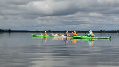
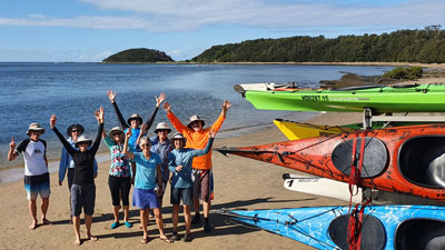
Day 2 - By sea-kayak across the Shoalhaven (3 km walking - 12 km by sea kayak) |
For the second day, we packed up dry tents - that always makes me feel good. From our campground it was just a short walk to the Shoalhaven Heads boat ramp. We arrived at the same time as Dane, from Sea Kayak Jervis Bay, who was towing a trailer with 3 double and 3 single sea kayaks. This was our means of transport across the Shoalhaven River system. After unloading and setting up the kayaks, followed by the safety presentation and kayaking tips from Dane, we set off. |
||
 (Photo: D. Leyder) |
 Sea kayaking on the Shoalhaven River |
 (Photo: D. Leyder) |
 A perfect day for paddling |
 Vista of the Shoalhaven backed by the Illawarra Escarpment |
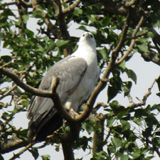
It was perfect out on the water, with a light breeze and cloud and sunshine competing for the sky, as we headed out past the moored yachts and crossed the river to the western shore of Comerong Island. Up river to the west, the rounded dome of Coolangatta gave way to the distant blue face of the Illawarra Escarpment. A sea-eagle cruised by to bestow its blessing. |
|
 A mid-paddle pause to take in the panorama (Photo: D. Leyder) |
 Paddling along the shore of Comerong Island |
After some smooth paddling across the flat waters of the river, we entered the Berry Canal. This wide canal was dug by hand in the 19th century to connect the Shoalhaven with the Crookhaven Inlet to the south. The river liked it so much, it changed course to flow out to sea via this route, which is why the original mouth of the Shoalhaven is usually blocked by a sandbar. The green pastures of dairy farms lined this part of the canal. Halfway along, we pulled in to a small mudflat beach for a break. There are not a lot of opportunities to haul out on this crossing. |
|
 Short break on a Berry Canal mudflat (photo: J & P Gatenby) |
 Paddling up a mangrove lined side creek (Photo: D. Leyder) |
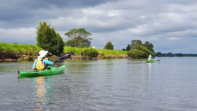
Continuing on, we passed the Comerong Island ferry and entered the Crookhaven Inlet. The western shore of the island was now reverting to its original habitat, with mangroves lining the shore. It gave us a chance to paddle up into the creek system that marks the southern end of Comerong. The first creek was smaller, restricting us to a narrow channel fringed with the upright roots of the mangroves - part of an impressive mangrove swamp. The second, Currie Creek, was a much wider channel that actually split the island. Here, taller trees and overhanging branches created a picturesque waterway to explore. |
||
 In the heart of the mangrove forest |
 |
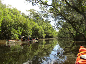 The still waters of Currie Creek |
Back in the main channel, we pushed on quickly to reach the sandy beach at Greenwell Point. Here we were in for a lunchtime treat, as Dane had recommended we visit the Pelican Rocks Café, voted three times as having the best fish and chips in New South Wales. The fair Nello joined us and, yes, the fish and chips were very good! |
 |
 End of the sea-kayak crossing at Crookhaven Head (Photo: Dane from SKJB) |
 |
The last section of our crossing was to run with the tide down the river to the Crookhaven Heads boat ramp, where Dane was waiting to pick up his kayaks. It had been a great day on the water - thanks Dane. I think this is clearly the best way to do this part of the Great South Coast Walk (unless you are a purist, who has to walk the walk - for me, doing it under your own power passes the pub test). |
||
 The wide golden sands of Culburra Beach |
 A touch of luxury at the Culburra beach house (photo: J & P Gatenby) |
The day was not yet over, and we needed to cut across to Culburra Beach for a 2km hike along its firm sand to our accommodation for the night. This time it was a beach house, with views out across the ocean. It was a great spot to be at and relax in, especially when the sound of rain falling on the roof began halfway through the night. The fine weather was over, and the extended spell of rain had begun. |
|
|
Day 3 - Culburra Beach to Huskisson (22.5 km - 20m ascent - 20m descent) |
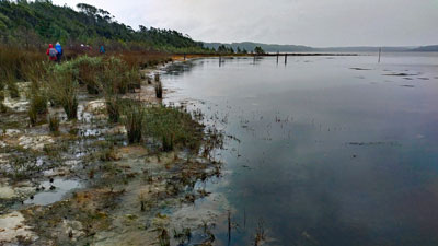
A grey wet morning greeted us and gore-texes were the order of the day, as we headed out and down the southern end of Culburra Beach to cut across Penguin Head through a short bit of suburbia and reach the edge of Lake Wollumboola. This lake is an ICOLL (intermittently open and closed lake or lagoon) that, for the most part, is closed off from the ocean by a sand bar - an easy way south. This was not the case, however, in a La Niña season and a month earlier the lake had broken through the bar and was still flowing out to sea. The night before, Bernard and I had checked out the entrance for a crossing and found a low tide route that was no more than thigh deep. Everyone debooted and, though there was still a strong outflow, easily waded the 150m to the southern edge of the entrance. Our first water crossing was completed. |
|
 Heading down Culburra Beach in a gentle drizzle (Photo: J & P Gatenby) |
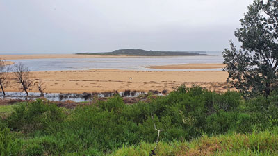 View over the new opened mouth of Lake Wollumboola (Photo: J & P Gatenby) |
With a steady drizzle setting in, we continued on around the boggy edge of Lake Wollumboola. All this part had been exposed when the lake level dropped a month ago, following the rupture of the bar - a fascinating and somewhat aromatic strip of sedges and estuarine vegetation. |
|
 Crossing the entrance of Lake Wollumboola (Photo: D. Leyder) |
 On the shore of Lake Wollumboola (photo: J & P Gatenby) |
A fenceline and sign brought us to the border of Halloran Trust land. The Halloran Trust has several large blocks of land in the region and their eventual aim with this portion is to return it to the National Park - a great outcome, seeing old cadastral maps showed the region divided up for a future coastal village. For the moment, it is still private, but we had permission to cross. |
||
 Wet track in the lakeside forest (Photo: J & P Gatenby) |
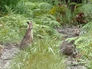 Some locals watching us pass (photo: D. Leyder) |
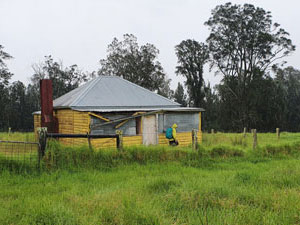 The old yellow farmhouse (photo: J & P Gatenby) |
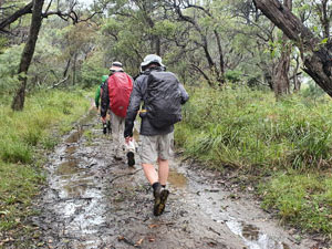
A faint 4WD track appeared on the beach and soon turned into the fringing forest before emerging onto an area of long, very wet grass. My socks were soon saturated as the water wicked down into my boots. It was probably an old dairy farm and the yellow weatherbord ruins of a cottage supported this. Leaving the grassland, the route picked up a road to pass beneath the canopy of some beautiful coastal forest. There is something soothing about the scent of wet eucalyptus. |
|
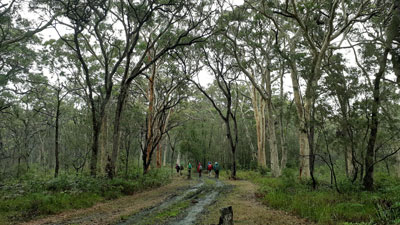 An impressive bit of eucalypt forest |
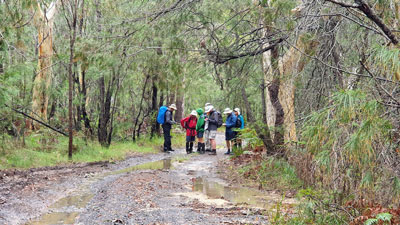 Taking a map bearing in the casuarina-eucalypt forest (photo: J & P Gatenby) |
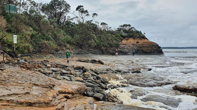
The track brought us out to the Currarong Road, a long strip of asphalt, and for 2 km we had to follow it, fortunately on a a wide grassy verge. This brought us to Red Rock Road, a gravel track that cut through the forest of Jervis Bay National Park to the shores of the bay. The drizzle began to ease as we neared the bay, emerging onto the white sand beach a bit to the east of Red Rock Point. |
|
 The white sands of Jervis Bay |
 Sidling around Red Rock Point (photo: J & P Gatenby) |
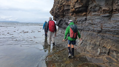
Red Rock Point is a small headland surrounded by a rock platform. The tide was high enough for shallow wavelets to roll across, but we were able to sidle around on its slippery surface to reach the long sandy stretch of Callala Beach. Ahead we could see the boats moored in Callala Bay, but before we could reach the village, we had to deboot once again to make an unexpected, though short, water-crossing, as a very full Wowly Creek flowed out into the bay. Then it was a bit of suburban walking, as we headed to the local bakery and coffee shop for lunch. |
|
 Rock platform west of Red Rock Point (photo: J & P Gatenby) |
 Crossing Wowly Creek |
Back to the beach, a footbridge took us across the wider Callala Creek and a long meditative walk on the white sands of Jervis Bay to Myola. The drizzle had eased to a few drops and my shorts almost dried in the breeze. It was good to be feeling more comfortable, because, after 22 km, we were nearing the end of the walk. |
|
 Nearing the end of Callala Beach (photo: J & P Gatenby) |
 At the end of a wet day's walking (photo: J & P Gatenby) |
Despite a longer than needed crossing of the sandy peninsula at Myola (an unfortunate navigational error - mea culpa), we reached the Myola landing of the Husky Ferry. There, in the 12-seat canopied ferry were Captain Dave and the fair Nello. The ferry was our means to cross the deep Currambene Creek, the presence of the fair Nello with her esky fully of chilled beverages and assorted cheeses and nibbles was a means of celebrating the end of a long day's walking.
Captain Dave took us down the creek and out into a sheltered cove of Jervis Bay to relax and enjoy a rain-free end to the day. When the aperitifs were finished, he dropped us off at the Huskisson boat landing for a short walk to our accommodation - an industrial size shed converted to a 3-bedroom beach hut. |

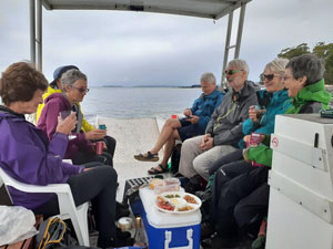 Aperitifs aboard the Husky Ferry |
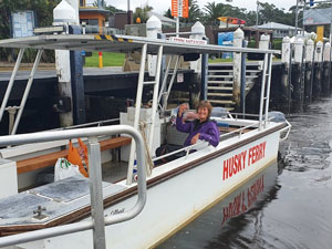 The Husky Ferry (photo: A. Laird) |
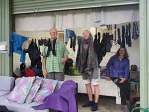 At "The Shed" after a wet walk (photo: J & P Gatenby) |
It proved a comfortable place for the night and, after hot showers, we headed off to the iconic Husky Pub for a meal. (multi-day walkers don't always have to rough it). However, this time umbrellas were unfurled, as the brief dry interlude had passed and a heavy drenching rain had begun to fall. The forecast "rain bomb" had arrived. |
||
It rained heavily all night (over 100 mm) and the downpours continued into the morning. The weather reports issued warnings of local flooding in the Sussex Inlet and St Georges Basin, areas that we would need to pass through. More heavy rain was forecast for the next few days. As well, the entrances to the lakes and lagoons to the south would clearly be running high and we had four to cross. As a group we had experienced a great and varied three days and it would have both spoiled it and put ourselves at risk to continue. As Alan commented, it was noteworthy that people got up in travel clothes rather than walking gear. Hence, we decided to abandon the walk at Huskisson, did a car-shuffle to bring the vehicles back from Ulladulla and headed our separate ways. Already on the way back, I found myself making mental plans to complete the stage. |
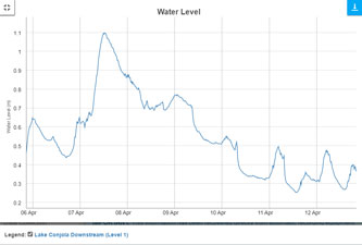 Water levels at Lake Conjola during the April "rain bomb" - a good reason not to continue |
|