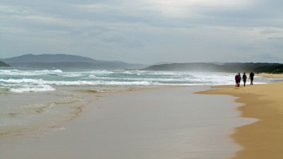
| Stage 3 - Jervis Bay to the Murramarang Coast |
About |
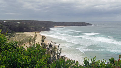
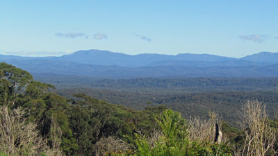
The second part of our staged group hike along the Great South Coast Walk had ended rather abruptly after only three days, when a La Niña induced rainbomb dropped over 100 mm of rain in 24 hours, causing local flooding and making water-crossings potentially dangerous. We called the walk off at Huskisson and retreated home. Six months later, with the arrival of Spring, it seemed time to push on down the coast. The details were mapped out and bookings made for accommodation along the way for early October. Unfortunately, soon after the dates were locked in, the Bureau of Meteorology announced the return of La Niña, that periodic pattern of ocean surface temperatures that brings increased rain to our part of the world. La Niña duly delivered just prior to our planned departure, with widespread rain and flooding over South-Eastern Australia. With 120 mm falling in 24 hours, it seemed almost appropriate - as we finished one leg, so must we start the next. However, we managed to delay our start by one day to avoid walking in the heavy rain. Let's hope that the next band of rain doesn't arrive before we finish in six days time. |
|
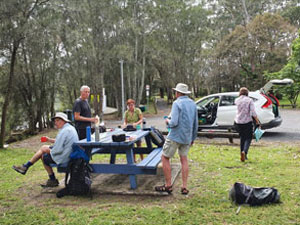
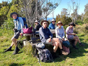
Apart from myself and the fair Nello (our support driver), Jan and Philip, Jacqui and Ian were back for Stage 3, and we were joined by Sonja and Ian's brother, Phil. As for the last stage, our group of eight drove down from Canberra to our starting point at Ulladulla, this time staying in a cabin, as the heavy weekend rain slowly eased. It seemed a far better way to start than camping on the sodden ground. |
||
 |
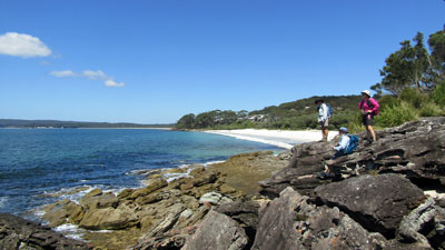
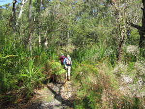
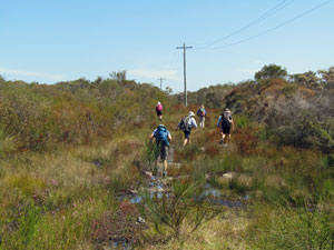
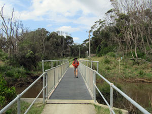
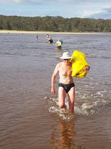
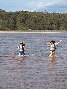
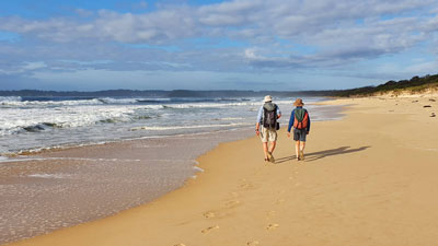
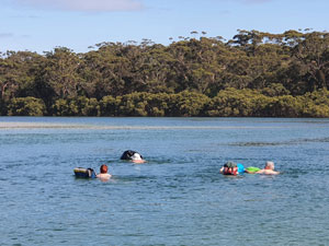
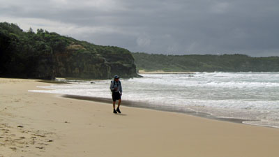
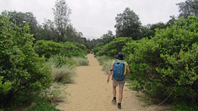
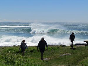
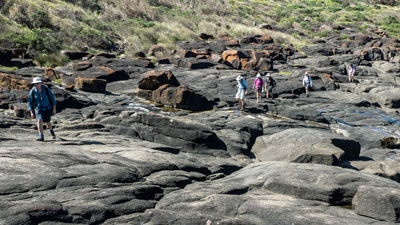
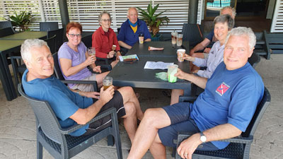
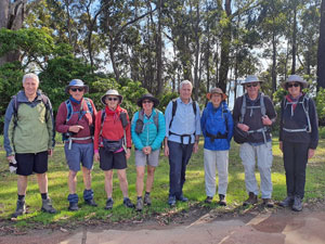 The Stage 3 walking party |
|
The next morning we woke to clear skies - delaying our start had been the right decision. With just our daypacks, we travelled by maxi-taxi to Huskisson - to the iconic Huskisson Pub, to be exact, as it was at this spot that we officially called an early halt to Stage 2. |
|


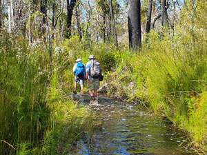
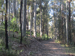
Day 1 - Huskisson to Sussex Inlet (26.5 km - 210m ascent - 210m descent) |
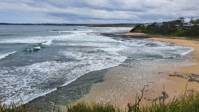
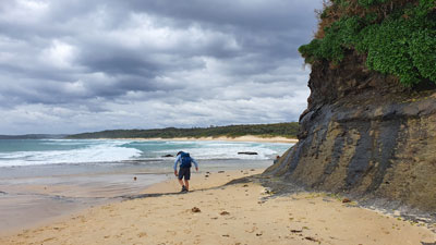
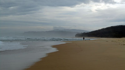
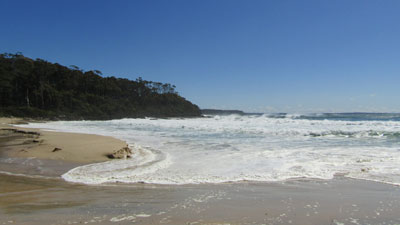
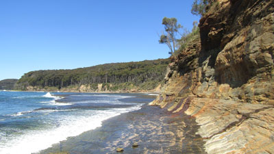
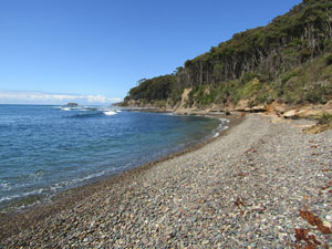
I left our support vehicle at Hyams Beach before jumping in to the maxitaxi and continuing on with the group to Huskisson - this meant that the fair Nello could walk with us for the first section of today's walk. Setting out from the Huskisson Pub, we followed the Bay to Basin cycle/walk path - the calm blue waters of the Bay on our left and the beachside houses of Huskisson and then Vincentia on our right. It was an easy stroll in the morning sunshine and many locals were out for their morning perambulation. On reaching Plantation Point, we dropped down on to Nelson Beach to walk along the white sand beneath its low, weeping red cliffs - a lovely juxtaposition of colour. |
|
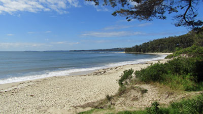 A calm Jervis Bay in the morning sun |
 The red cliffs of Nelsons Beach |
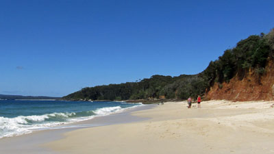
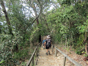
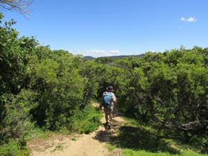
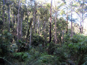
Climbing up the steps at beach end, we entered the forest of Jervis Bay National Park to follow the White Sand Track, as it passed a series of lovely white sand coves known as "The String of Pearls" nestled into the forest. The trail brought us out into the streets of Hyams Beach and a stop at its reknowned cafe for a take away coffee, which we enjoyed with lunch on the beach with its fabled white sand. Here the fair Nello left us, to drive the support vehicle on to our overnight accommodation at Christians Minde. |
|
|
|
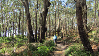

The rest of us then headed along the ultra white sand of Hyams Beach, keeping an eye out for a small communication tower on the forested dunes to our right. It, and the track to it from the beach, were easy to spot and we headed inland to pick up a well formed track through the beautiful coastal forest - after the rain, the route was wet but not muddy, though one section had water over it, requiring removal of footwear. |
|
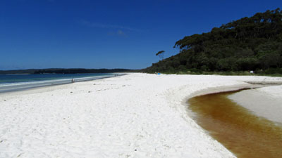 Hyams Beach claims to have the whitest sand in the world |
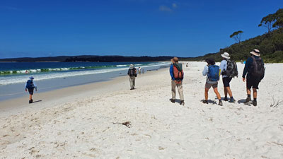 Setting off down Hyams Beach (photo: J&P Gatenby) |
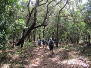 The coastal forest backing Hyams Beach .... |
|
 .... is quite varied |
||
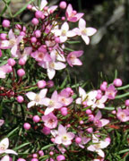
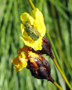
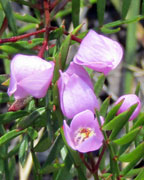
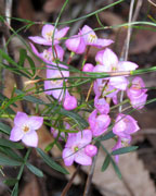
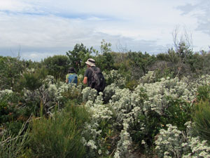
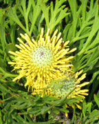
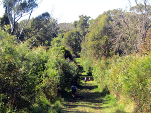
The forest path led us out of Jervis Bay National Park, over the NSW/ACT border and into Booderee National Park. The next part of the walk was a bit exploratory, as I wanted to see if we could walk across Booderee on fire-trails rather than just follow the gravel road around the edge of St Georges Basin. Reaching the main road through the park, we wandered for a while along its wide verge, before picking up an overgrown track that followed a powerline easement up through the densely vegetated old dune system. It was a wet and boggy route, but filled with wildflowers - yellows, pinks, purples, whites, orange and blue. |
||||
 |
 |
 |
 |
 |
 Route up the heath-covered old sand dunes |
|
 View of Pigeon House from the heights of Booderee |
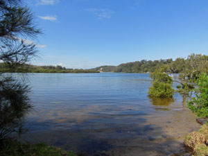
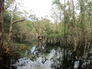
The route led us down to the shores of Lake Windermere, one of two large perched lakes. Here, however, the powerline easement turned from somewhat overgrown to dense, impenetrable heathland scrub (the risk of an exploratory walk). We were obliged to detour back to the Caves Beach Road and try again at the next side-road - a 1.5km detour to avoid some very scratchy bush-bashing. |
||

 Tranquil Lake Windermere |
 Escaping the Botanic Gardens |
 A stroll along Pine Paddock Road |
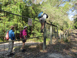
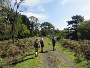
On reaching the fence of the National Botanic Gardens, we entered by an open gate. With many paths, there was some route confusion before we found the correct track following the fenceline. However, we should have been on the outside, not the inside, and ended up having to climb a high gate to exit the Gardens (NB stay right at the first gate - you can follow the fence on the outside as well as the inside and so avoid this hassle). The dirt service road led us down the western flank of Booderee, a different and more open vegetation, as we began to wind through a series of old dunes. We were on Pine Paddock Road, named for the pines, a remnant of an old plantation, growing in amongst the native vegetation. This eventually brought us out onto Ellmoos Road, a gravel road winding along the shore of St Georges Basin. |
||
 Swamplands on the western flank of Booderee |
 St Georges Basin |
 Walking long Elmoos Road |
With the calm estuary waters on our right and the forest shading the road, we made quick progress - crossing a final section of forest to reach Christians Minde, a private enclave in the National Park, settled by a Danish sailor in the mid 1800s - 26.5 km in 7h30. It had been a hard day at the office, but Christians Minde was a fine reward, with its cluster of rust-red historic weatherboard buildings set in green grassy clearing on the edge of the fast-flowing channel of Sussex Inlet. |
|
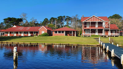 The lovely setting of heritage-listed Christians Minde (photo: J&P Gatenby) |
 Evening lights at Sussex Inlet |
 |
 Relaxing on the deck at Christians Minde with some of the locals (photo: J&P Gatenby) |
 |
It was great to have a hot shower and cold beer in the warm late afternoon sun on the deck of our cottage and, as the sun set, the lights of Sussex Inlet village twinkled across the water - a fitting end to a satisfying rain-free day of walking. What a difference 24 hours makes. |
||
|
Day 2 - Sussex Inlet to Lake Conjola (22 km - 170m ascent - 170m descent) |
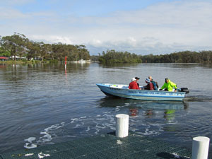
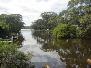
The day of the big water crossings had arrived and the fine sunny start to it was welcome, with the buildings of Sussex Inlet reflected in its glassy surface. A quick phone call to Sussex Inlet Marine directly across from the Christians Minde jetty saw the owner in his "tinny" puttering across the channel. Two such trips and we were on the other side ready to walk. |
||
 Morning reflections on Sussex Inlet |
 |
 Crossing from Christians Minde to Sussex Inlet town |
We quickly made our way along the paths and streets of the village, keeping close to the wide channel itself. The sand hills further down the channel plunged straight into the water - it looked tricky, but, when we reached them, a steep set of stairs took us up to the top of the densely vegetated dunes and down its far end. |
||
 The calm waters of Sussex Inlet |
 |
 A side canal at Sussex Inlet |
Here, the preferred route would have been along the narrow channel beach, but the tide was in and the beach had vanished. We detoured via the road to reach the entrance to Cudmirrah Beach. The tables at the Surf Life-Saving Club provided a good place for morning tea. |
||
 Descending the big sandhill |
 The entrance of Sussex Inlet |
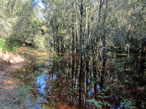
 Perched swamp in the old dune forest |
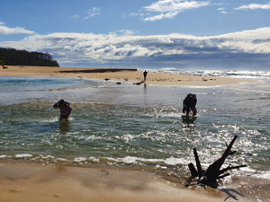
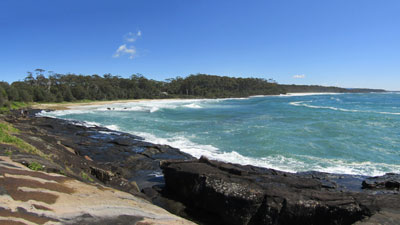
Cudmirrah is a wild and isolated beach and, with the big surf rolling in and an abundance of negative ions, it was very pleasant walking all the way to the Swan Lake outflow. Normally blocked by a sand bar, the heavy rains of La Niña had filled the lake and water was flowing swiftly out of the channel. A local resident who was watching our arrival pointed out a thigh deep crossing point further away from the entrance - water crossing 1 achieved. |
|
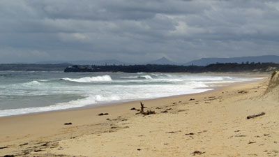 The wildness of Cudmirrah Beach |
 View south from Berrara Head |
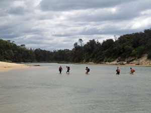 Water-crossings ... Swan Lake wide and shallow ... |
 ...Swan Lake short and deep ... |
 .... and the fast-flowing Berrara Creek |
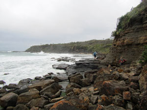
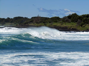
The big seas blocked the route around the next headland, so we climbed up to follow the cliff-side streets of Cudmirrah village through to the Berrara River mouth. The water crossing here, well back from the entrance was wider, but no deeper, although the outgoing tidal current was quite strong - water-crossing 2 completed. With the tide going out, the beach walking became easier as we headed down Berrara Beach for a lunch break at the rocky outcrop near Mermaids Pool, watching the big surf explode against the dark rocks. By now the early morning sunshine had given way to high grey cloud. |
||
 Big Seas at the Mermaids Pool (photo: J&P Gatenby) |
 Rounding the rocks between Berrara and Monument Beaches (photo: J&P Gatenby) |
After picking our way across the rocks to reach Monument Beach, we had a bonus water-crossing - the small Nerindillah Lagoon, which almost never connects to the sea, had over-filled and broken out following the record weekend rains. Fortunately, the channel, though fast flowing, was shallow and we were able to cross relatively easily - water-crossing 3 completed. |
||
 Checking out the outlet of Nerindillah Lagoon |
|
 A local watches us pass by |
Soon after the crossing, we finally left the sea and climbed up to North Bendalong. After a quick descent to take the easiest route via Washerwomans Beach, we climbed back up to Bendalong village and a much anticipated coffee. We arrived at 3.02pm - the coffee shop had shut at 3.00 pm. Still, the ice-creams from the general store next door alleviated the disappointment. |
||
 Inyadda Creek |
 |
 The Manyana-Bendalong Friendship Bridge |
From Bendalong, a well-formed footpath led us down to the Bendalong-Manyana Friendship Bridge (sounds like they had a war) and up again to Manyana Village. We wandered through the streets for a while before finding a track down to Manyana Beach. Ahead lay Green Island, guardian to Lake Conjola - we were almost there. Conjola was the big crossing and our walk was timed to reach it at low tide. Three days ago, the big rains had increased the lake level dramatically, but since then water had been pouring out - the crossing was feasible again. |
|
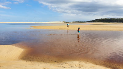
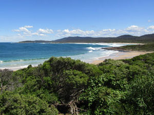
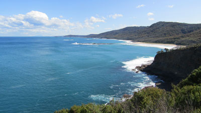
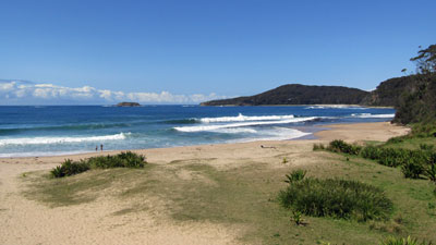
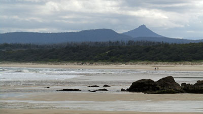 Looking across Cunjurong Beach to Pigeon House |
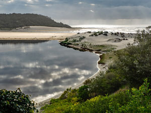
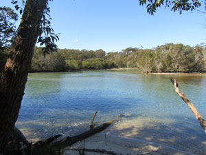
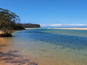
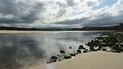 The entrance of Lake Conjola |
 |
|
 |
The fair Nello, having driven the support vehicle from Ulladulla and organised our sites at the camping ground on the lakes southern shore, stood, a solitary figure across the water, ready to be entertained by our crossing. We stripped down to our underwear, dry-bagged our gear and headed out across a shallow northern channel and over the broad expanse of now-exposed sand flats to reach the main channel. This channel was wide, but, in the end, only waist deep (or chest-deep, depending on your height) - water-crossing 4 was completed and our accommodation for the night reached. After a long wade in the cold water, the hot shower at the campgrounds was a luxury. |
||
|

Day 3 - Lake Conjola to Ulladulla (16.5 km - 120m ascent - 110m descent) |
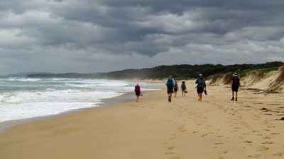
Today was an earlier start than previously - we had one more water crossing at Narrawallee Inlet, an hour down the track and the tide was already rolling in. We had timed our walk for a low-tide crossing at Conjola, which meant that we would be out of sync with the tide for Narawallee. The sooner we got there, the lower the water level and the easier the crossing would be. With the morning sun shining and the breeze at our backs it was pleasant walking down Conjola Beach bathed in negative ions with a big surf rolling in. Picking our way around the small sandstone promontory with its lovely wind and wave-etched rocks, we continued along the soft cream sand of Buckleys Beach to reach the big sand spit at Narrawallee. |
|
 Morning cloud over Lake Conjola (photo: J&P Gatenby) |
 Wave-etched sandstone platform |
 Passing a surge channel in the rocks |
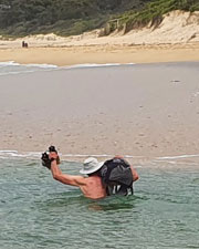
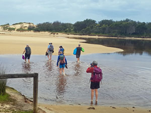
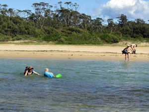
Here we took stock - despite our early start, the broad expanse of water meant that the tide was nearing full, already covering the sand flats. A deep 40m wide channel lay between us and the shallow sandflats, too deep to wade as a quick reccy proved. It was time for a cold swim, so we stashed our packs inside dry bags that held enough air when sealed to float, stripped down to our underwear and headed across the channel. It was a slightly longer swim than anticipated as the incoming tidal current carried us a way before we reached the shallows of the sand flats. A long wade to shore across them, passing some nice mangroves, completed the crossing - our most adventurous so far. |
||
 Swimming our packs ....... |
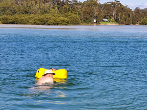 ....across Narawallee Inlet (photos: J&P Gatenby) |
 Time for a cuppa after the swim (photo: J&P Gatenby) |
After changing back into dry clothes, we dropped down on to Narrawallee Beach to continue our southwards progress. At its southern end, we left to cross over Bannister Headland via the streets of Mollymook and reach Mollymook Beach. From here, it was but a short stroll to the café at the southern end of the beach. The fair Nello had stopped by to join us for a well-earned hot coffee. |
|
 Narawallee Beach |
 Southern end of Mollymook Beach |
Pushing on, we rounded the rock pools at the southern end of Mollymook to cross over the sandy cove of Collers Beach and climb a set of stairs before the cliffs of North Headland took over. A quick traverse of the backstreets of Ulladulla brought us to the entry of the North Headland Reserve and a track that wound its way through the tall heathland scrub of the reserve. The track was made more interesting by the scatterings of colourful wildflowers, several viewpoints and a series of carved wooden reliefs showing the history of the area from an indigenous perspective ....... thought provoking. |
|
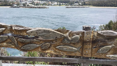 Wood relief carving on North Head (photo: J&P Gatenby) |
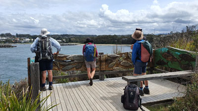 Looking out over Ulladulla (photo: J&P Gatenby) |
Leaving the reserve, we descended towards Ulladulla Harbour along a geological timescale walkway. Rocks from the region of increasing geological age (with information panels) marked our descent .... fascinating. |
|
 Ulladulla Harbour |
 Memorial to the 2020 bushfires |
Arriving at the Harbour, it was but a short stroll past the Fish Co-operative and ocean swimming pool to a set of stairs that brought us up to Ulladulla Headland Park and our tent site for the night. It was still early afternoon, plenty of time to relax and catch up on chores before continuing on down the Great South Coast Walk. |
|


Day 4 - Ulladulla to Lake Tabourie (16 km - 100m ascent - 110m descent) |
Day 4 began with a car shuffle - the four cars belonging to walkers plus support vehicle were driven down to South Durras where our walk would end, and the drivers were driven back in the support vehicle. We were now ready for the second part of the walk. Day 4 also began with an overcast sky, though the strong overnight wind had eased somewhat. With a later start due to the car-shuffle, we set out at 10am and quickly walked through some residential streets of Ulladulla to reach Rennies Beach. |
 Crossing Rennies Beach |
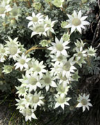
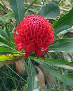
Crossing the beach, we climbed back up to the entrance of the South Pacific Heathland Reserve, a small area of protected coastal vegetation. It was a pleasant stroll through the water-logged tracks of the reserve, the dense heathland brightened up by scatterings of wildflowers in shades of white, yellow, blue and mauve. The large solitary red bloom of a waratah was the highlight. |
||||
|
|
 The wildflowers of the South Pacific Heathland Reserve |
|
|

From the reserve, we dropped back on to the soft tan sand of Racecourse Beach. The wind was at our backs making the walking easier and, after crossing over a small rocky headland continued on down Burrill Beach. The tide was rolling in fast and not a lot of beach was left to walk on. The recent big seas had eaten into the dunes wedging us between the low sand cliff and the water. Eventually, we left the beach via a short steep climb and sandy track through the heath. |
|
|
|
This led to the new Burrill Lake Bridge, which we crossed to reach a coffee shop on the southern shore of the lake - an excellent place for an early lunch. From the coffee shop, the track wandered through the reserve on the southern shore of the lake. Reaching its end, we continued across Dolphin Point Beach and on to the rock platform of the point. |
||
 The rock platform beneath Dolphin Point |
 An interesting passage |
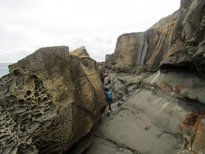 Rock couloir beneath Lagoon Head |
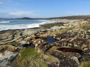
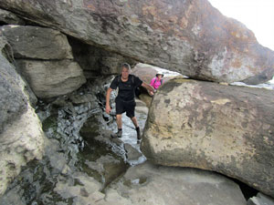
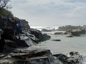
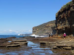
It was a pleasant change to pick our way around the rocks, with water-etched patterns and fossil beds, especially on the southern end beneath Lagoon Head, where the route meandered down corridors, around boulders and beneath overhangs of an eroded sandstone jumble. |
|
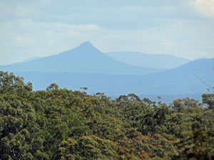
 View of Durras Mountain from the rocks of Lagoon Head |
 Meditative walk along Wairo Beach |
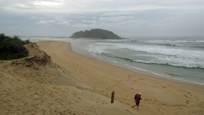
The route brought us out to 4 km long Wairo Beach, an isolated stretch of pristine sand. with the tide now retreating, it was firm underfoot and with the wind at our backs and big surf crashing in, the next hour was beach-walking at its meditative best, as we drew closer and closer to Crampton Island. The lone figure walking towards us in the distance slowly morphed into the fair Nello, who had headed up to join us after organising our camp sites. Crampton Island guarded the entrance to Lake Tabourie and the campground. It had been a shorter walking day, due to the car-shuffle, but a very pleasant one, especially with the rain showers that threatened failing to materialise. |
|


Days 5 - Murramarang Coast: Lake Tabourie to Pretty Beach (23 km - 240m ascent - 230m descent) |
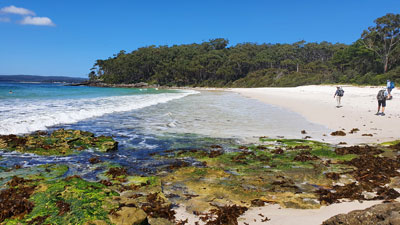
The grey clouds finally delivered on their threat overnight and a couple of rainbands passed by, pitter-pattering on our tents. Fortune favoured us and, by morning, the showers had passed. Having tested out the crossing at Tabourie the night before, we quickly waded the knee-deep, low-tide channel and crossed the sandspit on the far side to reach Tabourie Beach and continue our southward journey. As we passed Stokes Island and picked our way across the small rocky outcrop to reach Sunburnt Beach, the cloud gave way to sun. We were in for a fine day. At the southern end of the beach, a track led us up through the forest to Termeil Campground and then down again to the entrance of Termeil Lake. |
 Heading out to cross Lake Tabourie |
 Looking back to Crampton Island |
 Grey clouds over Tabourie Beach |
 A tricky section of rocks |
 Coastal forest at Termeil Point |
 Crossing Termeil Lake |
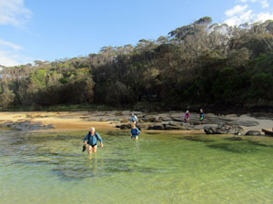
The lake was open, but with the tide still relatively low, a short thigh-deep wade saw us easily on the other side to continue the walk down the pale tan sand of Termeil Beach towards the dark profile of Meroo Headland. The sheer cliffs of the headland obliged us to take the track inland to Meroo campsite and then back down to the entrance of Meroo Lake on its far side - a pleasant though somewhat water-logged track through the coastal forest. Strolling across the broad sandbar at Meroo, we reached the lake entrance. With the tide now coming in fairly quickly, we headed up to the shallower lake-end of the channel - the crossing was another relatively easy wade, though we did have to time it between the wave surges rolling into the lake. |
||
 Tidal surge at the Meroo Lake entrance |
 Open forest on Meroo Head |
 Crossing Meroo between surges |
 |
Ahead, we could see the waves crashing up against the rocks of Nuggan Head and it seemed prudent to take the inland route around it. Cutting in from the beach, we quickly picked up the track that led to Willinga Lake. It was pleasant walking through the forest, but once we descended to the lower southern side of the point, we found ourselves in the wetlands of Willinga. For a few hundred metres the track became a long shallow lake lined with bright green sedges - it was the end of dry boots. |
 |
 Once a track - now a sedge-lined waterway |
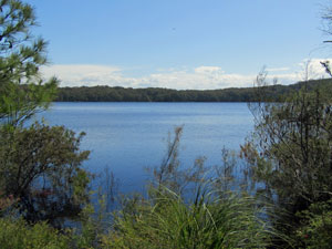
 Willinga Lake |
 Crossing Willing Lake Entrance |
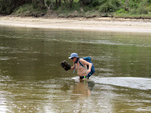
Crossing the entrance channel of Willinga Lake was even more interesting - the tide was now quite high and timing the crossing between the strong surges became critical. Still, we all made it across, chest-high for some and neck-high for others. |
|
 White water at Bawley Beach |
 Looking back across the rocks of Bawley Point |
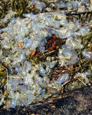
From here, we followed a short track through the bush to Bawley Beach and on to the gently sloping rock plates of Bawley Point. Crossing the small Cormorant and Gannet Beaches, we reached a mobile coffee shop on the next headland - a great spot to relax with a coffee and watch the big Pacific surf rolling in. The big seas had washed myriads of bluebottles onto the beach, which added a lot of popping sounds to the roar of the surf as we strode over them. |
||
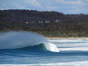
 The surf at Gannet Beach |
 |
 The big seas roll in |
After this, we dropped down on to Murramarang Beach and followed it to the Aboriginal Historical Area, where the track led us past a grove of sighing casuarinas and through the heath-covered dunes that overlaid several ancient shell middens. Humans have been visiting this area for many thousands of years. |
||
 The heathland of Murramarang Reserve |
 View over the heath towards Kioloa |
 Surf's up at Kioloa Beach |
Passing Bull Pup Point, the reserve gave way to a long stretch of beach walking, at first down Racecourse Beach and then over a small promontory to Kioloa Beach. This brought us to O'Hara Head and the tide was now heading back out. Two of our group, Jan and Philip, know this area well and they led us on a wander around the sloping rock platform and jumbled boulders that ring the headland. It made for a great low tide variant. |
|
|
|
 |
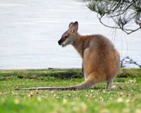
A quick crossing of Merry Beach brought us to Snapper Point. Here we climbed up onto the point and wandered along the cliffs of its southern edge for great views of the coastline to the south and Durras Mountain. A short descent brought us to Pretty Beach campsite, where the fair Nello was waiting with our gear. It had been a long and varied day of walking and it was good to settle down with the kangaroos and wallabies that call this camp home. |
|
 The forest near Pretty Beach |
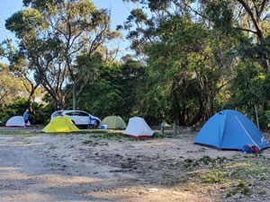 Campsite at Pretty Beach (photo: J&P Gatenby) |
 Relaxing after a long days walk(photo: J&P Gatenby) |
Even better, for the first night on the walk, the stars twinkled down on us from a clear sky. |
||
|
Day 6 - Murramarang Coast: Pretty Beach to South Durras (22 km - 390m ascent - 400m descent) |
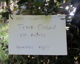
We woke to a cool, clear morning for our last day of Stage 3. A bit of revision to our original walk plan was also in order, as the National Parks people had closed all tracks along the coast between Pretty Beach and Pebbly Beach, including the link from Clear Point to Mt Durras, as this section was being upgraded for the proposed Murramarang Coastal Track. We had hoped to follow the firetrail up to the summit of Mt Durras and then drop down to Clear Point and onwards along the coast. Fortunately, there was another option as the firetrail continued down the inland side to the Mt Agony Road and then along the road to Pebbly Beach. at least it would be new territory. |
||
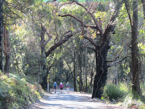
 The elegance of a spotted gum forest |
 Open bushland on the summit ridge of Durras Mountain |
 Time for a break on the summit (photo: J&P Gatenby) |
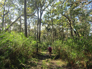
The climb up Mt Durras was long and steady, at first beneath the shade of the tall eucalypt forest, then the more open canopy, but thicker undergrowth, of the ridge line. Glimpses out east to the blue Pacific and west to the blue, mountainous silhouette of the Budawangs made this a pleasant walk. After an hour of climbing, we reached the summit for a short break. |
|
 Views from Durras Mountain out to the blue Pacific .... |
 ... and inland to the blue Budawangs |
Passing the Clear Point turn-off and its track closed sign, we continued on down a steep and slightly overgrown trail to reach Mt Agony Road. The tall spotted gum forest and richly vegetated gully with its cabbage palms made this an enjoyable detour. A quick trudge along the, at first, gravel then asphalt road brought us quickly to Pebbly Beach and morning tea time. We were back on track. |
||
 Not the coastal route this time |
 Cabbage palm gully |
 A stroll along the Mt Agony Road |
There was no time to dally over morning tea - the tide was rolling in and we had to skirt our way around the low red rock cliffs and softly rattling, smooth stone beaches to the south of Pebbly Beach. With a few judicious leaps between wave surges, as they rolled in to pin us to the cliffs and rattle the pebbles on the beach, we made it to the wide pale sand of Depot Beach. |
|
 Looking out over "not so" Pebbly Beach |
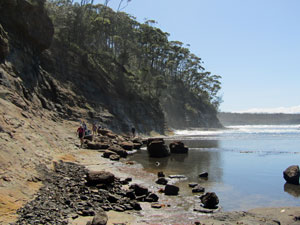
 The rock platform south of Pebbly Beach |
|
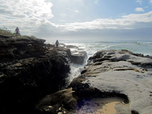
The southern end of the beach runs into a long and impressive rock platform that sweeps around the base of Point Upright. On a low tide it is passable and a very nice walk. Today, however, we were near peak tide and the ocean swell was still quite large. We decided to check it out, nonetheless, and worked our way around the corner, only to watch waves rolling across the platform and splashing in to the cliff face. It was time to turn back a few hundred metres and take the high tide route.
|
|
 Why we decided not to walk around the rock platform ..... |
 ... and walk over the burrawang covered headland instead .. |
 ... to reach the beach and Durras Lake (photo: J&P Gatenby) |

 View south from Point Upright to distant Gulaga |
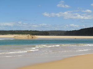
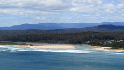 View of the newly-opened entrance to Durras Lake |
A new track was being cut over the top of Point Upright - winding its way up through the spotted gums and burrawang groundcover before descending steeply to Durras Beach. Halfway along, we made a quick in-out trip along a track to Point Upright itself and a glorious view of the coast to the south - from the distant silhouette of Gulaga to the newly opened mouth of Lake Durras - wide and white-capped, it was our last water-crossing. The northern end of the beach was a good spot for lunch, before wandering down it towards the lake entrance. |
||
 Durras Lake entrance (mechanically opened a week before) |
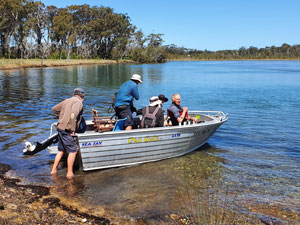 Alan arrives with his tinny (photo: J&P Gatenby).... |
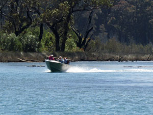 ... for a speedy ride across Durras Lake |
Only a few days before we set out, the local authorities had decided the lake was too full and mechanically opened it - now a wide and fast flowing channel and was in the process of re-shaping itself, with areas of quicksand near the opening. It would have been our most serious crossing, but fortunately, Jacqui was once a Durras girl and had arranged with her friend, Alan, to ferry us across in his tinny. This necessitated a short stroll through the spotted gum forest to a landing spot up-lake. Alan was waiting and, a few minutes later, we were all across at the boat ramp on the other side and were all still dry .... thanks Alan! Heading back to the beach, we continued southwards for a couple more kilometres to reach the Murramarang Resort and our cars. Over 120 km since we set out six days ago, Stage 3 was over. |
|
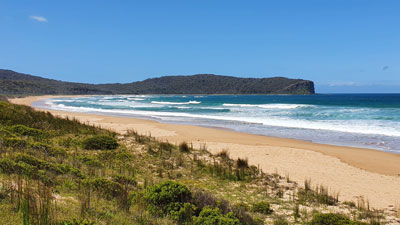 View back towards Point Upright from South Durras Beach |
 End-of-walk celebration |
We had indeed been fortunate with the weather, bookended by record falls last weekend and rain forecast for tomorrow. We had passed through four National Parks with a diverse range of forest types and heathland, crossed headlands, rounded rock platforms and walked along pristine isolated beaches. As well, the ten water-crossings this stage had been a bit more adventurous then the previous two. Re-walking this section had also enabled me to make some adjustments and add variations to the original route. Thanks to Jan and Philip, Jacqui, Sonja, Ian, Phil and the fair Nello for making this yet another memorable and congenial stage of the Great South Coast Walk. |
|