
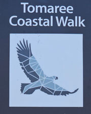
| Tomaree Coastal Walk |

About |
 |
Opened in September 2023, the Tomaree Coastal Walk is Australia's newest multi-day coast track. Although it is only 27 km long it traverses a diverse set of landscapes - sandy beaches, rocky headlands, coastal hills and large sand dunes, passing through of short and tall heathland and different forest types on the way. So here we are, two months later at Port Stephens north of Newcastle to check it out. We decided to do this walk in a bit more luxury style and booked a unit at the Port Stephens Koala Sanctuary. The units were built only 3 years ago to support the work of the Koala Hospital located in the Sanctuary. Set in shady grounds amongst the tall trees and gardens dotted with tall gymea lilies, it was a pleasant place to stay - the swimming pool was a bonus that would be appreciated after a day's walk. The Sanctuary was conveniently located at One Mile, which splits the walk inot a longer 18 km ffirst day and shorter 9 km second day. |
 |
The one downside was that I would be doing this walk alone. Despite recovering from her double knee replacement and successfully doing several multi-day walks with her new titanium inserts, the fair Nello has been hit with a pinched nerve in her L4-L5 spine. Life is literally a pain and long walks are not on the cards at the moment. Still, it meant that I had a driver to get me to the starting point at Shoal Bay. |
|


Tomaree Coastal Walk - Day 1 (18.5 km - 460m ascent - 450m descent) |
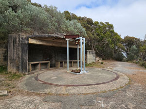
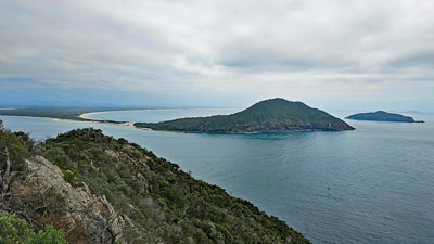
There was still quite a bit of high cloud as I set off on the first section of the Tomaree Coastal Walk, a climb up to the summit of Tomaree Head, the prominent feature guarding the southern end of the entrance to Port Stephens. Following the red brick road quickly and steeply upwards, I was soon in the humidity of the forest and perspiration was already starting to drip from my forehead. The head formed part of WW2 defences and, surprisingly, the walk route does not visit this bit of Australian history. Halfway up the climb, I continued on a 1 km loop to see the ruins of some of the big gun emplacements that guarded Port Stephens from a potential Japanese invasion - a worthwhile detour. |
|
|
|
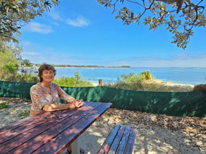
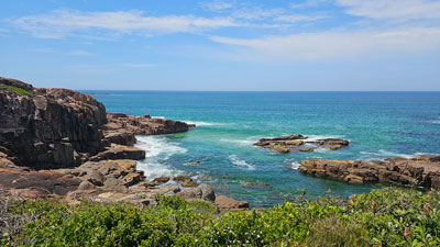
The loop brought me back to a series of metal ladders, boardwalks and stone steps that led quickly up the rocky tops to the summit and the glorious views over Port Stephens and south along the golden beaches and cone-shaped hills that define this coastline. From here, the track retraced its route down to the start point, where I spotted the fair Nello sitting at a table taking in a lovely view over Shoal Bay. The spot was aptly named Pennys Seat and it seemed a good time to stop and enjoy a coffee with her from the nearby mobile coffee van. |
|
|
|
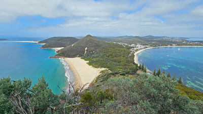
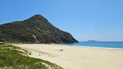
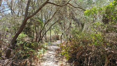
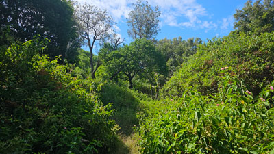
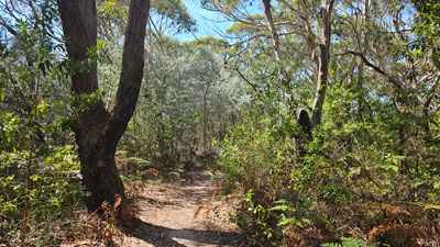
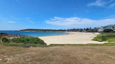
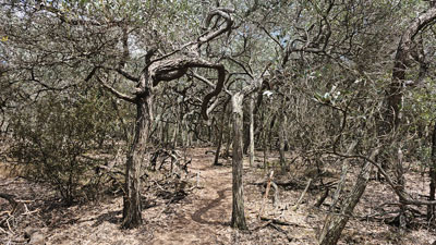
Leaving her, I pushed on and headed across the dunes for a short stroll along Zenith Beach - a short strip of pristine sand framed by the cones of Tomaree Head and Stephens Peak and one of the nicest beaches I have seen. The sun was now well and truly out and the day warming up. A second path across the dunes brought me to the start of a long firetrail that wound its way up and down across the lower western slopes of Stephens Peak and Quarry Hill. Starting out under shady forest with glimpses of the blue waters of Port Stephens through the trees, the forest changed to more open heathland and back to a more stunted forest as I traversed the landscape. |
|
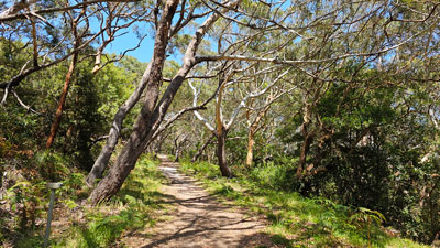 Gnarly coastal forest ...... |
 .... and open heathland on the dlopes of Stephens Peak |
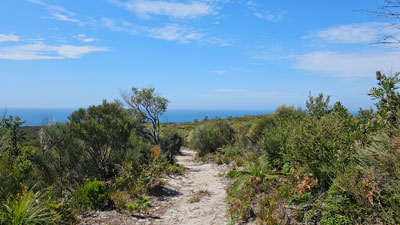
On reaching a junction, I chose to head east along another firetrail beneath the pleasant deep shade of tall coastal forest. The trail ended at the rear of the dunes and a short, steep, sandy climb up to the crest led me to a superb view to the east of the narrow sand spit connecting the mainland to Fingal Island. |
|
 View down the dunes toward Fingal Spit |
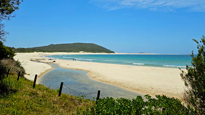 Panorama of Fingal Beach |
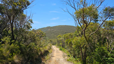
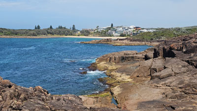
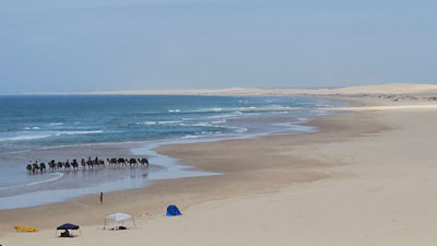
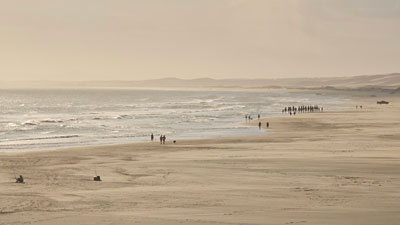
Descending the dunes, I reached the northern end of the long sweeping sandy beach that rims Fingal Bay. Strolling along it, I soon reached the Surf Life Saving Club and the Longboat Cafe, where, as anticipated, the fair Nello was waiting for me for lunch. She may not have been able to walk with me, but these catch-ups on route almost made up for it. After lunch, I followed a cycle path around the rest of Fingal Bay and its beach houses, climbing up at its southern end to reach a nice bush track that led into the headland heath. The next few kilometres would be a meandering wander through thick coastal heathland with occasional glimpses of the now rocky coastline. The air deep in the heath was still and warm and it was a relief to pass through the occasional shorter open bushes or past a gap where a cool breeze blew. |
|
|
|

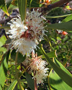
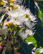
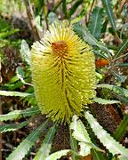
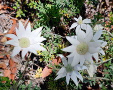
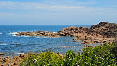
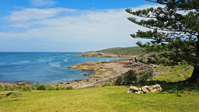
Passing the somewhat woofy Boulder Bay Wastewater Treatment Facility, the track entered a section of nice coastal forest with patches of flannel flowers and cycads. It continued on its headland way, heathlands on the sandstone heights, taller more open forest in the back dunes, groves of gymea lilies with their 6m flower spikes and glimpses of the rocky coast. At Big Rocky, I detoured down a short side track to take in the views of the rocky outcrops with their pools and stony coves. |
|||
 |
 |
 |
 |
|
|
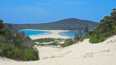
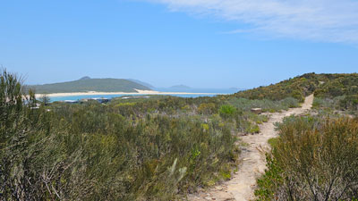
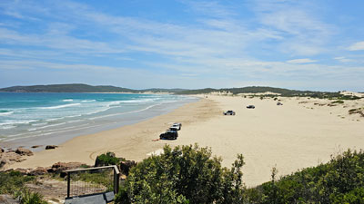
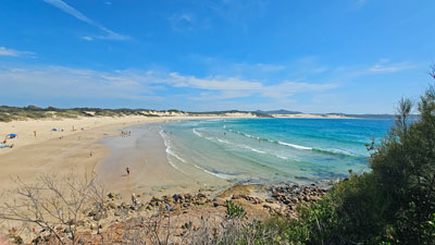
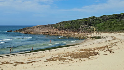
Then it was onwards along one final heathland / forest path to reach Samurai Beach. From the viewpoint and with the tide out, the beach was very wide, firm and flat - one might say perfect to drive on. Clearly, that had been said before as several 4WD vehicles were parked along its length. |
|
 The wide expanse of Samurai Beach |
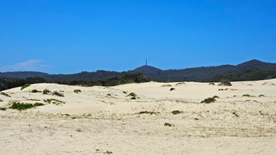 Dune system backing Samurai Beach |
I sauntered by, heading quickly up the firm sand to the vehicle entrance/exit point through the expansive dunes that backed the beach. The sand on this track was very different, dry, soft and hard on the calves. Still, it was a way to experience the dune system and, after a while, I found the firmer foot track that skirted a reed-filled swamp area and arrived at the gateway to the Koala Sanctuary, home for the night. |
My, how good the pool in the sanctuary looked when I arrived to find the fair Nello doing her hydrotherapy laps. Soaking in the pool and replacing my salty perspiration with its cool clear water was the perfect way to finish the long day of the Tomaree Coastal Walk. |
|
Tomaree Coastal Walk - Day 2 (10 km - 210m ascen - 210m descent) |
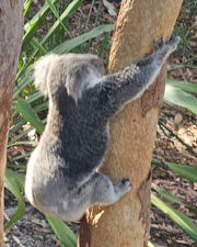 |
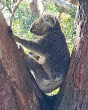
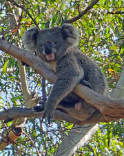
Today the forecast was for over 30°C, conditions in which I normally wouldn't go for a bushwalk. However, there was no choice as tomorrow would be even hotter and, besides, we were leaving then. We did have an interesting start to the day, as part of our deal staying at the Koala Sanctuary was a guided tour of the facilities, including pens housing koalas that were recovering from injury or could no longer live in the wild. I'm not normally a "guided tours person", but the fair Nello and I did learn a lot about the koala hospital and rescue service and some things about koala biology that I didn't know or had forgotten. I say the latter because 53 years ago, I did a Zoology Honours project to determine the oestrous cycle of the koala. I've been pissed on and had my finger bitten by koalas in the process (I can't blame them considering what I was doing), and the project left me with more than a passing interest in these iconic marsupials. |
 |
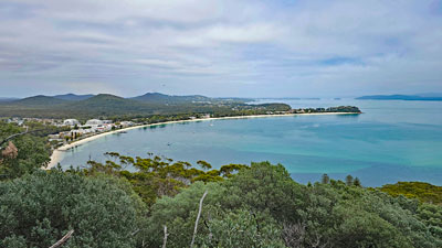
Still, it was getting warmer and time to set off on this second and shorter day of the coast walk. I headed directly to One Mile Beach, crossing a small lush section of coastal forest and a broader dune system to reach it. |
|
|
|
|
 View across the bay to the coastal dunes |
 |
A set of stone steps at the southern end of the beach led me up onto the edge of the headland with expansive views back up the coast. After a while, it doubled back, climbing gently to cross the forested headland on a sandy foot track, before descending through a dense heathland to the the rocky coastal edge. |
|
 The forest .... |
 .... and heathland behind Morna Point |
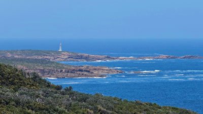
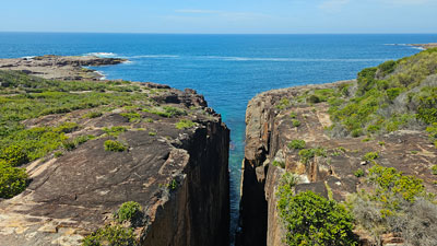
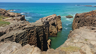
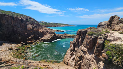
A viewpoint gave the opportunity to admire a deep slot canyon, a gash in the cliff line penetrated by the ocean that bears witness to the ancient volcanic system that once dominated this region. From the slot canyon, I followed the signage across an open area of rocky headland, part of the ancient lava flows, and on to the village of Boat Harbour - the cooling breeze out on the rocks was appreciated but it was time for a break on this hot day. |
|
|
|
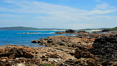
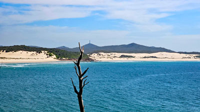
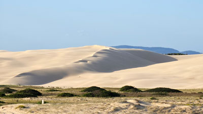
Crossing the beach at the end of the tranquil cove of Boat Harbour, I climbed up to wander past its houses, before picking up a road down to Kingley Beach. The coastline was starting to open up with expansive views to the south and, for the first time, I had a glimpse of the fabled Worimi sand dunes, apparently the largest mobile dune system in the southrn hemisphere. |
|
 Kingsley Beach |
 Rocky coastline near Little Kingsley |
This area seemed to follow newly created track that meandered along along the rocky top towards Little Kingsley Beach. Sets of sandstone steps made the climb down to and out of the beaches easy. From Little Kingsley, the track led back into some gnarly banksia, acacia and paperbark heathland that morphed into taller eucalypt forest before arriving at the village of Fishermans Bay. |
|
 Deep in the gnarly banksia heath |
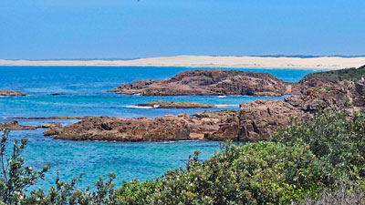 The Worimi sandunes stretching 25 km to the south |
I was rapidly closing in on the end of the walk - one last section of jagged rocky cliffs and a final view over another slot canyon brought me to Anna Bay. Looking down from the height of the track above I noticed a familiar figure at the Slot Canyon viewpoint - the fair Nello had walked out to meet me. |
|
|
|
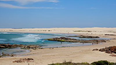
She led me back across Birubi Point to a superb viewpoint of the massive Worimi Dunes. This seemed to be the official end of the Tomaree Coastal Walk, but the dunes attracted me and I thought it would be nice to wander up to the dune tops and experience a little of the Sahara-like landscape. After lunch at nearby Birubi Beach, I followed a footpath over to the Birubi Surf Club and the start of the dune system. However, I soon changed my mind about walking deep into them - as soon as I stepped onto the broad expanse of sand, a thermal wave of reflected heat blasted up. Extensive dune-walking suddenly seemed a better proposition for winter, and a swim in the cool rocky channels of Birubi Beach with the fair Nello seemed the much better proposition for now. It was a very refreshing end to a hot day of walking. |
|
|
|
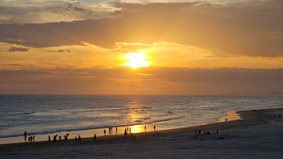
That evening we returned to Birubi Beach for a sunset dinner to celebrate a great walk along some new coastline and watch the sun set over the sea - not something you can do very often on the east coast of Australia. |
|
