| Santa Cruz Trek (Cordillera Blanca) (part 1) |
Getting there |
||
|
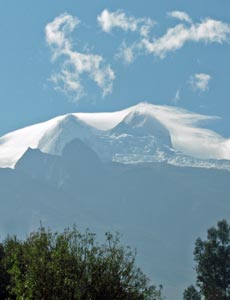 View of Huascaran from Caraz - draped in cobweb clouds |
|
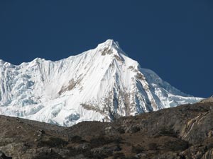
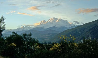 The last rays of sun illuminate 6750m Huascaran, Peru's highest mountain |
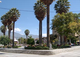 The main plaza of Caraz |
|
Laguna Paron Day Walk |
||
|
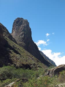
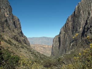
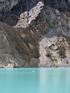
 The impressive 1000m black rock walls |
|
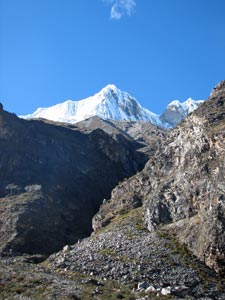
 Farmlands on the way up to Laguna Paron |
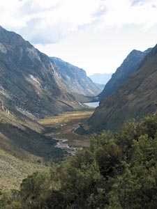
 View toward the mouth of the Paron Canyon |
|
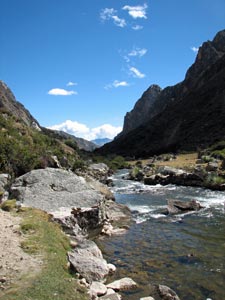
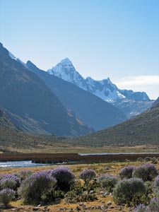
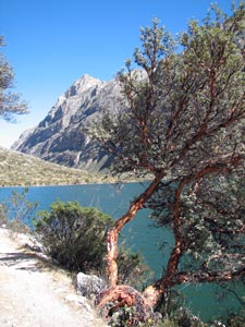
 First view of Laguna Paron in its alpine setting |
We travelled up to the lake by taxi, climbing up a rough dirt road past small houses, fields, crops and orchards, guided upwards by the icy 6350m pinnacle of Nevada Huandoy, to eventually reach the mouth of the canyon that led to Laguna Paron. Looking the 1000m high almost vertical walls and dark sculpted granite spires, we knew that we were arriving at somewhere special; looking the large mass of greyish cloud at the head of the canyon, we weren't quite sure what we would actually be able to see. |
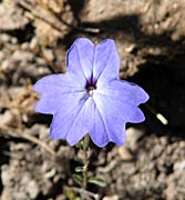
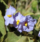
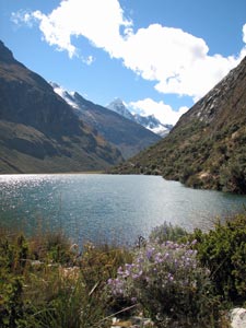
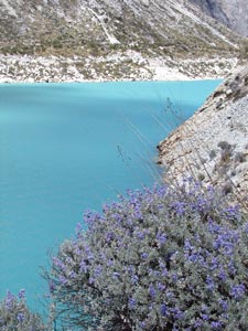 Blue lupins and turquoise water |
|
 |
 |
||
 |
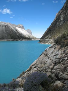
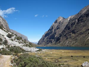
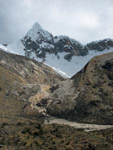
After a series of switchbacks that took us up the steep bed of the Rio Paron as it rushed down through the canyon, we arrived at the lake. At 4200m, a few hours walking here should help get us back into high altitude trekking mode. Despite the cloud, it was still an impressive sight, held back by a steep morain on one side and a sheer granite cliff on the other, the turquoise waters of the long lake took our gaze back to its far end and the glaciers of Nevados Pyramide (5880m) and Chacracaju (6120m). The clouds covering their peaks hid the scene that adorns many postcards, but we could not help but be impressed by the setting. |
 |
|
 Morain wall below Huandoy |
 On the track around the lake edge |
 Looking back up Laguna Paron |
 Lunch in the shade of a Quenua tree |
 Farewell Laguna Paron |
 Climbing the morain high above the Paron River |
As we walked around the northern edge of the lake, lined with blue lupins beneath steep cliffs, the sun broke through to shine on the 6350m peak of Huandoy high above its southern shore. Cloud drifted past the mountain and the great slabs of the glaciers perched on the edges of rocky precipices high above the turquoise waters. |
 The glaciers of 6350m Nevado Huandoy |
|
|
 |
|
 Huandoy appearing between the clouds |
 Nello in the Quenua forest |
 Another view of the 1000m canyon walls |
 The Paron River |
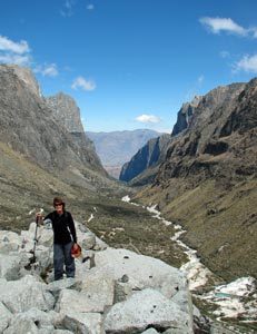
Day 1 - Cashapampa to Llamacorral (10km - 860m ascent) |
|
|||
 The 6240m pyramid of Nevado Santa Cruz |
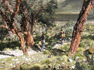
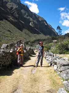
 Eliab and Nello at the start of the trek |
 The mouth of the Santa Cruz Gorge |
 Path up into the gorge |
|
||||
 |
 |
 |
 |
 |
|
|||
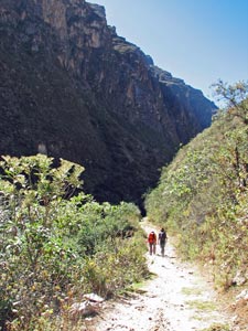
 Rockfall in the Santa Cruz Gorge |
 Loking back down the gorge |
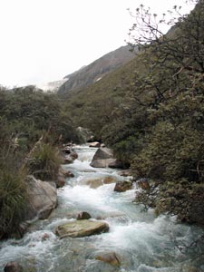
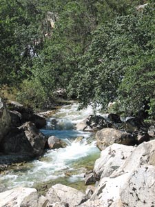 The Santa Cruz River |
 The stony path up the gorge |
|
|
||
 |
 |
 |
|
|
|||
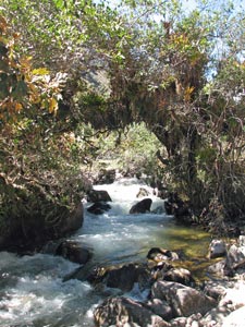
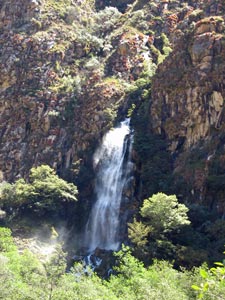 Waterfall in the gorge wall |
 The Santa Cruz becomes more gentle |
 Track between the old stone walls |
|
 A good spot for lunch |
We followed a broader path that meandered along a rocky ancient morain; many of the rocks had been used to build low stone walls, built over the centuries by local communities to hold their cattle. We met several of these mountain cows on the way. |
||
|
|
|
|
|
||
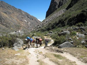 Luis and the donkeys catching up to us |
 A curious ball cactus in flower |
 In the upper valley - looking towards distant Taulliraju |
|
||
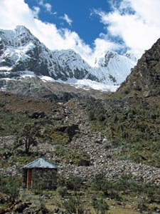
 Campsite at Llamacorral |
 |
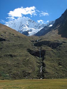
 5850m Nevado Taulliraju at he head of the valley |
Day 2 - Llamacorral to Taullipampa (18km - 650m ascent - 250m descent) |
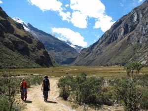
By morning the wind had dropped to a gently breeze that barely turned the wind turbine and there was not a cloud in the sky. Soon the sun burst out above the distant silhouette of Taulliraju, washing out the eastern horizon in a blaze of light. At 8am we were ready to head on up the valley from Llamacorral eastward into the early morning sun. We followed the babbling stream across the grassy flats, which eventually narrowed as we neared a rocky spill from a gap in the southern wall of the valley. |
 The Santa Cruz River babbling through the valley |
|
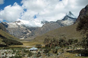
 Early morning in the grassy flats of Llamacorral |
 The ridge of Nevados de Caras gives us a taste of what is to come |
|
|
|||
 A deep cleft in the wall of the valley |
 Nello heading up through the lupins |
 View of Laguna Icchicocha and Taulliraju |
 Our faithful caballo bringing up the gear |
 The reedbeds of Laguna Ichiccocha |
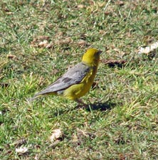
 At 4200m we didn't expect to see a black-capped gull |
 Looking back down the flat valley between the two lakes |
 Laguna Jatuncocha sparkling in the morning sun |
|
|||
 |
 |
 |
 |
|
|
||||
 On the shore of emerald-green Jatuncocha |
 Quenua tree next to the lakeside track |
 Trail through the quenua thicket |
 6040m Quitaraju above a ribbon waterfall |
|
|||
 View back over Jatuncocha in its steep-walled valley |
 Heading down the road to the high pampa ... |
 ... where wild horses grazed |
|
||
 The river at Quishuarpampa - a good lunchspot |
 View of our track up from the hanging valley |
 About to crest the lip of the valley and see... |
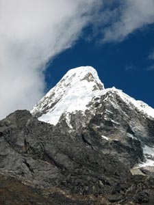
 ...magnificent 5945m Alpamayo |
|
 The Alpamayo Cirque - viewed from the "world's best lunchspot no. 18" |
||
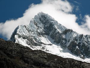
 The impressive 6025m Nevado Artesonraju
|
 The jagged razor-edged profile of 6040m Nevado Quitaraju
|
 Can you spot the climbers? Look high 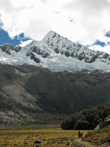 The peak of Alpamayo 1750m above the pampa  Glacier tumbling into the milky green water of Laguna Arhueycocha |
|
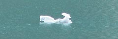
 Pale green face of the glacier and iceberg |
 The fluted ridgeline of 6008m Pucajirca Oeste high above the lake |
 Across the valley the cornice capped peak of 5880m Nevado Piramide |
 In the full sun the water looked even milkier |
 The 5850m peak of Nevado Artesonraju piercing the clouds |
|
 Alpamayo landscape |
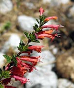
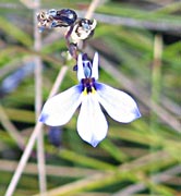
 Blue lupin spike |
 |
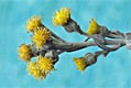
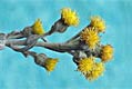
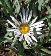 Flowers of the alpine pampa |
 |
 Crossing a mountain stream |
|
||||
 Crossing the grassy slopes above the Santa Cruz Valley |
 View back down the valley to the high pampa and Laguna Jatuncocha |
 View up Quebrada Arteson to Nevado Artesonraju |
 Taulliraju reappears- magnificent in the late afternoon sun |
|
||
 Taullipampa - elected to the list of "World's best campsites" |
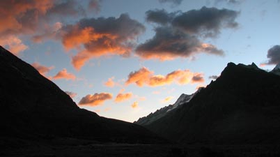 Santa Cruz sunset |
 A pinkish tinge fringes the peaks in the last rays of the sun |
|
||