| Santa Cruz Trek (part 2) |
Day 3 - Taullipampa to Cachmapampa (15km - 650m ascent - 1100m descent) |
|
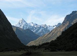
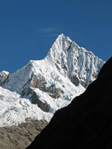 Morning sun on Alpamayo |
|
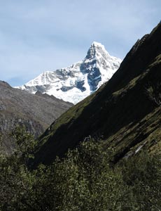
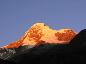 Alpenglow on Artesonraju |
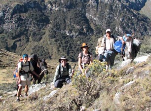
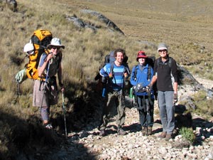 One of the good things about trekking is that you meet nice people |
|
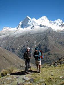
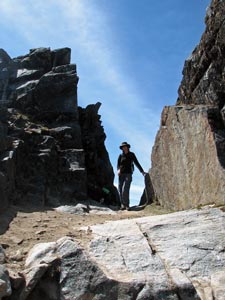
 Climbing the Punta Union Pass 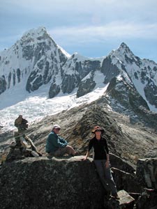 Eliab and Nello at 4800m on the ridge of the Punta Union Pass |
|
||
|
|
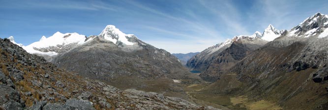
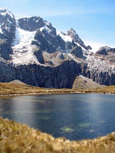
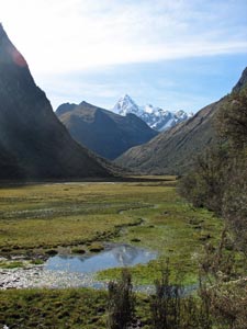
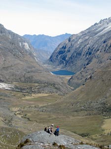
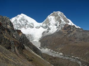
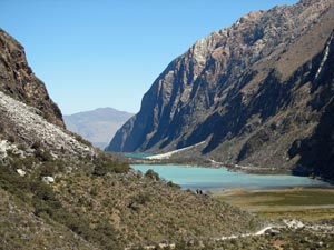
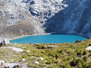 Taullicocha at the base of Punta Union |
|
|
|||
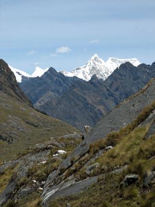
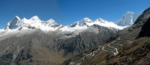
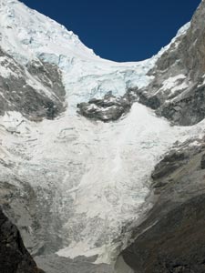
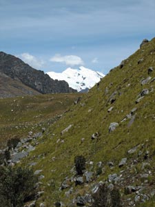
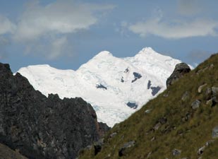
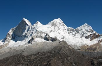
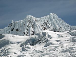 The magnificent glaciers and fluting of the Cordillera Blanca |
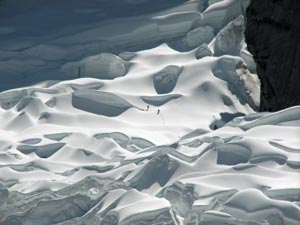 Spot the glacier walkers - easier than last time |
||
|
|||
|
|||
 Nello in the gap of Punta Union Pass (4760m) |
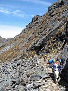 Mule train ascending the pass from the east |
 The contrast of dark rock walls and snow |
 Descending the east face of the pass |
|
|
|
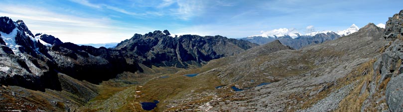
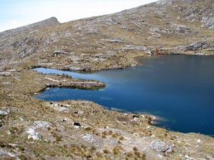 The first of two glacial lakes |
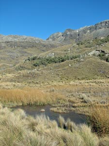
 Morococha in the tussock grass puna landscape |
|
 |
|
 |
|
 Track down the morain below Cerro Pucaraju |
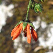
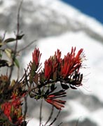
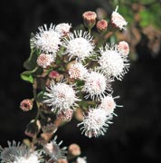
 Contrahierba in the "V" of Huaripampa Valley |
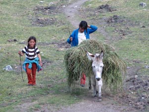
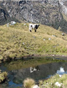 The Peruvian mountain cow |
 Waiting for "he who takes too many photos" |
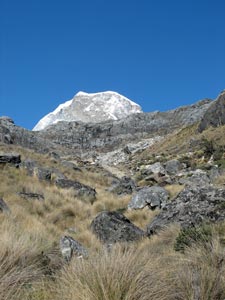
 Nevado Contrahierba - another 6000+m mountain |
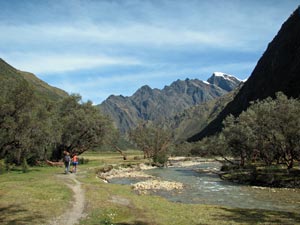
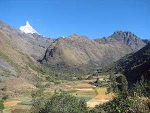
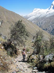
 View back up the Huaripampa Valley |
|
|
|
|
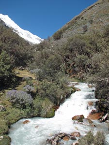
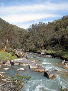 The Huaripampa River |
|
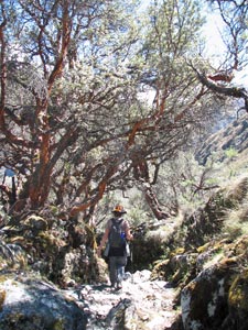
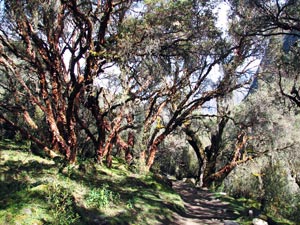 In the shade of a quenoa forest |
 Track between forest and river |
|
|
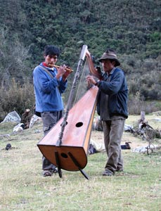
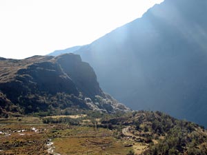
The valley now opened out into a broad marshy flat, across which braided streams meandered. As we crossed the flat, the familiar profile of Taulliraju began to appear yet again above the northern horizon. It was certainly the beacon of our trek. Finally, we reached our campsite at Cachapampa and, once again, Luis had found a sheltered spot - next to the river, with a coke/beer salesman from the nearby village awaiting our thirsty arrival.
Two local musicians were also waiting, which led to the surreal scene of the fair Nello and I sitting on camp chairs in a grassy field in this magnificent Cordillera Blanca landscape, listening to a private recital of Chimaychi music on harp and flute, as the sun set behind the mountains; surreal but serene. |
|
|
Day 4 - Cachapampa to Pacchapampa (11km - 700m ascent - 360m descent)
|
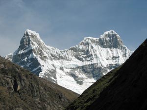
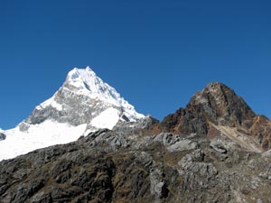
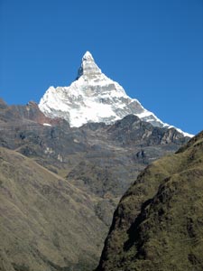 The 6120m "finger" of the eastern face of Chacraraju |
|
|
 Chacraraju surveying the fertile valley of Huaripampa |
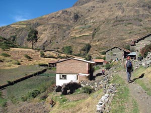
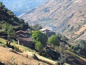 The houses of Huaripampa |
|
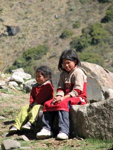 Caramelo Kids of Huaripampa |
|
||
 |
 |
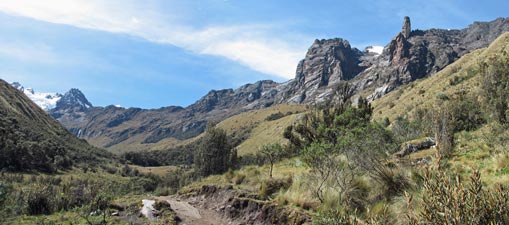
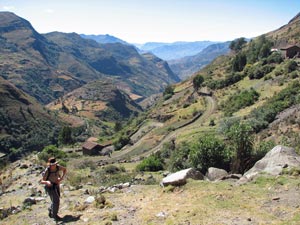
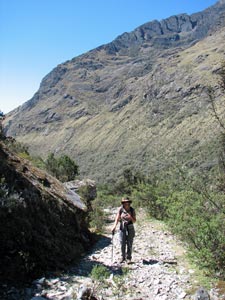
 Crossing a dry ridge between two valleys
|
|
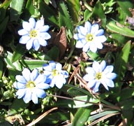
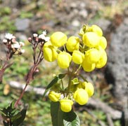
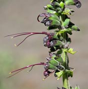
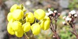
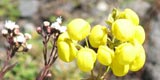
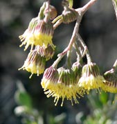
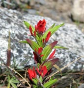
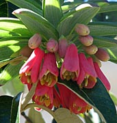
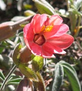
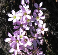
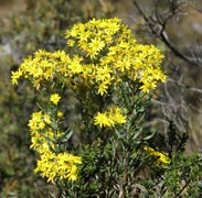
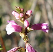
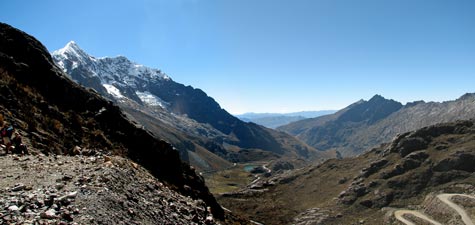
It was also time to change valleys; the track climbing steadily around the edge of a dryish spur before heading up the Quebrada Morococha, shaded by trees and shrubs and lined with white and yellow flowers. |
|||
 Climbing the morain up to Vacqueria |
Sadly, once we had crossed this stream, a steep climb awaited on the other side - up an ever drier ridge and finally a stone morain to reach Vacqueria. Here most trekkers end their walk and catch the local collectivo or bus back to Caraz or Huaraz. For us, it was a good chance to rest, only just having regained the height lost this morning. We chatted to a group of Japanese waiting for their bus; they had done the trek as an acclimatisation for an ascent of 5760m Nevado Pisco and not a one less than 60 years old - now there's a thought for something to do in ten years time. All hail to the group! |
|
|
|
||
 The road to Chapicalqui |
 Climbing the old horse-track up the Yanapaccha ridge |
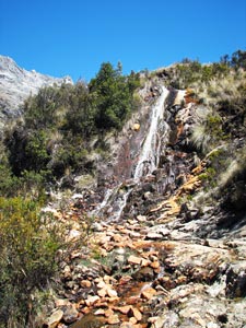 A small waterfall on its red rocky bed |
|
|
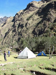
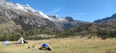 Pacchapampa campsite at 4140m beneath the western ridge of Chapicalqui and Llanganuco Pass |
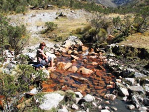 Time to soak tired feet in the icy waters at Pacchapampa |
Day 5 - Pacchapampa to Yuraccampa (11km - 590m ascent - 830m descent) |
|
|||
 Looking back over Pacchapampa wetlands and campsite |
|
|
 Expedition group photo |
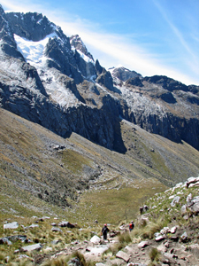
 Huascaran emerges above the Punta Union Pass |
|
 Frozen pond in the high puna grasslands |
|
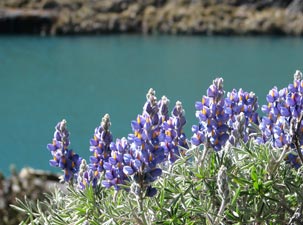 Lupins on a lakeshore |
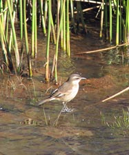 Small bird on a frozen pond |
||
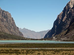
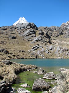 Glacial lake below the Punta Union Pass |
|
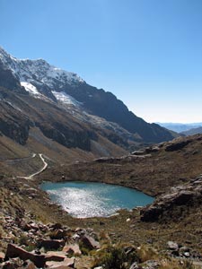 Glacial lake shimmering in the sun |
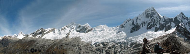
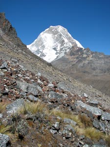
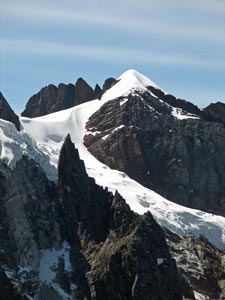
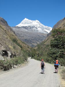
 The 6400m pyramid of Nevado Chapicalqui |
 View of our path up the eastern side of Llanganuco Pass |
 Nello and Eliab at Llanganuco Pass |
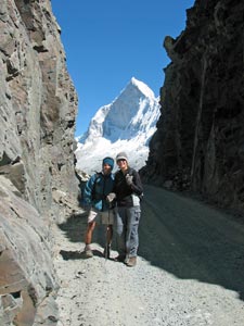
Adding a layer of clothing to keep out the icy wind, we walked from one side of the pass to the other; the white profile of one the peaks of Huandoy framed by the dark rock of the pass told us that we were about to see something special. Emerging on the western end of the gap, a huge panorama opened up; to the north, the four peaks of the Huandoy Massif, linking to Nevado Pisco and the high fluted ice walls of Nevado Chacraraju. Below the many switch-backs of a road, five years in the making, descended steeply 800m to the valley floor.
|
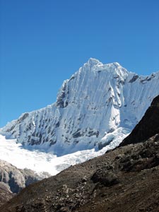 The fluted western wall of 6160m Chacraraju |
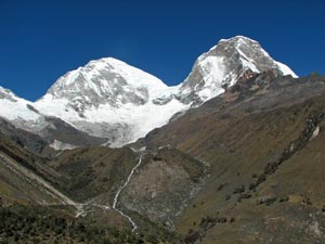
To the south the twin peaks of Huascaran, at 6758m the highest peak in Peru and second highest in South America filled the skyline, a hanging glacier filling the gap between them. The glacial morain curved away beneath the peaks feeding into a silvery cascade and stream that carried the meltwaters down through a steep-wall valley covered with tussock grasses and lupins. |
|
 The four peaks of 6350m Nevado Huandoy |
 The twin domes of Huascaran - Peru's highest peak at 6758m |
|
|
|||
|
|
|
|
|
|||
 Descending the western slope of the pass |
 Passing through one last groves of quenoas |
 The rushing waters of the stream fed by the Huascaran glacier |
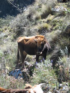 The Peruvian mountain cow - faunal emblem of the Santa Cruz trek |
|
||
 One last look at Huascaran in its magnificent setting |
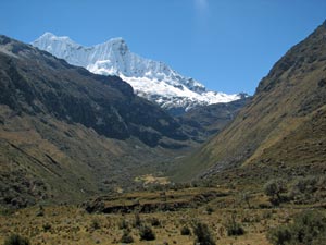 The valley leading up to Chacraraju |
 View over the steep walled Llanganuco lakes |
|
||
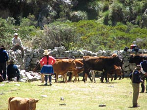 Cattle market at Yuraccampa |
 The grassy flats above the Llanganuco lakes |
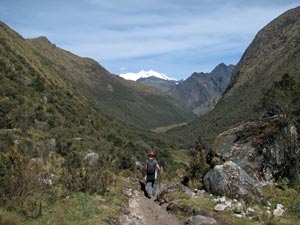
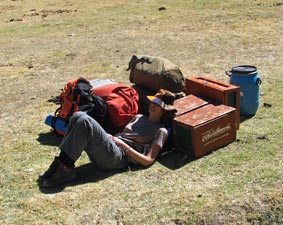 Five days in the mountains can be tiring |
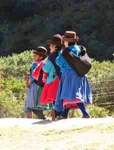 Three women of Ancash |
|
|
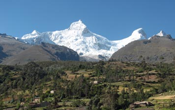 It is easy to see why Ancash is referred to as the Switzerland of Peru |
 More superb alpine scenery on the descent to Caraz |
|
|