| Bay of Fires Walk |
About |
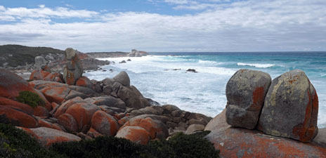
The Bay of Fires was named by an early British sailor for the numerous smoke plumes from the aboriginal campfires along the coast. Sadly, the original inhabitants are long gone, but the physical beauty of the bay, with its blue seas, white sand and red-tinted rocks remains. The Bay of Fires Walk has become one of the better known walks in Tasmania, largely due to its promotion as a high-end hike, complete with stay at luxury ecolodge with gourmet meals and fine wines. Curiously, although the ecolodge is situated at the northern end of the Bay of Fires, most of this walk is further north, along the beaches of Purdon Bay and Cod Bay in Mount William National Park (I suspect that Cod and Purdon have less cachet as a name for a great walk).
Lesser mortals, however, can still walk the Bay of Fires, even though the logistics can be difficult. We also wanted to walk the full length of this iconic bay, so some serious planning had to be done. There is a problem with fresh water, as many of the campsites have no tanks and the coastal creeks are all brackish. Hence, the day prior to starting the walk, we drove out and checked possible camp sites, leaving a food and water stash at Policemans Point and a couple of water bladders hidden at Big Lagoon. We also checked out the mouth of Ansons Bay, which we had to cross. We had timed our walk to fit in with low tide at that point and it was good to see that it could indeed be crossed, if involving a short swim. Arranging for the local taxi to take us to the start point at Deep Creek and pick us up from the end point at Binalong Bay completed the preparations. Thus, with all in place, we spent a pleasant evening at St Helens where we would leave our car, dreaming of the next four days walking on Tasmania's fabled Bay of Fires. |
|
Day 1 - North from Deep Creek (8.5 km - 30m ascent - 30m descent) |
It took almost an hour in the taxi to reach the starting point of our walk at Deep Creek in the Mount William National Park. After farewelling the driver, we set up camp in the shelter of a grove of casuarinas and had an early lunch. Today would be more of a stretch-your-legs walk without the weight of a full backpack. Light of foot, we wandered down the road briefly to climb the high coastal dune. |
||
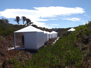
 Campsite at Deep Creek |
 |
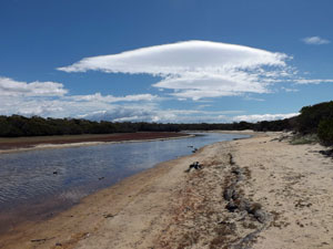
 The lagoon at Deep Creek |
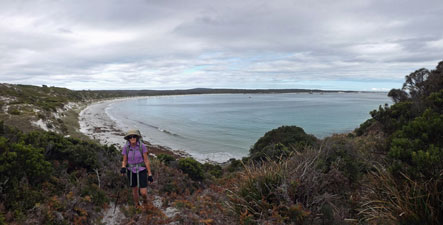
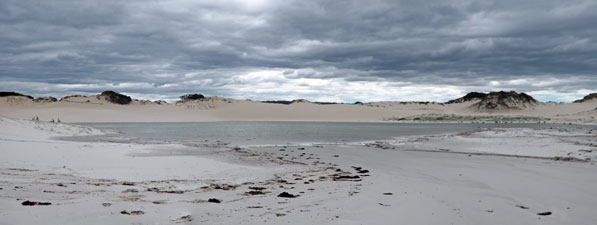
From its crest, there were glorious views of the gently curving strip of white sand separating the azure waters of Purdon Bay from the line of heath-covered dunes. To the south, we could see as far as the lighthouse on Eddystone Point, while to the north, the view across the water extended as far as the silhouettes of the Furneaux Islands in Bass Strait. With clusters of massive water-smoothed tan and grey boulders both on and off shore, it was an impressive coastscape. |
|
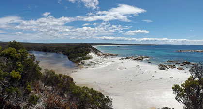 View north over the entrance to Deep Creek |
 The Furneaux Islands (over 40km away) |
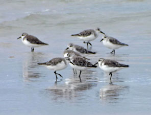
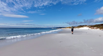
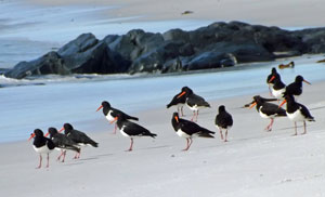
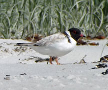
We dropped down on to the beach and turned north, enjoying the firm white sand beneath, the blue sky above and the cool easterly breeze. There must be some big kelp beds off shore in this part of the world, as retreating waves left scallop-shaped lines of kelp fruit on the sand and a slightly sulphurous, briny scent drifted from the fermenting piles of washed up sea-weed. It was not an unpleasant smell, just one which very definitely said "you are at the seaside". We were alone on the beach, apart from the scurryings of plovers, wheelings of gulls and piping calls of oyster-catchers, unhappy to have their idyllic life disturbed by a pair of humans. |
|
 Rocks off Deep Creek Head |
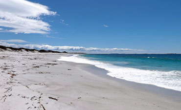 The long white beach of Purdon Bay |
A little further on, we reached a gap in the dunes where the shallow lagoon of Broad Creek lay trapped behind a wide sand bar. Here we turned inland to follow the lagoon northwards behind the dunes. The air warmed up in the lee of the wind, as we passed the red samphire flats and followed a narrow foot pad into the heath. The track led us through the dense coastal scrub, cutting from one salt-scalded clearing to another, before eventually climbing up on to the crest of the dunes - back into the cool easterly breeze and extensive views up and down the shore. Out to sea, the surf broke on the distant bird haven of George Rocks. |
|
|
|
Dropping back on to the beach, a short walk along the boulder-strewn sand brought us to the glamper camp set up for people doing the commercial Bay of Fires Walk. We two non-commercial walkers had a quick sneak-peak and headed on to sit on the rocks below and enjoy the sweeping views of white-rimmed Cod Bay curving to the north. |
||
 |
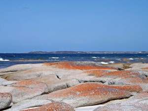 Lichen-covered rock platform |
 |
Then it was time to turn back, this time sticking to the sandy beach highway as it led us southwards and back to Deep Creek. On reaching the sandy bar of the creek, we continued on a little to enjoy the turquoise water and clusters of orange-lichened granite boulders scattered on the beach, in the shallows and out to sea. |
|
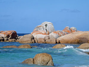 Off-shore rock formations |
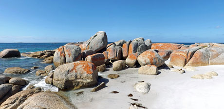 The colours of the shoreline rocks |
|
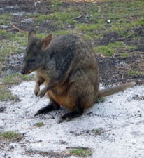
With the cool of evening in the air, we headed back to our tent, where the camp wallabies and pademelons were already on the move. This is a great place for wildlife - as I write, blue wrens flit about my feet and a kookaburra watches me imperiously from a nearby branch. |
|
|
 |
 |
||
The walk was short but spectacular and left us keen to to head south in the morning to Eddystone Point and the Bay of Fires beyond. Only a brilliant sunset would make the evening more perfect ..... and nature obliged. |
|
Day 2 - Deep Creek to Policeman's Point (16 km - 80m ascent - 80m descent)) |
It had been an interesting night, with wallabies, pademelons and possums creeping around the campsite, occasionally upsetting saucepans with a clang. Still, we slept reasonably well and woke to a very different day - a big band of cloud had pushed in from the south-west. The wind felt light and warm, however, as we hoiked on our full backpacks and set off, looking forward to pleasant conditions for the day's walk.
|
|
After a brief back-track down Deep Creek road, we cut through the sandhills, past a couple of the old fisherman's huts
|
||
 A curious morning light |
 |
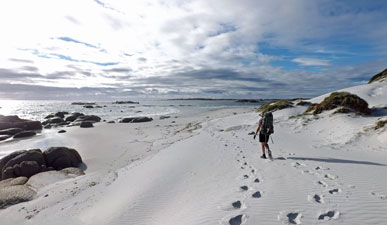 Heading south on the soft white sand |
Reaching Picnic Point, we picked our way over the large lichen-bright boulders that line the coast here, before turning in near some more fisherman's huts to follow a faint footpad through the scrubby heath to the next beach. Thus we avoided the worst of the boulders at Picnic Point. |
||
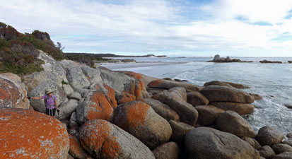 Crossing the boulders at Picnic Point |
 |
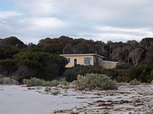 An old fisherman's hut |
The southern end of Purdon Bay was a sweeping curve of white sand, protected from the big seas by Eddystone Point, whose lighthouse had been our focus all morning. At its end, a small foot track took us up the steep side of the point and through some dense headland heath to yet more fisherman's huts. The dirt track into these huts led us out onto a gravel road and the gravel road led us to the lighthouse precinct.
|
|
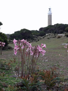
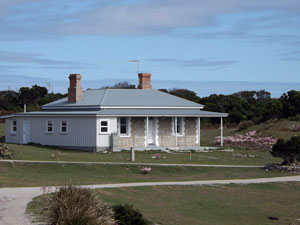
On a neat grassy clearing, with clumps of lurid pink naked ladies in bloom, were the three keepers' cottages, while, just below, the lighthouse rose 40m above the point. Built in 1889 with chunky curved slabs of granite, Eddystone is an elegant lighthouse. It was a good place for a break and, what's more, the sun peaked out from a gap in the clouds. |
||
 Eddystone Lighthouse (built in 1889) |
|
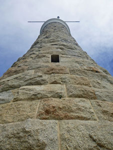 A curious view of the lighthouse |
Over the heath, we could finally see the northern end of the Bay of Fires, a long and wide line of white sand backed by white and tan dunes, and framed by the silhouettes of distant hills. It made us keen to get there, so we returned to the cottages and found the sandy foot pad that led down to a small cove. From here, a short climb up onto the edge of the dunes led us past a rocky outcrop and back onto the broad stretch of white sand that we had seen.
|
It was indeed a lovely place and we revelled in the walk down as the big surf rolled in. Along the way, we crossed paths with a pleasant group of four walkers who had joined the beach just below the lighthouse. They were heading to Ansons Bay and were the only other walkers we would meet all day. Little did we all know that the coastal scenery in between was only going to get better. |
|
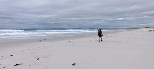 On to the broad white sand beach of The Bay of Fires |
 Walkers below the lighthouse |
|
|
|
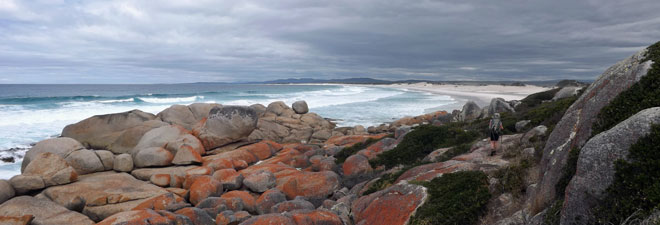
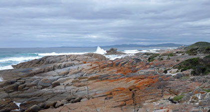
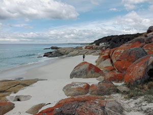
At the end of the long beach, a large shelf of massive slabs and boulders barred the way. The route across, however, was easy to find and we picked our way across slabs of orange-tinted granite backed by the blue sea and pounding surf. The sun even came out from time to time to light up the rocks - fire by name and fire by nature. |
|
 Rock ribs marking the end of the northern beach |
 Red-lichen tinted rocks backed by the foaming surf |
|
|
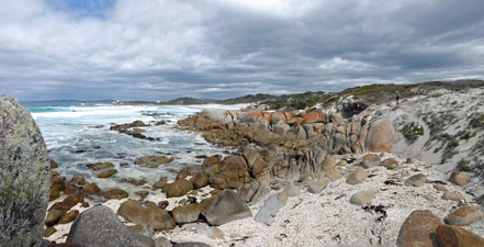
We passed a progression of these granite outcrops, weirdly beautiful of shape and colour, separated by small shelly-beached coves, as we wandered along to the sound of the surf and the clinking of shell beds beneath our feet. We could see why this part of the Bay of Fires is special - so special that the commercial walk people have built their luxury ecolodge high on the wooded slope above. |
|
|
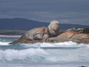 The big rock turtle climbing on to Bailey Head |
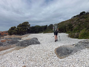 Crossing the shell-beds |
|
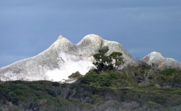
Passing the giant turtle-shaped rocks of Bailey Head, the fair Nello and I picked our way carefully across the steep heath-covered slope beneath the lodge on faint foot pads, before dropping back on to another long stretch of bright white sand. |
|
|
|
We had reached Abbotsbury Beach, which runs along the spit between Ansons Bay and the Tasman Sea - 4km of wide white sandy beach walking lay between us and our destination at Policeman's Point. That and one other obstacle - the entry to the bay itself. When we arrived at the end of the spit, we could see the campsite some 150 watery metres across the entrance. However, 120m of that was a wide sand bank, lapped by ankle-deep water. That left just 30m of deeper channel near our side that had to be swum. |
|
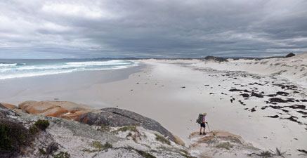 The beginning of 4km long Abbotsbury Beach |
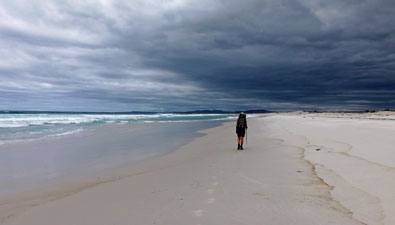 Bad weather on the way? |
We had, in fact, arrived a bit early and the tide was still flowing out, which meant warmer bay water in the channel (it would have been very cold ocean water had the tide been coming in). So, stripping down and with the aid of one of our thermarests, plus the waterproof liner and a couple of dry bags, we swam our gear across - one pack at a time and then a third trip for the boots and poles. It was a successful crossing with gear still dry, though I felt as if I had expended more energy on those three swims than I did walking 4km down the spit. |
||
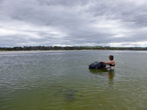 Nello about to swim the channel at Ansons Bay |
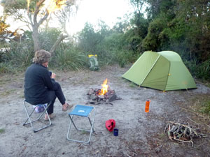 A bit of warmth at Policemans Point campsite |
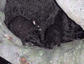 Possums in the dark |
Having found a nice sheltered spot, we set up camp and retrieved our stash of food and water from its hiding place. It was mid-afternoon, which left plenty of time to relax and watch the tidal surges roll across the sand bank as the bay filled once again, or observe the skills of a gannet diving for fish - what superb birds, part stuka, part u-boat. As evening approached, the fair but pyromaniacal Nello's thought turned to reconstructing the stone fire pit on our site and lighting up a camp fire. There is something primevally comforting about sitting around a fire and reflecting on a great day's walking - especially when you have the added comfort of a couple of camp stools (which our kindly camper van neighbours loaned us for the night). |
|
Day 3 - Policeman's Point to Big Lagoon (17.5 km - 60m ascent - 60m descent) |
The clear starry night gave way to a cloudy morning, as we headed down the path alongside the shore of Ansons Bay. Full-tide had not long passed, very different from our crossing of yesterday with the channel looking very full and wide. The current rushing in through the narrower mouth would make one think twice about crossing here. Still, we were now on the southern shore, so we turned the corner and headed south once again - leaving behind the piles of fermenting kelp, we followed the firm sand highway along, as the sun peaked infrequently through gaps in the clouds. |
||
 |
 Heading south from Policemans Point |
 |
 View over the hills backing The Gardens |
 |
 A peek into the coastal hinterland |
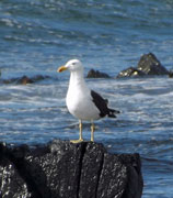
Ahead lay Pebbly Beach, a different coastscape - gone the granite boulders, hello jumbles of big water-rounded basalt stones. The geology had changed. We picked our way across a long ledge of clinking plates and stones, at times following faint trails that led through the heath at the back of this stony bank. Then it was back on to the beach and the whole exercise was repeated one more time. |
||
 A coastal creek |
 |
 Crossing the basalt stones of Pebbly Beach |
Behind us, a dark rain squall was heading out to sea, while ahead the sun shone on the grass green clearings of The Gardens, backed by timbered hills. Sun and cloud would share the sky for the rest of the day. |
||
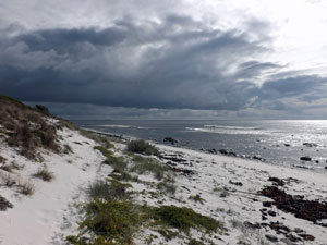 Rain squall passing to the north |
 |
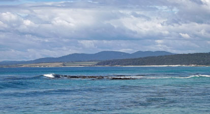 View across the sea to the pastures of The Gardens |
After the last basalt ledge, we reached a long, gently-curving stretch of beach, steeply sloping with trudgingly soft white sand. We trudged our way on, taking turns to follow each others footprints (which, like draughting on a bike, does save energy). After stopping for a break at the edge of picturesque Broadwater Creek, we continued our trudge to the next set of rocks. |
||
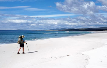 On Break Yoke Beach |
 |
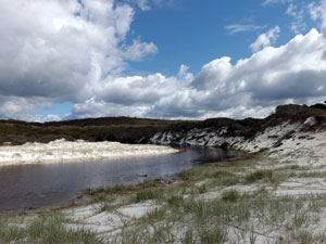 The lagoon at Broadwater Creek |
|
It was back into the granite, with its signature massive slabs and red-lichened boulders. When the sun shone, the colours were brilliant, particularly when backed by an azure sea.
|
|
We worked our way over a series of these superb boulder jumbles and their occasional red-rimmed rock pools, separated by lovely white sand coves. They were so nice that we took another break at one, the entry to Break Yoke Creek. Nearing The Gardens, the rocky passages were becoming more difficult. Luckily, the eagle-eyed Nello spotted a faint foot track that led us up on to the casuarina-covered slope at their back and down on to the next sandy beach at rocks' end. |
|
 Rock pool with ocean views |
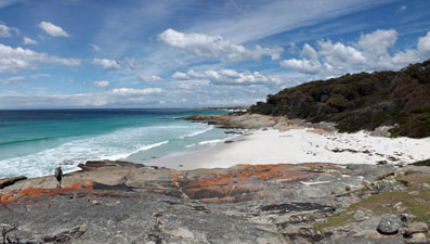 Heading towards The Gardens |
We had reached the large sandy spit between Gardens Lagoon and the sea - more soft-sand trudging to its end, where we climbed up to follow a stony path along another ledge of clinking basalt stones. On the inland side, the green paddocks were home to a herd of Black Angus, who watched us pass with the unperturbed curiosity of cattle. |
||
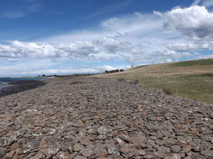 A section of basalt stones lining the shore |
 Residents of The Gardens |
 The beach in front of Gardens Lagoon |
On the far side of the basalt ledge, the sandy beach firmed up again and our walking speed picked up another kilometre per hour. It was also one of the most beautiful beaches that we had passed, with the sun turning the water an almost perfect shade of glassy turquoise. |
|
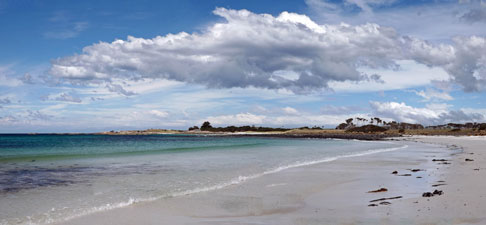 The Gardens Beach from the north ..... |
 .... and from the south |
|
Climbing the granite boulders at its end, we quickly reached the terminus of the asphalt road leading to The Gardens. Time was pushing on and, feeling a little "beached out", we decided to follow the road, which made for a change of scenery as we passed paddock and farmhouse, cabin and modern beach house. It also brought us into the face of a cold southerly wind that had sprung up - refreshing. |
|
 A luminous rock platform |
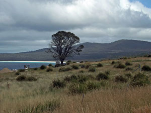 Open land at The Gardens |
|
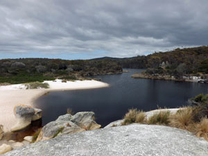
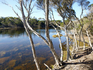
Finally, the road wound its way back to the bridge across the entry of the Big Lagoon - our home-to-be for the night. A bit more walking remained, however, up the asphalt road, then out along a gravel road and finally along a sandy track that led us to our campsite. It had been a bit of a detour, but the site was a lovely spot, sheltered from the strong wind on a flat, sandy waterside clearing hemmed in by tree-covered slopes on a cove in Big Lagoon. |
||
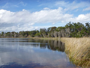 The tranquility of Big Lagoon |
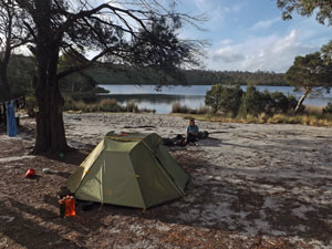 Big Lagoon campsite |
 An evening wade to cool the feet |
After setting up camp and retrieving our fresh water bladders, we had time for a pleasant end of day - sipping coffee on the softly lapping water's edge in the late afternoon sun as fish fingerlings nibbled our feet and a trio of swans cruised elegantly by. the water was even warm enough for a most refreshing dip - the perfect end to a long day on the track. So, as I finish writing, I see that the fair Nello again has a fire going in the stone pit - time to get the dinner and enjoy our rehydrated egg plant cous-cous with home-made harissa sauce ....mmmmm! |
|
|
Day 4 - Big Lagoon to Binalong Bay (9.5 km - 50m ascent - 50m descent) |
Big Lagoon was just as tranquil in the morning as the night before and it was difficult to leave. Still, the end of the walk lay ahead, the swans had all drifted off around the corner, and the butcher bird that serenaded us sweetly at dawn had headed off to sing in other places, so we took our leave as well. Retracing our steps along sandy track and dirt road, we regained the Gardens Road. This time we left it almost as soon as we arrived, heading down onto the soft white sand of Taylors Beach for a long trudge south in the morning sun. |
|
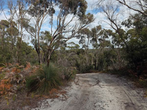 Road out of Big Lagoon campsite |
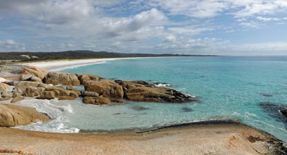 Looking back down Taylors Beach |
At the end of the beach we crossed the sand bar blocking Sloop Lagoon to climb on to the rocky outcrop. A couple of deft moves to cross a sandy nook between waves brought us to another small, but lovely beach. From it the path climbed up to reach an access road, which led us over the forested headland and down to sheltered leafy Seaton Cove. |
||
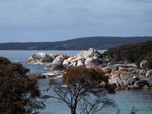 View across Seaton Cove |
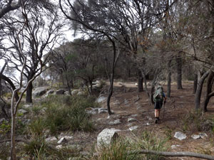 Track beneath the coastal casuarinas |
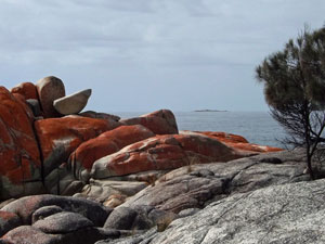 Rocky coastline near Seaton Cove |
Where the road ended, a foot track took over, wandering through the coastal forest behind a bouldery stretch of coast line to reach North Cosy Corner. Here, for the first time, we came across people out swimming, surfing or just sunning themselves on the sand. It was a Saturday and the camping ground of North Cosy was packed. After wandering across the beach for a while, we took advantage of the long drawn-out camp ground of neighbouring South Cosy Corner, climbing up to follow the dirt road that paralleled the coast. It gave our feet a welcome change from soft-sand walking. |
||
 Rocks near Cosy Corner |
 |
 Boulders at the northern end of Swimcart Beach |
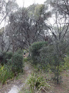 In the coastal casuarinas |
Crossing the bar of Swimcart Lagoon, we left one campground and joined another that stretched down the coast between sand and heath. At its end a foot track led through this dense coastal heath to cross the narrow neck of Round Hill Point. |
 Last rocky cove before Binalong |
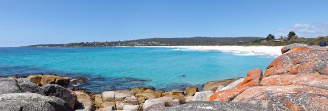
Only one small beach and a long stretch of granite boulders now lay between us and Binalong Bay. It was good to spot the footpath that wound its way across a casuarina-covered slope behind the rocks, passing narrow rocky coves and platforms stained red with lichen. Eventually the track reached the last outcrop before the bay - what a superb sight looking out over the red-tinted granite to the perfect blue sea and white beach of Binalong Bay. We dropped down onto the sand and took off our boots for one last stroll down the white sands of the Bay of Fires as the clear Tasman Sea waves rolled in and out, soaking our tired feet. |
|
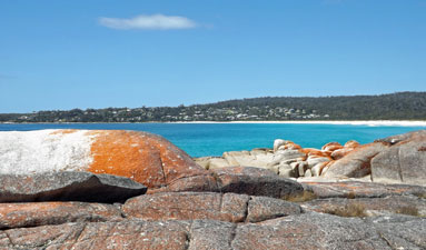 Civilisation ahead - nearing walk's end |
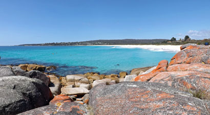 The perfect colours of Binalong Bay |
It was a good way to finish, and we declared the beachside coffee shop to be the end of the walk - how good that mug of strong flat white tasted after four days on the track. The Bay of Fires had certainly lived up to its reputation and we saluted it. |
|


