The Kosciuszko Lakes Walk

The Lakes Walk is a 20 km track that meanders across the roof of Australia, taking in sweeping views as it passes several glacial lakes, and includes a short detour to reach the summit of Kosciuszko, at 2228m the highest mountain on the continent. It is a walk that can be done several times without boredom setting in, as the landscape changes dramatically and quickly with season and weather in this high country. I have explored much of this area on skis in winter, when the mountains are covered with a mantle of snow, and have twice done this walk earlier in the season, when large snow drifts lay across the track and provided definition to the rounded shapes of this alpine landscape. However, in summer, the Australian Alps are noted for the brilliant displays of wildflowers and, with this in mind, the fair Nello and I, together with a group of friends, headed up to spend a late January weekend in the mountains and once more do Australia's premier alpine daywalk.

Having spent a convivial evening at Cooma Lodge, as guests of Gina, our group drove up to Charlotte Pass where the walk began. This is a loop track and we decided to do it anti-clockwise, as shorter steeper climbs and longer slower descents seem easier than the reverse. The sun shone strongly as we set out on the Main Range Track, but we were content to know that up here the temperatures would stay in the low 20s, while, back home, people sweltered in the high 30s. Wear a hat and plenty of sunscreen though - it will be 20 km before you see another tree!

The grey paved path descended quickly through low alpine scrub to the Snowy River, source of much Australian folklore. Only a few kilometres from its source, some judiciously placed boulders enabled us to cross easily and start the steady climb up onto the Main Range.


At the start of the Main Range Track

...


The track climbing up from the Snowy


The Snowy - Australia's iconic mountain river


Start of the alpine meadows

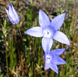
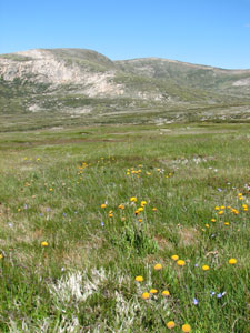
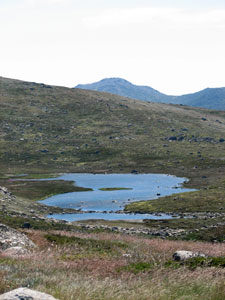
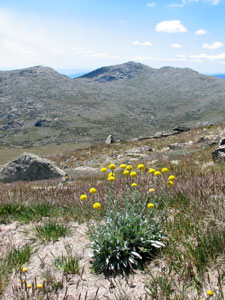
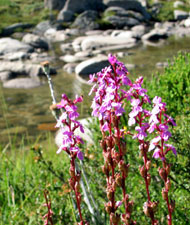
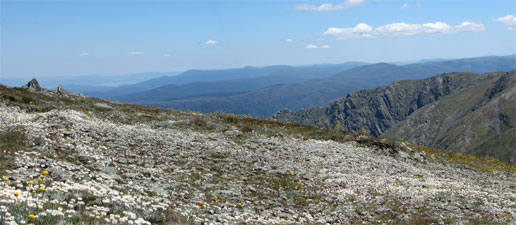
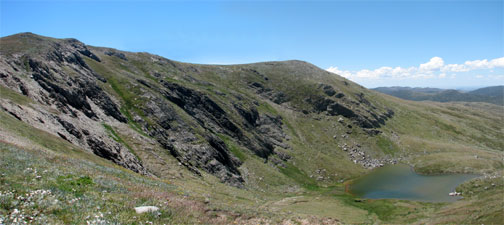
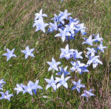
Quickly we entered the region of alpine meadows, dotted with the white, yellow and pink of alpine flowers. To the east lay Hedley Tarn, the first of several glacial lakes that we would pass. Climbing steadily on, the gently undulating rim of the range opened out above a broad basin as the track changed from paving to crushed granite. This is a fragile habitat that had suffered much from overgrazing by cattle up until the 1950s. It took a long time to recover from that and the National Parks authorities have made a big effort to protect it by providing good tracks for bushwalkers - the modern day equivalent of the cattle - please keep on them!
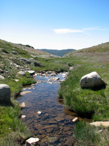


Hedley Tarn


Alpine stream


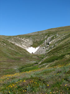
One of the last snow drifts

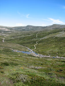
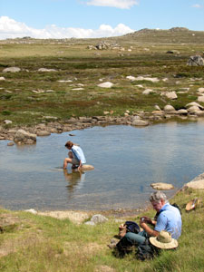
As we climbed, we passed many granite outcrops, before crossing the crystal clear water of a mountain stream. The stream was fed by seepage and the melt waters of a remnant snow drift tucked into a south-facing gully and was lined by the bright green spongy plants of an alpine bog community.

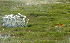
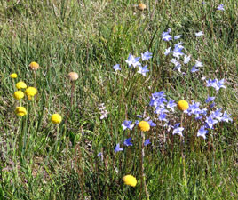
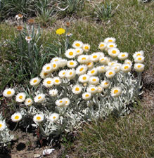
Climbing over one more ridge, we emerged at a saddle overlooking Blue Lake, its surface shimmering in the sunlight beneath the rocky walls of Little Twynam. It was a good spot to take a break and admire this view and the silver and white carpet of snow daisies that stretched upwards toward the rim of the range.


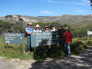
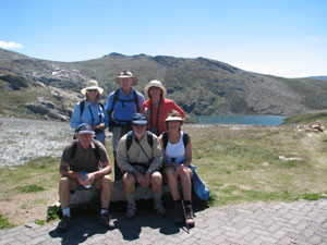
The obligatory group photo


Blue Lake glimmering in the morning sunshine

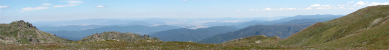
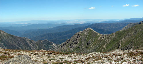
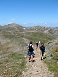
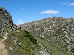
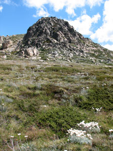
From Blue Lake, the ascent began in earnest up a natural earth track with sweeping views up the Snowy River Valley to the Etheridge Range and beyond. Around us the rounded shapes of Mts Clarke, Northcote and Lee defined the edge of a large glacial basin, while ahead the track climbed steadily toward Carruthers Peak, past rocky outcrops, bright green fens, clumps of mountain celery and ever more brilliant fields of alpine herbs.

Soon we emerged at the saddle between Carruthers and Twynam, to be greeted by a cooling wind and a magnificent sweeping panorama across the pointed rocky outcrop of The Sentinel to the fading shades of blue of successive ridges to the northwest. In parts, the forest burnt in the severe fires of 2003 stood out starkly, like a grey cobweb spread across the landscape. The western side of the Main Range is much steeper and more rugged than the part we had just passed through and for the next few kilometres the track would take us through this quasi-alpine landscape.


View across The Sentinel toward the north western slopes


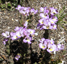
The glorious daisy fields near the top of Carruthers


One last push took us to the 2145m summit of Carruthers Peak. Just below it the carpet of everlasting daisies, mingled with yellow of billy-buttons and and odd dash of pink was at its brilliant best. With its glorious 360º views, including the three highest mountains on the continent (Kosciuszko 2228m to the south, Townsend 2209m to the west and Twynam 2196m to the east), Carruthers is a place where you spend a long contemplative time.


On top of Carruthers (2145m)

However, we had only done one third of the walk and had to push on. The wind whistled softly in our ears as we descended to the next saddle. For part of the way, we walked on a new path of large flat granite rocks - being built at a cost of $200 per metre to prevent further erosion. At least now I know where the $32 we paid to spend 2 days in the Park went - another 16cm of the Main Range track!


Descending from Carruthers towards the
rounded dome of Kosciuszko on the horizon

On the saddle we found ourselves in the midst of the "windswept feldmark" community, where prostrate, slow growing woody shrubs cling to the thin soil studded with shards of sedimentary rock; a fragile, tenuous grip on the roof of Australia. Looking over the rim to the east, Club Lake could be seen nestling in its glacial bowl below the dark wall of Carruthers.


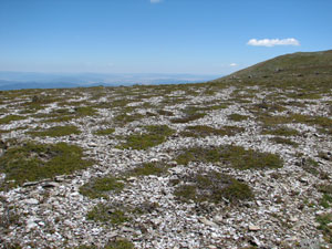
Feldmark plant community on the stony windswept
ridge of the Main Range


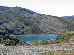
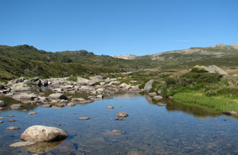
Club Lake - held back by terminal morain at the base of Carruthers Peak

Ahead lay Mt Lee and, in the distance, a rounded dome resembling an ant nest, even more so with the many tiny black shapes moving across its top - it was Kosciuszko, Australia's highest peak and visited by hundreds of people on every fine weekend day, most of whom arrive via a metal-gridded ant trail from Thredo Village to the south.

Soon, Lake Albina appeared below us to the west, beneath the the precipitous rocky slopes of Mt Townsend, "Little Austria" as it has been christened by off-piste skiers. It was a good place for a break before we traversed the steep slopes of Mt Northcote.


Traversing the steep slopes of Mt Northcote - with
Mueller's Peak in the background

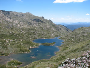
Lake Albina in its glacial bowl at the head of
Lady Northcote Canyon

At each step, a look back revealed increasingly spectacular views of Lake Albina, dammed by a terminal morain at the mouth of Lady Northcote Canyon, which drops 1200m to the Geehi River below. Nostalgic memories came back of winter stays in long gone Lake Albina hut and moonlight skiing on the slopes above the lake.

Leaving Lake Albina we passed under the lee of Mueller's Peak. The wind dropped and the myriad bushflies that had hitched a ride on our backs and packs felt free enough to take off and pester our faces. They say that everything has a price, and the cost of spending time in this beautiful part of the world during the summer is the March flies and the bush flies - bring your insect repellant! Fortunately, the track led us out onto a more exposed ridge, which settled the flies and gave cooling relief as we climbed the long spur up toward Kosciuszko.


Billy buttons on the slopes of Kosciuszko

Reaching the junction of the Main Range Track and the Summit Track, we decided to make the 2km round detour to the top. Although I have been here many times before, there is always something special about standing on the highest point in the continent. Much is placed in perspective when you look out from here on a bright clear day across the vastness and openness of this ancient mountain landscape, to the Victorian Alps in the west and the distant Monaro Plain in the east.


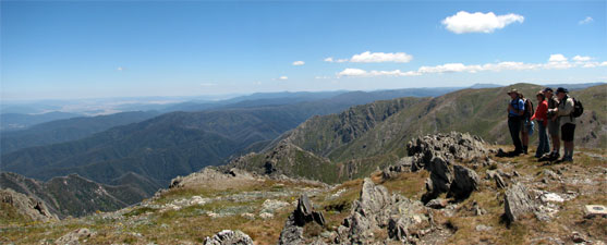
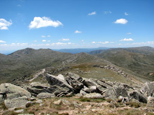
Views from Kosciuszko northward along the route we had walked

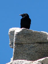
With several hundred visitors a day the pickings
are good for Kosciuszko's ravens

We descended the Summit Track to Rawson's Pass and then started a long steady descent down 7km of gravel road - the most spectacular part of the walk was over. Passing under the long line of rocky tors on Etheridge Spur, we reached Seaman's Hut, built in memory of a ski-tourer who died of exposure here in 1928 - a reminder of our vulnerability in these mountains.


One of the impressive granite tors of
Etheridge Spur


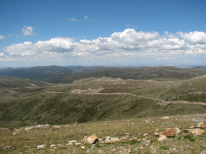
The Summit Road - our route home, cutting a long
line into Etheridge Spur

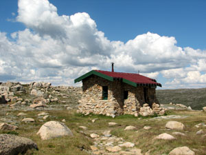
Lonely Seaman's Hut - built in memory of
James Seaman who died in a blizzard at this
spot in 1928


Bliss = soaking tired feet in the cold
waters of the Snowy River

A little further on and we once again crossed the Snowy River, spending a few minutes to rest on the banks surrounded by clumps of bluebells or soak tired feet in the cold clear water (NB some of us reported that the sensation of baby trout nibbling your feet can be quite agreeable!). Finally heading on, we followed the road down until the appearance of groves of black sallees, with their beautiful grey and olive trunks, greeted our arrival back at Charlotte Pass and the end of the walk.


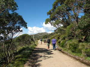
The road home through the Black Sallees

It had been a tiring day, 22 km with the climb of Kosciuszko, and everyone had the odd muscle ache or blister, but in the conviviality of a superb dinner back at the lodge, we all agreed that this had been a great walk and was well worth the effort. The Lakes Walk has to be one of the best alpine daywalks in Australia. Thanks Gina, Pete, Odile, Mike, Jennifer, Onko and needless to say, the fair Nello, for your great company and a wonderful weekend.