Podocarpus Country

Getting There


The Galapagos adventure was starting to shift from the present to the past as our bus cranked up the Ecuadorean highlands towards Cuenca. Two bus changes and nine hours after we left Guayaquil we had reached our destination - Vilcabamba, the valley of eternal youth, the rainbow at the end of the gringo trail, whatever you wish to call it. This magical place has attracted visitors for the past 20 years, many of whom have never left; a tranquil place in the mid-Andean valleys of Ecuador, Vilcabamba is the home of legends and ex-pat gringos, some of whom have blended in with the locals, others of whom stand out like hairs on a Christmas ham.

The attraction of Vilcabamba is its reputation for longevity, rising out of the presence of large numbers of centenarians when the average age of an Ecuadorean was only 60. Whatever else it is, it is certainly a peaceful and laid-back place, especially when compared with the noise and bustle of Puerto Lopez. Moreover, it is a gateway to the Podocarpus National Park, home of Ecuador's only conifer of the same name, over 500 species of bird and many different habitat zones from arid valleys through cloud forest to the cold paramo grasslands; a place well worthy of a visit and we had come to do it homage.


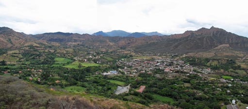
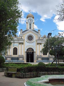
Church and plaza - Vilcabamba


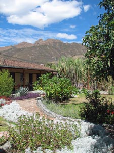
View across the garden of our hostel
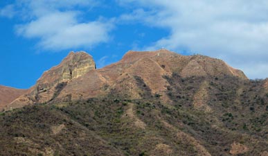
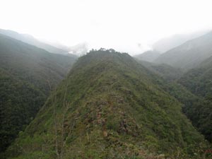


Mandango Peak


The back drop to the village of Vilcabamba is Mandango Peak (or Stoneface as its Quechua name signifies). This impressive peak rises steeply to a narrow ridgeline with the profile of a person's face looking upwards. It is one of those peaks that begs you to climb it when you see it - so we did. Our first surprise came at checking in at the entrance to the Camino de Mandango, where we were advised to leave any valuables and money in storage - apparently this is the one place in the area where people occasionally get mugged!

Still it was a Sunday and the locals were either in church or at the bars drinking beer, so we headed off. The track immediately entered very dry shrublands - most of the trees had dropped their leaves and the understorey shrubs looked parched, as they held out for the start of the rainy season.


Mandango Peak

---
A rare splash of colour in the dry landscape


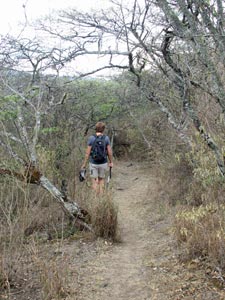
Track through the thirsty vegetation


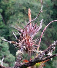
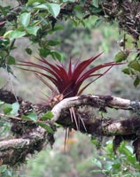
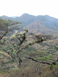
Airplants on the Camino de Mandango

It was a hot and sweaty climb; leaving the tree cover, we continued to ascend steeply with the heat radiating off the dry rocky soil, before we finally crested a narrow ridge to reached the first cross. From here, we had impressive views over the village and beyond to the cloud covered mountains of Podocarpus National Park, an area that we hope to explore later.

However, the cross was not our goal; to the right, the "head" of Mandango lay like the narrow prow of a ship, so we dropped down a little onto the far side of the mountain, traversing the steep slopes, golden with their cover of dry grass. The path led us beneath the sheer cliff at the rear of Mandango, a pleasant place to rest in the shade before clambering up a steep gully to follow the top of the cliff and finally zig-zag our way steeply up to the ridgeline just below Mandango's nose and high point.


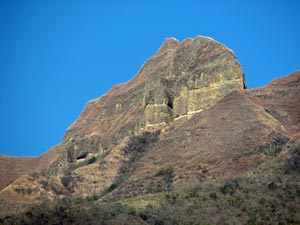
The impressive ramparts of Mandango


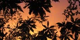
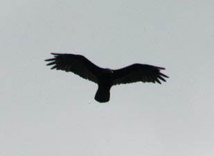
Silhouette of an Andean hawk

View of Mandango Peak from the north

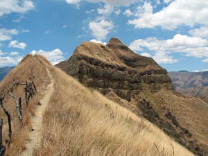
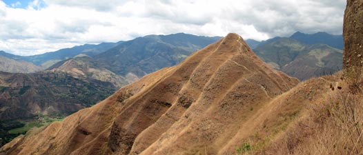
Track along the dry ridge leading up to the face of Mandango

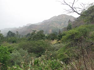
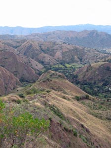
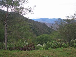
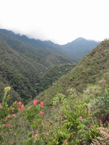
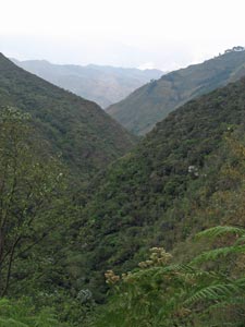
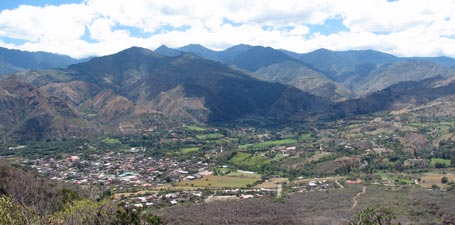
View over the Vilcabamba Valley toward Podocarpus National Park


What an impressive spot it was; apart from the magnificent 360° views, we found ourselves on the edge of a razor-back ridge, with an almost sheer drop on one side and a grass covered 45° slope leading back to the cliff on the other.

The ridge top was less than a metre wide and the track ran along it - I did not. With the old gut-churning feeling that only the altitudinally-challenged will know, I stood there gripping the soil with my toes. The fair Nello wandered casually up the few metres more to the nose to claim the mountain and then we returned to the village.

Just for the record, we were not mugged!


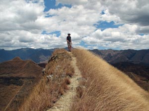
Nello on the crest of Mandango's ridge
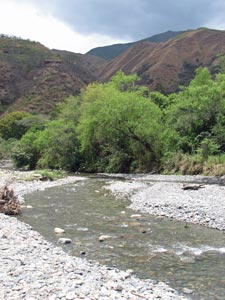
Rumi Wilco Reserve


The Rio Yambala at Vilcabamba


The steep slopes and gullies of Rumi Wilco


Crossing the crooked bridge


Curiously eroded "hoodoo"


View over Rumi Wilco Reserve

Phase two of our getting back into walking shape was a short exploration of Rumi Wilco Reserve, a private nature reserve named for the "Wilco" tree, sacred to the indigenous people who lived here. This reserve protects some riparian habitat along the Rio Yambala and an area of drier native vegetation climbing back up into the steep slopes and gullies of the adjacent hills. Our walk took us along the river, up one of the gullies past the largest kapok tree in the valley and across a narrow ridgeline, where erosion had carved the conglomerate rock-clay cliff edges into curious hoodoos.


View over Vilcabamba from Rumi Wilco


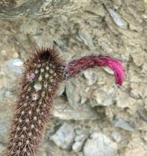
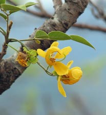
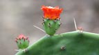
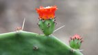
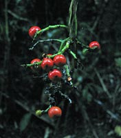
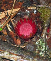
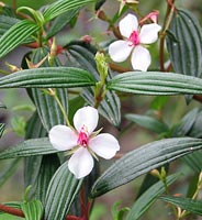
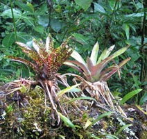
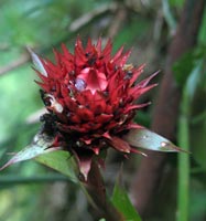
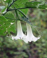
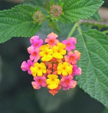
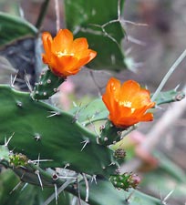
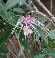
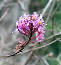
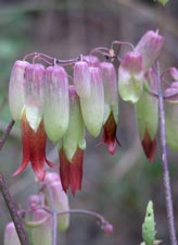
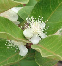
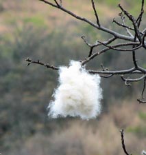
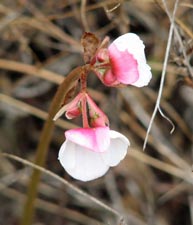
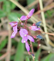
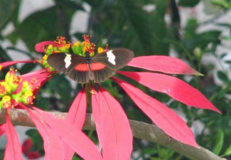
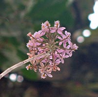
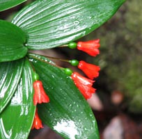
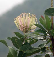
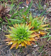
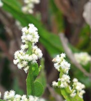
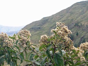
An assortment of flowering cacti, herbs, shrubs, orchids and kapok trees


It was a good way to pass the afternoon and to discover some of the interesting flora of this ecotone between the arid and humid parts of the Andes Ranges. The only worry was the twinges of pain that the fair Nello had begun to feel in her shins on the steep descent from the ridgeline.

Solamaco Trek - day 1

This trek has something unique; it is the first time in the 3000+ km of treks described on this site that no photo of the fair Nello will appear. The bit of pain that started on the walk in Rumi Wilco blew up into a full-on attack of shin splints overnight; Vilcabamba has become the Wonboyn of South America and rest is the only cure. Still, there are not many better places to rest than this peaceful valley.

We had already organised this trek up into the wetside of the Valley, so leaving Nello to relax in the tranquil gardens of Le Rendez-vous Hostal, I set off alone. Alone, that is, except for our local guide Sergio and the two inseparable friends, Niño the packhorse and his mate, Boomer the dog.


The track started out in the upper Yambala Valley, passing through the grounds of Cabañas Yambala and climbing quickly up a steep ridge, via a meandering eroded gully that had been worn even deeper with centuries of use. As we climbed higher the views opened up over Vilcabamba nestled below the enigmatic profile of Mandango Peak. A large grilled gate led us onto a long traverse, first across the steep open slope then passing an area of wilding pines, followed by more shrubby flower-rich vegetation high above the Yambala River.


Sergio and Niño


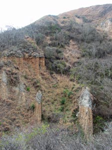
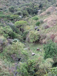
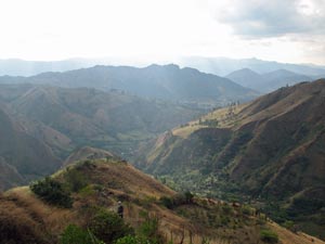
Looking back to the drier cleared ridges

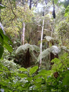
A clearing in the forest

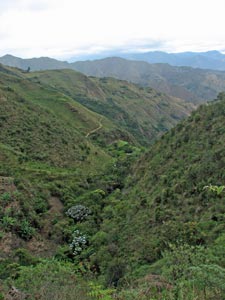
View ahead to the cloud forest

It was even greyer now than when we had started and soon the first few drops of rain condensed from the cloud-filled sky. We crossed one small stream surrounded by lush riparian vegetation and a second next to a refugio in a sheltered hollow. Ahead the peaks had already disappeared and a grey veil of heavy rain was approaching. It was time to put on the wet weather gear!

Soon we were descending steeply once again, down an increasingly wet and slippery track etched up to a metre deep in the pinkish clay. The vegetation gradually changed again, becoming denser as we neared the valley floor and the rushing torrent of the Rio Yambala. We followed the stream under a dense cover of epiphyte covered cloud-forest trees, dripping wet in the steady rain. We sheltered for a while under an overhang, but with no sign of the rain abating, pushed on to leap from rock to rock and cross the Yambala. The track followed the left bank of the river for a while before heading back, this time via a narrow two-log bridge at the junction where the Quebradas Solamaco and Rabadilla de Vaca flowed out of their steep cloud-forest covered valleys to form the Yambala.


Upper reaches of the Rio Yambala


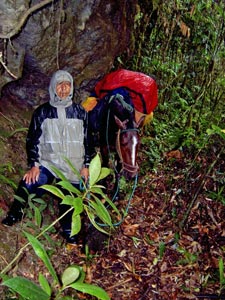
Sheltering from the rain

Steep cloud-forest filled valley

We headed up the Solamaco Valley, rock-hopping across the river three more times; stoically, Niño and Boomer waded the rapidly flowing stream at each crossing. After the last crossing, we left the river to climb steeply up the side of the valley, eventually arriving at a clearing with a small adobe hut. We had reached Refugio Solamaco; a welcome sight with its comfortable bunkrooms and dry verandah. My plastic Peruvian poncho hadn't stood up well to the rain and it was good to get out of wet clothes and socks and have a nice hot cup of Sergio's home-grown coffee.


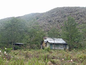
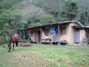
Niño in front of Refugio Solomaco


Boomer has a rest

View from Refugio Solomaco


The pale green leaves of a young podocarpus


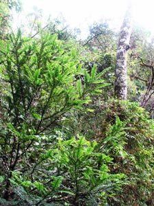
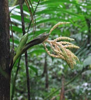
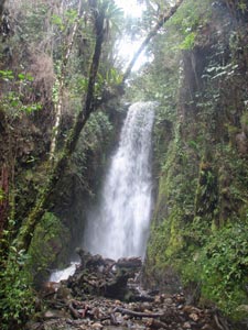
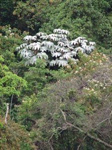
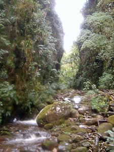
An hour or so after lunch, the rain had cleared sufficiently to head out again. Sergio wanted to show me a hidden canyon and waterfall further up the Solamaco. We descended rapidly via a steep "machete-track", beneath the tall cloud-forest trees, covered in bromeliads, ferns, lichens and the odd orchid, which shared the forest with tall tree-ferns, giant bamboos, figs, palms, lianas and the iconic podocarpus.
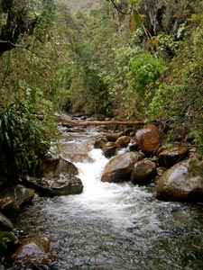
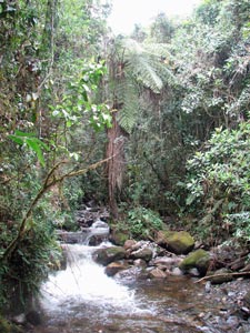
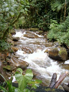

Vegetation of the cloud forest

Almost 180m below the hut, we reached the river and started to follow it upstream, sometimes wading (thankfully there were gumboots in the refugio), sometimes clambering over wet rotting logs or green moss-covered boulders, as we pushed into the canyon. Looking up, the silhouettes of the different types of cloud-forest foliage almost hid the sky. After passing a very narrow gap, we reached the small, but beautiful waterfall cascading out of a rocky chute and framed by the dense green dripping vegetation.


Rio Solomaco


Entering a narrow gorge of the Solomaco

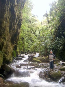
Wading up through the Solomaco Gorge

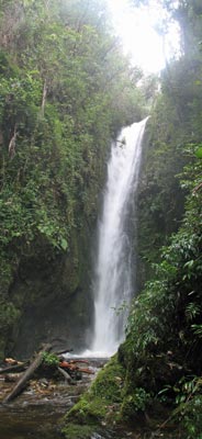
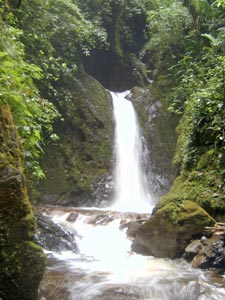
Cascades at the head of the gorge

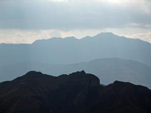
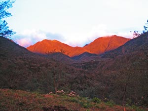
The sun finally appears on the tops of the Andes ...

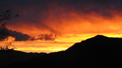
... before lighting up the sky ....


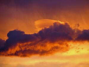
... in a fiery orange sunset

Retracing our steps to the refugio, the sky seemed to be changing in the west, the cloud cover opening up just enough to allow the sun to turn on a magnificent flaming sunset. Hopefully, this was the promise of a finer day as I was looking forward to exploring the rich Andean cloud-forest some more. The day still held a few surprises though; just before midnight, I was awoken by the loud crash of something falling off the table, then the bed began to shake and the timbers holding up the hut creaked loudly as it swayed slightly for the next 20 seconds - I had just experienced my first (4.6 Richter) South American earth tremor!


Solamaco Trek - day 2

By next morning the rain had cleared away and many of the 500+ bird species that inhabit this region were singing in the trees and forest undergrowth. However, the cloud cover was low and hid the tops of the ridges - there seemed little point heading further up into the obscurity of the paramo tussock lands, so it was time for plan B. This involved a short trip a bit higher up the slope, along another rough machete-cut track through the cloud forest to see a 300-year old podocarpus that, at 40m high, towered above the rest of the trees.


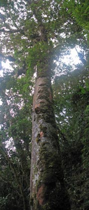
Looking up a 300-year old podocarpus


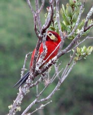
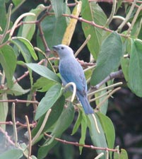
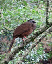
Bearded guan (Penelope barbatus)
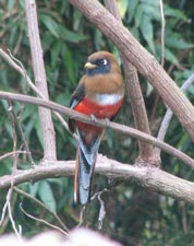
Quetzal

Then it was time to load up Niño and head back down the steep track to the river. However, this time at the junction of the two streams, we turned left to climb up the steep and narrow ridge between the two valleys. Soon we were entering into a shrubby more open ridge-line vegetation, very different to the cloud forest below and with many new species of flowering shrubs.


The bracken-lined track followed the long razor-back ridge as it undulated gradually upwards until we reached the gate of "Las Palmas", a private reserve and one of the "bosques protectores" adjacent to the Podocarpus National Park that limit encroachment from landholders who just want to slash the forest and turn it to "productive" use.


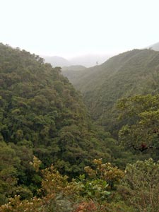
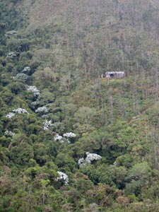
Sharp ecotone in the cloud forest


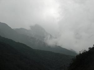
Mists obscuring the peaks of Podocarpus National Park

The ridge up to Las Palmas


Looking up towards the mountain tops

At Las Palmas, the ridge widened and we wandered through a slightly boggy landscape of low shrubs and herbs, scattered with white and pink-flowering orchids. The "hand of god" was all around us, and what a curious plant it was - with scented cream flowers clustered on the sides of the three-bladed leafy stems. As always, Sergio identified and explained the traditional uses of many of these fascinating plants.


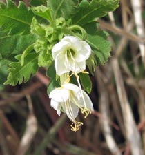
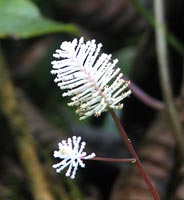
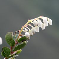
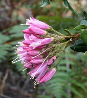
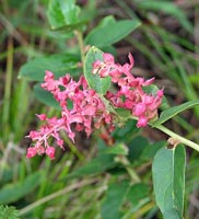
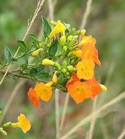
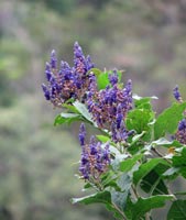
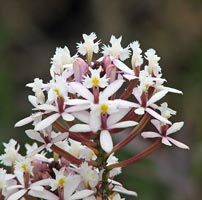
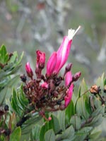
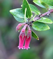
The ridge was covered with flowering shrubs
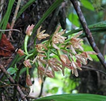
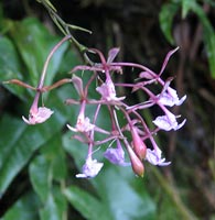
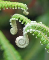
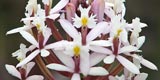
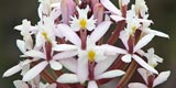
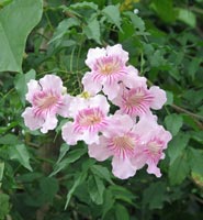
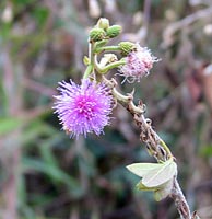
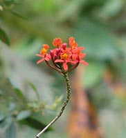
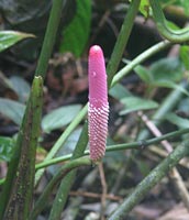
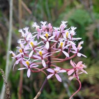
One of many orchids

"La Mano de Dios"


Lower Las Palmas Falls


Crossing the mini-plateau, we descended once again into the verdant cloud forest, a little bit further up stream on the Quebrada Solamaco, scrambling over logs, under low branches and past tangling vines to reach two more waterfalls. At 15m and 20m high, respectively, they were larger and more powerful than the one yesterday, with a strong horizontal mist blasting out from their splash pools and an everwet verdant flora filling the narrow chasm of the river.


Upper Las Palmas Falls


We retraced our steps 150m back up to the plateau and ate our lunch on the verandah of Refugio Las Palmas (at 2460m the highest point of the trek) as the cloud drifted around the top of the ranges behind us. Then it was time to head back, down to the river and back up to the long traverse and ridge that we had climbed the day before, towards the distant sunlight that shone over the Vilcabamba Valley.


Las Palmas Refugio


Last look at Quebrada Solomaco


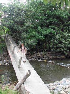
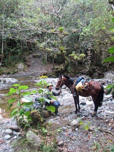
Sergio and Niño at the river crossing

The path out of the cloud forest


It had been a fascinating exploration of a very different part of the Andes - the diversity of these mountains never ceases to amaze. Thanks Sergio, for being an informative guide and pleasant companion, and to Niño and Boomer, the latter who always seemed to be just at my heel to make sure that all was well.

----------
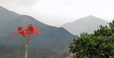
Flora and transformed landscapes to the west of Vilcabamba


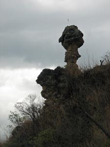
Silhouette of the reclining stone face of Mandango

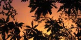
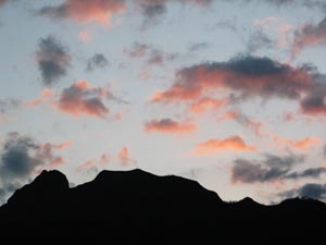
Sunset over Vilcabamba

The sun was now out again, and all that remained now was to wander 3km down the dirt road back to Vilcabamba, watching the locals go about their business in the small farmlets on the way. Hopefully, the couple of days rest will soon have the fair Nello walking pain-free; it is time to head south again as the trekking season will be starting in Patagonia.