Choquequirao to Machu Picchu Trek (part 3)

Colpapampa to Santa Teresa hot spring (16km - 40m ascent - 810m descent)

I'm not sure whether we were woken by the rooster, the pigs or the mule snorting next to our tent, but we were soon up and having breakfast. As we ate, several groups of trekkers wandered by from the south. Colpapampa lies at the convergence of two tracks, the Salkantay Track and ours, and it was clear that the next part of the trek would be much more populated than we had enjoyed for the past six days. Still, 30-40 people on a track is very different to the 500 per day who walk the Inca Trail. Today's walk would be a five hour wander down the rich and diverse vegetation in the valley of the Salkantay River. We were about to enter what the locals call "the eyebrow of the jungle".


We set off, quickly descending the 80m gorge walls to reach the Rio Totara, crossing it just before it merged with the Rio Salkantay to create an even broader rushing torrent of water. We had seen the spring-fed streamlets higher up merge to form a babbling brook, watched it grow as further side-streams fed into it and then saw it double in size as it merged with the Salkantay. This process would continue until the water passing us today flowed into the mighty Amazon and, one day, out to the Atlantic Ocean.


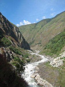
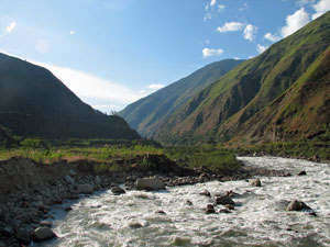
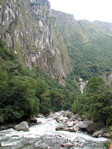
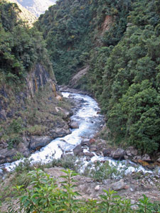
Junction of the Totara and Salkantay Rivers

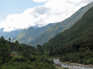
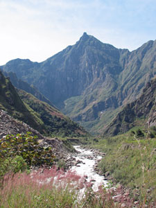
Looking up the Salkantay Gorge


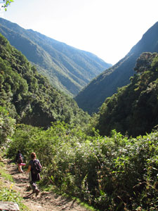
Heading into "the eyebrow of the jungle"
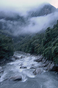
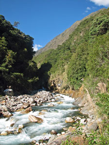
Salkantay River

The valley was steep-walled and clad with green forest and arching bamboo. New plant species were appearing; pink and red flowering begonias, giant horsetails, palms, ferns and different glossy green and thick-leaved shrubs. As before, Felix told us the quechua names of many plants and explained their uses; treatment for fever, hangover cure, seasoning for cooking, dyes etc. We sampled fruits and nibbled nuts as we descended, crossing several fast-flowing sidestreams by stepping stones or rustic log bridges. Our bodies enjoyed breathing the humid, oxygen-rich air of these lower altitudes.


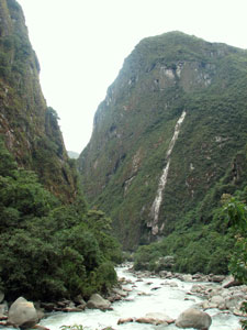
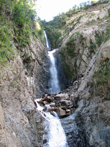
Waterfall tumbling into the Salkantay Valley


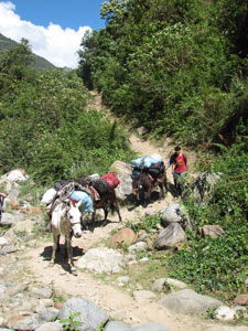
Mule train heading down from Colpapampa

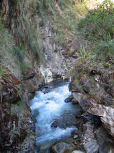
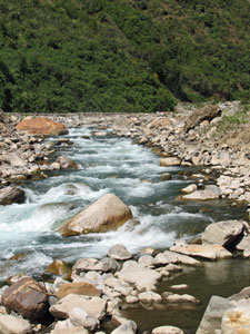
The boulder-filled river bed

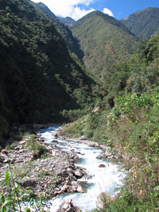
Salkantay flowing through its lush valley

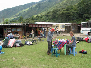
A trackside fruit and drink stall


Huinayhuayna orchid


A rare and very exotic orchid


Passing through a coffee plantation

Reaching a grassy opening, we stopped to rest and buy some granadillos at a small trackside stall (the first of several as we entered the more populated and more cultivated lower part of the valley). We were enjoying the more relaxed walking, with a cooling breeze blowing up the valley as we sucked the sweet juice of the granadillos and admired the new flowers and orchids that lined the track.


Soon we were passing through small coffee and banana plantations, and adobe huts appeared frequently alongside the widening track, which eventually led us into the small town of La Playa. The electricity wires and television blaring through open doorways told us that we were back in "civilisation". The far end of town was a gathering point for trekkers - we stopped for a cold drink and hot lunch at an outdoor restaurant, listening to the sounds of Bob Marley and other trekkers chatting and sipping beers. We were definitely back in civilisation, but didn't feel quite ready for it yet.


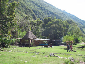
The approach to La Playa

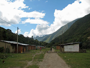
Road through La Playa village


Return to civilisation - La Playa

There was a slight change to our original trek plans at La Playa. The usual route to Machu Picchu continues up and over a densely forested ridge to reach the Hydroelectric Station on the Vilcabamba River. Felix gave us this option or one of catching a local bus to Santa Teresa, 14km further down the valley, where the Salkantay River flowed out into the Vilcabamba, to camp out at a small hot spring. The distance from Santa Teresa to Machu Picchu was much the same as that from La Playa and the climb gentler, but much the same ascent. The thought of soaking in a hot spring after 6 days of trekking was impelling. Thus, we found ourselves making a detour in a crowded minibus down a winding dirt road high above the Salkantay River, creeping past a landslip that had taken the road and half a local village with it, and down through the coffee, banana (and odd coca) plantations to the town of Santa Teresa.


Crossing the Salkantay suspension bridge
at Santa Teresa


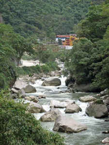
The Vilcabamba River near Santa Teresa


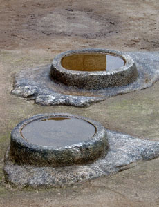
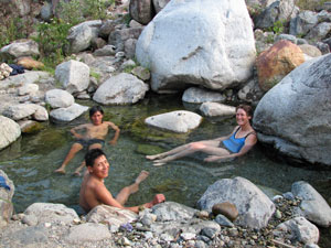
Soaking in the riverside hot spring

From here we started walking again, taking a short 2km stroll along the broad stony bed of the Vilcabamba River, crossing the Salkantay on a long suspension bridge just before it merged with the Vilcabamba and pushing on into the narrowing gorge of the river. We stopped at a secluded flat spot, where Felix pointed out the side path to the "secret" hot spring, a small pool of clear, warm water set amongst the rocks.

The pool was just large enough for four people to lie in and soak away the aches and pains of trekking. That, plus the chance to wash dirty hair at the edge of the surging Vilcabamba River, meant that for the first time since the Rio Blanco several days ago, we felt clean and refreshed. It was a good place to camp. The air at 1650m was warm and rich, and it was pleasant to sit outside in the evening darkness, listening to the frogs and crickets and watching the intermittent flashes of the fireflies.


Santa Teresa hot spring to Aguas Calientes (14km - 500m ascent)

We had a latish start this morning - the sun was already heating the floor of the valley when we set off at 9am to wander along the stony river flats, past carex rushes, pink-flowering orchids and the odd balsa tree (so now I know where the model planes I made as a kid came from). The pink seed heads of Colombian feather grass covered the steep valley slopes - like many introduced plants, beautiful but dangerous! Leaving the flats, we crossed the river on a solid metal girder bridge, built to replace one swept away in disastrous floods 10 years earlier.


The pretty pink curse of an invasive grass


The gorge of the Vilcabamba narrows


The gorge narrowed and steepened after the bridge and we headed gently up a wide dirt road, passing small banana plantations that clung to the steep slopes. A little later we crossed the outlet of the hydro-electric station higher upstream, the water jetting out fiercely from the rock face like a giant fire hydrant. Coffee, banana and fruit plantations were now becoming more common. Then, rounding a bend, we saw it for the first time rising sheerly and sharply above the Vilcabamba River; the site of Machu Picchu.


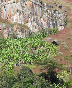
Banana plantation on the steep slopes of the gorge


Water surging out of the outlet tunnel of
the hydro-electric station

First glimpse of the Machu Picchu site -
the towering point of Huayna Picchu


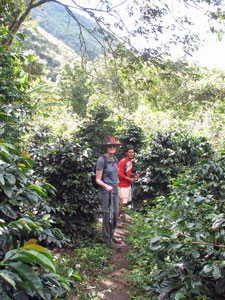
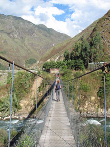
Spurred on by the sight, we crossed the river, now known as the Urubamba, once again and turned eastward for a short walk into the hydro-electric station and its train terminus. Many trekkers end their walk here and catch the train for a 40-minute ride into Aguas Calientes. We joined the throng of waiting trekkers and other visitors for lunch at a railside restaurant, but our plans were different; we chose to walk the last 6 km along the gentle grade of the railway line. The train wasn't due to arrive for another two hours and we would be in town before it.

Farewelling Javier, Valerio and Ephraim, who took our gear by train and then continued on to Cuzco, we set off along the train line from the hydro-electric station. Not long after, a quick short-cut brought us up through a coffee plantation to reach the main Cuzco-Aguas Calientes line. From here it was but a long stroll along the train track, as it slowly spiralled its way through the dense vegetation of the steep Urubamba Canyon, pushing deeper into the Machu Picchu Reserve. The cloud that had been hovering about since lunch gradually thickened above us into a sombre grey mass that threatened to rain on our parade.


The fair Nello leaves on time at 14:00

The verdant valley below Machu Picchu

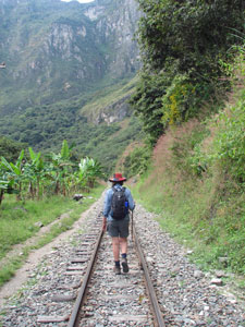
Train track / walking track


Waiting for other track users to pass

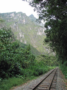
Entering the steep part of the canyon
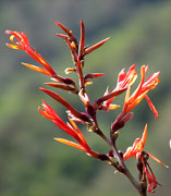
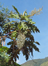
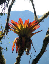
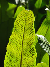
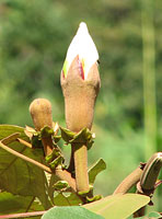
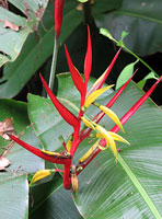
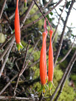
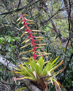


Bromeliad in bloom

Eventually we left the railway to follow a dirt road for the final kilometre into Aguas Calientes, a booming tourist town that has cashed in on the popularity of Machu Picchu. It was a work in progress, with new hotels and apartments under construction everywhere and a railway line down the main street, while every second door seemed to house a restaurant or souvenir shop with a tout out front to drum up business.


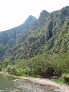
Steep canyon walls of the Urubamba River

The boulder strewn river near Aguas Calientes

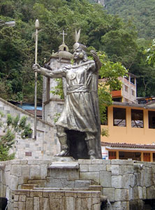
Statue of the Inca - Aguas Calientes

We checked in to our hospedaje and headed up to the thermal pools for which the town is named for a pleasant soak in the warm mineral-rich waters, followed by a shower and a pisco sour or two to celebrate our arrival. Then it was a pizza and early to bed; tomorrow we would be up at 4.30am to prepare for the culmination of our trek and one last climb - the 400m from Aguas Calientes to the famous Incan ruins of Machu Picchu.

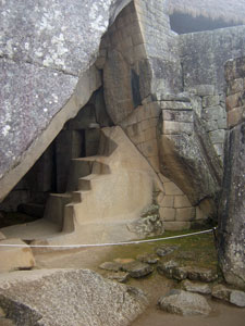
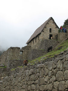
Day 9 - Machu Picchu (10km - 650m ascent)


Pre-dawn mists above the Vilcabamba River

We were off before dawn, strolling down the road from Aguas Calientes to the start of the climb up to Machu Picchu - the climax of our nine day trek. The sheer rock walls along the edge of the Urubamba River vanished into the clouds; somewhere above were the mystical ruins of the Incan "lost" city, but to reach them we first had to climb over 1700 stone steps. We crossed the river and climbed up through the dense humid forest, crossing many times the switchbacks of the road access as we took the direct and steeper trajectory.

By step 1100 we were entering the mist; by step 1200 the mists were condensing to rain, gentle but wet. We reached the entry gate damp and in deep fog; it was not the entry that we had planned.


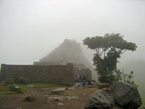
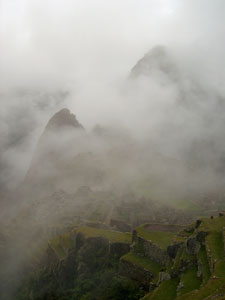
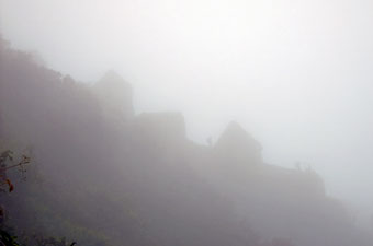
First glimpse of Machu Picchu shrouded in the mists


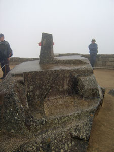
Exploring the ruins near the astronomical observatory


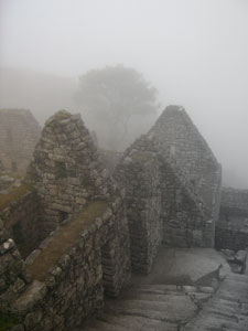
Part of the residential sector

The rain soon stopped, but the gently swirling fog and mists remained as Felix guided us around the maze of fascinating streets, buildings and terraced gardens, explaining their purpose along with the history, religious beliefs and customs of the quechua people at that time. The eerie mists created an appropriate ambience for a place whose origins and demise also remain shrouded in mystery.


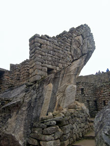
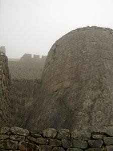
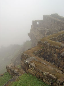
Ramparts of Machu Picchu

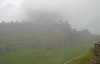
Fog shrouds the Central Plaza


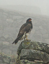
Caracara surveying its domain

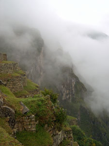
Mists rise up the steep walls ........


..... to envelop Machu Picchu

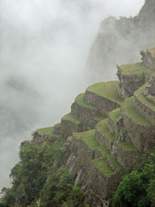
The steep garden terraces

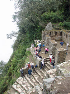
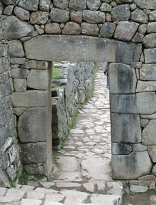
The main gate into Machu Picchu

The people of the Incan empire were brilliant stonemasons and their skills ensured that the houses, temples, walls, watercourses, observatories and other features of this site remained for 400 years hidden in the jungle growth of Machu Picchu, before being rediscovered by science in 1911. Slowly, as we wandered through the various sectors of the the site, the mists cleared more and more, never quite leaving, but gradually revealing the ruins in their totality. It was not the Machu Picchu of postcards that we visited, but an eerie and enigmatic Machu Picchu, where the ghosts of the past seemed closer in the mists.


Classic Inca stonework in a doorway of the
Royal Palace


The Intihuatana - used as a solar observatory


Water drainage system carved in
natural rock


Carved mirror pools used to observe the stars


The Royal Tomb - a blend of
natural rock and stonework


Part of the Temple of the Condor


The Temple of the Sun - Machu Picchu's
only rounded building


Q'ollca (storage hut) with rethatched roof


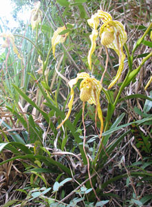
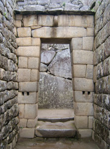
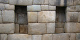
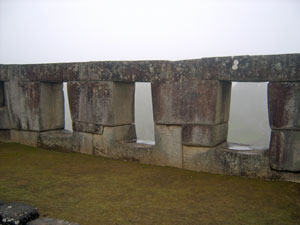
Templo des Tres Ventanas
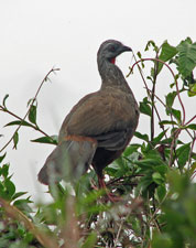
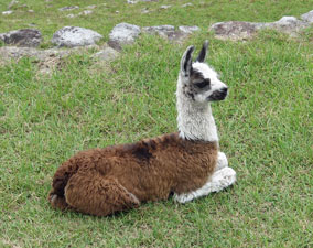

A local resident

The western sector in front of Huayna Picchu peak

After visiting the ruins, to prove our gluttony for punishment, we headed off across the upper agricultural terraces to join up with the old Inca road and climb another 250m to Intipunko - the Sun Gate - entry point to Machu Picchu from the south. The cobbled stones of the old road were lined with brightly coloured flowers of orchids and cloud forest shrubs, as it wound around the sheer edge of the Machu Picchu mountain.


The large fruit-eating guan


The tiny nectar-sipping picaflor


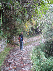
Nello following the Inca Road


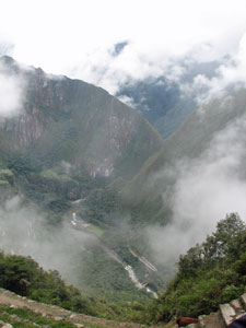
Looking 600m down to Aguas Calientes from
the Sun Gate


The Sun Gate (Intipunku) guarding the Incan
road across a steep saddle

Perched on a saddle, high above the modern town of Aguas Calientes, we sat on the ancient stones of the gateway listening to the sound of trains and civilisation drifting up from 600m below. The present was intruding into the past and we wondered what the original inhabitants would make of it all now - their city so famous, overrun by tourists and surrounded by modern infrastructure.


After five hours of exploring this amazing place, we declared our trek officially finished and headed back down to Aguas Calientes by bus, sat in the plaza to watch the world go by under the stern gaze of a large statue of the Inca, and caught the train back to Cuzco.

It had been one of the best treks we have done, twice down into the depths of a canyon, twice across a high alpine pass, traversing landscapes ranging from semi-desert to alpine grasslands and dense cloud forest, getting a feel for life in the remote Andean villages and for the history of ancient empires.

Thanks Felix, for being an excellent guide, to Javier, Valerio and Ephraim, the supermen who carried all our gear from canyon floor to high mountain pass twice over, and to all five for being such friendly and amusing companions on the trek.


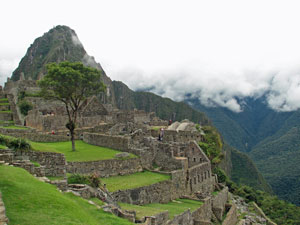
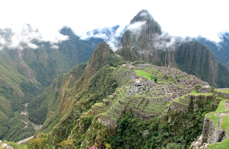
The incredible setting of Machu Picchu