| Pu Luong Trek |
Getting There
|
|||
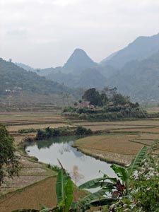
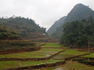
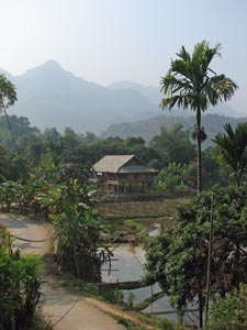 In the Mai Chau Vallley |
|
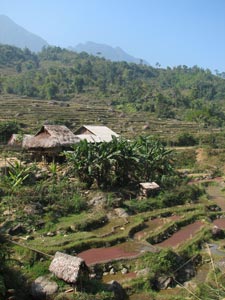
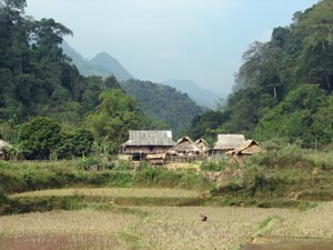
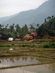
 Houses and paddies of Pom Coom Village |
|
 |
 |
||
Day 1 - Van Mai to Ban Hang (3.5 km by boat and 7.5 km on foot - 220m ascent - 70m descent) |
|||
|
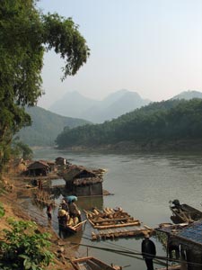
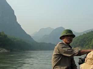
At 2pm we hopped back into the 4WD, together wih Ms Vuong, our local Thai guide and cook extraordinaire, to drive a little further on to Van Mai village on the banks of the Ma River. Here we board a small longboat for a 4km cruise down the fast flowing stream (an old Viet Minh supply route for the siege of Dien Bien Phu); green topped karst cliffs, the odd stilt house and gardens passed in and out of view as the distant mountains faded blue towards Laos.
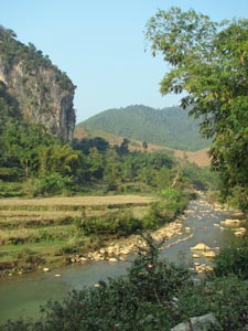
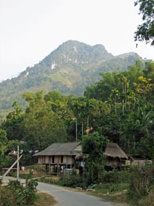
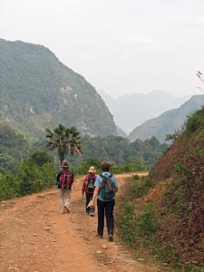
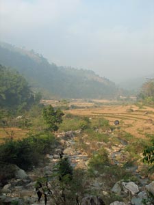
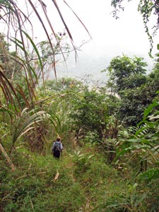
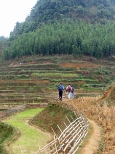
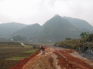
At the next village we landed and our trek began, as Linh led us up to Ban Sai village to follow a road up away from the river. The earthern road followed the course of the Suoi Pung River upstream into an ever narrowing valley; river floor and lower slopes terraced with gardens and recently harvested rice paddies beneath lush green forested hills. This road wound and undulated its way for several kilometres, every corner opening up a beautiful rural vista. |
|
|
 |
 |
||
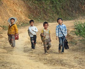
As we passed through the village of Tan Phuc, smiling children appeared from houses and fields to call out "hello" or "xin chao" - it was a scene to be repeated at every village on our walk. Leaving the road, we headed lower down into the valley along a dirt motor cycle track, crossing the river to reach the villages of Ban Duom and Ban Hang, the latter our destination and first homestay of the trek.
|
|||
|
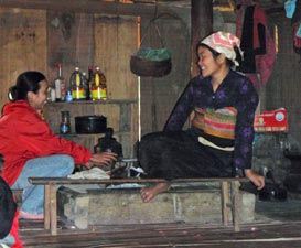
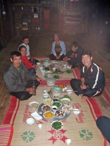 Dinner with the Nam family in Ban Hang |
|
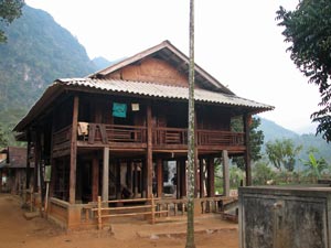 The Nam family stilt-house - our home for the night |
 Enjoying a welcoming shot of rice wine and puff from a bamboo bong |
|
Day 2 - Ban Hang to Ban K'ho Muong (14 km - 540m ascent - 360m descent) |
|
|
||
 Leaving the paddies of Ban Hang ... |
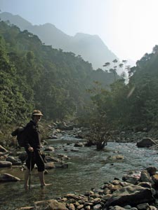 .. to wade the stream in a forested gorge |
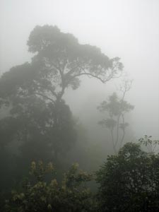
 Misty morning in Pu Luong |
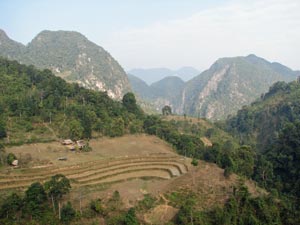
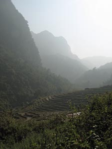
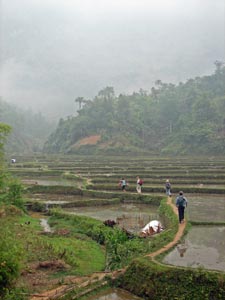
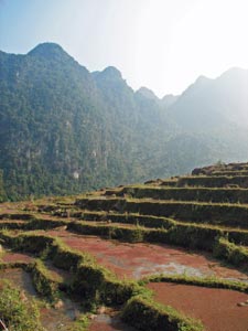 The terraced rice paddies |
 |
|
||
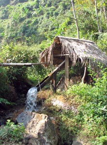 Tipping bucket rice mill |
 Self-sufficiency |
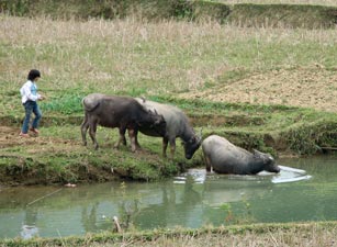
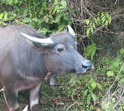
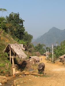 Water buffalo in Eo Ken village |
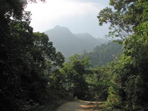
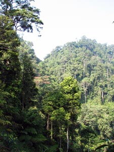 The rain forest of the pass between valleys |
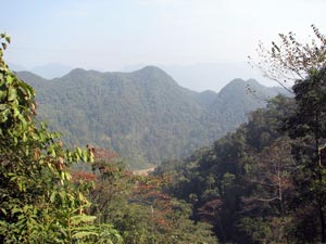
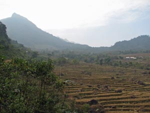
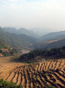
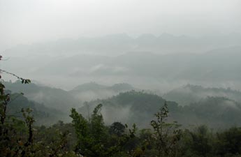
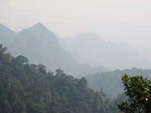 Pu Luong landscape in hazy blue |
|
 Road down through the rain forest 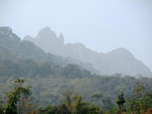 The rugged profile of Pu Luong's mountains |
|
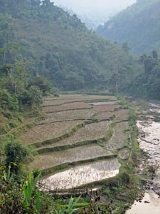
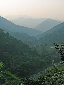
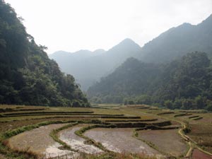
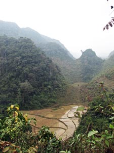
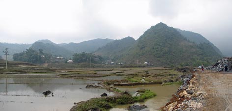
Then it was steeply downhill, ahead a beautiful sheer-walled valley and behind the blue profile of the mountains. The terraced paddies descended the slopes like a giant's staircase - postcard stuff.
|
|
|
||
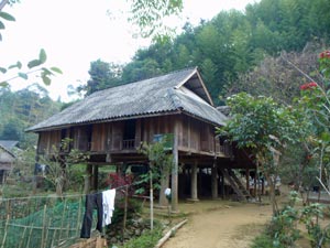 Our home for the second night - in Ban Kho Muong |
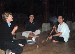
 Ms Voung and our White Thai hostess |
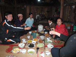 Yet another feast with the locals |
|
||
 Early morning at Ban Kho Muong |
|
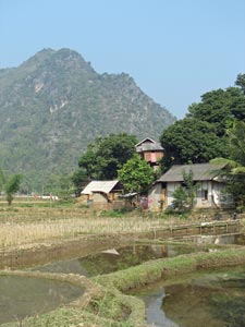
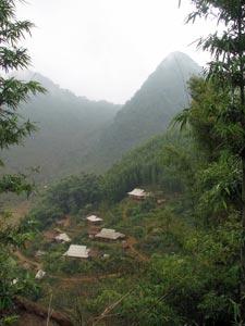
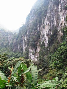 The limestone cliffs Pu Luong |
|
 |
 |
||
|
|
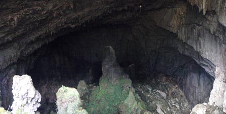 Entry to Hang Doi - the Bat Cave |
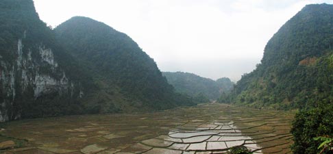 View back across the paddies and karst cirque from the spur |
 |
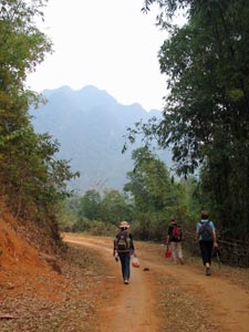
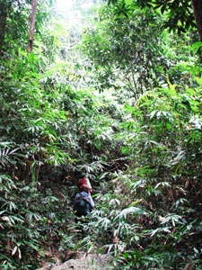
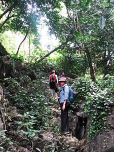
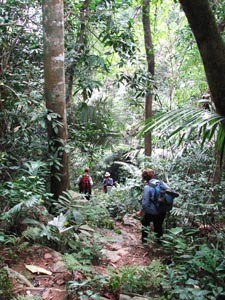
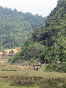
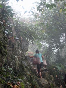
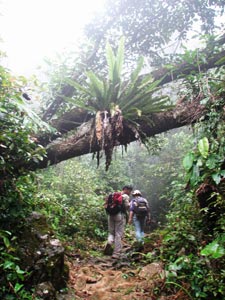
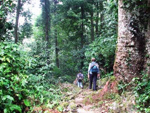
Our route onwards lay at the end of the cirque; a steep zig-zagging footpath leading straight up into the mountains. The air was still and the sky was covered with thin cloud, keeping the moisture in. By the time that we reached a small plateau from which to stop and admire the views back over the cirque, we were soaked in perspiration. The steep climb continued, entering dense jungle vegetation and crossing a rocky cleft in the mountain range, before plunging steeply down its eastern face. Our descent beneath the lush green canopy of the rain forest was even steeper and more direct than our ascent until we reached the line of karst cliffs, when it took a shallower and more contoured route. |
 |
|
 |
 |
 |
 |
The climb and descent through the rain forest as we crossed a rocky spur of the Pu Long Mountains |
|||
 Out of the forest at last |
|
|
 Rural setting - Pu Luong |
 View back across the paddies to the range we just crossed |
|
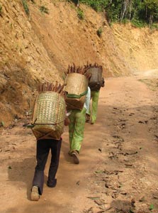 30kg of cassava per basket! |
From here, we followed a newly made road that cut a slash of maroon, red and pink clay through the rich green tapestry of vine clad forest. On the way, we were passed by three young women, each carrying a 30kg basket load of cassava, on their backs supported by headstraps, to the next village. It put our achievement into perspective.
|
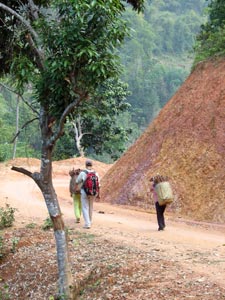 New road carved into the pink clay slope |
||
|
|||
 The three cassava girls |
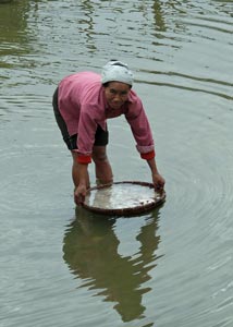 Rinsing the vegetables |
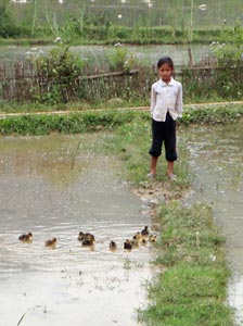 Minding the ducklings |
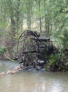 An old water wheel |
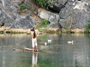 Fishing in the local pond |
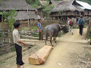 Carting a log to be sawn in planks for the new house |
 Bringing the water buffalo home |
|
||
 The Suoi Cham River valley at Ban Hin |
 View across the paddies to our stilted hut ... |
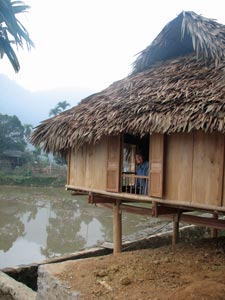 ... and close-up of our home for the night |
|
 |
|
|
 Narrow route across the paddies |
The track then began to traverse less steeply upwards beneath the rock face. Below us the fingers of paddy fields stretched into the tree-covered hills and mist rose up valleys giving definition to the grey profile of the mountains on the opposite slopes of the Suoi Cham Valley. |
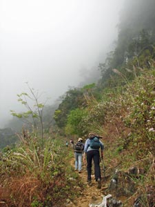 A steep climb up the mountains |
|
||
 Our "local" local guide |
 Pause on the rocky ascent |
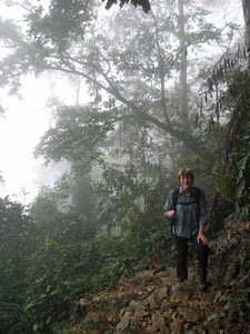
 In the dense mists of the cloud forest |
 Slowly emerging above the cloud layer |
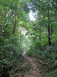 Track through the rain forest |
|
||
 |
 |
 The descent from the pass |
|
|
|||
 The ruggedness of the Pu Luong landscape |
 Out of the forest and into the paddies |
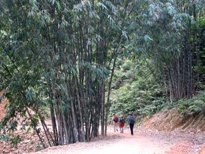
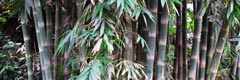
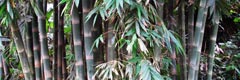
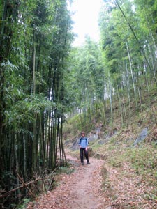 Passing through a bamboo forest |
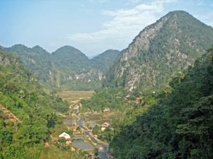
 Overlooking Ban Ba village |
|
||
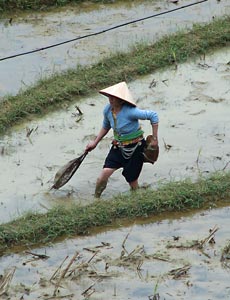 At work in the paddy |
 The intense green of newly planted rice shoots |
 Trudging down the red mud road |
|
||
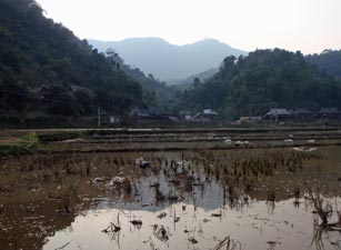
 Flooded paddies after the unseasonal rain |
 Vuong and Linh |
|
|