| Kaçkar Mountains Traverse |
| Crossing the Kaçkar Range - Olgunlar to Yukari Kavron (13.5 km, 1320m ascent, 1070m descent) |
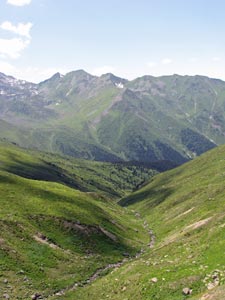
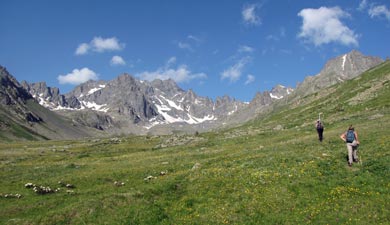
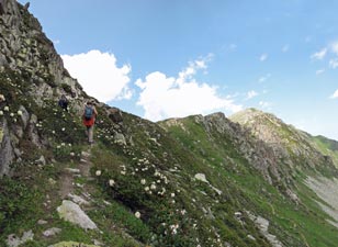
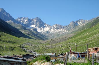
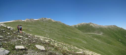
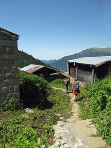
After our last breakfast at Yaylalar, Ibrahim, the fair Nello and I were given a lift up the concrete road to Olgunlar, the start of our crossing of the Kaçkar Dağlari. Our baggage had headed off for a long and circuitous route by road to Yukari Kavron, our destination on the north side of the ranges, while we took the shorter and harder route on foot. We set off at 6am, following the rushing stream northwards up the Dibe Valley, before climbing steeply up to an old mule track. The temperature was crisp as we followed the track more gently upwards, still in the early morning shadows of the eastern side of the valley. |
||
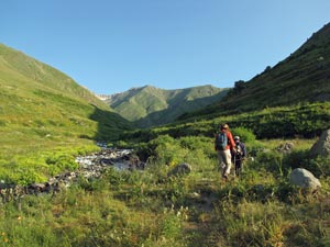 Early morning start near Olgunlar |
 |
 View back in the deep morning shadow |
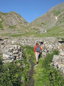 Crossing the stone walls of Dibe Yaylasi |
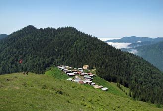
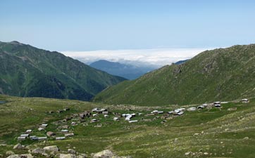
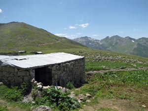
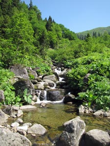
After a while, the valley curved to the west and, soon, we were back in bright sunlight, the morning rays warming our backs as we walked through thickets of young raspberry canes. A little later, we arrived at the roofless low stone walled buildings of Dibe Yaylasi, another seasonally occupied summer grazing spot. We wandered through the nettle infested buildings to a spring on the far side. It was a good place to stop and top up with water, as it would be the last spring on our crossing. |
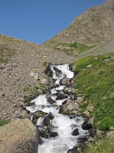 An impressive set of cascades above Dibe |
||
 |
 |
 |
||
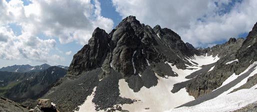
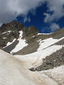
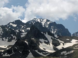
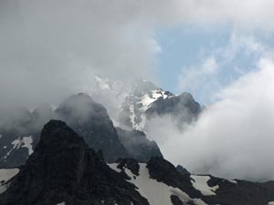
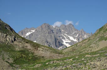 The rocky summits of the Kaçkar Dağlari |
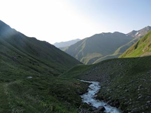
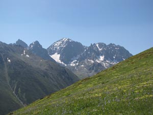
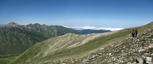
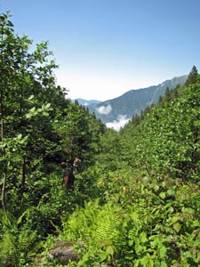
Leaving the village, we climbed steeply past a series of impressive cascades that tumbled down through a narrowing of the valley – the roar of rushing water demonstrating the power of these mountain streams, fat with melted snow. The valley now resumed its northerly direction and opened out to a wide green grassland, backed by the snowcapped rugged peaks of the main Kaçkar Range. |
 Looking back down the valley |
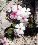
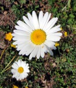
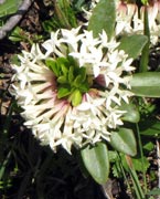
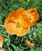
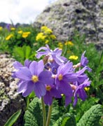
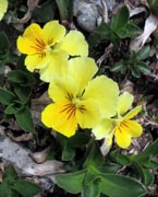
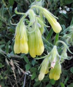
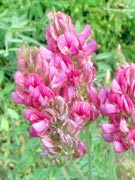
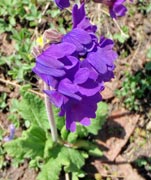
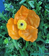
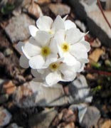
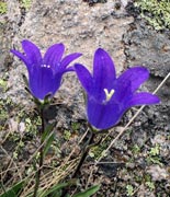
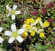
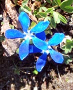
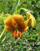
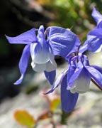
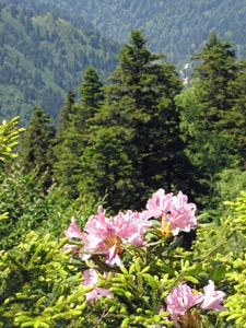
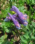
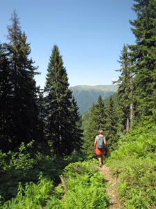
It was pleasant walking quietly, through this landscape, the only sound the stream below and the soft crunch of our feet beneath us. The valley was a magnificent natural Turkish carpet - a rich tapestry of different shades of green, knotted with threads of blue, purple, pink, white, yellow and orange (how is that for hyperbole!). Not far from the Duperdüzü campsite, we left the valley floor to start a steep climb up its flower-speckled eastern flank – the serious climb to Naletleme Pass had begun. |
||||
 |
 |
 Crossing the broad grassy valley of Duperdüzü |
 |
 |
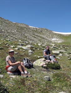
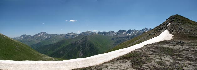
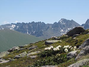
After a climb, traverse and second climb, the pass came into view, a snow-tipped saddle guarded on either side by high rock walls. It was a good place for a break, time to take in the views down the lush green Dibe Valley to the blue on blue shades of the distant Güngörmez Mountains. Closer up, the rocky ramparts of the Kaçkar Range itself were even more impressive. |
||
 |
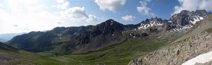 Panorama of the Duperdüzü Valley stretching up towards Mt Kaçkar |
|
 |
 Blue shades of the Güngörmez Mountains to the south |
 The climb to Nalatleme Pass |
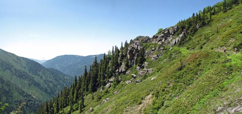
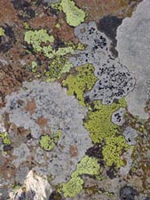
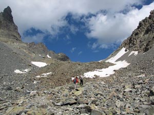
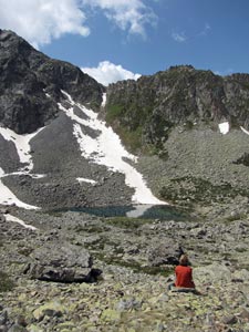
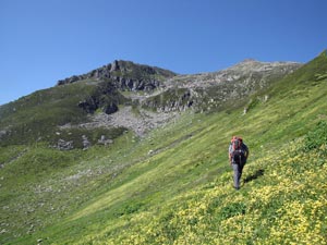
The final push up to the pass took us into a world of jumbled boulders – richly patterned and coloured in shades of brown, tan, grey and pink, and spattered with yellow-green lichens. We clinked across this boulderscape to reach a series of snow drifts that took us across a flat area to just below the pass itself. One last steep climb up the rock face and we were there at 3225m Nalatleme Pass, 1100m higher and 3½ hours after setting out. An icy wind whipped across the saddle, so we took shelter behind a low circular rock wall to recover lost energy and take in the views that had just appeared over the northern side of the range. |
 The closer we got to the pass the further away it seemed |
To our left, a long ridgeline of snow-tipped green mountains, beyond green hills and valleys heading off into the distance, and immediately in front, a barren landscape of rocky scree. This was our path down. |
 Sheltering from the wind on the pass with the tip of Mt Kaçkar visible in the gap |
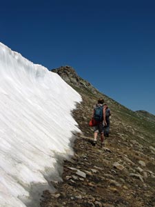
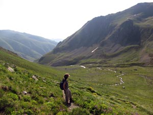
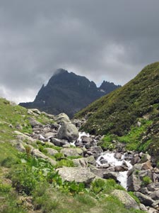
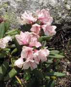
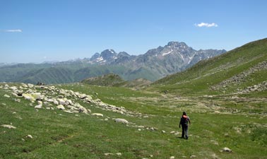
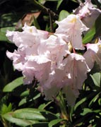
We followed Ibrahim down a winding mule track that took us quickly lower. Passing a small tarn, vegetation started colonising the rocks with semi-prostrate white-flowering rhododendrons and clumps of buttercups breaking up the monotony of stone. As we dropped below the tarn, the valley beneath us opened out – to the east, we overlooked the dark waters of Karadeniz Gölü at the head of a long green glacial valley, while to our west in a small cirque lay another still tarn, directly beneath the dark rock wall of 3404m Nalatleme Tepe. This tarn-dotted rocky landscape was stunning and we stopped for a while to take it all in. |
||
 Descending the barren scree on the north side of Nalatleme Pass |
 |
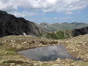 One of several small tarns north of the pass |
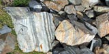
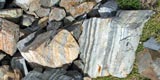
One of the things that we noticed was that we had now dropped well below the ridgeline that formed our onward route - another climb was due! Ibrahim left the mule track, to pick up a faint path marked by the occasional splash of red paint, which took us rock-hopping past the tarn and up toward the ridge. Suddenly, we found ourselves on knobbly granite boulders – having crossed some form of sharp geological boundary. The slabs of granite provided a sort of natural staircase, making the ascent of the ridge easier. The granite staircase passed a steep green wall carpeted with rhododendrons to bring us over the top. |
|||
 The route ahead |
 Contemplating the beauty of an alpine tarn |
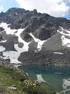 The beautiful tarn beneath Nalatleme Tepe |
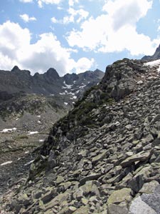 Rocky landscape of northern slopes |
|
 View of our route down from Nalatleme Pass |
|
 The ascent from the tarn-dotted valley |
We had also reached a point where the remaining route to Yukari Kavron was a simple one – no point for Ibrahim to walk down there and then head all the way back to Yaylalar, so we convinced him to head on back now and save himself a few hours of walking. He had been an excellent guide, even though he only had a few words of English and we even less of Turkish. |
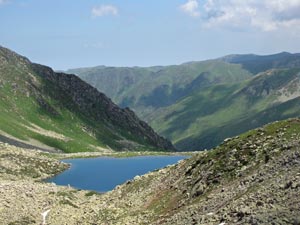 Final view of Karadeniz Gölü (Black Sea Lake) |
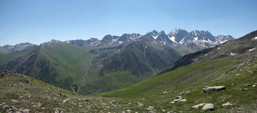
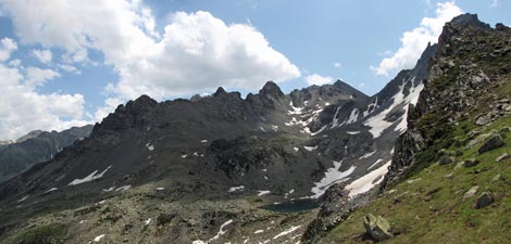
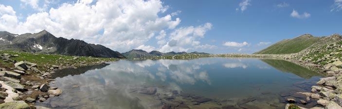
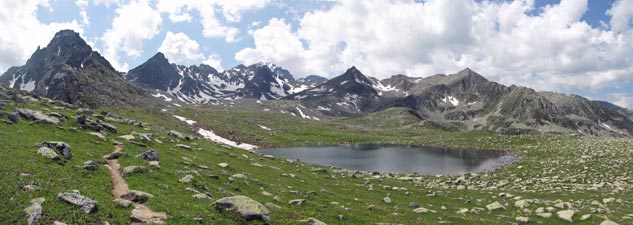 Panorama of the Kaçkar Range (3351m Nalatleme Tepe to the left and the dome of 3937m Mt Kaçkar in the centre) |
||
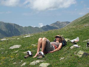
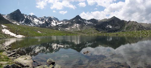
The fair Nello and I sat down in this magnificent setting to eat an early lunch and just let it seep into our souls. For an hour we were alone in the Kaçkar – time to reflect on its beauty, watch the clouds drifting by, admire the reflections in the lake surface, take time to sit and watch a tadpole wriggling by in the cold water – it was the best hour of our time here. However, magic moments have an end, and loud voices coming from over the horizon signalled the end of ours. A large group of trekkers appeared from Yukari Kavron and the stillness was broken - probably just as well, as the clouds had begun to take a greyish hue. |
 How to enjoy the Pontic Alps |
 The north-east face of Mt Kaçkar (3937m) - it was hard to believe we were on its summit just two days ago |
 Meditational moments no. 17 - clouds reflected in a glacial lake |
||
 |
 Reflections of the Kaçkar Dağlari |
 |
We got up and headed off down the long valley to the village. Looking back, the mountains were taking on a menacing dark look and the sky was filling with even darker cloud. As we approached the village, low cloud began to drift up the valley from below and not long after we arrived, a thick mist settled in to obscure the views. We had been very lucky to have had that time at the lake. |
||
 Cloud creeping in over Mt Kaçkar - time to go |
 Our route down to the Kavron Valley |
 The fair Nello meets some admirers |
 Dark clouds forming above the valley |
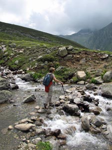 Stream crossing |
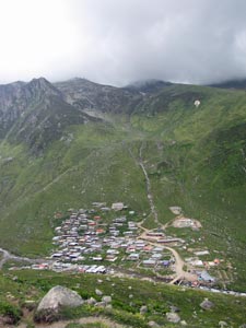 Looking down on Yukari Kavron village |
 The fog moves in |
|
 |
 |
|
 |
 |
 |
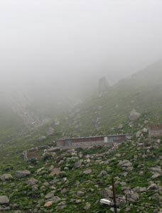
Foggy day in Yukari Kavron The dense fog that had crept up the mountain valleys and engulfed us the previous night was still there when we woke up. A couple of patches of blue sky, a view up the valley, some rays of sunshine all offered promise of better things, but ultimately the fog settled in for the day with varying degrees of visibility from misty to pea-soup. |
It was not a day to be out trekking in the Kaçkar mountains. The plan for the day had been to walk up the broad U-shaped Kavron Valley to a small glacial lake and then walk down again and, truth be known, we had decided to have a rest day instead. Five days of big 1000m climbs had worn us out and we needed a recharge, so we weren’t too disappointed to be house-bound. |
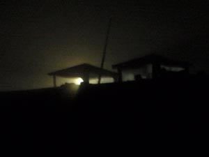 Foggy night in Yukari Kavron |
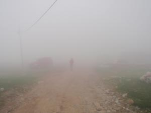 Heading off to the café in the morning fog |
 An occasional break taunted us with a glimpse of the valley ... |
 ... and then it was back into dense fog |
The café with potbelly stove and interesting people coming and going was a good place to hole up in the fog and enjoy a lunch of muhlama, the Turkish fondue, but time still passed slowly. It was much slower for the minibus-loads of day-tourists who had come up from below and stood around like lost sheep in the swirling mists. At least we had a room and a bed to retire to from the café, when we got tired of it.
|
|
| Samistal Plateau (17 km, 970m ascent, 2010m descent) |
The fog lasted 30 hours, which meant that we woke to clear blue skies for our last trek in Turkey – what a relief. With our guide, Mehmet, leading the way, we headed out of Yukari Kavron. There was no time for warming up, it was straight up the steep grassy slopes of the long ridge jutting out to the north from the Kaçkar massif. |
 Long way down to Yukari Kavron |
|
 So that's what the Kavron Valley looks like! |
 The climb up the Samistal Plateau begins |
|
|
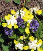
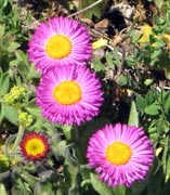
“Yavaş, yavaş” (slowly, slowly) was the rule for the climb, as Mehmet led us on a zig-zagging ascent across the flower-speckled alpine meadow – the subtly sweet scent of yellow and white pea flowers wafting by.
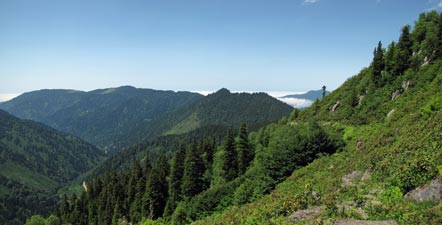
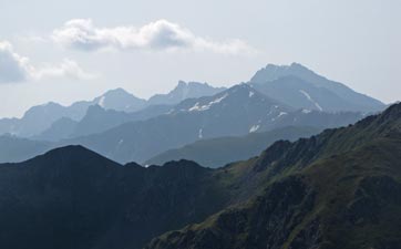
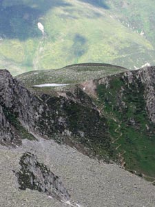
As we climbed, more and more of the main range became visible until we were treated to a vaste panorama of the Kaçkar Dağlari, Bulut Dağlari and Altiparmak Dağlari, the three main mountain ranges – a breathtaking view. One more upward push took us to the remnants of a long cornice and the crest of the ridge at just over 3000m. |
|
|
 A last look at the 3937m dome of Mt Kaçkar |
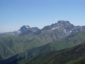 The summits of Altiparmak (3501m) and Kindeval Tepe (3562m) |
||
|
 |
 Behold the route ahead |
|
||
 The beauty of the Kaçkars |
 |
 Traverse along the western flank of the Samistal Plateau |
We headed down a broad grassy bowl to enter a narrow valley that curved away to the west. A small stream babbled its way down the valley, its damp course marked by a ribbon of lush green herbs and mosses in the drier green of the meadow. It was nice to walk by a stream that didn’t shout at you. With no rock walls and little remaining snow, this ridge was a gentler variant of the Kaçkar landscapes. |
 Crossing the alpine meadows of the Samistal Plateau |
 |
 A gentle mountain stream |
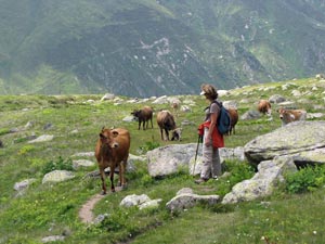
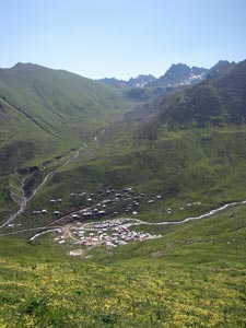
The curving valley led us down to Samistal Yaylasi, one of the more substantial summer grazing villages, with houses built of large square stone blocks. It was a good place for lunch in the warm sun. On the way out, we stopped to watch an old man making butter in his house – the old ways live on in these yaylasi. |
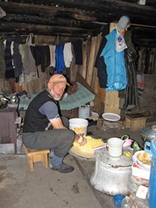 The butter maker plies his trade |
|
 Samistal Yaylasi spreading out over the high summer pastures |
 House of the butter maker of Samistal |
|
|
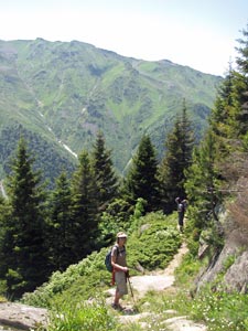
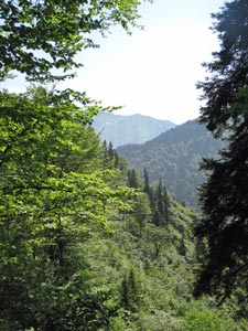
From Samistal, we picked up a footpath that took us on a long and gentle downward traverse of the south-facing wall of a bare side valley. The valley floor dropped away quickly and soon we were high above it. Prostrate junipers were becoming more common on the slopes and different types of wildflowers began to appear, as the dark silhouettes of spruce trees became visible on the far slopes of the larger Palovit Valley ahead. The vegetation was starting to change substantially. |
|
||
 |
 |
 |
||
|
||||
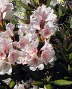
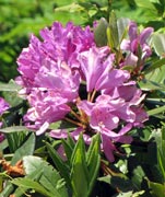
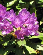
The vegetation was now much lusher, with ferns, large rhododendrons sporting pink and mauve flowers, and plants that looked like they should be growing in the tropics. |
|
||
 |
 |
 |
|
|
|
|
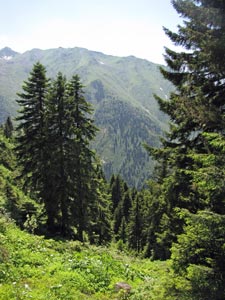
 Rhododendron and spruce |
 Passing through Hazindak |
|
 |
|
 |
|
 Descent through a spruce grove |
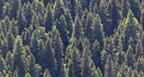
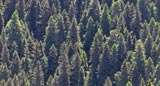
 The lushness of the Black Sea forest |
 A tranquil mountain stream |
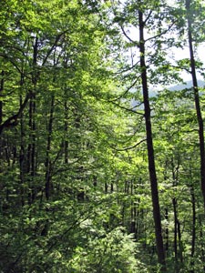 Dappled sunlight in the broadleaf forest |
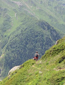
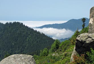
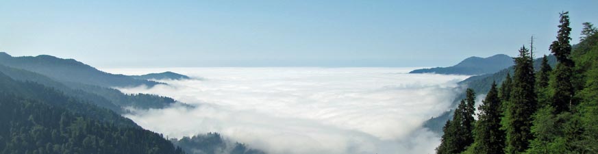
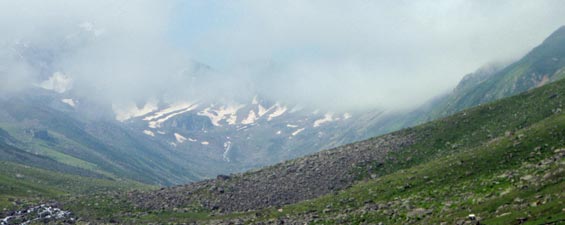
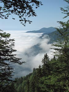
Through the gaps we could see the immense white sea of cloud, now closer beneath us. It was a spectacular sight, but it was also clear that the cloud was on the move, rising slowly up the valleys. The race began in earnest as our traverse finished and the descent of the steep slope via tight zig-zags and knee-jarring steps began, but the cloud won.
With about 300m of descent to go, we entered the swirling mists to continue downwards past the ghostly shapes of the forest trees. Eventually we head a roaring sound below and quickly reached the bank of a foaming white water torrent – we had arrived at the floor of the Kavron Valley. Ayder lay a little bit higher, across a small footbridge and on the other side. We walked into town damp from the mists and knees aching from almost 2000m of descent. |
|||
 The forest was beautiful in the warm sun ... |
 ... but the sea of cloud crept in ... |
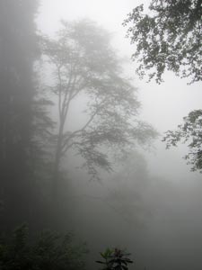 ... and soon we were walking in dense mist |
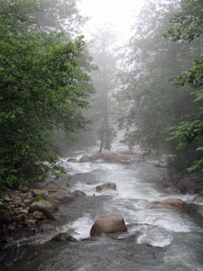 Kavron River rapids near Ayder |
|
|||