| A Taste of Mount Field |
About |
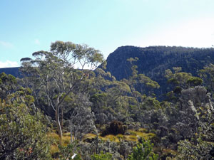
Established in 1915, Mount Field is Tasmania's oldest National Park. Its present boundaries encompass a diverse range of habitats, from lowland rainforest, through different types of eucalypt woodland to alpine shrub and herbfield. When we planned our walking holiday down the east coast of Tasmania, we noticed that it coincided with a planned visit by our bushwalking club with the Hobart Walking Club. One of the trips offered by the Hobart Club was a three day visit to Mount Field National Park to sample the bushwalking on offer there. It was an opportunity too good to miss, so we have joined a group of walkers from the two clubs for this "taste of Mount Field". Read on and join us too. |
|
Lake Dobson to Twilight Tarn (13 km - 540m ascent - 540m descent) |


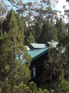
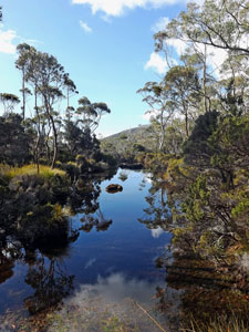
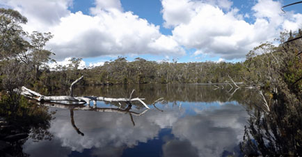
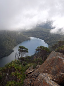
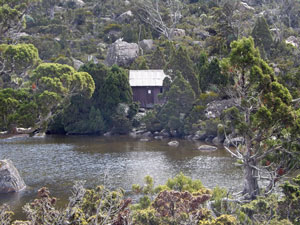
We arrived at Lake Dobson carpark, loaded our supplies and wandered the few hundred metres along a gravel access road to the far end of the lake, where the Hobart Walking Club's hut lay nestled amongst pencil pines, deciduous beech and mossy rocks - a lovely spot looking out through the trees to the lake. It would be our home for the next two nights. |
|
|
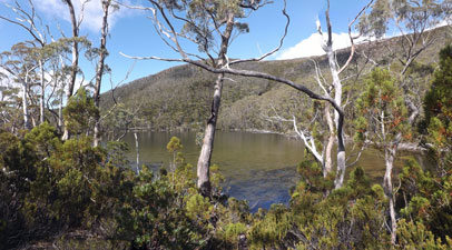 Lake Dobson from the hut |
 |
|
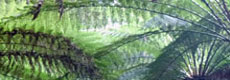
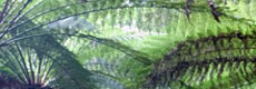
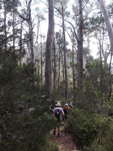
After settling in, we headed off for our first discovery tour of Mount Field National Park under the guidance of Storm, the President of the Hobart Club. She led us out from the hut and, almost immediately into a pocket of primal temperate rain forest, where the track wound its damp, dark path past tall trees, moss-covered rocks and stumps, gnarly roots, and beneath a grove of spiky-topped pandani, their dry-leaf fringed trunks varying from one to 10+ metres in height. |
||
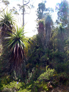 Pandani Grove |
|
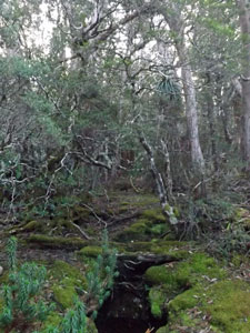 A patch of temperate rain forest |
This Tolkienesque habitat quickly gave way to more open eucalypt forest around the shore of shallow Eagle Tarn, where we climbed back up to the gravel access road. We quickly left it again, to follow a rocky footpath, which led us to a junction leading to Platypus Tarn. A steep and rocky track led us down to the tarn for lunch and the same steep and rocky track led us back up again. |
|
|
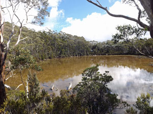 Eagle Tarn |
 Platypus Tarn |
|
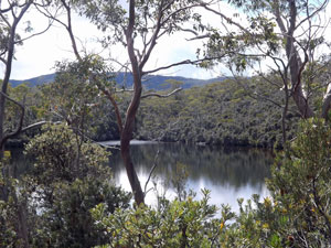
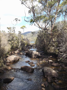
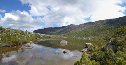
Pushing on, we started a steady descent of the wide Broad River Valley. One arm of the river ran from Platypus Tarn to Lake Seal to Lake Webster, and the path followed the valley down on the eastern side of these lakes, beneath a canopy of eucalypts and across duck-boarded water courses. Behind the lakes lay the ridges of the Mount Field plateau. |
||
 View across Lake Webster to Mt Bridges |
 Crossing the wetlands |
 Looking across the grasslands to Lake Webster |
 A small pondage near Lake Webster |
 |
 |
 |
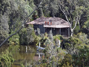
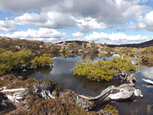
Rounding the lower end of Lake Webster, we crossed a wide marshy area and then the Broad River itself, on a narrow steel footbridge. From here, the track climbed steadily up the western flank of the valley, winding its way beneath the trees to reach a lovely shallow lake perched in a bowl on the slope. We were at Twilight Tarn and, at its end, the character-filled rusting iron hut provided the perfect place for a break. The hut had been built in 1926 as a skiers' shelter and still contained relics of that era. |
|||
|
|
 Broad River |
 Crossing the Broad River flats |
 View up to the valley walls |
There are two ways back from Twilight Tarn - continuing up and over Tarn Shelf would be harder and longer and was also part of the route for tomorrow, so we took the alternative and retraced our footsteps back to the hut. It had been a good introduction to the mid-level habitats of Mount Field - a nice entree that left us all keen for the main course, walking the high country tomorrow. |
||
|
Rodway Range - Tarn Shelf Circuit (15.5 km - 640m ascent - 640m descent) |
|
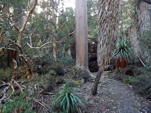
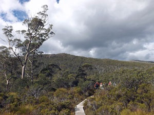
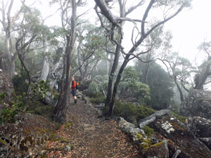
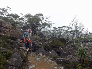
Looking out the window of the hut, I could see the eucalyptus canopy fading into the morning fog. It was not an auspicious start for a walk in the high tops of Mount Field National Park - a walk that was to be the main course of our "taste of Mount Field". By the time Storm led us off, little had changed. We quickly crossed the goblin landscape of the pandani grove to reach the gravel road heading up through the forest to the small ski field beneath Mt Mawson. Three long, steep zig-zags later we were there. |
|
 Climbing the Snowgums foot track ... |
 ... as the trees become more and more stunted |
|
|
It was time to leave the road and take to the rocky Snow Gums foot track. The mists still hung about the slopes as we climbed steadily upwards through rock garden and gnarly snow gums. Eventually, we broke out above the trees, where the faint silhouettes of mountain ridges faded in and out of the mist.
|
|
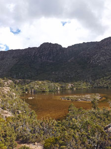
Pushing along across this high plateau, covered in low alpine shrubs, we made a short detour to see whether there might be a view over Lake Seal through the fog. There was - the lake far below superbly framed by the low cloud, which drifted slowly upwards towards the tops. |
||
 |
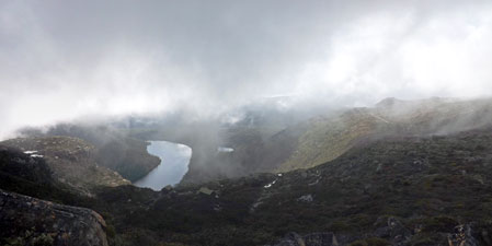 View of the valley and Lake Seal beneath the swirling mist |
 |
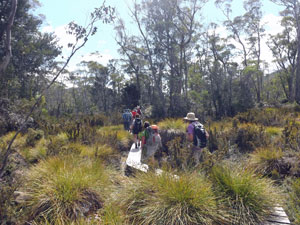
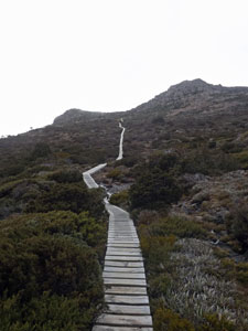
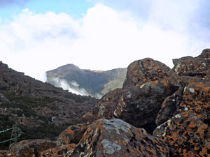
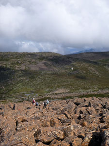
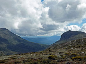
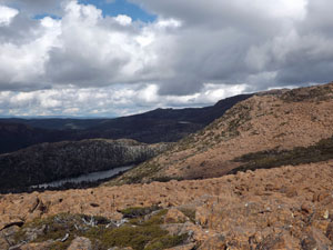
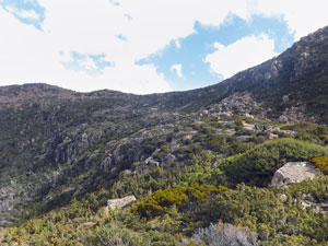
From here, a longish section of duckboard took us across the boggy plateau. Then it was more climbing up a rocky path, as a thick band of fog drifted in to partially obscure the track ahead. Somewhere above Rodway Hut, the mists began to clear, opening up views of the lake-filled valley below once again and showing us the boulder-strewn slopes of the Rodway Range ahead - thither lay our path. |
|
 Climbing up to the Rodway Range |
 Crossing the boulder-strewn top of the Rodway Range |
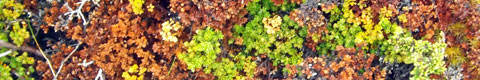
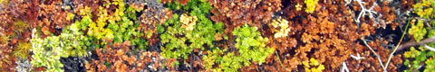
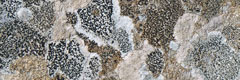
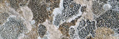
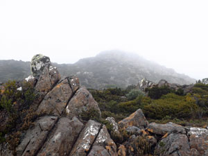
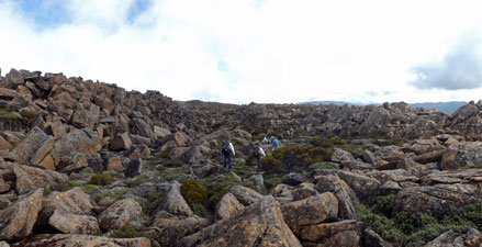
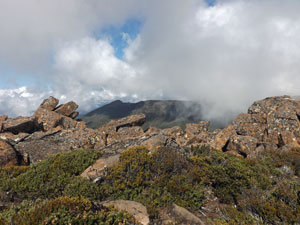
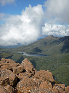
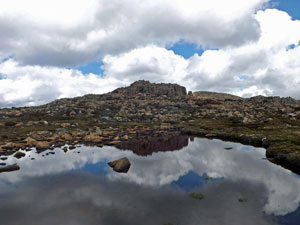
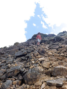
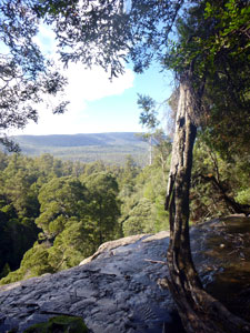
The massive orange and grey dolerite boulders, splashed with the black, white and cream of lichens were to be our kaleidoscopic route for the next few kilometres. Slowly, we followed the occasional cairn or pole that marked the way across this magnificent rock jumble. Passing through a boulder gully know locally as the Lion's Den, we reached a view-point over Lake Newdegate. By now the mists were dissipating rapidly and the sun was warming the air and lighting up the orange hue of the rock. |
|
 Passing through The Lion's Den |
 Looking down on to Lake Newdegate from the Rodway Range |
|
 |
|
|
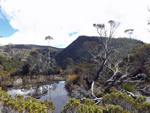
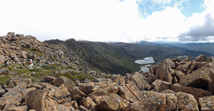
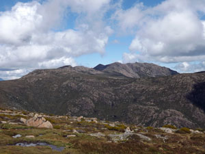
After a break, we headed on to begin a slow rock-hopping descent across a sea of lichen-speckled boulders. Views were now opening up to the west - over Lake Belcher and across to the long spur leading over Naturalist Peak to Mount Field West, the pinnacle of these mountains.
The rock scramble brought us down to the K Col, a saddle between the Rodway and Field West ridges. Here, amongst the green mosaic of cushion plants, we ate our lunch as we enjoyed the cool mountain air, sunshine and the alpine scenery.
|
|
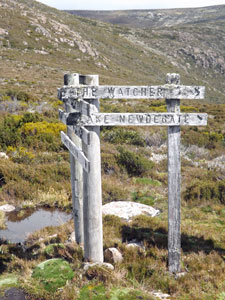
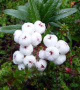
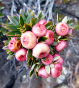
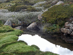
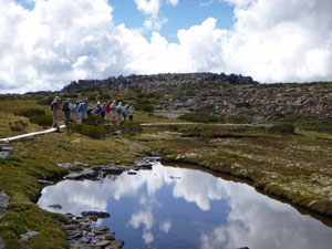
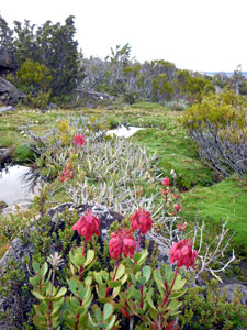
Turning north from K Col, Storm led us high up across the eastern flank of the deep valley between the bluff dolerite walls of Field West and The Watcher. The muddy track sidled through cushion plant, pineapple grass and low alpine shrub - a lovely setting, but one which made us feel a little guilty as cushion plants squelched underfoot. Fortunately, on cresting the ridge behind The Watcher, we finally found ourselves on duckboard, as we passed by a series of lovely tarns - clear, still, dark ponds, their edges shaped by cushion plants. |
||
 |
 Looking across to Tyenna and Florentine Peaks |
 |
|
|
|
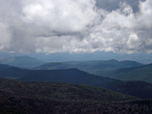
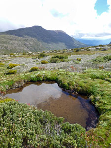
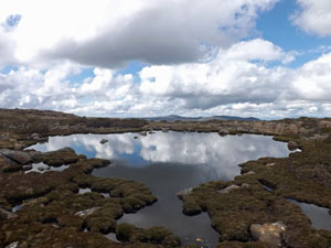
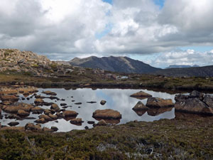
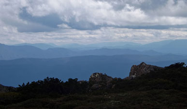
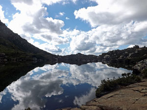
It was very soothing to walk across this soft, boggy landscape of the Newdegate Pass, with tarns of varying size and shape reflecting the clouds and the boulder-piled ridges about them. Out to the north, the ridges of the central Tasmanian mountains faded blue into the distance. |
||
 |
 Reflections of plant and cloud |
 |
 |
|
 |
|
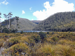
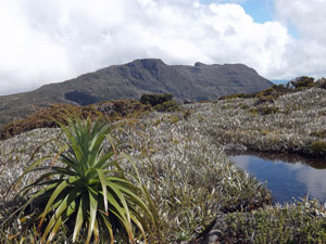
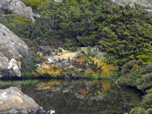
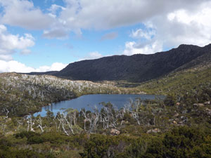
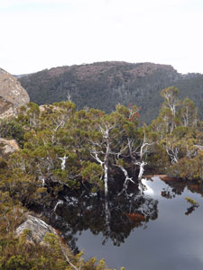
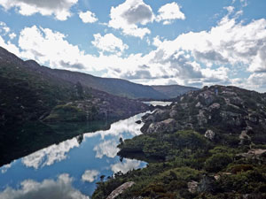
This changed quickly, though, as a steep, rocky descent brought us down a level, to wind our way through dense head-high scrub to the shores of Lake Newdegate. Looking down its length from the outflow, below the slopes of the Rodway Range covered in deciduous beech and a scrubby eastern shore, silvered with the ghost-like trunks of long burnt pencil pines, I declared it my favourite lake in Mount Field. |
|
|
|
|
As a bonus, it has a small and charming, but somewhat derelict hut on its shore. The lake was a good place for a rest, before continuing on. Ahead lay the rising tiers of Tarn Shelf, lying beneath the shadow-darkened walls of the Rodway Range. |
||
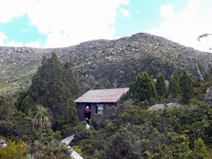 Newdegate Hut |
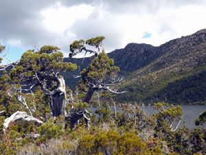 An ancient pencil pine on the shores of the lake |
|
 |
|
 |
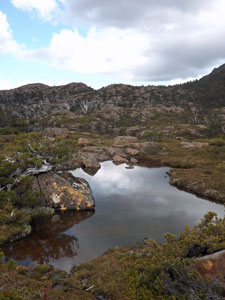
We commenced the undulating climb up these tiers, passing literally hundred of tarns as we went - from lake-sized tarns to bathtub-sized tarns, clear, dark tarns and pale green tarns, tarns reflecting plants and tarns rippling in wind, cliff-edge tarns and deep valley tarns - it was an amazing tarnscape. |
||
 Tree-lined Backhouse Tarn
|
 Farewell to Newdegate Hut
|
 Tea-coloured James Tarn
|
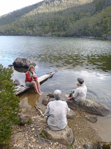
Finally, we climbed the last tier, leaving behind this magical part of the park to reach Rodway Hut. The circuit part of our walk was almost complete, and a short climb back up to the plateau, reconnected us with the duckboard of our outward path. From there we headed back the way we came, with a slight detour across the ski-field to regain the access road and descend to the hut - with plenty of time left to soak our feet in the clear, cold water of Lake Dobson. |
|
|
 Clouds reflected in Robert Tarn |
 The route towards Rodway Hut |
|
It had been a long day, and one that tested the strength of ankles and knees, but everyone felt that sense of tired exhilaration after a hard walk in magnificent country. We had been especially lucky with the weather - the ethereal misty cloak lifting to reveal the high country here in all its splendour. Thanks Storm. |
|
Tall Trees and Waterfalls (6.5 km - 160m ascent - 160m descent) |
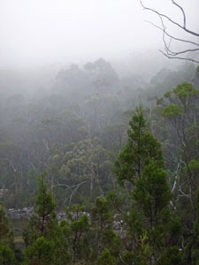
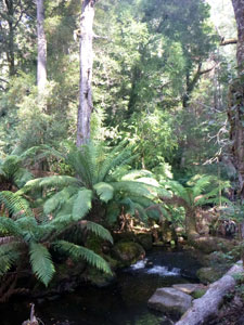
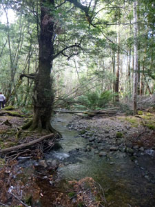
Once again we were greeted in the morning by fog, this time accompanied by a spotting drizzle and a 6° temperature. It didn't worry us, though, as we were packing up and leaving the Hobart Walking Club's rustic hut on the shore of Lake Dobson and heading down the mountain. Storm had one more walk in mind for us - starting at the Visitor Centre 16 km down the road and 800m lower at the base of the mountain. To our great delight, it lay in the sunshine and relative warmth. The cloud cover was left behind on the heights of Mount Field. The walk today would be a short one, and one that many day-trippers to Mount Field do. However, that does not detract from it, as it highlights the landscape features of the lower levels of the mountain - waterfalls and tall trees. A wide paved track left the Visitor Centre to enter the forest and followed a babbling creek beneath the bright green fronds of a tree fern grove. Already the trees that reached skyward were looking big, but these were not yet the "tall trees". |
||
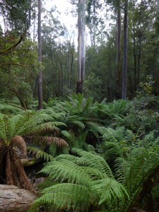 Ferny understory of the Mount Field forest |
|
 A tree-fern grove on Russell Creek |
|
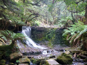
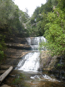
We soon arrived at the face of Russell Falls, where the creek cascades some 60m over a broad two-tiered rock shelf - it was a lovely sight, even though our Tasmanian hosts apologised at its lack of spectacle due to the current drought. It must be a truly spectacular sight after heavy rains, because even today it was impressive. |
||
 View from the top of the falls |
 Fern-lined creek system |
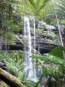 A discrete view of the lower Russell Falls |
|
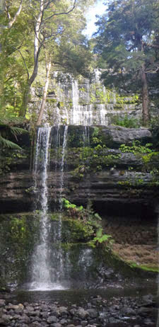
Leaving the base of the falls, we climbed up a set of wooden steps to reach their top, before making a short detour along the fern-lined creek bed to see the smaller, but beautiful Horseshoe Falls in their dark forest glen. |
|||
|
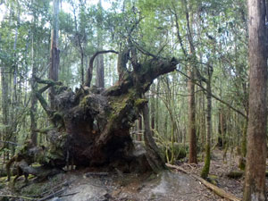 Fallen giant |
|
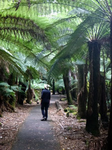
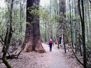
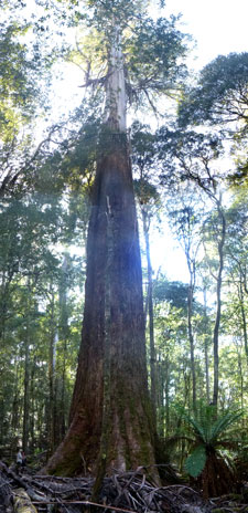
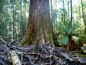
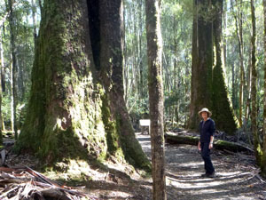
Then it was on to the "Tall Trees Walk" - where the really big swamp gums grow. These giants, which can reach over 90m, are truly impressive trees, with their huge rough-barked boles tapering into smooth trunks that rose to a gnarly crown soaring high above the canopy of lesser trees. The tallest swamp gum at Mount Field was 79m and I got a stiff neck trying to photograph its crown. We wound our way through this open forest in the shade of the giants - magnificent. |
||
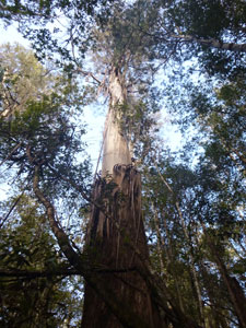 In amongst the tall trees |
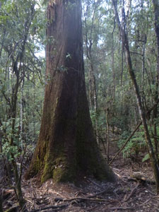 Base of a forest giant |
|
|
||

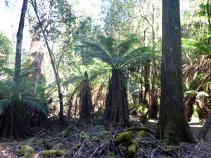 Tree-ferns in the sub canopy |
 On the Tall Tree pathway |
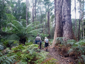 Forests of Mount Field |
From the tall trees walk, a well-formed path led us gradually downhill to reach the third waterfall, Lady Barron Falls, in the deep valley of a creek of the same name. After admiring it, we followed the fern-covered and mossy banks of this lovely creek downstream. The blood got circulating as we climbed up a set of 239 wooden steps to leave the valley of Lady Barron Creek and wander back the last few hundred metres to the Visitor Centre. |
||
 Lady Barron Falls |
|
 Lady Barron Creek |
It was a great way to finish our trip to Mount Field - an easy walk with superb scenery and a chance to discover the richer habitats of its lower slopes. If the first walks were the entree and main course, this last walk was the dessert. Thanks, Storm, for showing us your favourite part of Tasmania - I can see why that would be the case. Thanks also to the other members of Hobart and Canberra Walking Club for their pleasant company, both on the track and in the hut. As an exercise, for us, this interclub get-together has been a great success. |
|