
| Stage 5 - Narooma to Tathra |
About |
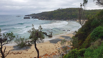
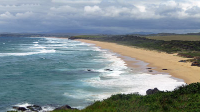
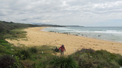
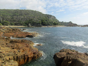
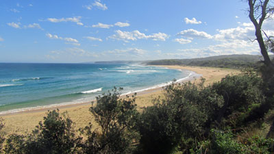
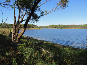
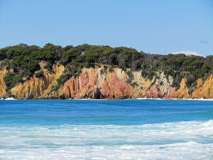
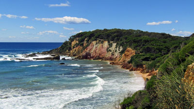
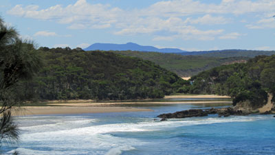
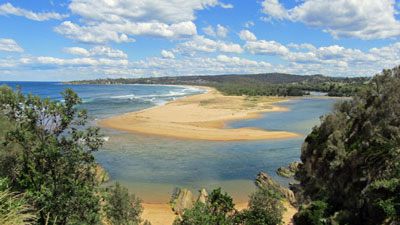
The fifth part of our staged group hike along The Great South Coast Walk took us from Narooma to Tathra, 85 km and 5 days of walking to the south. It was a bit shorter than other stages, but that was because the next possible end-point was Merimbula, which would add another 30 km to the stage. Either this stage or the next one would be a shorter one and Tathra, with its historic pub and micro-brewery makes an excellent place to finish a multi-day walk. We planned to camp out each night, partly because it is difficult to find cabin accommodation for just a single night and partly because we would be crossing Mimosa Rocks National Park, which is served by more basic campgrounds. The route is now becoming less developed and includes an off-track section in the national park. Apart from that, there are two sections where private land runs down to the cliff-tops, making the only route along some fairly rugged rock platforms. This adds to the enjoyment of the walk, but needed careful timing to ensure one can pass at low tide. The tide is also critical for the main water-crossings, at Murrah Lake, Bithry Inlet and Nelson Lagoon. With people having various commitments in March and April, the one period where our itinerary fitted well with tides was the end of January and early February. Thus, we had a summer stage and the added pleasure of a bit of swimming. Apart from water-crossings and rock shelves, the walk takes in the now expected long sections of golden sand beach, smaller sandy coves, grassy and forested headlands, wetlands and passes through three National Parks, Eurobodalla, Biamanga and Mimosa Rocks. The ever-changing land- and sea-scapes of the South Coast of New South Wales never cease to amaze. No day risks becoming boring. |
|
|
|
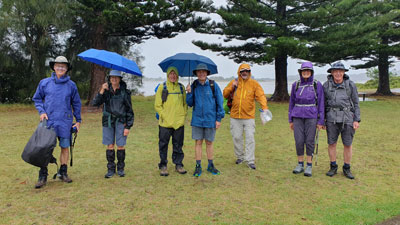
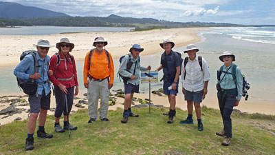
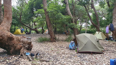
The one change to this walk was that the fair Nello had fully recovered from her bilateral knee replacements. After serving four sections as support driver, she would join the walkers. Alas, poor Marg was still recuperating from her leg surgery, but this meant she could take over as support driver and still accompany the walkers. The fair Nello and I headed down a day early to check out water-crossings, campsites and locate the start of the off-track section, before being joined by the others. Thus, the same nine of us as for Stage 4, myself and the fair Nello, Jan and Phil, Lois and Bernard, Marg, Alan and Ian, assembled at the Tathra Tourist Park to commence Stage 5 of the Great South Coast Walk. Plans were already changing - with a strong rain band sweeping in from the west, we swapped tent-bookings for cabins to avoid packing up wet tents before we had even started walking. |
|


Day 1 - Narooma to Mystery Bay (13.5 km - 110m ascent - 110m descent) |
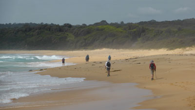
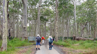
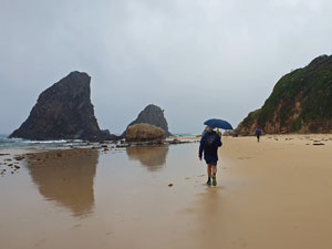
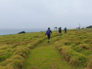
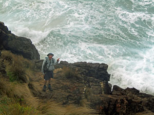
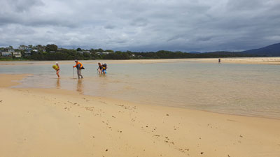
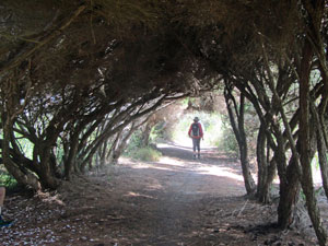
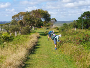
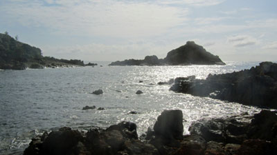
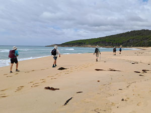
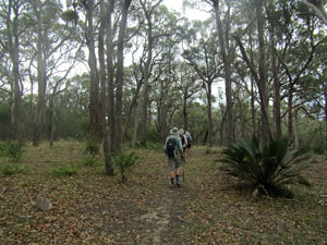
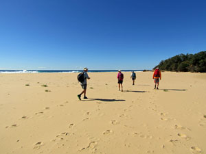
I had a feeling of deja vu as I listened to the rain beating down on the roof of our cabin in Tathra. It was looking like the same wet start to our walk as we had experienced on Stage 3 when it rained all night on the eve of our departure. This would be different though .... then the rain stopped and we had six days of fine weather. Today, it was still raining as the maxitaxi took our group of 8 walkers to our start point at Narooma, where we had finished Stage 4. It was still falling steadily as we set out in full wet weather gear - the sort of rain that will eventually find its way through any protection .... and it did. It was a pity, as once you walk along Wagonga Inlet and past the golf course to Glasshouse Rocks Beach, this is one of the prettiest sections of the coast. Rain being steadily driven into your face by the southerly wind can distract from that beauty. I felt disinclined to get my camera out in these conditions, but some of the others took a few photos, which show the bleak weather and the diverse beauty of this coast, even in the rain. |
|
 Someone rolled ot the blue carpet for us in Narooma (photo: J & P Gatenby) |
 Wet walk to Glasshouse Rocks (photo: J & P Gatenby) |
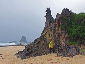 Some spectacular folding in the rocks (photo: J & P Gatenby) |
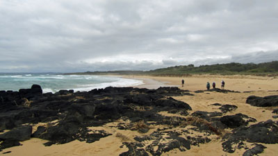
Such was our day, as we crossed the cemetery on the headland to walk along the low tide beach route past the Glasshouse Rocks - their brooding dark forms still impressive in the greyness. This is a compulsory low tide walk, as the land above the cliffs is private. It did, however, provide a bit of fun with rock-hopping and a scramble over a narrow ledge above the breaking waves, before eventually bringing us to the sandy stretch of Handkerchief Beach. |
||
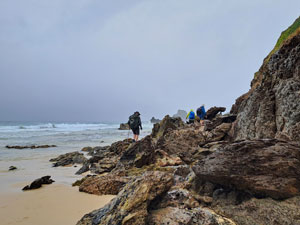 Start of the low tide passage (photo: L Padgham) |
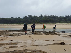 Wading Handkerchief Creek (photo: J & P Gatenby) |
 Grassy track across Bogola Head (photo: J & P Gatenby) |
By the time we reached the end of the beach, the rain was wicking down my socks and into my boots and any semblence of dryness was vanishing. So, when we reached the creek at the end of the beach, we just strode straight through - our boots couldn't get much wetter. This brought us to an exposed passage across Bogola Headland, following a grassy cliff-top track above dark off-shore rocks and sandy coves. Way out to sea, hazy in the rain, Montague Island watched our passing. |
|
 Beach near Nargal Lake (photo: J & P Gatenby) |
 Taking our bearings at the Corunna Lake sandbar (photo: J & P Gatenby) |
Eventually, we dropped down onto Fullers Beach for an almost 3km stretch of soft-sand beach walking, past Nargal Lake and on to reach the rocky cliff line of Corunna Point and the entrance of Corunna Lake. I was expecting a wade here, but the entrance was blocked by a wide sandbar - we strolled across and climbed up a smooth pathway to the top of the headland. At last the rain was easing. |
|
 Rocks of Corunna Head (photo: J & P Gatenby) |
 View over Billys Beach (photo: J & P Gatenby) |
A grassy track took us into the coastal heath and shelter from the wind, winding its way past Billys Beach and through to the long Mystery Bay Campground. We had planned to camp here for the night, but the muddy sites did not appeal to a group of saturated walkers. It was time to actuate the fair Nello's plan B - swap this and our next nights campsite in Bermagui for cabins (one problem with walking down the coast is that places often require a minimum stay of 2 nights). This meant a bit of a car-shuffle, but Marg came to our rescue and ferried us all to Bermagui in two shifts. A hot shower and dry clothes are quick to lift the spirits much more than sitting on a wet log in bleak damp surrounds. Plan B was a good idea and we could better reminisce and appreciate the coastal landscapes - rock platforms, headlands, beaches and forest - through which we had passed, while feeling dry and snug with a glass of red in hand. |
|
Day 2 - Mystery Bay to Bermagui (19 km - 120m ascent - 120m descent) |
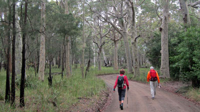
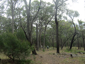
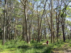
The rain had well and truly moved on, but the sky remained overcast, as Marg ferried us back to Mystery Bay to continue our walk. Quickly passing through the village, we picked up a gravel firetrail that led through some lovely spotted gum forest to reach the curiously named 1080 Beach. |
|
 Track through the spotted gum forest south of Mystery Bay |
 Heading down 1080 beach |
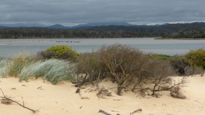
At the end of the beach lay the entrance to Tilba Tilba Lake, cut off from the sea by a broad sandbar and backed by the cloud-capped silhouette of Gulaga Mountain - a nice spot for some morning tea. As we ate, the sun broke through the clouds - the day was only getting better. |
|
 Gulaga wearing a cap of cloud |
 The sand-barred entrance to Tilba Tiba Lake |
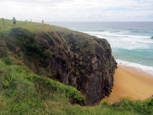
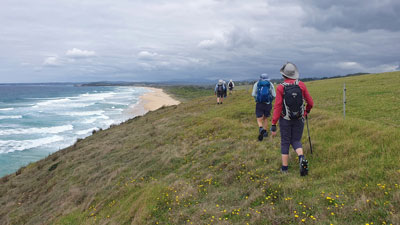
Here we climbed up onto the long grassy tops of Tilba Head, lined with enormous off-shore rocks and steep-walled coves. To the south, the distant silhouette of Biamanga Mountain became our new focus, as we dropped down on to the next beach. |
||
 Small cove on Tilba Head |
 |
 Surf pounding the rocky edge |
 On the grassy tops of Tilba Head |
 |
 Big seas and dark skies south of Tilba Head |
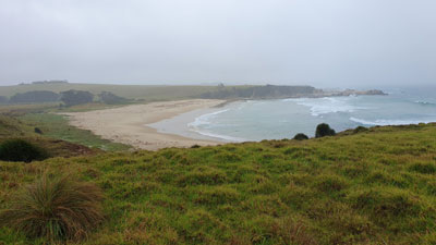
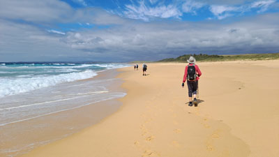
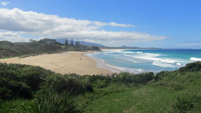
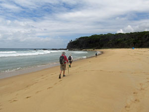
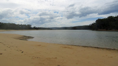
Ahead lay 5km of isolated golden sand, a long meditative walk into the face of a stiff ion-rich southerly wind with the sound of the surf our only accompaniment. A small rocky promontory in the middle of this section provided a brief change, before we continued on our beach promenade to reach the mouth of Wallaga Lake. |
||
|
|
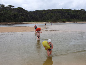
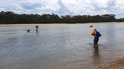
Some 20 metres across the entrance channel lay Murunna Head and our track south. There were two possible ways to reach it, either a 2km detour to cross by the road bridge or a short swim or wade. It wasn't a hard decision but it was hard to see the depth, so we stripped down to bathers, loaded up drybags and waded in .... and waded out ... not very deep at all with the tide well out. |
|
 Crossing the entrance to Wallaga Lake (photo: J & P Gatenby) |
 The party at Wallaga Lake Entrance (photo: J & P Gatenby) |
The northern slope of Murunna Head sheltered us from the wind and, with the sun now shining brightly, we took the opportunity for a swim in the channel and lunch on the grass looking back across the broader reaches of Wallaga Lake the mysterious Gulaga. After lunch, we climbed the green verge of Murunna Head to follow a shady track through the dense heath along its cliff line - stopping at several viewpoints to enjoy Murunna's magnificent rock formations and coastal scenery. |
||
 Drinking Horse Rock |
 Gulage towers above the dense coastal heath |
 Camel Rock (Bactrian or Dromedary?) |
 The rocks of Murunna Head |
 Haywards Beach - looking south |
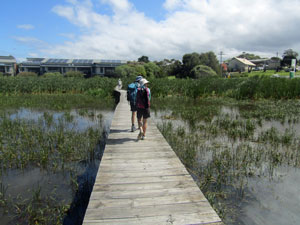
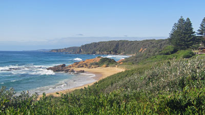
Bermagui was now in sight and the Coastal Track led us the final few kilometres into town through thick heathland and forest, between the sea and Long Swamp (an important waterbird wetland), a short stretch along Haywards Beach, and a final wander through the reed-covered wetlands to reach the Bermagui Bridge and town. |
|
 Coastal heath on the Bermagui Coastal Track |
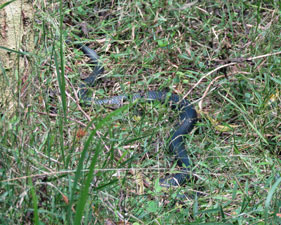 Can you spot the red-bellied black? |
 Passing through a grove of paperbarks |
 Panorama of Haywards Beach and distant Gulaga |
 Rounding the last headland with Bermagui in sight (photo: J & P Gatenby) |
A few minutes after crossing the bridge we stopped at the wharfside gelataria / coffee shop - a great place to relax and give our feet a break. Finally, we wandered the last kilometre along the waterside parks and up the hill to our cabins for our second night in Bermagui. With time up our sleeves, it seemed a good idea to head across to the iconic Blue Pool - a large walled rock pool below the cliffs that has provided safe swimming for over 90 years. It was a great place to cool off, with its resident fish and crabs and the odd wave breaking over the rocks into it. |
||
 Crossing the swamplands |
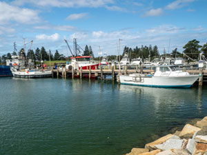 Fishing boats at Bermagui wharf (photo: J & P Gatenby) |
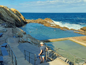 The Blue Pool (photo: L Padgham) |
I like Bermagui - it is probably the most authentic of the larger towns along the Great South Coast Walk. |
|
Day 3 - Bermagui to Aragunnu (24 km - 250m ascent - 260m descent) |
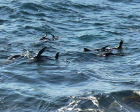 Seals at Play near the Blue Pool |
It was an early start to the day, but we were welcomed with brilliant sunshine. I had originally planned to camp at Hidden Valley, where the fair Nello and I spent a wonderful night on a grassy flat camped near the old fisherman's hut. Since then, the land has been gifted to Mimosa Rocks National Park and camping is no longer permitted. Hidden Valley would have been a long walk, and the next campsite at Aragunnu is another 2 km on over a saddle ..... it was going to be a long day. |
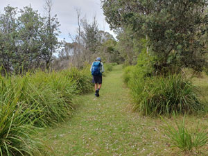
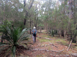
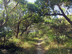 Heathland track south of Bermagui |
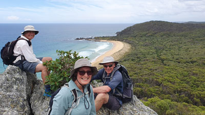
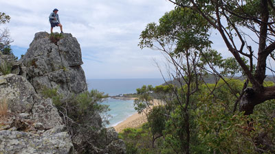
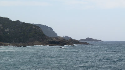
The first few kilometres flew by, as we strolled through the backstreets of Bermagui and then next to the road out of town, with a short detour along a bush track. This brought us to Michael Lerner Lookout at Jerimbut Point, with its impressive views back up the coast to Bermagui. |
|
 Looking at our route south from Bermagui |
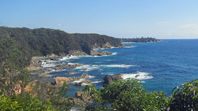 View back towards Bermagui at Jerimbut Point |
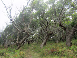
A bit more walking next to the road, with a brief stop to feast on some blackberries, followed by a stroll through a grove of pittosporum, brought us to Baragoot Lake. Here we discovered that the track taken 19 years ago was now completely overgrown - it required a short walk further up the road to reach a point where we could enter the coastal section of Biamanga National Park and follow a forest track to Baragoot Beach. |
||
 Yum! time for some blackberries (photo: J & P Gatenby) |
 |
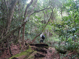
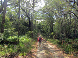 Track through the forest of Biamanga |
It was now time for a section of soft-sand beach walking, followed by a short climb over a grassy, heath covered promontory to reach the Cuttagee Lake Bridge. On its far side, we dropped back on to Cuttagee Beach, where a walk along its firmer sand brought us to the edge of the Barraga Bay village. |
|
 Baragoot Creek |
 Leaving Cuttagee Beach |
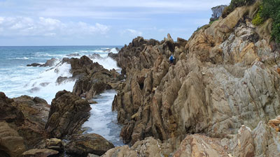
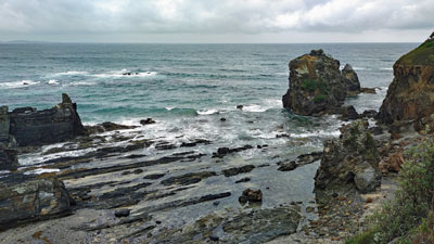
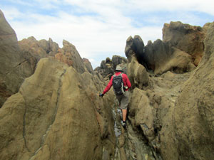
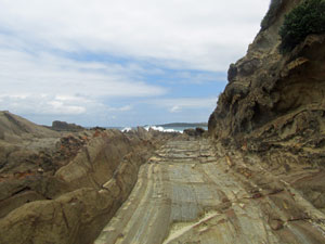
The route now changed to a bit of streetside walking, to find a bush track that led us through some nice spotted gum forest and eventually to the track leading down to Armonds Beach. Armonds is a designated nudist beach and we felt somewhat overdressed as we crossed it to reach the rocks at its southern end. This was the start of a long and rugged rock shelf beneath the low coastal cliffs and, as the land above is private, it is the only way to go. After stopping to take on board a bit of extra energy, we set off. |
||
|
|
|
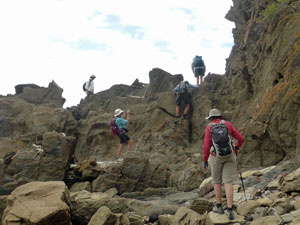
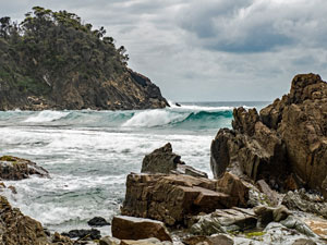
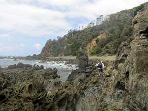
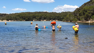
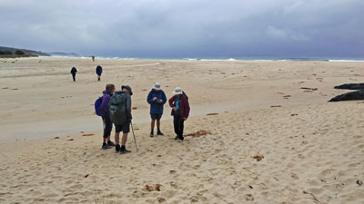
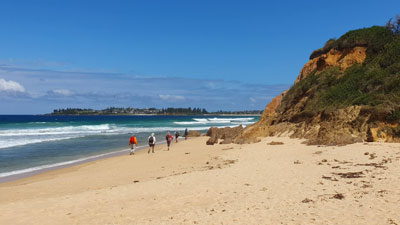
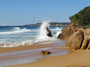
The route is spectacular, with its jagged rocks and sections of pebbly beach, but is hard on the ankles and definitely to be done during the lower part of the tide ... that we had timed perfectly. After a long rock-hopping and balancing act, we rounded the point to reach Murrah Lake, its picturesque setting being a good place for lunch before crossing. It was, in fact, easier than it looked, and we had a simple waist-deep wade to reach the sand spit on its southern shore. |
|
 Murrah Inlet |
 Crossing the inlet (photo: J & P Gatenby) |
|
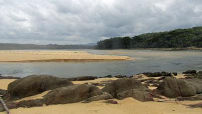
The spit formed the northen edge of Murrah Beach, which meant a soft-sand trudge to Goelan Head at its southern end. Stopping for lunch does sap energy levels a bit. Goelan Head was an eye-opener, as it was very different to when the fair Nello and I crossed it 19 years ago. Then, it was private property with well-grazed pastures - now it is part of the national park and much of the original vegetation is returning .... thickets of wattles, banksias and paperbarks, tussock and sedges growing up amongst the thick grass .... but still, open enough to cross easily.
After crossing the headland, a short beach stroll brought us to the point where we could climb up onto the Hidden Valley Firetrail. This grassy well-shaded track led us into Hidden Valley campsite. The fisherman's hut was still there and it really would have been nice to pitch our tents on the grassy flat overlooked by Bunga Head. All we could do, though, was have a rest and gather some energy to cross the saddle behind Bunga Head. |
|
Having located the entry gully, we followed the track up the drier northern side of the saddle before descending the the moister southern side, with its lusher vegetation ... an extra 2 km more than our original plan. It was a great relief, after 24 km of walking, to find Marg and the support vehicle waiting at our campsite in a shady area next to our own private (if stoney) beach. |
|
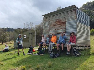
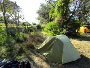
 Campsite at Aragunnu (photo: J & P Gatenby) |
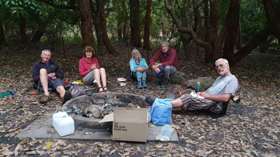 Relaxing after a long day of walking (photo: J & P Gatenby) |
Tents up, the fair Nello and I quickly headed down to the beach with the remains of a bottle of red from Bermagui - sitting on a rock, soaking our feet in the gentle rise and fall of the water with a glass of red in hand was a great way to finish what had been a hard day at the office. |
|
|
Day 4 - Aragunnu to Middle Beach (12 km - 230m ascent - 220m descent) |
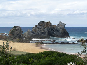
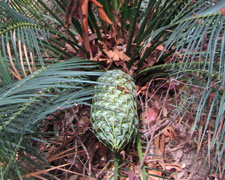
Today was going to be a much shorter walk - half the distance of yesterday - which gave everyone a bit of a sleep-in. It also gave us time for a leisurely wander up the bush track and boardwalk from our campsite to Mimosa Rocks, to take in their impressive setting framed by the brooding outline of Bunga Head. The rocks are named for the SS Mimosa, which sank after hitting some submerged ones in 1863. We explored the rocks a little, as far as the small blowhole, which was working well with the north-east swell. |
 Early morning light at Mimosa Rocks |
 Red rocks near Bunga Head |
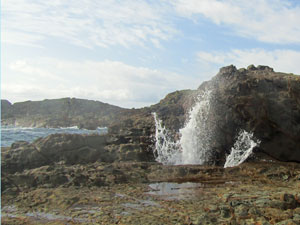 The little blowhole at Mimosa Rocks |
 View south from Aragunnu |
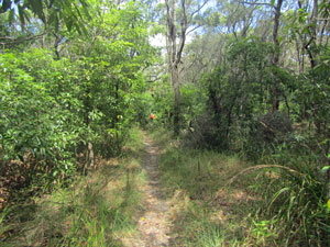
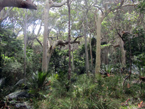
Then the walk south began - if a lot shorter, it was not going to be short of adventure as no track exists between Aragunnu and Picnic Point. When the fair Nello and I walked this section 19 years ago, it took a lot of rock-scrambling and bush-bashing to get through. Since then, several people have tried more inland routes and recently, a bushwalker with the nom-de-plume of Leonardo de Terminus, blazed a much easier route following more open ridges through the forest. He mapped it on his GPS and also marked it with ribbons. Now it was our turn to check this out. |
||
 Heading south across Aragunnu Beach |
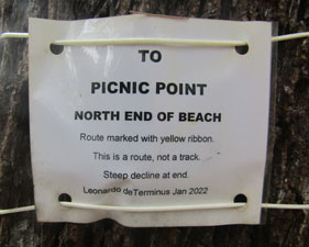 Thanks Leonardo |
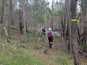 The ribbons of Leonardo's Way |
Descending the wooden steps onto the soft golden sand of Aragunnu Beach, we turned south and followed its length to the beginning of a rocky shore and coastal cliffs. This is the way we headed 19 years ago, but today, armed with our GPS, we clambered up the gravelly entrance gully at the end of the beach and headed inland. The first lime-green ribbon quickly appeared and soon we were following a line of them up the steep slope of a ridge. On reaching the ridge, we settled in to a pleasant amble beneath the canopy of an open casuarina / eucalypt forest, padding softly on a carpet of dry casuarina needles. |
||
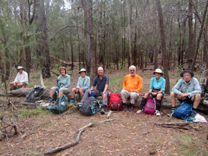 Lunch stop in the casuarina forest |
 |
 Following a ridge-line on Leonardo's Way |
After crossing a saddle to follow a second ridge, we eventually reached Ginns Lookout, a sharp rocky protusion that offered a glorious panorama over Picnic Point and its beach. A track started here, descending steeply along an old fenceline before crossing the dune heathland to reach Picnic Beach. A short walk along the beach brought us to Picnic Point campground and lunch. Leonardo's Way was certainly much easier than our original route and, with a bit more usage, I suspect it will eventually wear into a track - a big thank you to Leonardo for pioneering a good route across this section. |
|
 On Ginns Lookout above Picnic Beach (photo: J & P Gatenby) |
 View back along the coast from Picnic Point |
Lunch over, we followed a foot track that climbed steadily over the open-wooded hill to the south of Picnic Point, eventually leading us down to Bithry Inlet and our only water-crossing of the day. |
||
 Open forest south of Picnic Point |
 |
 Descending the headland towards Bithry Inlet |
Bithry is a wide inlet, but we had timed our arrival for low tide and were able to wade across in a sweeping arc that followed the line of sandbanks upstream from its entrance. It is funny that after, trying to keep ourselves and our dry bags as dry as possible on our wade (at most chest deep), we then jumped in for a soak in the cool refreshing current of the channel. |
|
 Bithry Inlet from the south bank |
 Heading out to cross Bithry Inlet (photo: J & P Gatenby) |
The land on the south side of Bithry Inlet was gifted to the National Park some years ago and now has a network of walking tracks. We followed one of them across the low head to Penders Beach, and then walked along an undulating track beneath the low coastal forest and past stony Stinking Bay (with its waft of decaying seaweed) to reach Middle Beach campground. |
|
 Gnarly forest on the windswept coastal slope |
 Stinking Bay |
 Inland the sheltered forest is lusher and more upright |
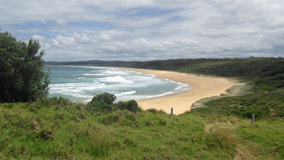
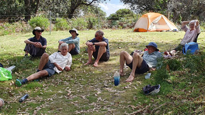
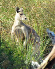
Marg was waiting with our camping gear and we quickly set up tents in this small and intimate campground, with its freshwater dam, shady trees, kangaroos and wallabies and a big surf beach nearby. A quick dip in the clear, but tannin-stained, fresh water of the dam was the perfect way to cleanse ourselves of sweat and salt-water, leaving plenty of time to relax in the late afternoon sunshine or watch the surfers riding the break for which Middle Beach is reknowned. |
||
 Panorama of Middle Beach |
 Relaxing at the campsite (photo: J & P Gatenby) |
 Middle Beach Campsite ... |
 ... with bushrats by night .... |
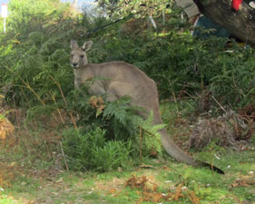 .... and roos by day |
It had been another great day of walking and the highlights of the evening were visits to our tent by the native bush rats that call this place home. |
||
|
Day 5 - Middle Beach to Tathra (16.5 km - 140m ascent - 140m descent) |
It was a glorious day for our last day on the track and we even got to sleep in a bit. Ahead lay Nelson Lagoon and there was no point getting there too early - it was high tide around 8.30 am and the later we got to the lagoon, the lower the tide and the easier the crossing would be. |
||
 The peaceful fringes of Middle Lagoon |
 |
 Crossing the bar at Middle Lagoon |
It was about 9.30am when we finally left the pleasant Middle Beach campsite and wandered down the track beneath the coastal heath to Middle Lagoon. Skirting its edge to reach the sandbar blocking its entrance, we came across our first tidal hurdle. With waves breaking against the low headland cliff to the south, we were obliged to climb up and make our own track for a few hundred metres through the heath to reach Gillards Beach. |
||
 Why we climbed over the headland |
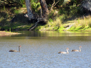 Swans on the lagoon backwaters |
 Another rocky outcrop blocking the beach |
Here we headed inland to follow a nice walking track past a reach of Middle Lagoon and beneath the banksia and paperbark heath to reach Gillards Campground. After wandering through the campground, we found another bush track that crossed to Cowdroys Road and, after a short road walk, another track took us through a thick grove of paperbarks to Cowdroys Beach. |
||
 The forest between Gillards and Cowdroy |
 The colours of Baronda Head |
 A bit of rope work to reach the top |
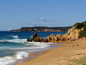
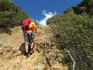
All seemed to be going smoothly as we strolled down the golden sand of the beach while admiring the ochre colours of Baronda Head, until we noticed waves breaking against a protruding line of cliffs ahead. An inspection proved that this was definitely a low tide only route, but, fortunately while back-tracking, Jan spotted a rope-line leading up the low gravelly cliff. A brief clamber up it brought us to the far end of Cowdroys Road, and a stroll down the road brought us to the shore of Nelsons Lagoon. It was around mid-tide and the water was still flowing out swiftly. |
|
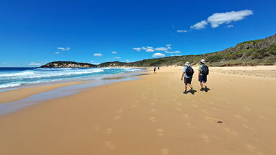 A meditative stroll down Gillards Beach |
 Baronda Head |
After gauging the best route, we stripped down to bathers, packed our gear into dry bags and headed off along a shallow wade upstream to a point where we could launch ourselves into the deeper channel and swim across it - the current carrying us back down to reach the sandy spit between the lagoon and the sea. It felt so good, that we wandered across to the southern edge of the lake for a swim before enjoying its beautiful setting over lunch. |
||
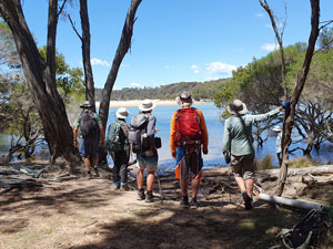 Checking out the best route to cross Nelsons Lagoon |
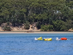 Swimming the channel (photo: J & P Gatenby) |
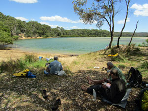 A great lunchspot after the crossing |
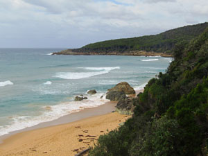
We were now on the final leg, following road and track through the hilly forest to take in the coastal view at Wajurda Point, descending steeply down a long set of steps to cross the isolated beach at Moon Bay, and climbing up more steadily to reach the next ridge. The forest here was very pleasant, as we headed down a track past the ruins of old buildings, with a strange mix of cypress, monstera and kniphofia left from their garden. |
|
|
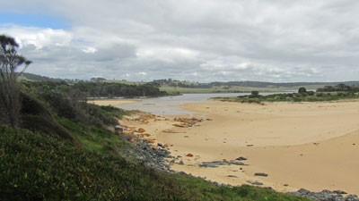
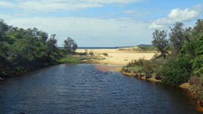
Reaching the wide Mogareeka Inlet, we wandered around its shoreline to cross over to its southern shore on the road bridge. From here, all that was left was a long flat walk along the cycleway into Tathra, before crossing onto Tathra Beach, climbing up the steps at its far end and reaching the Tathra Pub. We had left our cars here five days ago and, after verifying that they were still there, hurried into the pub to celebrate the end of the walk with a pint of their craft-brewed beer - an excellent way to celebrate the end of the walk. It was so good, in fact, that we returned that evening after setting up camp, to have a counter tea of fish and chips and further sample the produce of their micro-brewery. |
|
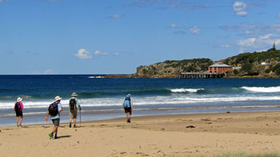 Th end in sight - heading towards Tathra Wharf |
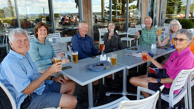 A celebratory beer at the Tathra Pub and Microbrewery (photo: J & P Gatenby) |
Despite, a first-day drenching, yet another stage had been completed in good style. As the fair Nello (whose new knees are now declared completely healed after walking 85 km in 5 days without pain) said .."the scenery was great, but what I enjoyed most about this walk was the company". Thanks again, Jan and Phillip, Lois and Bernard, Ian, Alan and Marg (who served us well on swapping the role of support vehicle drive with the fair Nello). |
|
|
