
| Stage 4 - The Eurobodalla Coast |
About |
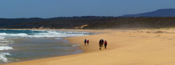
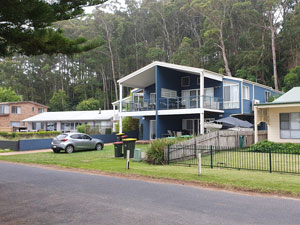
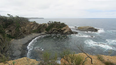
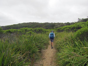
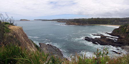
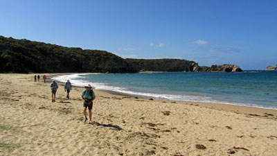
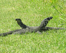
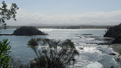
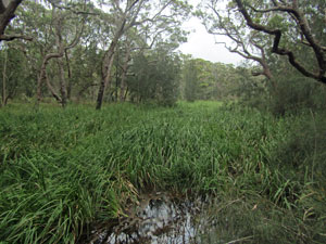
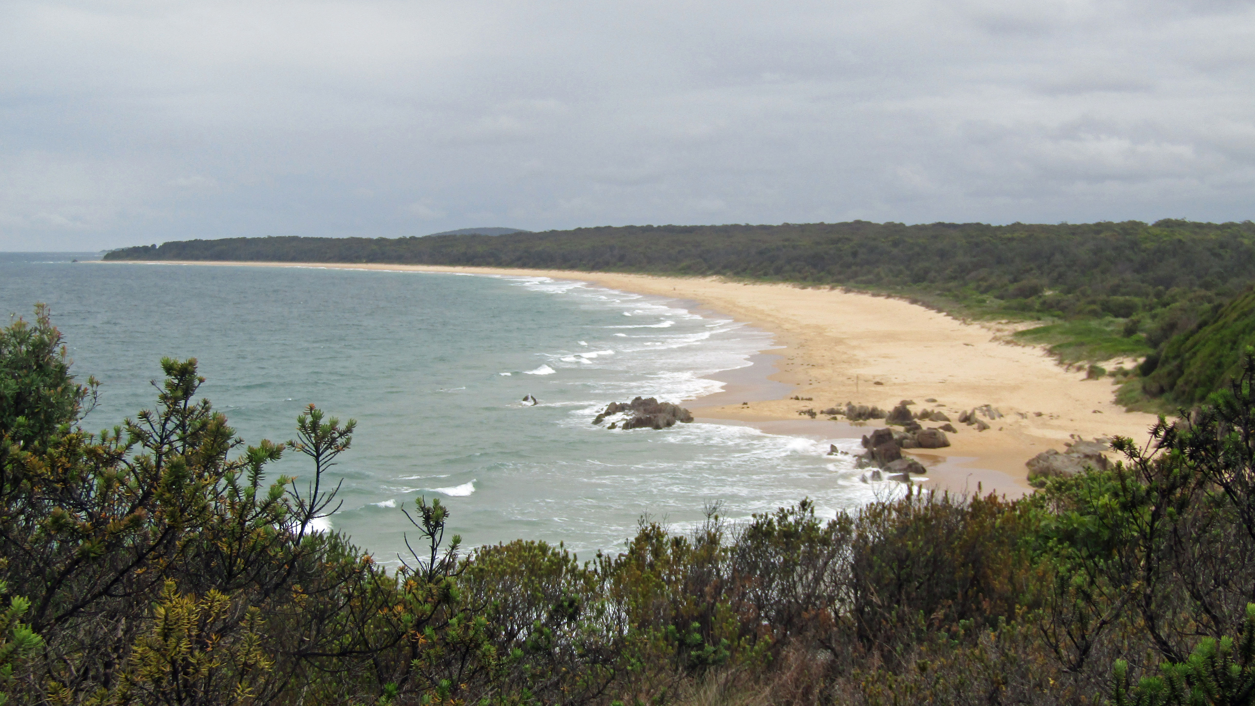
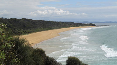
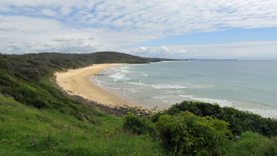
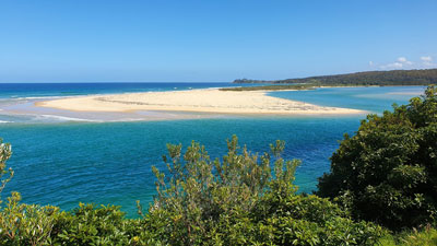
The fourth part of our staged group hike along the Great South Coast Walk picked up from South Durras and took us 110 km further down the coast to Narooma, passing through Murramarang and Eurobodalla National Parks. The coastline changed frombeing more indented, with lots of headlands, low cliff-lines, coves and small beaches to a more open shore, with long stretches of sandy beach separating the headlands. The trip comprised five days of 20+ km hiking and one day of kayaking - the kayaking being a means to cross Batemans Bay without a long stretch of walking to the road bridge and through the centre of the town. Despite the area being highly developed, we could keep to the headland walking tracks and only use suburban streets for very short periods.
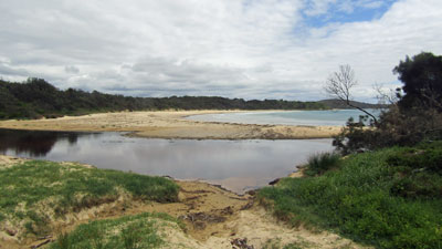
Logistically, it proved a bit of a challenge, as there were two major water-crossings - The Moruya River and Tuross Lake - and the people with whom the fair Nello and I crossed these in 2004 were either no longer there (local oyster farmer) or no longer offered the service (Turoos Marine Rescue). We were obliged to revert to car transport to get around. In fact, we created a new rule - a water crossing is considered achieved if you dip your foot in the water on one bank when you reach it and then on the other bank, before continuing on. Overall, there was a bit more car-shuffling than on previous legs. |
|
|
|
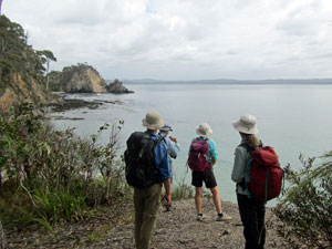
This trip, the weather was on our side ... a brief threat of rain on the first day, but none thereafter. The mix of coolish days with a some cloud and some sun was ideal for walking. The only downside was the strong marine wind early on that curtailed our kayak trip ( though not stopping us from doing the actual crossing). Accommodation was again to be a mix of camping (3 nights) and AirBnB type beach houses (4 nights). Thus, nine of us, myself and the fair Nello, Jan and Phil, Lois and Bernard, Marg, Alan and Ian, assembled at our pleasant Long Beach holiday house on a fine Sunday afternoon to commence Stage 4 of the Great South Coast Walk. |
||
|
Day 1 - South Durras to Long Beach (20 km - 420m ascent - 420m descent) |
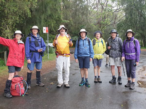
It was still drizzling when we drove from Long Beach to the Murramarang Resort at South Durras to continue our walk from where we had ended Stage 3. Here we met up with Jocelyn, a club member who now lives at Durras and who offered to show us the early part of the track. Once we had put on our wet weather gear, Jocelyn led us down to the start of the rock platform at Wasp Head and took us around the base of the head. |
|
 Heading out onto Wasp Head rock platform |
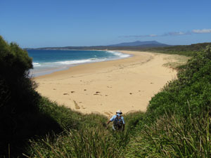
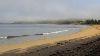
 The beach at Murramarang |
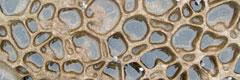
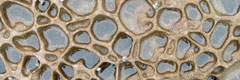
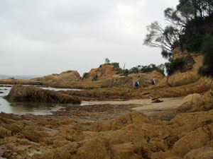
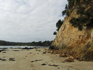
The rock platform was magnificent, with wind- and water-sculpted sandstone in a range of ochre shades. These were complemented by the extrusions of pock-marked rock and lattices of rich ironstone, while out to sea, Wasp Island guarded the horizon. |
||
 On the rock platform |
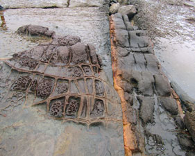 The curious erosion patterns on the rock platform |
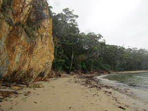
 Cliffs east of Emily Beach |
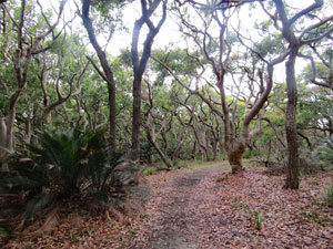
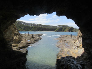
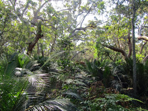
Approaching some low cliffs on the southern side of the Head, Joceyln led us up a narrow track into the gnarly wind-swept forest of the headland and across to Emily Miller Beach, where she left us to continue on - thanks for sharing a it of local knowledge, Jocelyn. By now the weather was beginning to fine up and the drizzle ceased, leaving behind a grey, but not unpleasant day. At Emily Miller, the tide was low enough that we could cross the rock ribs in its middle and check out a shallow cave on the beach. |
|||
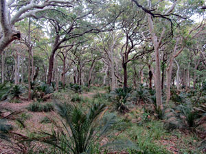
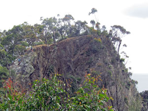
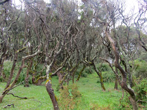 The gnarly goblin forest of Wasp Head |
 |
 |
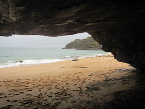 From inside the cave on Emily Beach |
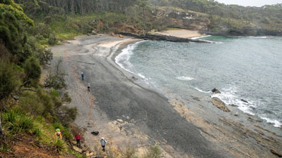
We continued on to the end of the pale sand beach to find a route up onto the next headland and a well-formed foot track that led across its pleasantly timbered top to drop down on to Dark Beach. What a contrast to the previous beach, its southern end grey coarse sand instead of the pale sands of Emily Miller. We were passing through a major geological unconformity, where Sydney sandstone gave way to the much older, jagged and dark rock of the Lachlan Fold. |
|
 Inspecting the sea cave on Emily Beach (Photo: J&P Gatenby) |
 The contrasting sand colours of Dark Beach (Photo: J7P Gatenby) |
We continued on to the end of the pale sand beach to find a route up onto the next headland and a well-formed foot track that led across its pleasantly timbered top to drop down on to Dark Beach. What a contrast to the previous beach, its southern end grey coarse sand instead of the pale sands of Emily Miller. We were passing through a major geological unconformity, where Sydney sandstone gave way to the much older, jagged and dark rock of the Lachlan Fold. |
||
 The gravelly gray sand of Dark Beach |
 |
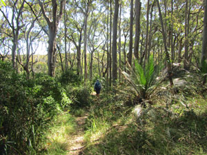
Headland forest in Murramarang National Park |
Picking our way up the slope from Dark Beach, we rejoined the track to head across to Myrtle Beach. However, just before reaching it, we made a quick detour out along a relatively overgrown track to the end of the point for a superb view northward along the coast. |
|
 View north towards distant Durras Mountain |
 Crossing Myrtle Beach |
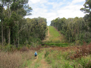
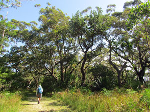
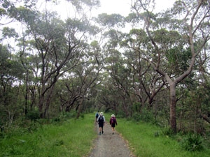
Retracing our step, we descended onto Myrtle Beach, rounded a small rock promontory and then found the far access track that led back to a gravel road. It was easy walking for a few kilometres along the road, as it passed beneath the canopy of some superb spotted gum forest. |
|||
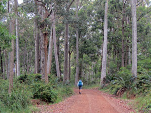 The elegance of a spotted gum forest |
 |
 |
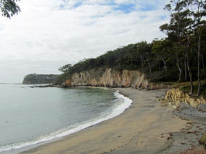
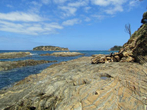
 View from Little Oakey Beach |
On reaching a junction, we turned left to head towards Oakey Beach, before following a foot-track down to Little Oakey. The cliffs of the headland between Little Oakey and Oakey Beach were impassable with the current tide and sea conditions, but fortunately, instead of having to back-track too far, we picked up the recently cut route of the Murramarang Coast Track - currently being developed and not yet officially open. |
||
 Wetland behind Oakey Beach |
 On Oakey Beach |
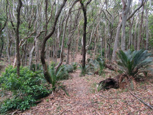 Burrawangs and gnarly headland forest |
The new track meandered around the top of the headland to descend through a swampy coastal creek and break out on to the sand of Oakey Beach. It was a good place for lunch. |
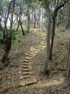 Sandstone steps on the new Murramarang Track |
|
 On the way to North Head |
 |
|
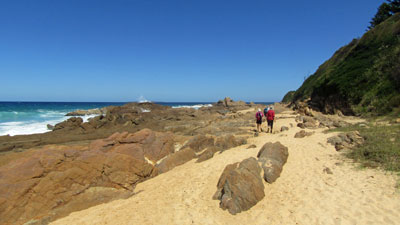
After lunch, we headed back behind the beach to once again pick up the new track, where an occasional set of sandstone block steps showed the work going in to it. Its meandering course around forested headlands and across beaches would be our route onwards - passing Honeysuckle Bay to reach North Head and its camping ground, then across the soft sand of North Head Beach to The Judges, all along with magnificent view of the jagged cliffs and islets of this coastline. |
|
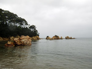
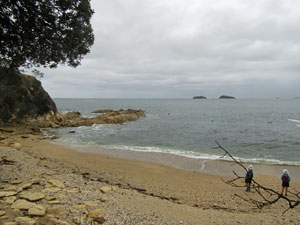
 Rocky cove east of North Head |
 The wide sand of North Head Beach |
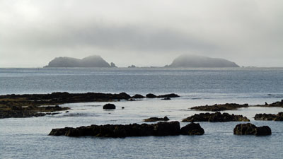
 View past the cliffs to The Tollgates |
 The Three Islets |
 Heathland at the back of the beach |
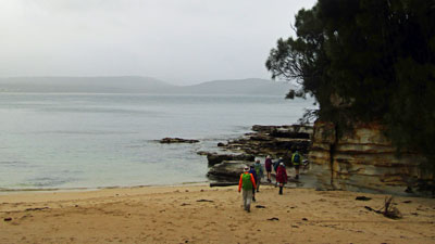
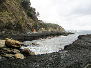
Finally, after a short detour to check out the Acheron Ledge, we arrived at the western end of Maloneys Beach, with its steep escarpment. It was a tricky track down to beach level, though we noticed a very solid and long set of steps is being constructed nearby for the start of the Murramarang Coast Track. Crossing Maloneys Beach on firm white sand, we were now nearing our destination - the house at Long Beach. All that remained was a walk around the rocks and short stretches of sand beneath the low cliff that separated the two places. This is definitely the low tide route, though. Hurrying a bit at the end, as the grey sky darkened and a few spots of rain began to fall, we reached the house and shelter .... just in time, as the few spots qucikly became a steady drizzle. |
||
 View out to sea at Acheron Ledge |
 The rocks between Maloneys and Long Beach |
 Sandstone cliff at the eastern end of Long Beach |
It had been a great, if tiring, day of walking along one of the most impressive sections of coastline of the walk. It is a section of the walk that relatively few people see, but I suspect that will all change when the Murramarang Coast Track is officially opened. |
|
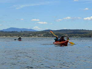
Day 2 - Crossing Batemans Bay by Sea Kayak (2.5 km plus 5.5 km by kayak) |
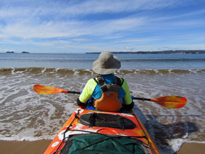
The overnight drizzle had finished and the morning sea mist had lifted off the calm bay waters, as we readied ourselves for the next stage of our southward journey - crossing Batemans Bay by sea kayak (to avoid a long walk through urbanised areas). We walked a few hundred metres from our house in Long Beach to reach the spot where Phil, from Bay and Beyond, would meet us at 8am and launch our kayaks. An early start was needed as the wind was forecast to build up during the day, which could make things interesting in the open water of the bay. |
|
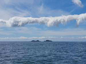
 Morning sea mist over Long Beach |
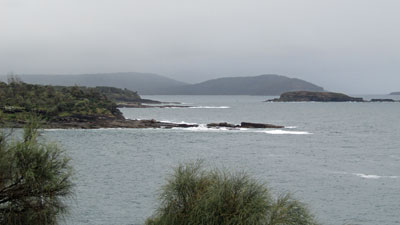
 The Tollgates beneath the mist |
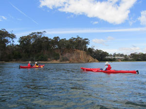
After the formalities of ensuring everyone knew how the kayaks and gear worked and were comfortable with it, we launched from the sandy beach and began a rhythmic paddle parallel to the shore towards the rocky promontory of Square Head. With a gentle breeze and slight swell, conditions were ideal. We had barely arrived at Square Head when a stronger gust rippled across the surface, soon followed by a steadily increasing southerly wind. The forecast wind shift had arrived early and Phil decided that there was no time to explore the rugged shore below the cliff of Square Head, it was time to paddle across the bay as quickly as we could. |
||
|
It became clear that our destination of Sunshine Bay, two headlands on to the south would prove a difficult slog into the wind and waves, so we opted to head into the shelter of Observation Point to the east. The marine wind warning issued by the weather bureau for today seemed fairly accurate. |
|
The consensus was that we had achieved our objective of maintaining continuity of the walk by paddling across the bay and it would be unwise to push further, so we paddled across the calm leeward waters behind the point to land on Corrigans Beach. Phil's wife arrived shortly after with muffins and hot coffee - a good way to end the paddle. The crossing had been a bit shorter than planned, but was still mission accomplished. |
A few drivers went back to Long Beach with Phil to collect cars and, after a quick car-shuffle to collect our last vehicle, we were all on the right side of the bay to continue. The downside of ending at Corrigans Beach, instead of the planned Sunshine Bay, was that we had to walk an extra 2 km along the streets of Batehaven to reach our accommodation. Tents pitched, it was time for the next car-shuffle, this time to leave two cars at Tuross Head, where we be in three days time. Sometimes planning a multi-day walk can be a bit complicated. |
|
Day 3 - Batemans Bay to Barlings Beach (21 km - 310m ascent - 310m descent) |
The urbanisation of Batemans Bay extends all the way from our overnight campsite at Sunshine Bay to the southern end of Malua, some 8 km. It is surprising then, that you can walk this coastline, with only a couple of very short sections on suburban streets. The rest is a rolling panorama of forested headlands, cliff-lines, rock platforms and sandy coves - truly superb. |
|
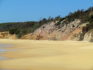
 Line of cliffs near Surf Beach |
 Cliffs at the southern end of Denhams Beach |
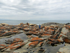
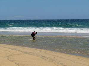
Thus, on leaving the campground, we wondered along the main road for a short distance, before turning off and picking up a foot track that led us down to Denhams Beach. A stroll along the beach and past some impressive tan-coloured cliffs brought us to Surf Beach. Then it was on past Wimbie Beach for a section of cliff-top walking. |
 Can you spot our rock climbers? |
 Sandy cove in the cliff line |
 A small coastal lagoon |
We followed the cliff-lined headlands around, crossing a couple of tiny coves to reach Lilli Pilli Beach. Here, the low tide permitted us to work our way around the rock platform beneath the cliff to Mosquito Bay and its justly famed coffee shop. |
||
 Taking in the views of the Headland Track |
 On the rock platform between Lilli Pilli and Mosquito Bay |
 Views form the cliffs backing Malua |
After a brief stop for a coffee or tea, we continued on the foot-track between house and cliff. This was part of of the planned route for the Batemans Bay Headland Track, which, with its rugged coastline and panoramic views will be a very impressive one when completed. The track brought us to Malua Bay, where we crossed the beach to find a secret passage (an overgrown cutting in the heath) that led us up onto the next section of cliff-top walking behind the houses of Malua Bay. |
||
 |
 Panorama from Pretty Point saddle |
|
Crossing Little Beach, we climbed up onto the saddle of Pretty Point, with its glorious vista southwards down the coast and towards Mackenzies Beach. The track now led down to the beach and our first problem point. Here, a deep surge channel on the rock platform and private property extending to the cliff-line blocked our progress. The only route so far has been to follow the main road for a couple of kilometres to avoid the private property before cutting back towards the coast at North Rosedale. We started out on the road, but noticed a set of steps leading across the roadside swamp to a broad well-cleared powerline easement. It did not have a private property sign, so we turned in and followed the easement, heading up and over a couple of steep hills before bringing us out into North Rosedale - certanly more direct as well as avoiding having to walk alongside a busy road. I must find out the legal status of such easements. |
||
 Exploring the powerline easement route |
 View from North Rosedale sea-cave |
 Rock ledge and Jimmys Usland |
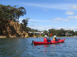
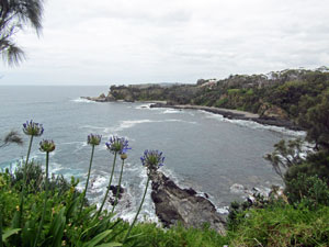
Crossing the streets of North Rosedale, we noticed lots of house-building going on, a consequence of the massive bushfires of 2020 - many house here were lost when the flames raged through this coastal village. Dropping back down onto a rock platform, we wandered around past an impressive sea-cave to reach the northern end of Rosedale Beach, a golden crescent of sand guarded by headlands at each end and Jimmys Island just offshore - beautiful in the bright sunshine. Here we stopped for a bite of lunch, sitting on some upturned fishing boats in the shade of a small grove of banksias. |
|
 Crossing Rosedale Beach |
 View northwards towards Jimmys Island |
Continuing on, we crossed the southern headland and, after a bit of toing and froing due to the disappearance of a former track, found our way on to the path that led to Guerilla Bay. The track passed through lovely forest and by small isolated beaches before bringing us to the large sandy stretch of Guerilla Bay. |
||
|
|
|
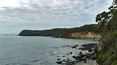
Here we passed up through the holiday houses to reach a back track above the cliff-line leading out to Burrewarra Point. We turned the other way, however, as that would keep us heading south along the coast, down to Franks Beach and beneath the dense canopy and gnarly trunked eucalypts of this small patch of Bangalay Sand Forest. Finally, passing Longnose Point, we continued on one last stretch of lovely forest track, before spilling out onto the northern end of Barlings Beach. Here, after 22 km of magnificently diverse coastline, our day came to an end, as we wandered in to the Barlings Beach campsite. Marg and the fair Nello had driven on ahead and set up our tents. It was definitely time for a celebratory ale and finally rest our feet. |
 View southwards past Barling Island |
|
Day 4 - Barlings Beach to Moruya Heads (20 km - 80m ascent - 80m descent) |
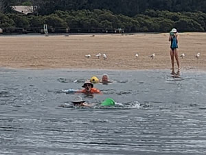
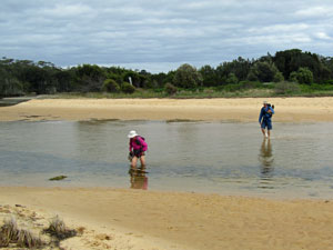
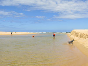
The sunny start to the day soon gave way to grey cloud as we headed down Barlings Beach, with a quick stop at Melville Point to take in the views of the rocky shoals guarding the entrance of the Tomaga River. We had set off from the campsite in swimmers, as less than 2 km down the beach we would be faced with the Tomaga River and a swim to get to the other side.
Then it was on to the river itself, to find a sand bar curving out into the waters. It was almost low tide, but a swim would still be necessary. We stripped down to our bathers, waded out into the river a bit further upstream than the boat landing on the other side and, to the amusement of a a group of locals at the riverside coffee van, swam out into the cool, outward flowing current, letting it carry us down as we swam across to emege at the boat ramp on the southern bank - mission accomplished and a nice mug of hot flat white to reward us. I was pleased that we didn't see the 2m long stingray cruising about the landing until we had emerged. |
||
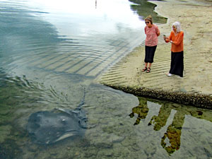 The girls watching a 2m stingray |
 Swimming the Tomaga River (photo: M.Sharp) |
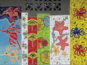 Community artwork at Broulee |
Changing from wet swimmers to dry walking gear, we continued on around the grassy headland of Mossy Point and along the firm low-tide sand of Broulee Beach into the face of a cold south-easterly wind. Phillip and Jan knew this area well and led us across the sandy spit to Broulee Island, before rounding its stony shore and rock platform to reach Bengello Beach. |
||
 The leeward side of Broulee Island |
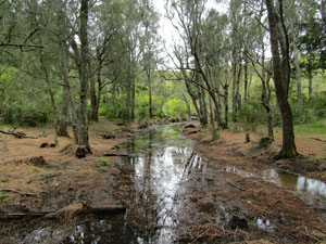
 Wetlands in the Bengello Reserve |
 Passing through Bengello Reserve |
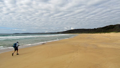
Ahead lay the 5 km long stretch of sand of Bengello Beach, exposed to the wind. We strode along the beach, soaking up the negative ions for a while, before heading inland to the shelter of the coastal forest and a gravel mountainbike road that parallelled the beach. This provided a change of landscape, as the Bengello Reserve houses several different forest habitats, wetlands and heathlands on its sandy flats. |
||
 |
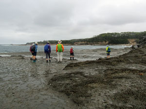
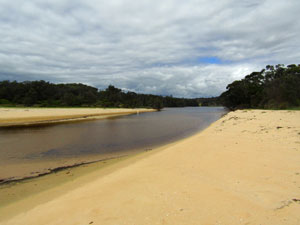
 The broad expanse of the Moruya River |
|
The track passed the Moruya Airfield to reach the breakwater of the Moruya River. Our original plan here had been to get a ride over with a local oyster-farmer, as the fair Nello and I had done 18 years ago, but times change and this proved not possible. So, after dipping out feet in the river waters on the north side, the fair Nello and Marg arrived to drive us the 12 km around to the southern breakwater, just 50 m from where we stood on the north side. After the compulsory toe-dip to validate the crossing, we continued on around the small beaches lined with driftwood piled up by recent storms and onto the rocks below South Head. |
|
 View northwards up Bengello Beach |
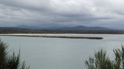 Moruya breakwater |
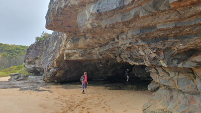
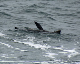
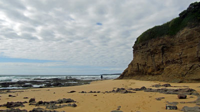
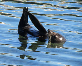
We had hoped to walk around the base, but were blocked by an impressive and deep sea cave, cutting in beneath the cliff. Still, Plan B wasn't a bad alternative - retreating a hundred metres, we climbed up a track onto the headland and followed it around, past a 19th century cemetery at Toragy Point. From the headland lookout, we could watch a couple of seals floating languidly, flipper aloft, in the waters below. That was a bonus. |
||
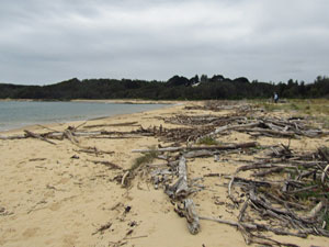 Driftwood piled up at the breakwater beach |
 |
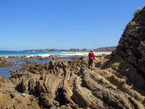
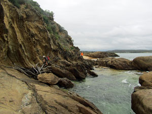 Edging our way onto South Head |
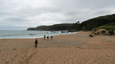
 Moruya Heads Beach |
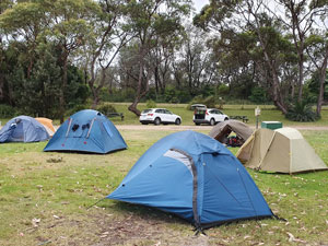
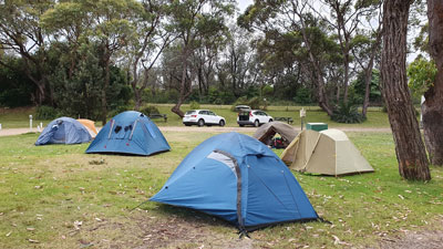 Our tents at South Moruya Heads |
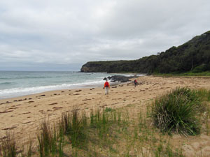
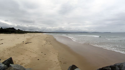
Descending the headland, we passed the surf life club building to reach the long golden stretch of Moruya Heads Beach. A few hundred metres down the beach, a path up through the dunes led us to the Moruya Heads campground, our tents and the end of the days walk. Despite the bleaker conditions, it had been a good walk - certainly an easier one than the continuouse climbing and descending of hill and headland that we did yeterday. |
|
|
Day 5 - Moruya Heads to Tuross Head (24 km - 110m ascent - 110m descent) |
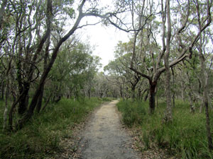
Today was going to be a bit unusual for a coastal walk, as we faced more time inland than on the shore. We headed southwards along a gravel road that led out of Moruya Heads and into the forest and wetlands of a low dune system. Entering Eurobodalla National Park, the road changed to a sandy track that brought us to the northern edge of Congo. Here we left the dunes to stroll briefly along the beach towards the rocky point and outward flowing mouth of Congo Creek. |
||
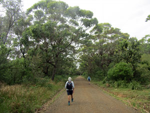 On the road to Congo |
 |
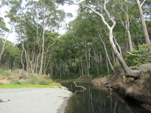
 Crossing Congo Creek |
The creek may have been flowing fast on a falling tide, but was shallow and a knee-deep wade saw us across. As the tide was low, we decided to wander around the small rock platform at the base of Congo Point and on to the long golden stretch of Congo Beach. With the sun shining and a cool breeze blowing, it was perfect walking weather. |
|
 Rounding Congo Head ..... |
 .... to wander down Congo Beach |
A little over halfway down the beach, a set of steps took us inland to reach the start of the Bingi Dreaming Track, so-named as it follows the ancient Song Lines of the Yuin Aboriginal people. The track meandered southwards beneath the canopy of the coastal forest, passing a couple of open view points, with impressive vistas of the long stretch of beach separated by low cliff-lines. |
|
 View southwards from lookout on the Bingi Dreaming Track .... |
 ....and the view to the north |
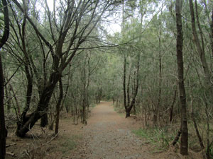
 The Bingi Dreaming Track .... |
 ... passes by coastal lagoons ... |
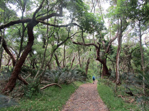 ... and beneath the forest canopy |
After a while it dropped down to sea-level to pass Meringo Lake (blocked from the sea by a nice sandbar, as a well-behaved coastal lake should be). Continuing on above the pristine sand of Meringo Beach to pass a small cluster of beach shacks, we were able to have a second stint of beach-walking, with the sound of the surf and the freshness of the salt air. |
|
 Looking northwards along Meringo Beach |
 Lagoon to the north of Mullimburra Head |
Passing Mullimburra Lagoon, we climbed up and over Mullimburre Head, beneath its thick heathland and casuarina groves. Descending once again to a small beach that barred the waters of Kellys Lake, we climbed steadily up to reach a more open landscape behind Bingi Bingi Point. The southerly wind was picking up, so it was good to find the shelter of the rocks on the northern shore of the point to eat our lunch. |
||
 Casuarina forest at Mullimburra |
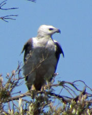 Dwaanga - the sea-eagle totem |
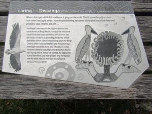 Interpretive signage on the Bingi Dreaming Track |
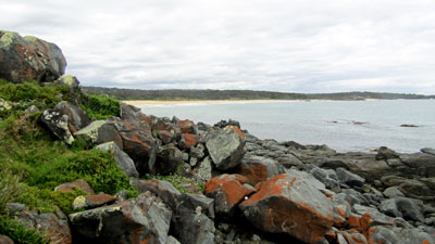 The rocks of Bingi Point |
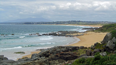 View from the point towards Tuross Head and distant Gulaga |
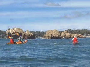
With a bit of time up our sleeve, we were able to wander out and explore the long finger of Bingi Bingi protruding into the Tasman Sea, with its ancient granite rocks and the rusting boiler from the SS Monaro, which was wrecked here in 1879. The point also offered superb views down the 4km length of Bingi Beach towards the distant summit of Gulaga. |
||
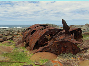 Rusting remains of the SS Monaro |
 |
 The granite rocks at the end of Bingi Point |
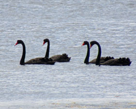
The beach was not our route, however, as we headed back to cross the open grassland behind the point and briefly descend to the sand, before heading inland to follow an open grassy valley with a series of small shallow perched lakes. Turning west, the track led us through dense heath to reach the shore of Lake Coila, a tranquil body of water framed by the blue backdrop of the coastal mountains. The water-level had dropped recently when the lake was mechanically opened to the sea, leaving a broad shoreline to walk along and admire the black swans as they floated by. |
||
 |
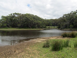 Small perched lake between Bingi and Coila |
 |
The shore-line curved eastwards to reveal the entrance to the lake, usually barred but now open to the sea. It was a potential barrier, but even though the tide was on the rise, the crossing proved to be an easy waist-deep, underpants wade. |
||
 Looking west across Lake Coila |
 The blue coastal ranges framing the lake |
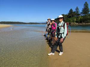
 Crossing the entrance channel of Lake Coila |
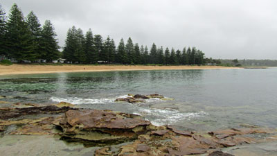
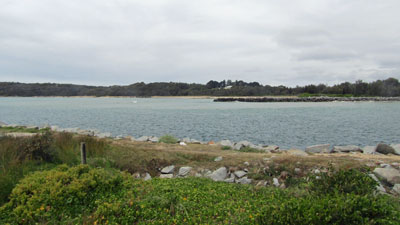
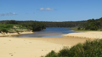
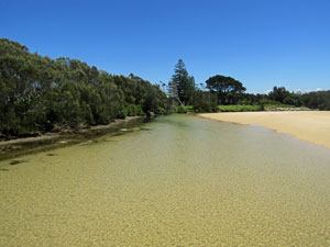
On reaching the village of Tuross Head on the other side, we wandered along the esplanade, with its long line of giant Norfolk Island pines. Sheltered from the wind, the day was getting hot and it was pleasant to reach the more exposed entrance to Tuross Lake. A much larger lake, the wide fast-flowing entrance was neither wadable nor swimmable, but that was a problem for tomorrow. For today, all that remained was a stroll along the cliff above the lake to reach the Boatshed Cafe and our cars (shuffled to here three days ago)- time for a sit down and iced coffee to relax after a long and satisfying walk and take in the glistening tranquility of the lake. |
|
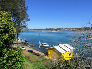
 The entrance of Tuross Lake from the north (photo: J&P Gatenby) |
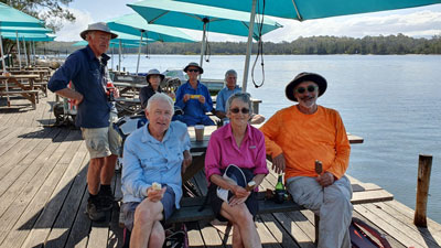 End of a good day's walking at The Boatshed on Tuross Lake (photo: J&P Gatenby) |
Finally, it was a 20 minute drive on to Dalmeny, where for logistical reasons, we were staying ..... in a very pleasant beach house with a large deck and views up the coast-line. It was a nice reward after a tiring day at the office. |
|
|
Day 6 - Tuross Head to Narooma (23 km - 80m ascent - 80m descent) |
This morning we should have been driving back to Tuross Head to catch a boat across Tuross Lake to its southern shore. Unfortunately, that plan was ended when the transport arrangements fell through at the last minute. As a result, we were driven from our accommodation in Dalmeny to Blackfellows Point Campground south of the lake and walked 2 km northwards to the end of the sand spit at its mouth .... only 100m across the channel from where we had stood yesterday. Still, a dip of the feet in its waters to match the one we did on the north shore yesterday verified the "crossing" and we turned around and head southwards again.
|
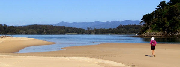
 Foot dip in Tuross Lake as proof of crossing |
 |
 View northwards from Blackfellows Point |
Returning to the campground, we followed the gravel road around the rocky cliffs of Blackfellows Point to descend once again on the beach for a short stroll along the sand and quick hop across Potato Creek. Climbing the headland, we quickly crossed the holiday-house lined streets of Potato Point to descend on to the next long stretch of sand - Jemison Beach. |
||
 Looking south towards Potato Point |
 Jemison Beach |
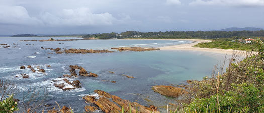
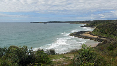
The sandstone headland at its southern end provided a good grassy spot for morning tea, with views stretching southwards to Dalmeny of our route down the coast. Dropping down on to pristine and isolated Brou Beach, we started a long meditative stroll along its 6.5 km length. |
|
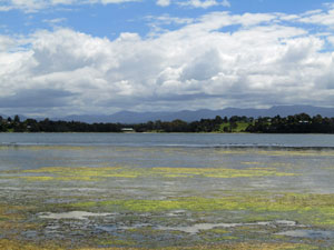
 A well-behaved coastal lake .... barred from the sea |
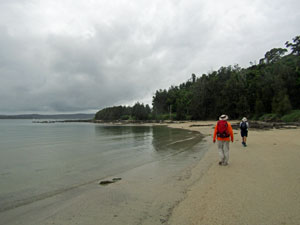
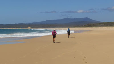 Meditational stroll down Brou Beach |
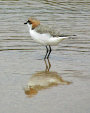
The walk was only broken by a stop to deboot and wade the shallow entrance to Brou Lake. Near the lake, Jan spotted a pair of coastal emus - quite a rarity in this part of the world. |
|
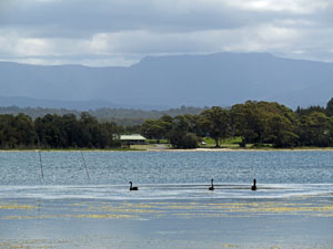
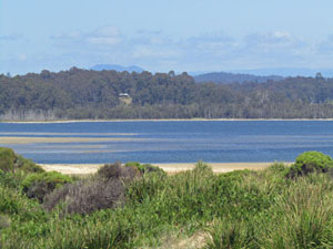 Brou Lake |
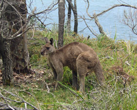
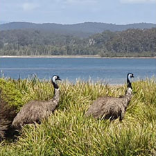 Brou Lake emus (Photo: J&P Gatenby) |
 Crossing the entrance to Brou Lake |
In fact, I couldn't be bothered putting my boots back on, walking closer to the breaking waves and letting the foaming surges roll over my feet ... bliss. The headland and houses of Dalmeny slowly got nearer, till, on reaching the wide and shallow entrance of Mummaga Lake, I crossed the footbridge and wandered up to our accommodation, a street back, in time for lunch. The first 15 km of the day's walk were done and it was nice to have a long break at the house. |
||
 Tinted cliffs north of Dalmeny |
 The shallow clarity of Dalmeny Creek |
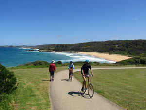 On the shared walk/cycle path at Dalmeny |
There was still 8 km to be walked to reach the end of Stage 4 at Narooma, so, later that afternoon, we set out again, joined by the fair Nello. The first section passed quickly as we strolled along the joint bicycle/walking path that followed the coast past the headlands of Dalmeny. On reaching Kianga Beach, we left the path for a bit of beach and rock platform walking - a bit shorter and more pleasant than the pathway. |
|
 Rounding the rocks near Kianga |
 Surf break over the rock platform |
Eventually though, we had to rejoin the pathway and cross over to reach the Bar Beach carpark and Wagonga Inlet, where we were greeted by a pair of seals lazing near the water's edge. From here, we picked up the boardwalk that skirted the inlet to reach the roadbridge across it. A few hundred metres on the other side, at walks end, our car was waiting to take us back to Dalmeny. |
||
 A nice set of rock ribs |
 |
 Tranquil Wagonga Inlet |
The walk was actually more exciting than that, as, while we were passing Kianga, Alan (who had stayed at the house) phoned to say that the dishwasher had caught fire and smoke was billowing out. A series of calls provided us with a running commentary, as they called 000 and the fire brigade arrived to extinguish the fire, followed by donning P2 masks to collect stuff from inside the smoke-scented building. We arrived back to find all our gear piled on the lawn next to a piece of charred metal that once washed dishes. In the house, a blackened cavity and charred floorboards showed how close it came to the house itself catching fire. Needless to say, we couldn't stay the night there, but the Whale Coast Real Estate people looked after us well and found alternative accommodation in nearby Kianga. Thus ended our excellent walk along the coast from Durras to Narooma, not with a whimper but a bang. |
|
