| The Not Quite Goeche-La Trek (part 1) |
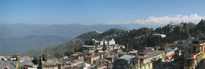
| After a lazy hazy rest day in Darjeeling, during which time we farewelled Chris and Hazel and met Pamela, our new fellow trekker, we were all ready for our next trek - up close and personal with Kanchenjunga and its neighbouring mountains. It was the fair Nello who saw it - up at 5.45 am, she looked out the hotel window and saw the snow clad Kanchenjunga range rising above the ridge of Darjeeling. For the first time in the 10 days since our arrival, the haze had lifted sufficiently to see the mountain. It was a perfect way to say farewell to this fascinating city. |
|
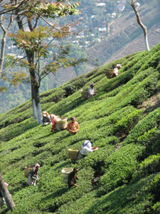 Tea pickers on the steep Darjeeling Hills |
|
|
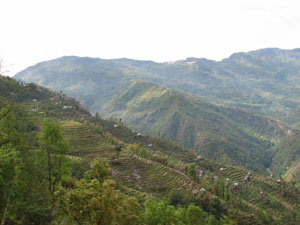 Terraced hillsides of Sikkim |
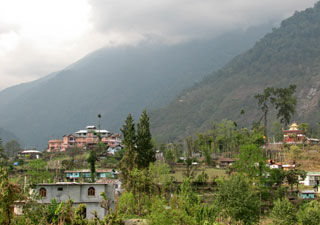 Yoksum, ancient capital of Sikkim |
|
|
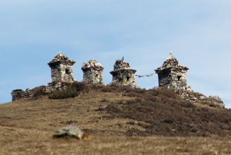
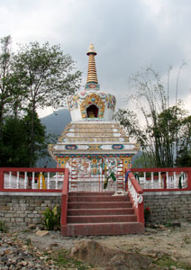 Chorten in Yoksum |
|
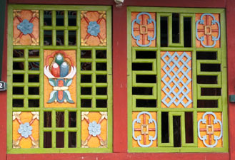
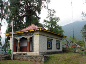 Part of the 300 year-old Dubdi Monastery |
 |
|
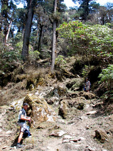
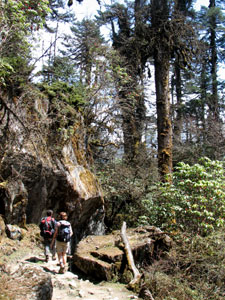
Yoksum to Bakhim - through the Sikkimese forest |
|
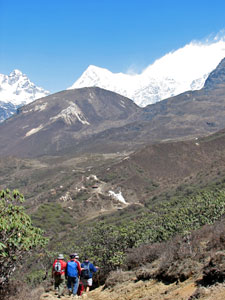
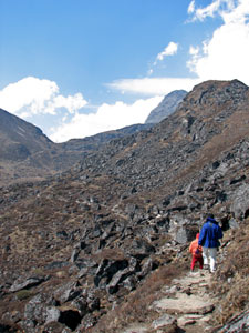
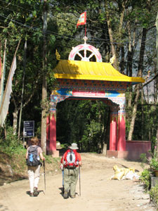 Nello and Pam head off on the start of the trek |
|
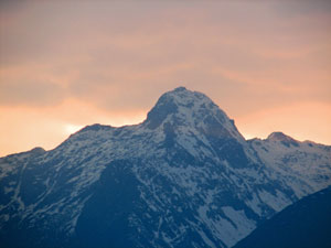
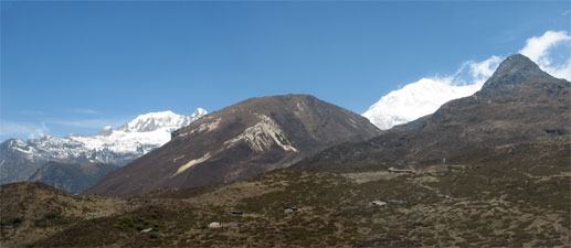
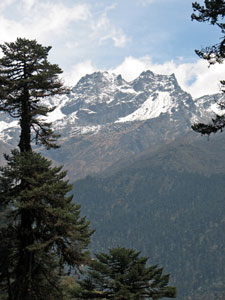
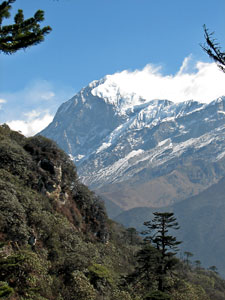
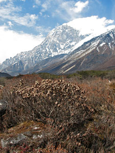
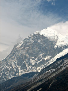
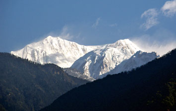 Kabru and Kangchenjunga rising to over 8500m above Yoksum |
 |
|
We climbed up through Yoksum in bright sunshine and, with temperatures set for the low 20s, shorts and T-shirts were the order of the day. Was it less than a week ago that we were on the Singalila Ridge in 3ºC, fog and icy winds? The track followed the valley of the Rathang Chu, traversing its steep sides through the green wonderland of Sikkim's forests - greens of every shade and texture surrounded us as we undulated and meandered along the track, crossing the odd sidestreams flowing down rocky gullies, and slowly gaining altitude as we were accompanied by the distant sound of the Rathang Chu rushing down over its boulder-strewn bed. |
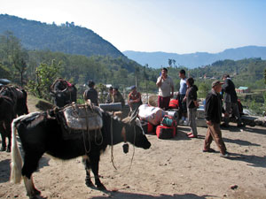 Trek staging post at Yoksum 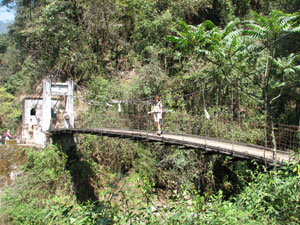 Nello crossing the suspension bridge over the Chusey |
|
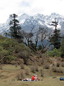
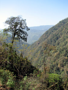 The steep forest-covered slopes of the Rathang Valley |
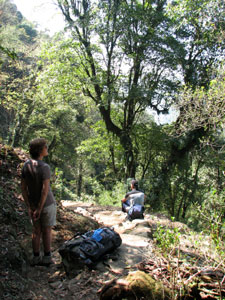 Rest stop in the Sikkimese forest |
|
|
||
|
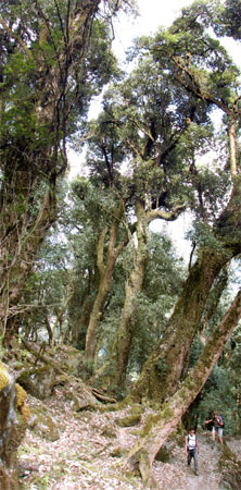 Climbing up amongst the forest giants |
||
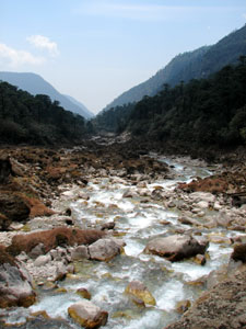
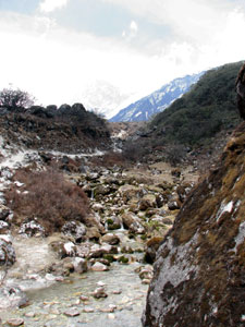
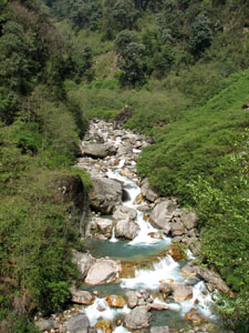 The rocky bed of the Prek Chu |
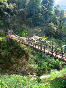 Flag draped suspension bridge across Prek Chu |
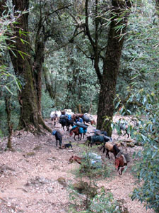 Trekking ponies making their way up the steep path to Bakhim |
|
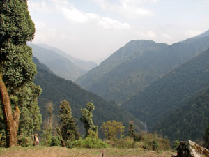 View from Bakhim back down the Rathang Valley |
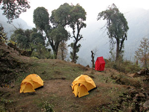
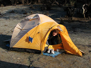
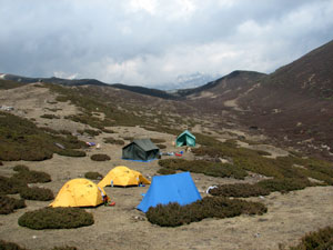
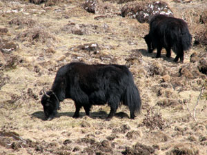
Suddenly, the huts of Bakhim appeared - we had reached 2700m and, after climbing more than 1000m, were glad to see our campsite on a grassy flat (well almost flat!). The resident squirrels were less pleased with our arrival. Time for hot ginger tea and biscuits, an explore of our site perched high on the edge of the ridge amongst the mossy boulders, giant lichen covered trees and curious Himalayan ground flora. In the meanwhile, our team had set up the tents (sleeping, dining, kitchen and toilet) - it was a very cosy site and there was no better way to fall asleep than to the soporific sound of the tinkling bells of the dzo grazing outside. |
|
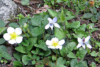 Wild strawberries and violets dotted the clearing |
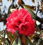
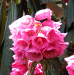
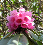
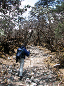
Bakhim to Phedang - up through the rhododendrons |
||||
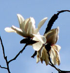
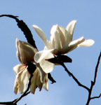
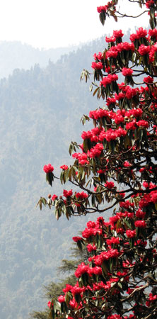
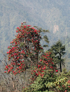 Rhododendrons and the odd magnolia lined the steep climb up to Tshoka |
|
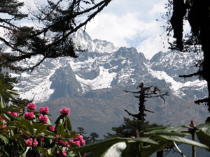
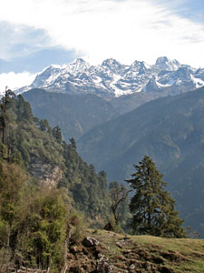 View of Jopunu (5950m) from Tshoka |
||
|
 |
 |
||
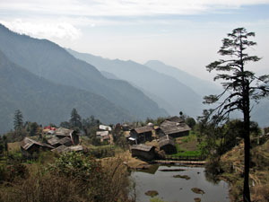 The village of Tshoka settled by Tibetan refugees |
With Sunder's son, Pasang, setting the pace and keeping us from bolting, we zig-zagged up through the open forest along a steep ridge line heading up to Tshoka, a small Tibetan village. The odd magnolia and rhododendron were now beginning to appear. Rounding a bend, a collective "wow" emergedfrom the group - across the deep valley was the snow-capped jagged line of mountains leading up to Jopunu (5950m) and Pandim (6690m). A few more metres in height and we arrived at Tshoka, for a welcome cup of hot chai at a Tibetan teahouse - 300m down, 700 to go! |
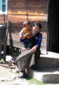 Tibetan lady with her grand-daughter |
 Looking back over Tsoka from the long climb up to Phedang |
 Fir forest on the ridge line |
 Across the valley lay a 5000m snow-capped ridgeline |
 |
|
|||
|
 A glimpse of the peaks through the dense forest |
 Unloading the dzo |
|
|
|||
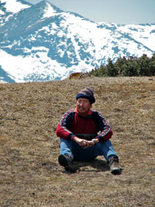
 Taking in the afternoon sun |
|
|
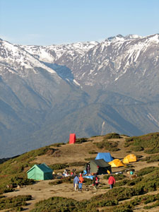
 The peaceful and panoramic setting of Phedang meadow |
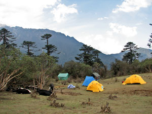 Campsite at Phedang |
|
 Afternoon light on Jopunu (5950m) |
||
By late afternoon, the clouds rolled in and, after glowing briefly orange, hid the setting sun behind grey veil. The temperature began to drop sharply - it would be our first taste of camping out in the cold of the mountains. Leaving the dining tent after another hearty 3 course dinner, we were greeted with a clear starry sky and the sight of a full moon rising behind the firs and illuminating the snow on the distant mountains. It was definitely going to be a cold night! |
|
|
    |
Phedang to Dzongri - above the tree line |
||
|
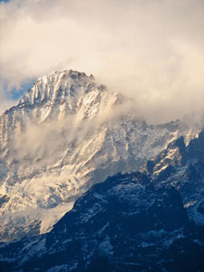
 Morning cloud streaming off distant Pandim (6690m) |
|
 Hot cuppa on a frosty morning |
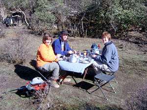 The hard life of a trekker - breakfast in the morning sunshine |
|
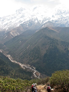
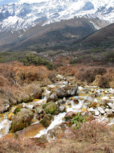
 Looking back over the climb and the pastel shades of the Rathong Valley - our path up |
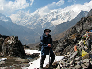
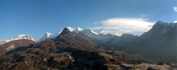
Leaving the meadow at Phedang we climbed slowly up through the increasing stunted rhododendrons, the fir trees becoming smaller and scarcer until they vanished - we had reached the tree line. Finally, at 3995m, we emerged onto a prayer-flag lined view point. A wide panorama of the mountains suddenly appeared as we topped the ridge; Janu, Rathong, Kabru, Kangchenjunga, Pandim, brilliantly white in the morning sunshine, with the sharp black tooth of sacred Kabur a sharp silhouette in front. |
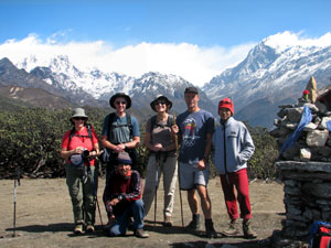 Pam, me, Nello, George, Pasang and Sunder (kneeling) - but who took the photo? |
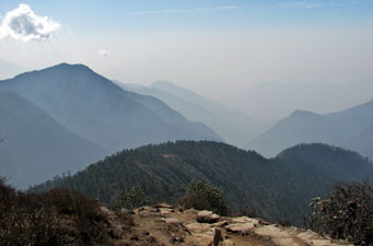
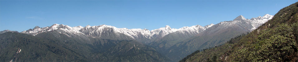 The northern end of the Singalila Ridge (ranging from 4-5000m) |
||
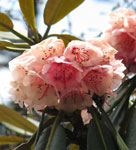
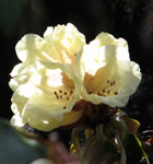
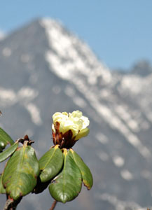 Up high the rhododendrons are cream |
An icy wind blew off the snowy peaks from the west and cut through our clothing, despite the sunshine. |
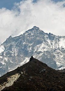
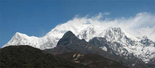 The dark cone of sacred Kabur (4820m) stands starkly in front of the massive dome of Kabru (7315m) |
|
 |
 |
|
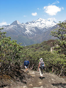
Descending through the rhododendron scrub to Dzongri |
||
|
 Sunder Sherpa - 25 years a mountain guide |
|
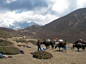 The dzos arrive with our camping gear |
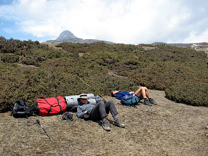 Hard day in the life of a trekker - but then it's over 4000m here |
|
 The climb up to Dzongri-La |
After lunch, the fair Nello and Pam had a nap in their tents, while Pasang took George and myself up the rocky path through low alpine heath and the odd cushion plants to Dzongri-La, an 4380m pass. From here we could see Kabru in all its glory, plunging over 3000 m from its snow-covered cap to the glaciers and river valley far below us. It was well worth the effort, though it gave me my first real taste of altitude sickness - on return, I crashed in the tent with a bad headache, but fortunately an hours rest and all was OK. |
|
 At Dzongri-La (4380m) |
 Pandim through the mist |
|
|
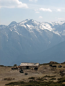 Yak-herder's hut at Dzongri |
|
 Campsite amongst the junipers at Dzongri |
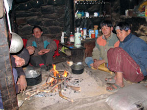 At home with the Yak-herders |
|
|
||
Dzongri to Thamsing |
||
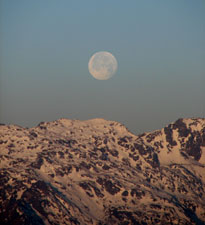 Moonset over the Singalila Ridge |
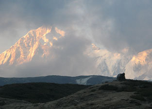
A heavy frost greeted us as we struggled out of our tents at 4.45 am. The full moon was just about to set over the Singalila Range as we sipped a hot cup of tea and headed off into the pre-dawn light. This morning we were climbing up to Dablakhang, a hill 150m above our campsite, to see the sun rise over Kanchenjunga. As it crept above the mountains to the east, it illuminated the nearer peaks and Kanchenjunga, for the first time not hiding behind a cloudy veil. It was definitely worth the early start to the day. |
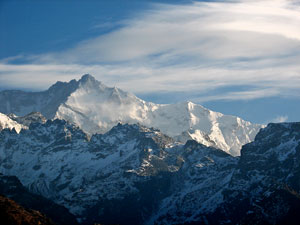 The first rays of the sun light up Kangchenjunga (8586m) |
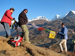 Sunder, Pam and Nello setting up some prayer flags |
 Early morning panorama - Rathong (6678m) , Kabru (7320m), Kangchenjunga (8586m) and Pandim (6690m) |
 Early morning at the Dzongri campsite |
|
|
|
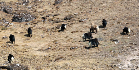 A herd of local yaks over-summering at Dzongri |
|
 |
Climbing once again, Sunder led us on a short detour to Laxmi Pokhari, a small glacial lake in a bowl at the base of Kabur. To the north-west, the impressive form of Pandim framed the dark green waters of the lake. Pandim was calling, and we continued on, rejoining the main track and descending sharply 250m through the dwarf cream-flowering rhodendrons to where once again fir trees started to appear in the landscape. |
 Hilltop shrine - Dzongri |
 Start of the descent to the Prek Chu Valley |
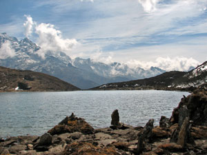 Laxmi Pokhari - a small glacial lake on the eastern slopes of Kabru |
 The porters heading off |
|
||
 Looking south down the Prek Chu Valley |
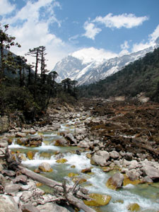 Looking north up the Prek Chu Valley |
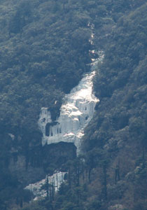 Frozen waterfall or mini-glacier? |
 George heading up the morain |
 Sidestream cutting through the lateral morain |
 A curious symmetry |
Finally we crested a rise in the morain to see below us the broad grassy meadow at Thamsing - our tents were just being erected and behind them, almost 3000m straight up, the rocky western ramparts of Pandim towered above. It was a good place to stop for the day and the slight drop in altitude was greatly appreciated. |
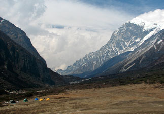 Thamsing campsite in a clearing of the glacial valley dwarfed by 6690m Pandim |
 Alpine heath and rivulet at Thamsing |
 Juniper bushes in the glacial valley |
The cold wind drove us into the dining tent, where we settled down to a game of cards, warmed by the hot water bottles that the cooks had prepared - aah, the hardships of trekking! But, by the time we went to bed at 8pm, a frost was already forming on the tent. |
 The 2500m face of Pandim |