
| Central Coast Walking |
About |
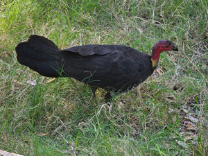
We know the South Coast of New South Wales very well and, over the years, we have visited different parts of its North Coast. However, the Central Coast - the area between Sydney and Newcastle - had always been a bit of a black hole that we zoomed by on the M2 motorway on our way north. It was time to remedy that, so the fair Nello and I planned a 5-day stay there to explore some of the walking possibilities. While heavily populated in parts, it still looked an interesting area on Google Earth, large estuarine lakes and deep inlets from the sea and a couple of coastal national parks. |
 |
|
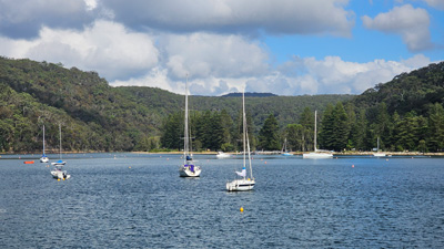
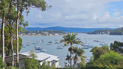
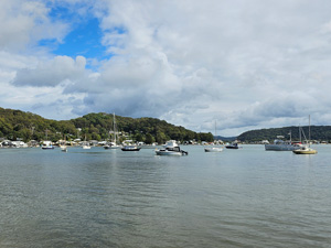
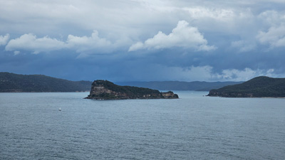
We chose Hardys Bay, a small and quiet village on the edge of Brisbane Water and tucked into the side of the forested slopes of the Bouddi Peninsula, as our base. In fact, it is adjacent to the Bouddi National Park, which is where we planned two of our walks. The other advantage of Hardys Bay was its proximity to the ferry terminal, with an hourly ferry service across Broken Bay from Palm Beach at the northern end of Sydney. Palm Beach lies on Pittwater, a deep inlet, that separates it from the Ku-Ring-Gai Chase National Park. We hadn't walked there either and the prospect of a ferry trip and a walk in the park was too enticing. Thus, on a fine day the week before Easter, we drove down the Hume Highway, skirted Sydney on the M7 and M4, crossed the broad Hawkesbury River on the M2 and turned east to pass through the town of Woy Woy, cross a narrow section of Brisbane Water and reach our AirBnB at Hardys Bay. |
|
|
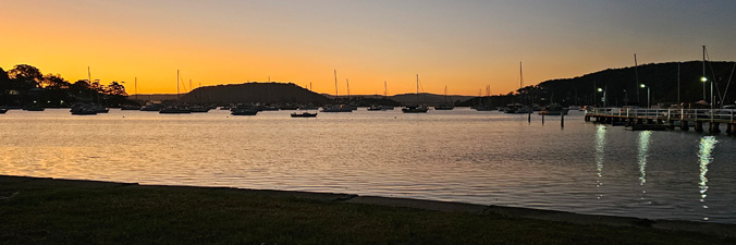
It was time to get to know the Central Coast a little better. That evening, as we sat on the shore of Hardys Bay, watching the sun set over Brisbane Water with a glass of red in hand, life seemed very good. |
|
Bouddi Coast Walk (11.5 km - 510m ascent - 510m descent) |

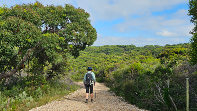
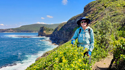
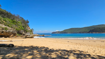
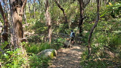
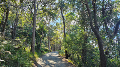
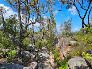
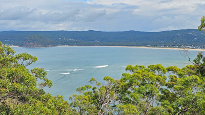
Our first walk was the Bouddi Coast Walk. It was not a long walk, but then Bouddi is not a big National Park. The walk began at McMasters Beach and traversed the northern sector of the park to end at Putty Beach. The host of our AirBnB at Hardys Bay had kindly offered to drive us to the start point, so after leaving our car at the nearby Putty Beach end, Frank drove us along the well-named Scenic Road to the McMasters Beach Surf Club. We had hoped for a coffee on its deck looking over the golden sand of the beach below to start the walk, but it was Tuesday and Tuesday is the day the kiosk closes. We set off on the walk. |
|
 McMasters Beach - start of the walk |
 Entering Bouddi National Park |
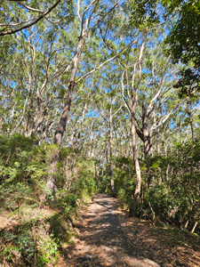
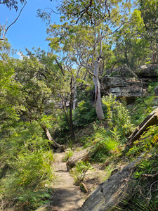
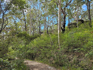
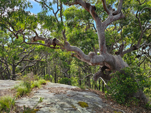
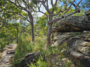
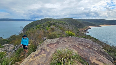
Cloud still dominated the sky as we climbed up through a section of coastal houses to reach the gate into Bouddi National Park and the canopy of gnarly Angophora forest. It was easy walking along the fire trail, with some sections of tall eucalyptus and large swathes of tall coastal heathland. Soon we reached the steep descent to Little Bay and quickly found ourselves on the grassy flat of the camping area at its rear, courtesy of a series of sandstone steps. |
|
 Leaving the forest and entering the heathland |
 Coastal cliffs near Little Bay |
By now, the sun was winning the battle for the sky and the cloud cover was quickly dissipating. The day was warm and a few trickles of perspiration were noted. It seemed a good idea to lean up against a driftwood log in the shade on this small beach and enjoy the light ocean breeze. |
||
|
 The beach at Little Bay |
|
Heading on, a new set of steps and road-surfaced path took us up through the shady coastal forest on to the next headland area. Just before the ridge, we finally had a section of natural sandy path to walk on - I liked it. That quickly changed when we crested the top and were greeted by a firetrail surfaced with woodchips (to be fair it would stop the white sand track beneath from being chewed up and rutted). |
||
|
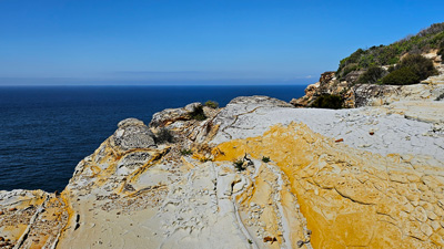
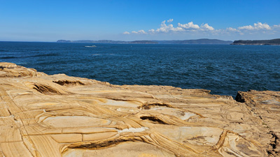
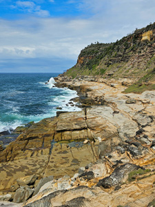
We followed this woodchip way through the open heath of Bombi Moors. At a junction, we decided to make a small detour down to the cliffs of Third Point, where the great views were framed by lovely slabs of wind- and water-sculpted sandstone. It was worth the wander there and back.
|
|
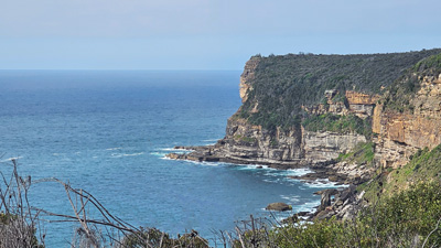
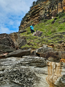
Continuing on after returning to the junction, we followed the moorland firetrail steadily downhill to reach its end, where another section of pleasant natural foot-track began. The track led us steeply down to Cave Gully, where a long rock overhang lined the dry watercourse (was this the cave?). On a coastal walk, steeply down is generally followed by steeply up - the stepped path led us to a lookout overlooking Bouddi Point. |
|
|
|
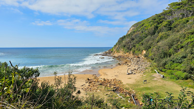
Descending to a high saddle separating the golden sandstone walls of Bouddi Point from the slopes behind, we dropped quickly and steeply on to the long curved sand of Maitland Beach - the perfect spot for lunch in the shade of couple of gnarly banksias. |
|
 Looking down onto Maitland Beach |
 Nice spot for lunch on Mailtand Beach |
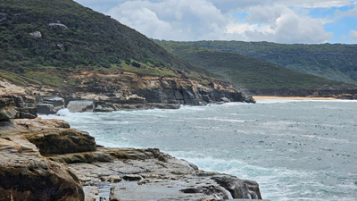
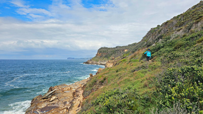
Lunch over, we wandered the length of the beach before re-entering the forest for another climb - this time up to Marang Point, with its superb vista back over Maitland Beach, Bouddi Point and its big rock platform. We were now about to enter one of the nicest part of the walk, as the track undulated its way, just above the cliffs in the shade of some dense coastal forest. |
|
|
|
The track led up to yet another great view at Gerrins Point, before descending back into the forest. It was all down from here, with a final section of boardwalk around some rugged but low sandstone cliffs, the waves crashing into their base. |
|
|
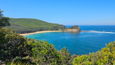
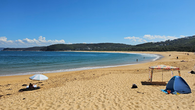
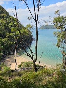
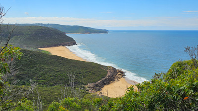
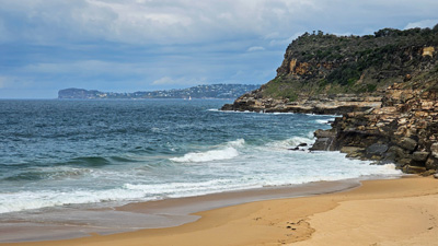
Suddenly we were there, at the northern end of Putty Beach, a long stretch of golden sand that merged into distant Killcare Beach. We set out on the firmer low-tide sand to reach the passage through the dunes that led to a car-park and our car. It had been a great introduction to the landscapes of the Central Coast ... now lets get down to the Killcare Surf Club and have a nice cold chocolate milk-shake. It had been quite a warm day and, although the track was easy, there was a lot of climbing and descending - our clothes were damp with perspiration. Apparently, chocolate milk is one of the best hydration drinks you can have. |
|
|

Ku-Ring-Gai Walk (9.5 km - 230m ascent - 230m descent) |
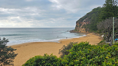
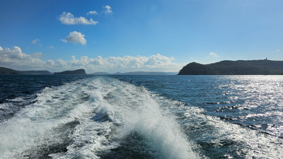
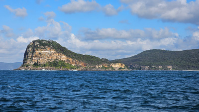
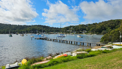
It was a cloudy, but warm, morning as we drove from Hardys Bay a couple of kilometres around to the ferry wharf at Wagstaffe. Armed with our ferry day-pass, we were heading off to do a walk in the north of Ku-Ring-Gai Chase National Park on the other side of Broken Bay. It was an interesting trip, first across to the other side of Brisbane Water to pick up more passengers at Ettalong, then a slow and winding trip along the narrow channel that allowed our exit from the broad sandbar and its breaking waves, followed by a rollicking ride for 20 minutes across the open sea, past the impressive profile of Lion Island and into the more sheltered waters of Pittwater. |
|
|
|
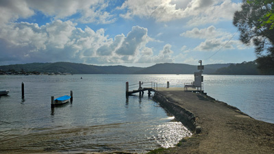
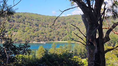
Here the ferry pulled into the wharf at Palm Beach and we quickly disembarked to embark on a much smaller ferry that would take us across Pittwater and to the coastal fringe of Ku-Ring-Gai Chase. We got off at The Basin, a peaceful camping ground set on a rare piece of flat land between the clear placid waters of Pittwater and the even more placid waters of The Basin, a small lagoon cutting back into the steep forested slopes of Ku-Ring-Gai. |
|
|
|
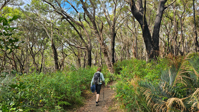
After a coffee from the campground vending machine, we finally set off on the walk. It was to be a walk of three stages, the first being a steady, but steep, climb out of The Basin, on a gridded concrete road that led upwards beneath the tall and dense canopy of the eucalypt forest. The eastern slopes of Ku-Ring-Gai seem to provide a moister environment for, as we reached the heights of the plateau behind, the forest became shorter, drier and more open. |
|
 Last glimpse of The Basin |
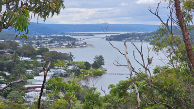
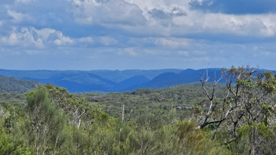 Panorama of the Ku-Ring-Gai hinterland |
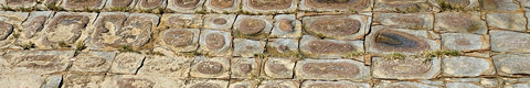
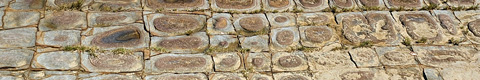
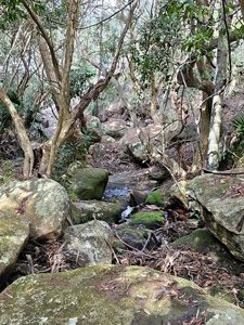
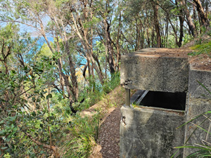
A gravel fire-trail now led us into the interior of the National Park as it followed a ridge line westwards to reach the site of some ancient aboriginal rock art. We took the short detour to look at these petroglyph outlines of people and animals, peck-pitted a few thousand years ago onto a flat slab of sandstone. It was a good reminder of how long this country had been occupied before Europeans arrived. |
||
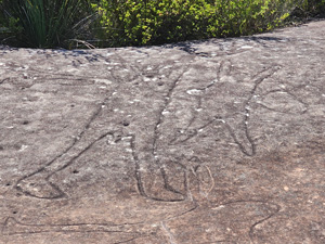 Petroglyphs of people |
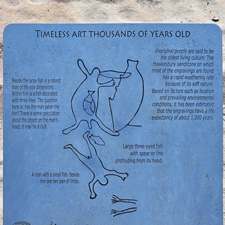 |
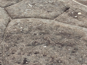 Petroglyphs of kangaroos |
|
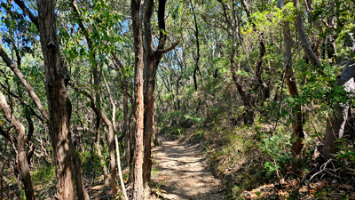
A little later, we came to the end of the firetrail, as it emerged on to an asphalt road. Stage 2 of the walk, a 3km stroll down West Head Road, was about to begin. Although there was hardly any traffic, apart from cyclists, walking alongside an asphalt road, even when it passes through interesting forest, is not very inspiring. After almost an hour of walking we reached a picnic area near the next aboriginal art site - the Red Hand Cave. This was stage 3 and it was back into the bush on natural foot tracks. |
|
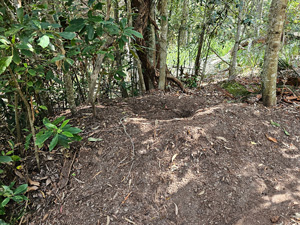
After a pleasant lunch in the shade of the picnic area, we wandered down a stony path to Red Hand Cave. It was an overhang of sandstone rock that looked out through the trees to distant Pittwater. We could see why it might be chosen as a place to paint. However, no matter how hard we looked, we could not find the red ochre outlines of hands that we expected. I even googled a photo of a hand to find the precise location of one such painting. The silhouette seemed much less clear. Had the artwork been vandalised? The thought was very disappointing. |
|
|
 Vegetation near Red Hand Cave |
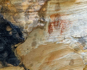 Can you spot the red hand silhouette? |
|
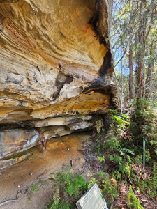
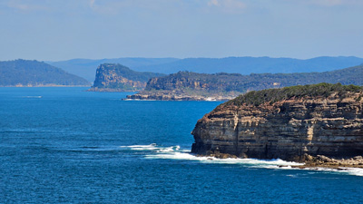
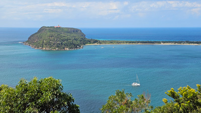
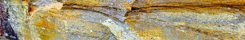
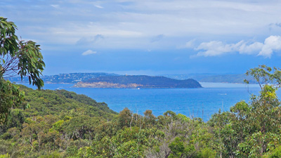
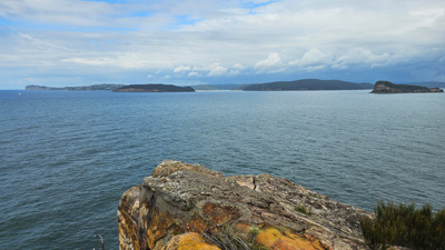
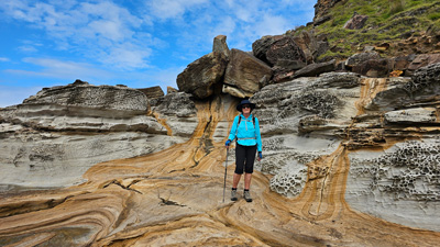
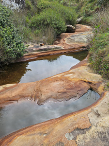
That said, the sandstone itself was superb, with its multi-hued sculpted surface under the overhang. We continued along the Resolute Foot Track, descending amongst the blocks of sandstone and superb pink-barked and rough-barked eucalypts. A final short ascent brought us to West Head Lookout (which is where the road was headed), which offered superb views across Pittwater to Barrenjoey Head and the long sandspit attaching it to the rest of Sydney, as well as across Broken Bay, beyond Lion Island to the distant tops of Bouddi National Park. |
||
|
|
|
The last part of the track was the nicest of all, leading us down between sandstone blocks into a lush gully above West Head Beach. From there, it began an undulating traverse across the lower slopes of Ku-Ring-Gai, with glimpses out over the blue waters of Pittwater and a cooling southerly breeze wafting through the trees. |
|||
 Taking in the view over Pittwater |
 Track beneath the sandstone blocks |
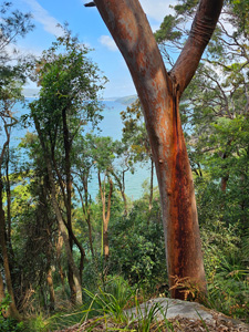 The beauty of eucalypt bark |
 Forest and sea |
|
|
|
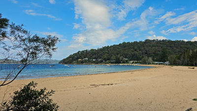
Crossing another rocky creek above tiny Resolute Beach, we rounded the next headland to arrive at the broad golden sands of Mackerel Beach, with its line of old holiday houses at the rear. It was the end of our walk and a stroll across the soft sand brought us to the ferry wharf. A short time later, the ferry rounded the head and we were on our way back across Pittwater to Palm Beach, feeling very contented with our brief exploration of Ku-Ring-Gai National Park. |
|
 The broad golden sand of Mackerel Beach |
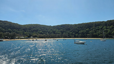 Leaving Ku-Ring-Gai by ferry |
We had a longer wait at Palm Beach this time to catch the ferry back to our base on Brisbane Water, but that allowed us to relax and enjoy a celebratory beer at historic Barrenjoey House, as is the post-walk tradition. With an interesting walk and boat trip across a beautiful part of the coastline, it had been another great day on the Central Coast. |
|
Bouddi Peninsula Walk (10 km - 240m ascen - 240m descent) |
It had rained lightly overnight and the morning was very humid with a full cloud cover. However, by the time we set out for our exploration of the southern part of the Bouddi National Park, the sun was breaking through and the day becoming steamy. I had planned a loop walk, starting and ending from our AirBnB, so we walked out the door and set off, quickly descending the steps at the end of our street to reach the tranquil shore of Hardys Bay. |
|
 Setting out with a view over Brisbane Water |
 The tranquil setting of Hardys Bay |
We strolled around the edge of the water, first passing a row of waterside houses pressed up against the steep slope behind and then rounding the head between the forest and the mangroves - a peaceful morning walk, shared by several of the locals. On reaching neighbouring Pretty Bay and its patch of suburbia, we turned up a side street to find the track leading directly up beyond the houses and into Bouddi National Park. |
||
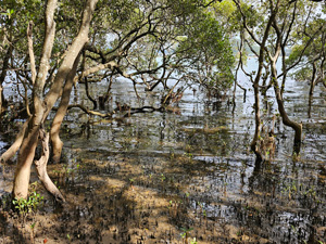 Mangroves fringing Brisbane Water |
 The harbour at Pretty Bay |
 Entering Bouddi National Park |
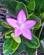
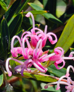
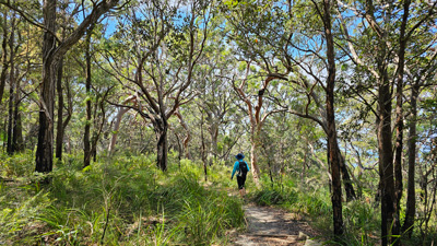
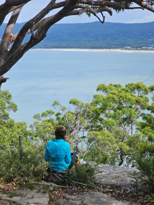
Here we picked up the Flannel Flower Track, which wound its way up through some lovely gnarly eucalyptus forest onto the sandstone slabs of the ridge-top. On reaching the top, the track passed one jutting slab of sandstone, where glorious views opened out over Broken Bay to the south. It was a good place to stop and take in the ambience of Bouddi. We had hardly covered any distance and the sweat was already dripping down my back ... the humidity must be near saturation. |
||
 Nice spot for a bit of reflection |
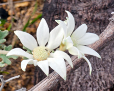
Pushing on, we followed the Flannel Flower Track gently downhill, out of the forest and into more open heathland to reach Box Head Junction. Curiously, we had not seen a single flannel flower on the track. |
 The sandstone slopes of Bouddi |
 The gnarly trees and sandstone blocks .... |
 .... on the Flannel Flower Track |
 The road to Box Head |
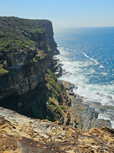
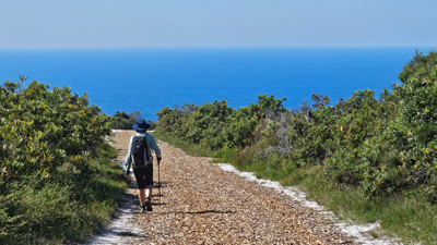
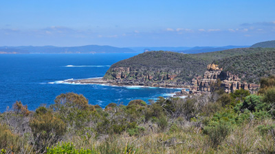
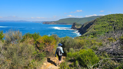
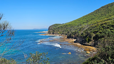
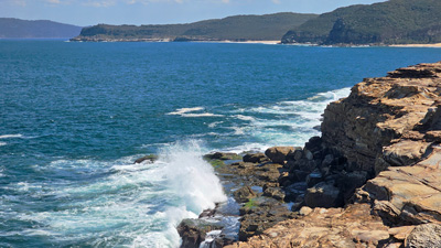
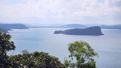
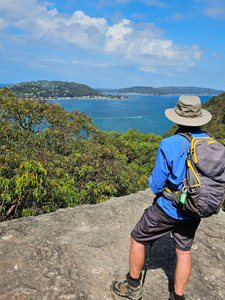
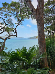
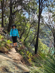
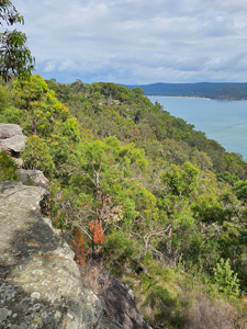
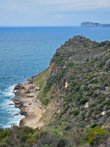
From the junction, we headed due south, firstly on a gravel road, then on a rocky foot track that led out along the sandstone ridge, beneath a more stunted gnarly tree cover and then heathland. Breaks in the vegetation gave superb views on either side of this narrow peninsula, towards Barrenjoey and Sydney in the south, and along the Bouddi coastline to the north with its golden beaches indented into the dark cliff-line. |
|
|
|
|
It looked like it would be a spectacular walk back along this coastline and, while sitting on the cliff-top seat at the end of Box Head enjoying the breeze and the views, I noticed a faint track heading downwards (probably used by rock fishermen). It was just to the right of a sign saying "Track Ends Here".
|
|
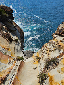
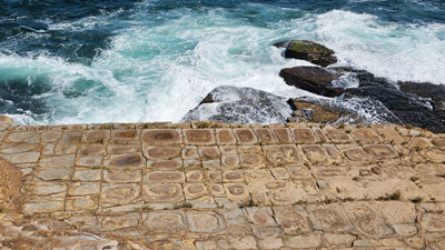
Not to be daunted by the signage, we picked our way very carefully down the track and around the boulder jumble at the base of the cliff to round the point and drop down onto a rock platform, high above the waves. From here the walking was easy again and being between the cliffs and the waves breaking onto rocks below was particularly enjoyable. |
|
 The shore-line route from Box Head |
 The beauty of sandstone |
|
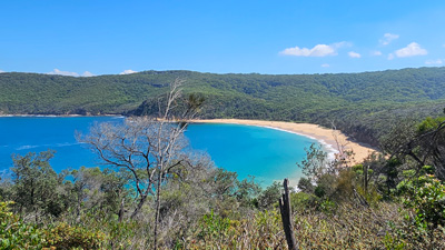
The track left the rocks to climb up and follow a grassy slope which led us around the back of Little Tallow Beach and onto the flat edge of another high rock shelf. From here a final stroll through the coastal heath brought us to Tallow Beach and its grassy camp ground. It was an excellent place for lunch, being amused by the antics of some young magpies playfully rolling each other around on the grass. |
|
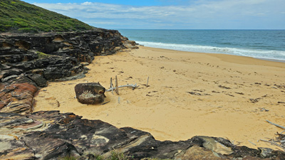 Little Tallow Beach |
 Looking back towards Box Head from Tallow Beach |
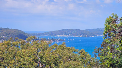
There was only one problem and that was we were now on the other side of the Bouddi Peninsula to our accommodation. Thus, our return journey started out with a steep climb up the gravel road to Box Head Junction and on to the ridge line, followed by a leisurely stroll down the western flank, with glimpses through the trees out over Brisbane Water, and a final steep descent through the hill-side houses of Hardys Bay to our accommodation. |
|
 |
 View over Brisbane Water |
 |
Like the other walks here, it had not been a long one, but packed a lot into it - a stroll along a tranquil inland waterway, walking the sandstone ridge tops with their unique forest and vegetation cover, great views of the East Coast shore-line and ocean, a wander along rugged rock platforms and past golden beaches. You really couldn't ask for more. |
||
|

