Prologue

Getting There

It is a long way to drive to Alice Springs from just about anywhere in Australia. For us, it was essentially three full days on the road, partly through familiar landscapes and partly through new unexplored terrain - the flat, dry interior of South Australia. Flat and dry it may be, but definitely not uninteresting. Coober Pedy, opal-mining capital of the world, set in its bizaare environment of flat desert, low hills and scattered mounds of earth from the opal diggings was certainly a place worth visiting. We spent the night in an underground motel - people here head down into the bowels of the earth to escape the extremes of desert temperature and it has become a mini-Cappadocia here, with houses and churches carved into the sandstone rock.


Our room in the underground motel


Coober Pedy landscape - air vents for underground dwellings


Church carved into the rock in Coober Pedy


The sun goes down on Coober Pedy

It is indeed a fascinating place, but a highlight for us was the detour we made to the nearby Breakaways Reserve, where the low eroding hills crumble away into the endless desert plain in a palette of ochre-tinted colour. I had never heard of them, but now wish we had had more time to enjoy them. They are worth a few photos here, before we continue north up the long desert highway towards Alice Springs and the Larapinta Trail, as the hours pass to the dulcet country tones of Patsy Cline, the driving beat of Bob Marley and the crescendic arias of Il Divo - there is no accounting for taste.

Below: The beauty of the desert - a set of early morning landscapes in The Breakaways north of Coober Pedy


Finally, we enter the Northern Territory and, a couple of hours later, we see The MacDonnell Ranges, rising in the distance out of the flat red desert of Central Australia to create a long barrier across our northward path. We have reached our destination.

With their steep-sided ridges cut by narrow passes and gorges, the MacDonnells frame grassy plains, dry sandy creek beds and deep rocky waterholes. These ancient mountains provide a refuge for a wide range of flora and fauna. As such, they provide a unique experience for those who walk across their diverse landscapes. This has long been recognised - the first sections of the Larapinta Trail were opened in 1990 and the 223km length of the trail was completed in 2002. Since then it has become the signature walk of arid Australia. The fair Nello and I had spent a camping holiday in this area with our daughter in 1993 and been enthused by its rugged beauty. Ever since I read about the trail being completed, I have wanted to walk its length and get a more intimate feel for the landforms of the red centre. The pull of Larapinta has become too strong - it is time to go and walk it.

Logistics

The easiest way to walk the Larapinta Trail is to call up one of the several companies who offer guided tours, pay your money, fly to Alice Springs and start walking - all will be catered for. However, for those of a more independent-mind, such as the fair Nello and myself, working out how to undertake such a long and remote walk is part of the overall challenge and, logistically, there is no doubt that it is a challenge.

The first decision is in which direction do we do this long one-way track. While the official maps and guide notes follow it from east to west, many people walk the trail from west to east. The argument is that it is cheaper to get transport to the far end and make food drops on the way before walking back to Alice Springs, ending the walk at Alice Springs means you finish back in civilisation and don't have to organise a final road trip home and you don't have to walk into the afternoon sun. The downside is that the walk passes through the most spectacular country first and finishes by passing through less interesting landscapes (though such value judgements are always in the eye of the beholder).

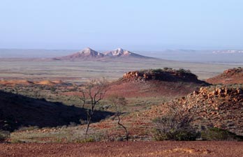
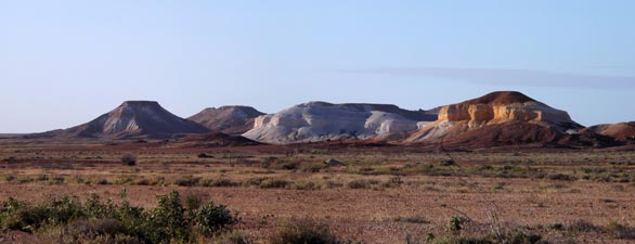
The fair Nello and I opted to walk the track from east to west for two main reasons: starting out in more open country provides easier walking initially and hopefully would allow us to build up our stamina (I find it always takes a couple of days to "walk yourself into" a long trek) and it also meant that we would be heading into more and more spectacular landscapes, with the distant target of Mt Sonder a beacon to beckon us on. It is always good to have your enthusiasm reinforced, especially on a trek that takes 17 days. As for the sun, the track is lies east-west so no matter which direction you will be walking into the sun for part of the day, whether morning or afternoon.

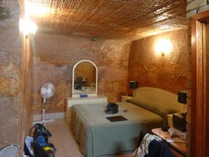
Having left our superman days well behind, the idea of walking for 17 consecutive days with a full pack did not appeal, so we decided to break the walk into four stages, with a rest day in between. It would be a chance for good food, a bed, a cold beer and a hot shower before setting off again. These stages were: Alice Springs - Standley Chasm, Standley Chasm - Serpentine Gorge, Serpentine Gorge - Glen Helen and Glen Helen - Mt Sonder. In fact Glen Helen Station, the only non-camping accommodation after Alice Springs was to become our home away from home, as we would spend time there before and after the walk and during these breaks.

We had made arrangements for transport from Standley Chasm back to Alice for our first break and from Serpentine Gorge to Glen Helen for our second break. We would walk in to Glen Helen for our third break and had organised transport from Redbank back to Glen Helen after completion of the trail, where our own car would be waiting for the drive back to Alice. As we had driven to Alice Springs, we had the luxury of having our own car. Nonetheless, our plan necessitated hiring a second small car in Alice Springs for a day. The day before setting off, we drove both cars out to Glen Helen loaded with five plastic tubs of food supplies, making food drops on the way at Simpson Gap, Ellery Big Hole and Ormiston Gorge, as well as leaving two tubs to be stored at Glen Helen.

For several weeks we had been making extra meals - chili con carne, spaghetti bolognese, chicken couscous, lamb curry, mushroom risotto, chow mein etc - dehydrating and vacuum sealing them, as well as drying apples, pears, mangoes and bananas for mixing with nuts to make our scroggin. Together with packets of soup, breakfast oats, cheese, packets of tuna and dried meats, plus ziplock bags of coffee, tea and powerade (blue of course) and chocolate for a treat, we filled the tubs that would keep us fed along the route. It had been a complicated logistical exercise, but everything was now in place.


Food supplies for the Larapinta

It was time to head off. So, after a night at Glen Helen, we left our car, drove back to Alice Springs in the rental car, caught a taxi out to the Old Telegraph Station and trail head, and started walking.