Kokoda Track(1. Kokoda to Camp 1900)

Getting There

I am writing this in the garden of Orohaven Lodge, in Kokoda village, on a steamy afternoon where the excess moisture is starting to change fluffy white clouds to a more ominous grey. Most of my fellow trekkers are having a siesta, but I can’t sleep. I am chafing at the bit to set out from Kokoda on our trek.

“Kokoda”, I hear you say, “but I though that you were starting the trek from Owers' Corner”. Well, we thought so too until the moment that we arrived in Port Moresby after a long day of plane flights from the sub-zero morning of Canberra to the plus-20s night of Papua. The thermal shock was to be followed by a planning shock. The trekking company rep who met us told us that the group who started before us had failed to make it to Kokoda on time, leaving her with a logistics dilemma – the only solution seemed to have been for us to fly to Kokoda the next day and start our trek from there, where the guides and porters awaited.  In doing so, we would not start walking as planned tomorrow, but would have a day off in Kokoda while the trek preparations were completed.


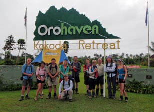
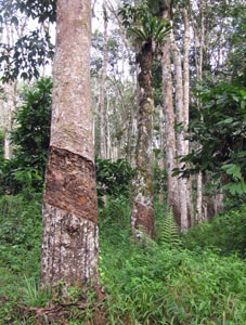
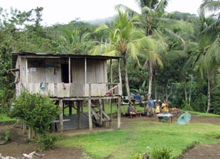
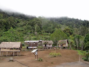
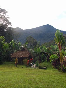
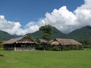
Orohaven Lodge - Kokoda


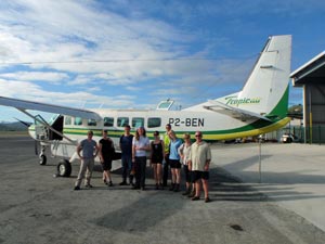
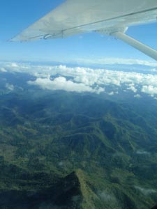
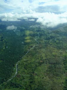
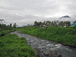
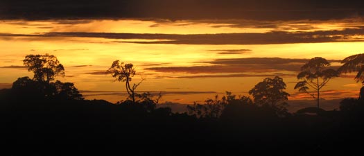
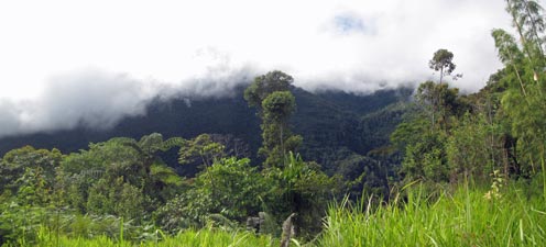
Ordinarily, changing from south-north to north-south would not have been an issue, but Nick, Imogen and I had been planning to follow the footsteps of Bill and his mates of the 3rd Battalion from Owers' Corner to Kokoda. From my reading,  I had a mental picture of the walk from south to north burned into my brain and now it had to be cast aside and replaced – disappointing.

That was yesterday and this morning we were up at 5am to get to the airport and board a small chartered plane (a Cessna Caravan that from appearances once belonged to the Wright Brothers). Still, the flight across was enjoyable and smooth, as we climbed above the puffy white clouds to look down on the rankled green tapestry of the jungle beneath, etched with streams and sharp spurs. These rugged foothills climbed up towards our little plane until a thick band of cloud hid them as we crossed the spine of the Owen Stanley Range. Reaching the northern slopes, the clouds broke up to reveal the tiny green airstrip of Kokoda nestled amongst the palm plantations and fields of a fertile valley. With a couple of lazy, but steeply descending spirals our pilot brought us down onto the grassy runway. Welcome to Kokoda!
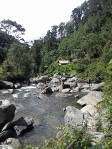
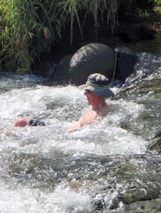


Ready to fly to Kokoda


Kokoda airstrip and the Owen Stanley foothills


Imogen and Nick in Madi Creek


Looking down over the Owen Stanley Range


Approaching the Kokoda airstrip

A soak in the cool rushing waters of Madi Creek, a visit to the tiny museum,  lunch beneath the thatched roof getting to know our eight fellow trekkers, afternoon siesta in a tropical paradise – idyllic perhaps? Perhaps not – before any big trek there is always a build-up of anticipatory tension, only released when the first steps are taken. So, here I am this hot and sultry afternoon, wound up like a spring and chafing at the bit (to seriously mix my metaphors).

Oh well, let’s go back down to the creek for a soak in the warm afternoon rain.


Madi River spa bath

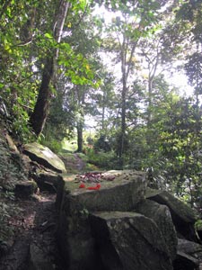
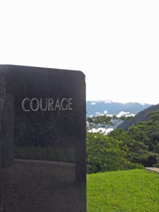
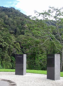
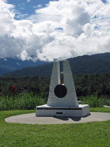
Memorial to the Papuan carriers who served
the Kokoda Track


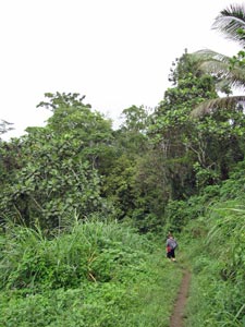
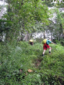
Day 1 - Kokoda to Usurava (14.5km - 1210m ascent – 200m descent)


After a pleasant night’s sleep in the long hut at Orohaven Lodge, the great Trek 813 expedition from Kokoda to Owers' Corner (formerly from Owers' Corner to Kokoda) got under way with a cry of “yumigo” (which should be easy for any pidgin-fanciers to translate). After the obligatory group photo, our leaders, Horace and Brendan led the 11 trekkers (Imogen, Nick and myself, plus Bobbi from South Australia, Jodie from Melbourne, Chris and Shawn from Brisbane, Lisa, Tristan and Gemma from Darwin, and Bill from Perth) and 13 porters off down the track. Low cloud hung over the valley like a heavy blanket, keeping the humidity high but stopping the hot sun from turning the day into a sauna.

We quickly headed away from the airstrip to Kokoda township, briefly following the footsteps of the 3rd Battalion, as they marched through Kokoda in November 1943. However, they were to continue to the battle of Oivi, where the Japanese rear-guard was wiped out and then on to the killing fields of Gona and Buna, where the invading army was eventually defeated. We did an about face and headed south toward the Owen Stanley Ranges from whence they came.


Trek 813 about to head off

Now we would walk the path of the 39th Battalion and later the 21st Brigade as they staged a fighting retreat against a vastly more numerous and better equipped Japanese force. Occasionally, like a clock running backwards, we would meet up with Bill and the 3rd Battalion at particular points of the track (let’s hope they don’t mistake us for the enemy). It would be a different experience of the track to the one we had planned.

At the edge of the village we passed beneath a set of arches marking the official start of the Kokoda Trail – we were on our way.


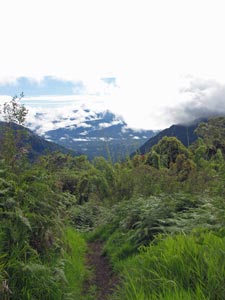
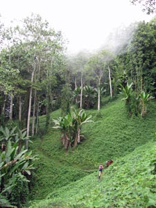
Low cloud over the valley

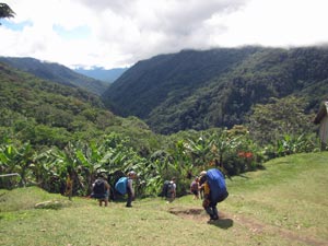
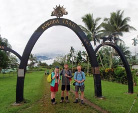
Imogen, Nick and yours truly at the official start

A long and mainly straight 4WD track led us quickly away from the village and up the Yodda Valley. Soon we were passing through an old rubber plantation, the trunks still bearing the old diagonal scars of sap collection, but natural rubber has long been replaced by oil palms as the cash crop of choice. Above us the cicadas set up a steady drone, as people wandered along and chattered. Clearly, we were glad to be on the way.


Easy stroll through the old rubber plantation


The setting of Kovelo village


Sap collection scars on the rubber trees


Heading into the jungle


A massive elkhorn fern


Beneath the oil palms

Leaving the long lines of rubber trees behind, we passed through the thatched huts of Kovelo village, where the track started to climb gently into the rain forest, past garden clearings and small plantings of banana and oil palm, to reach Hoi. The Faiwani Creek was a good place to have our first break as the real climb started from here. At this point, I realised that my shirt was already saturated and we hadn’t even begun to put in some serious work – this was going to be a very damp trek.


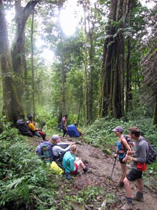
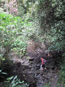
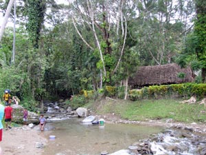
Rest stop at Faiwani Creek
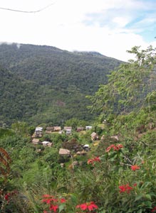
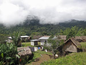
Hoi Village


The first big climb

From Hoi, the track led steeply upwards, taking on the end of a long jungle-clad spur. It was firm underfoot though slightly slippery as we steadily pushed 300m up to a grassy platform at Deniki. It was an uneventful first climb – for all except Lisa that is, who briefly fainted at one point. We still don’t know why, as she was one of the fittest trekkers and, once recovered, pushed on for the rest of the trek without any more problems. Perhaps it was the track just giving us a warning right from the start not to take it lightly. If we didn’t take that one, the small memorial plaque to a young trekker who died there a few years ago, certainly jogged our consciousness.

From the vantage point of Deniki you could look all the way back down the Yodda Valley to the green strip of the runway and nearby Kokoda village. It was not surprising that the 39th Battalion took up defensive positions here to face the Japanese troops that they could see streaming out of Kokoda towards them. Our stay was much more relaxing, being given an hour off for morning tea to laze on the grass and soak up the views, while catching the slight breeze that wafted over this open grassy platform.


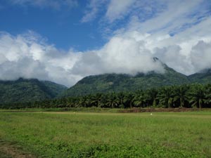
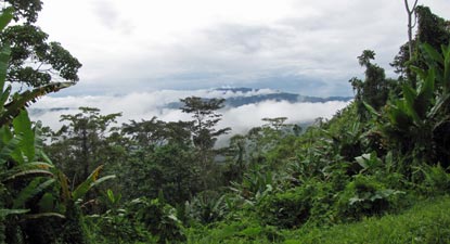
View from Deniki over the cloud-covered Yodda Valley

Then the porters began disappearing up the track and it was time to head on, following a route that undulated and meandered along the flank of a long ridge, between giant tree trunks and beneath a dark canopy of leaves. The occasional openings in the forest were covered in a tangle of choko vines and old vegetable gardens. The path gradually gained height until we crossed a small creek and immediately attacked the slope directly to quickly gain another 200m. Like the tour de France, this climb split the peleton as individual trekkers found their own climbing rhythms.


Crossing the hillside choko gardens

A break in the rain forest ....

.... and then more chokos

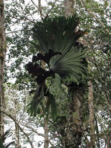
Beside a forest giant


Once on the ridgeline, we followed its winding crest, before crossing a couple of creeks and making one more steep climb. The welcome sight of a banana plantation heralded our arrival at Isurava village, welcome because the cloud was building up and rain was not long away. The campsite here was to be our haven for the night – in a thatch roofed long house rather than tents.


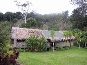
The village square at Isurava

After hot coffee, a shower beneath the icy cold spring-water that flowed out of a black plastic pipe (for those who dared) and a change from sweat-soaked clothes into dry ones, the world seem a better place. Above us the cloud layer hanging on to the forest-covered hilltops slowly descended to envelop us in mist and rain – welcome to the highlands of Papua.


Sleeping hut at Isurava

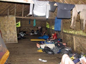
Making ourselves at home
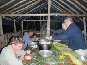
Dinner is ready

Darkness fell quickly and, after a big steaming bowl of spaghetti bolognese and some repositioning of some sleeping bags to avoid the drips that found their way through the thatch, we all hunkered down for our first night together on the track. Hallelujah – nobody snores!


Day 2 - Isurava to Eora Creek (10.5km - 610m ascent – 480m descent)


It seemed a long night. After the rain stopped the chorus of frogs, crickets and insects of the night took over. However, we were greeted by clear skies and a spectacular sunrise – it augured well for our second day on the track. We were off by 7.30am, heading quickly back into the rainforest as the track took us on a long traverse of the western flank high above Eora Creek. Through gaps in the trees you could occasionally look down this deep ravine to the low cloud still blanketing the distant Yodda Valley.


At last no cloud on the peaks

Isurava sunrise

Back into the rain-forest


Early morning over the Eora Valley


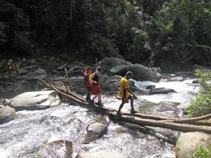
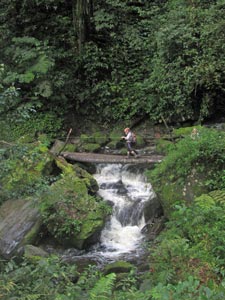
One of several sidestreams to cross

After an hour or so of steady walking, we dropped quickly down to the site of the Isurava Battlefield Monument. It was here, 70 years ago, that one of the defining battles of the Kokoda Campaign took place. The vastly outnumbered 39th Battalion held back the Japanese just long enough for reinforcements from the 21st Brigade to arrive and, together, they stopped the enemy advance for a crucial four days, inflicting heavy casualties. Even though the Japanese eventually pushed the Australians back, they learned that what was meant to be a quick march into Port Moresby was going to be a difficult and costly fight. In fact, it was the start of a month of hell for them, four long weeks which would leave them starving, short on equipment and demoralised, despite winning the individual battles. The memorial was built recently in a beautiful setting – four rectangular slabs of black granite facing down the valley, each carved with a single word ...

         COURAGE    -   ENDURANCE   -   MATESHIP   -   SACRIFICE

... the four pillars upon which is built the legend of Kokoda. It was a place for some quiet reflection on what those four words mean.


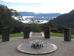
Memorial to the Battle of Isurava (August 1943)


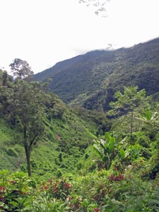
View across the valley from Isurava Battlefield

After some time we left the battlefield site to continue our meandering, undulating traverse beneath the dark green canopy; steep descents to cross the rushing side-streams that plunged down the ravine slope were followed by equally steep ascents to regain the contour, or sharp climbs over spurs were followed by tricky descents. Eventually we picked our way down through the steeply sloping vegetable gardens to reach the village of Alola, perched on the end of a saddle and overlooking the deep green ravine.


Climbing back into the forest


Trackside waterfall


Kunai grass clearing


Sometimes the jungle is not just green


Out of the kunai and into the forest


Looking down the Eora Ravine from Alola


This flat rock was used for battlefield surgery


Alola village

Alola was a good place for lunch – the sun was out and our wet clothing had a chance to dry out a bit. Lunch over, we headed once more onto the track, which descended steeply below the village to pick up the traverse at a lower contour, within earshot of the rushing Eora Creek. The track was getting muddier, but the gnarly roots and rocks gave traction in the short sharp dips and rises that followed in endless succession. We walked, laughed and chatted along a sun-dappled path where once wounded diggers struggled back from the Isurava front in the pitch black of a jungle night. Some made it, some died – were their spirits looking on as we passed so jovially and what would they think? They’d probably say “good on you, enjoy yourselves, after all that is what we fought for”.


The sun shines on Alola

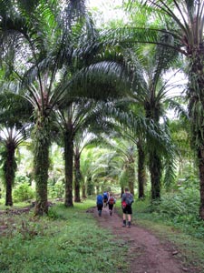
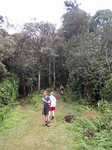
Heading off through the bananas

You rapidly lose spatial perception beneath the dense rainforest canopy and I was beginning to lose count of creeks crossed and spurs climbed until one last descent brought us to the wide boulder strewn bed of Eora Creek in its steep green-walled ravine. A series of logs balanced on the boulders took us across the fast-flowing waters (aided by our porters) and on to the magical setting of Eora Creek campsite.


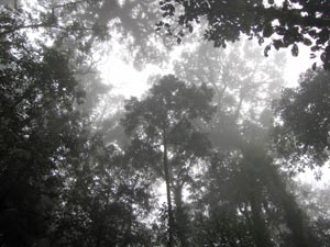
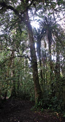
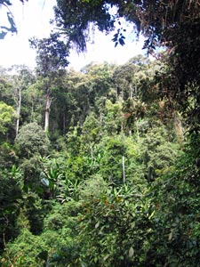
The dense rainforest canopy

A babbling sidestream


Where the tall trees grow

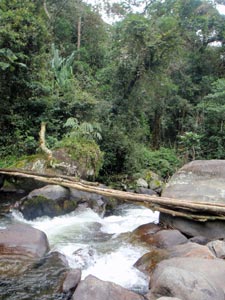
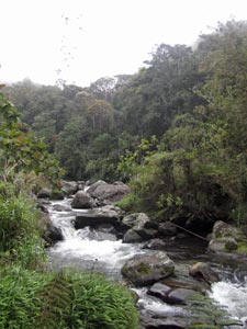
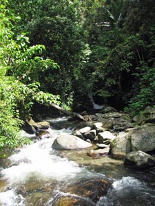
The tranquil beauty of Eora Creek

Imogen crossing the log bridge over Eora Creek

Taken from our swimming hole
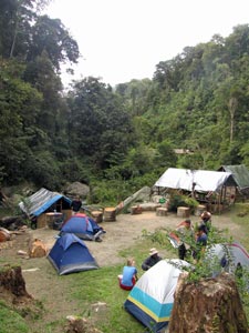
Campsite at Eora

It was only 2pm, but this was home for the night. We pitched our tents quickly and headed down to the creek – my, the water was icy (hard to believe that we were only a few degrees south of the equator), but my, it was refreshing and there were certainly parts of me that needed to be refreshed.

Eora Creek was a wonderful spot to while away the afternoon, as a cooling (and drying) breeze blew up the ravine. So peaceful and beautiful, so impossibly steep and impenetrable the terrain,  it was hard to believe that 70 years ago yet another major battle was being fought here – but this time it was the Japanese trying to hold back advancing Australian troops, as they pushed forward towards Kokoda in the latter stages of the campaign.

That night we ate around an open fire, the smoke drifting lazily about the campsite to the sound of rushing water from the nearby creek. As darkness fell, the shrill pitch of the "six o'clock cricket" announced the onset of the nocturnal chorus of insects and frogs. Occasional flashes of light marked the passage of a firefly and strange scents wafted out of the jungle - civilisation seemed a long, long way away.


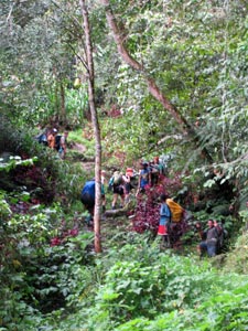
Day 3 - Eora Creek to 1900 Campsite (15km - 1050m ascent – 550m descent)

The night passed slowly, punctuated by the occasional flare of distant lightning illuminating the clouds and a couple of passing showers. Combined with the morning condensation, everything was dripping when we got up at 5.30am – packing up wet tents in the dark is not pleasant, but today we had to get away early as it was time to cross the Kokoda Gap, at 2190m the highest point of the track.

Our morning excitement came in the form of a low flying helicopter descending out of the cloud and circling our campsite before making a pinpoint landing on a tiny area of grass a few hundred metres away – precision flying in this steep-walled and narrow ravine. We were witness to the medical evacuation of a trekker from another party who was apparently having heart problems – yet again a poignant reminder that the Kokoda Track is a tough endeavour.


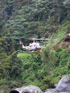
Medical evacuation of a trekker
from another party

Excitement and breakfast both over, we headed off to immediately commence a steep climb up from Eora Creek, passing the vestiges of several Australian weapons pits that had been dug at strategic spots to cover their retreat, and continually nag and slow down the Japanese through rolling ambushes. Soon we were climbing into the mist on a track that resembled a giant’s staircase – flatter sections separated by steep risers of gnarly rooted trees, all beneath a wet and dripping canopy.


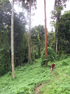
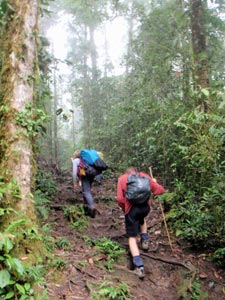
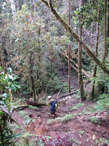
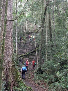
The climb up from Eora Creek begins

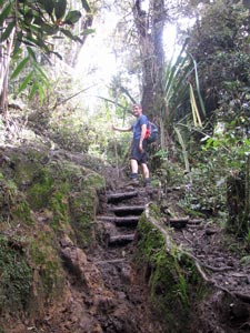
Another steep section

A rare opening in the forest
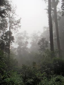
The mists seep in

Without the degree of openness that we had had while traversing a valley wall on the first two days, the forest took on the scent of decay. There was an ethereal beauty as the mist wisped between the tall trees, but I also felt a strange sadness seeping in with the mist in the still and heavy air. Perhaps it was that here we crossed the 3rd Battalion again as they pushed forward during the counter-offensive and I was trying to imagine the emotions of the soldiers in the forward patrols inching along the path wondering when the next ambush might occur. The lead scout was virtually a dead man walking if a well-hidden Japanese was waiting in his circular weapon’s pit. The rest of the patrol would then have to root him out and move on to face the next ambush. Such was much of the fighting on the track and it took three days for the Australians to fight their way from Templeton’s Crossing to Eora Creek. We would take 2 hours. No – I cannot possible imagine their emotions.


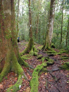
The dark beauty of the rain forest floor

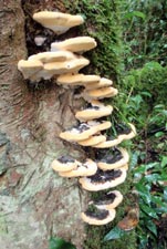
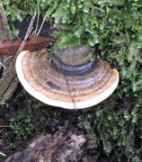
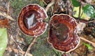
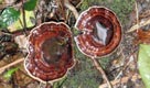
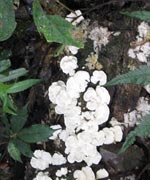
Phosphorescent fungi

Where the light comes in


A massive system of aerial roots


Bridge to Kagi (Templeton's Crossing)

My sombre mood was broken by a quick descent to Templeton’s Crossing for morning tea. As we relaxed at this pleasant spot on the Eora Creek, the cloud began to rise and, by the time we left, the sun was out.  Even a few rays reaching the forest floor seemed to bring cheer.


A rare splash of colour at Templeton's Crossing


Eora Creek at Templeton's


Heading south from Templeton's


Another steep climb out of Templeton’s Crossing, followed by a traverse and steep descent brought us to Dump No. 1, a supply station during the campaign and whose name does it no justice. Here we had lunch in a grassy clearing and spread out our tent flies to dry.


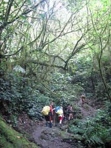
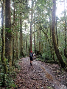
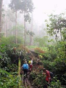
A steep and muddy climb

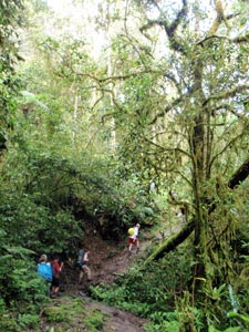
Beneath the lichen-drooping trees

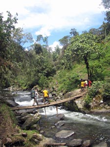
Crossing Eora Creek near Dump No. 1

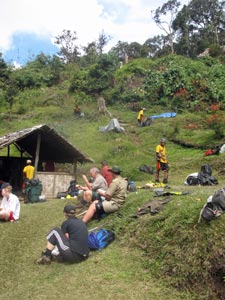
Relaxing in the sun at Dump No. 1


Nick climbing up to Kokoda Gap

The sun was becoming hot and it actually felt good to leave the open and head back into the jungle, where a long and steady climb with several steep and muddy pinches led us up to a small clearing. For the first time we could get more distant views, across to a neighbouring ridge and back down our route towards Kokoda village.


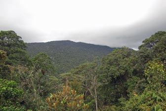
A rare glimpse of the neighbouring ridges

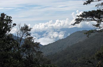
Looking back down our route from near Kokoda Gap

Then it was back into the forest, which had been gradually changing in character – mosses covered the tree trunks and pandanus palms began to appear, propped up by their strange aerial roots. The track was becoming distinctly muddier and, as our gradual climb became a gradual descent, we realised that we had imperceptibly passed the Kokoda Gap.  The high point of the trek was now behind us. Still, there were no views from here, not in this lush dripping forest of giant trees.


In the half-light of the moss forest

Nick contemplates the view

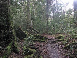
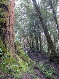
Muddy track through the moss forest

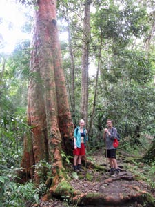
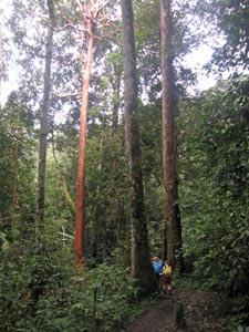
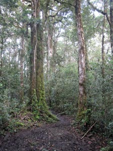
A red-barked forest giant


Every now and again, the overwhelming greenness of the vegetation was illuminated by a splash of colour - a purple flower here, a cluster of orange fruit there, a blue and tan striped fungus below. In some ways their rarity added to the appeal of this landscape.


The descent was a long and gradual one, probably the easiest walking since the road out of Kokoda. As we wandered through the moss forest, a place of ethereal beauty, the afternoon cloud that had been building up delivered on its promise and a steady rain began to fall.


The track begins to flow as the rain settles in


Moss-covered buttress roots

No Kokoda experience is complete without rain and, even beneath the canopy, it wet us through. It seemed pointless putting on wet weather gear – we were already damp from perspiration and the feeling of the soft fresh raindrops was actually pleasant.  However, soon the track began to flow, adding an extra degree of slipperiness to its glistening brown muddy surface.


Finally we reached our campsite at 1900 (or should it have been called 1940? -  my GPS thought so), just as the rain cleared up. Either way, it was a beautiful grassy clearing in the middle of the moss forest, with a shallow creek to wash the day’s toils away. Despite the rain, the porters soon had a fire going and hot coffees were the go. Stoking up a nice smoky fire or two was always the first thing they did on reaching a campsite and is one of the abiding memories of the trek.

Our night would be spent in a rickety thatched hut and to avoid the drips, Imogen suggested that we jury-rig our tent flies on the rafters above us – clever girl! We certainly slept more peacefully beneath them, as the great nocturnal insect sing-song cranked up its volume in the forest round us.


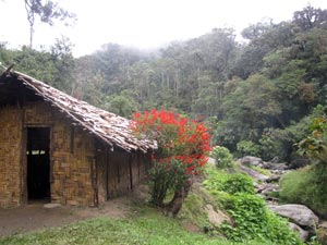
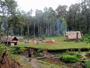
Smoke drifts over the 1900 Campsite

...... go to part 2