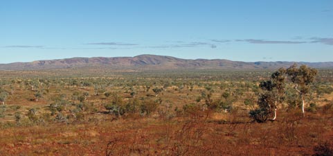
The Pilbara - Karajini National Park

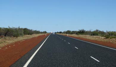
Getting there (from Broome)

The next day we were off again heading across the flat shrubby  landscapes of this sub-Kimberley area on our way to the Pilbara. It would be nice to say it was an uneventful if somewhat boring trip, except that with a dramatic bang, the left rear tyre blew just north of Pardoo Roadhouse. We changed the tyre and headed into the mining capital of the Pilbara, Port Hedland, to get a new spare tyre fitted. By now it was too late to head on; the way our luck was running we would have certainly hit a kangaroo had we pushed on into the night, so we found a place to stay in Port Hedland.

This place is so different from any other town we visited in the north-west, bustling, noisy traffic and long trainloads of iron ore clanking by in the night – and that was just alongside our caravan park. Still, we were lucky  - most accommodation in town is taken up by miners and workers making sure that all those mountains of iron from the Pilbara get shipped off to the smelters of China and Japan and the export dollars keep rolling on back in. I wonder if anyone stays here by choice.

It was an early start the next day as we had half a day to make up. We left Port Hedland with two good memories; the kind people who replaced our blown tyre late in the day and the reminder of the reasons why we had headed bush in the first place.  We were on our way again, the traffic of this port/mining town behind us, but the frequent roadtrains on the highway, full of supplies or ore, a reminder of the basis for this region’s wealth.

Regularly, we passed transportable homes rumbling slowly up the highway on wide-loaded trucks, homes for miners and workers – the global financial meltdown does not appear to have affected life on the ground here too much, the factories of China still hungry for iron.


Between Broome and Port Hedland the highway stretches for over 600km
with only one roadhouse in the middle


Approaching the Pilbara

For a while, the landscape remained interminably flat, but then began to change as we transitioned into the Pilbara. Soon we were climbing a long pass, through dark red cliffs and spinifex covered slopes to reach a plateau of dry rounded hills and stony red soil – welcome to the Pilbara. A couple more turn-offs along sealed roads and we reached our destination – Karajini National Park.


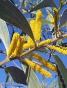
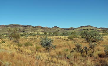
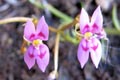
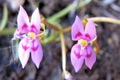
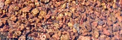
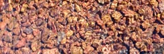
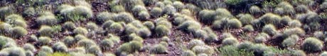
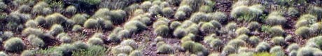
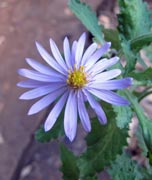
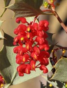
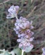
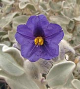
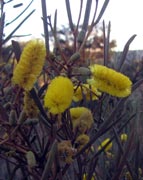
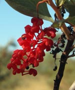
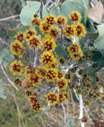
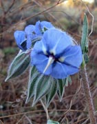
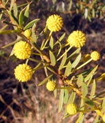
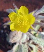
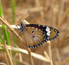
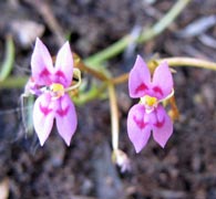
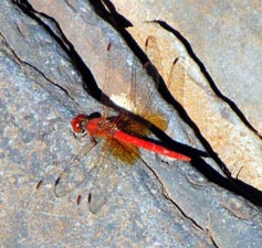
The flowers of the Pilbara are quite different from those of the Kimberley

We set up camp at Dale’s campsite,  pleasantly spread out beneath the scrubby acacias and low eucalypts of this plateau. After lunch, we wandered down to the edge of nearby Dale’s Gorge to be greeted by a spectacular sight; the iron-red, finely-layered gorge walls dropped suddenly from the plateau to the creek bed – white-trunked eucalypts scattered along its rim. Below, the Fortescue Falls flowed down one side of a series of natural steps, a bit like an ancient Greek amphitheatre, except that the stage here was a beautiful, clear, reed-fringed and icy cold plunge pool. It was time for the play to begin, so we jumped in to join a couple of other cast members who had braved the water – bracing stuff! The pools of the Pilbara are certainly a few degrees cooler than those of the Kimberley.


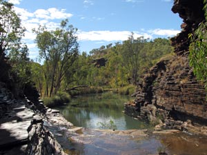
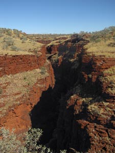
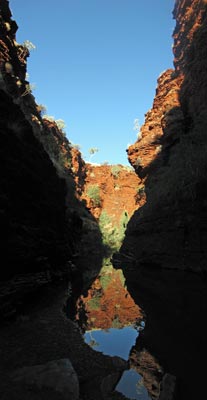
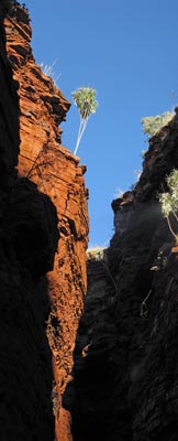
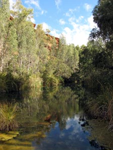
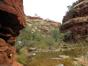
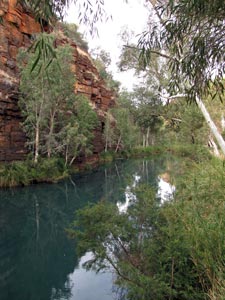
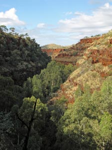
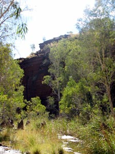
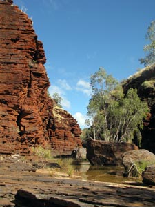
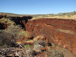
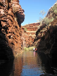
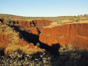
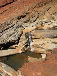
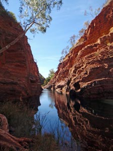
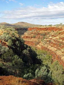
Looking down Daley's Gorge


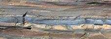
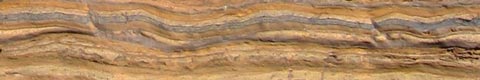
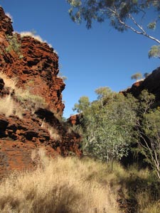
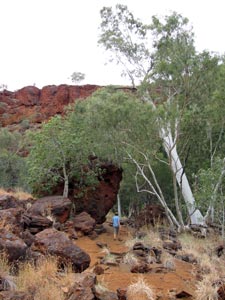
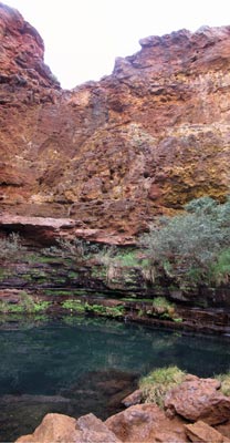
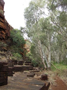
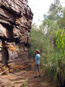
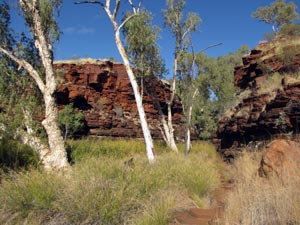
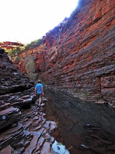
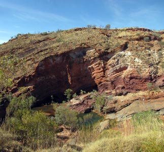
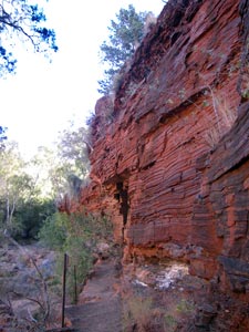
Track beneath the iron rich layered walls

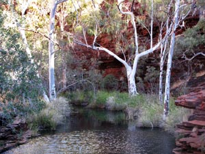
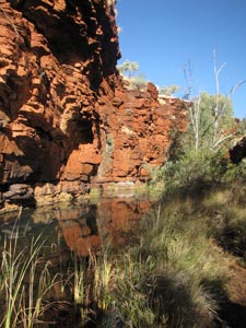
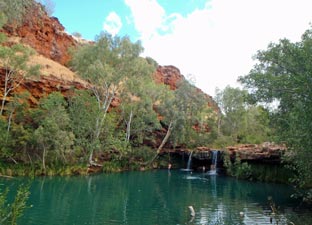
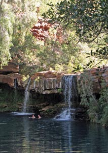
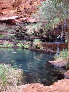
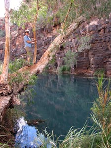
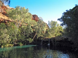
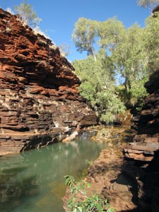
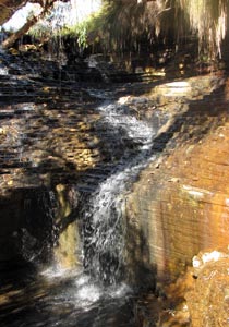
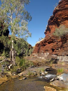
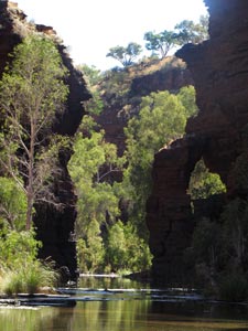
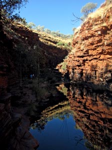
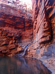
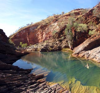
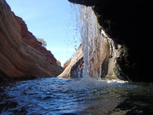
Tranquil pool above Fortescue Falls

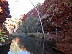
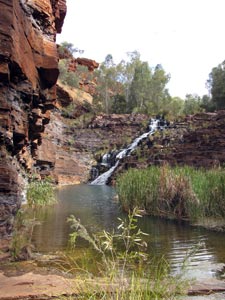
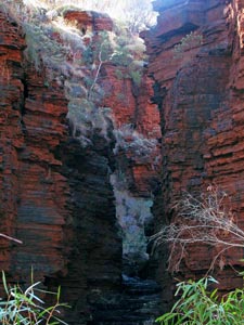
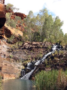
Fortescue Falls tumbling down the rocks
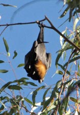
Fruit bat at rest


Brightly coloured honeyeaters flitted by as we then wandered further up the gorge, while high above a colony of fruit bats squabbled in the river gums. After a few hundred metres, we reached Fern Pool, an even more beautiful turquoise-colored waterhole, lined with lush vegetation, backed by sunlit red cliffs and fed by a small twin waterfall. Behind the falls, a small ledge was filled with bright, soft green ferns – giving the pool its name.

It would have been a very tranquil setting, but for the fact that the water here is warmer and a dozen or more people were happily splashing about and enjoying themselves. What the heck – we joined them. It would be very hard to come here and not have a swim.


White-plumed honeyeater


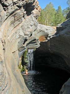
Fern Pool (aka Jaburu)


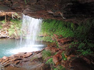
The ferny grotto behind the falls that gives the pool its name

Close up of the twin falls at Fern Pool

That night, we enjoyed our saucissons et legumes on a bed of pommes de terre puree (aka bangers and mash) with kiwi fruit and a fine merlot, beneath a bright and starry sky, wearing jackets for the first time since we started our adventure. We were heading south and our gradual acclimatisation to the southern winter had begun.

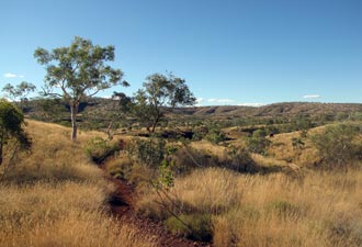
Dale’s Gorge Walk (7 km)


We did not hear the usual dawn chorus of birds this morning, but a much more visceral greeting to the new day. Around 5am, a pack of dingos wandered through the campsite, their low whinings reaching a multi-voiced crescendo of harmonious howling somewhere near our bushcamper. I knew that dingos didn’t bark, but I didn’t know that they sang.

Our second surprise came upon awakening. The stars had been replaced by a grey overcast sky and, what was that strange sound on the roof – the soft pitter patter of raindrops.

We hung around for a while, had a cuppa and, when the odd light showers appeared to have ended, we set out on our exploration of Dale’s Gorge. Our bushcamper was in the “Euro Loop” of the campground, so we headed out from there to pick up a wide, gravelly red track that led us through the yellow spinifex seedheads, past shrubby acacias and white-barked snappy gums. Several of the acacias were flowering; golden and reddish balls, or spikes of fragrantly perfumed blossom. Red holly-leafed grevilleas, blue and purple solanum, and several low herbaceous plants were also in bloom. The day was bright despite the grey skies.


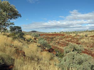
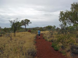
Red gravel path heading across the spinifex plain


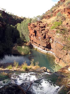
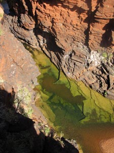
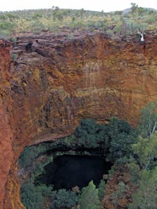
Looking down into the depths of Circular Pool

We soon reached the gorge rim and a viewing platform looking directly down onto Circular Pool 60m beneath; a dark blue waterhole at the end of a side-gorge. How inviting it looked at the base of those rich red cliffs! We headed on, following the track to another viewpoint “Threeways Lookout”, overlooking the point where the side gorge merged into the winding Dale’s Gorge.


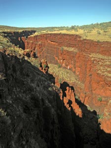
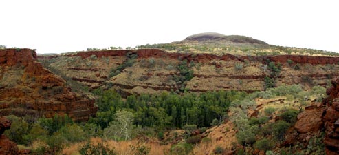
View over Dale's Gorge from The Threeways Lookout


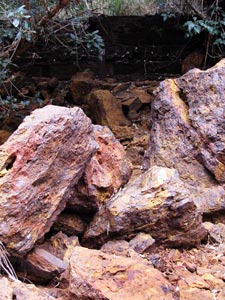
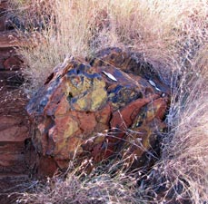
The track led through a jumble of dark brown boulders

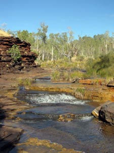
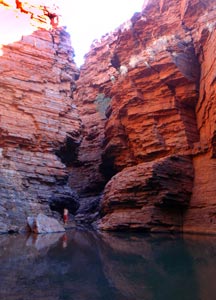
A little way further on we found what we were seeking – the route down. A series of stone steps led us down the steep gorge wall to reach the creek at the bottom of the side gorge – an amazing landscape of flat rock plates, seemingly stacked to create a series of terraces, on which lay huge amorphous boulders that had fallen down from above. We followed a set of yellow dots across the blocks and terraces, past the boulders and up the tree-lined stream to reach the sanctuary of Circular Pool. It was even better than when viewed from above.


Creek spreading out over the flat rocks


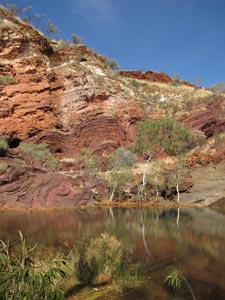
The clear blue waters of Circular Pool

Set in a grotto with sheer rock walls on three sides, the fourth barricaded by  a jumble of pastel-tinted boulders, lay a deep blue, crystal clear and glacial pool, fringed by trees and ferns and spring-fed by a gentle waterfall trickling out of the cliffside. The structure and composition of the rockwalls was fascinating – red from afar, the layers were comprised of different shades of red, yellow, blue, grey and tan.


The rock had shades of pink and blue ...

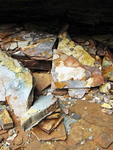
.. and orange and yellow and grey - amazing!!

Great place for a clear cold dip


The water may have been frigid, but it was too inviting – we quickly changed into our swimmers (beneath a tree so as not to provide amusement for any people above us on the viewing platform) and slipped in – it was the cold that makes your skin tingle and your body feel glad it’s alive – deliciously glacial. Clearly, the sun rarely reaches this secluded hideaway.

For us, Circular Pool was the best of the beautiful waterholes in this gorge system and it was difficult to leave. We eventually retraced our steps back across the terraced streambed, past the junction of the path down into the gorge and on to where the side gorge opened out into Dale’s Gorge.


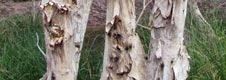
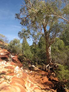
Paperbarks against the cliff face


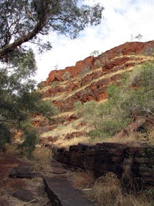
Looking up the tiered gorge wall


Eucalypt on the clifftop

From here, the track led us westward along a relatively flat path wedged between the cliff walls and a stream lined with tall paperbarks and eucalypts; a good place for lunch, listening to the birds in the treetops and shrubs lining the water.


Hugging the cliff wall to squeeze past a waterhole

Crossing the shallow stream on a set of stepping stones, we resumed our route up the gorge, past reed-fringed waterholes, gentle cascades, always clinging to the base of the magnificent rock-walls. At every step there was something to interest or fascinate; a flash of yellow as a honeyeater flew by, butterflies flitting amongst the tall grass, a black termite tube heading up the white barked trunk of a eucalypt, the flaking sheets on the trunk of a paperbark and, always, the ever-changing patterns of layering and colours in the rockface.


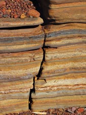
Checking out the structure and ....


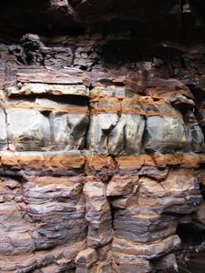
...colour of the rock face

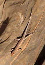
Strange creature in a tree

Yet another limpid green pool

Back to Fortescue Falls

Then suddenly, we emerged into a familiar scene. We had arrived at the downstream end of Fortescue Falls, looking at it tumble down its terraces from across the plunge pool. By now the sun was starting to break through the cloud to light up the falls and their surrounds.


Looking over the pool from the top of the falls

We skirted around the pool to spend some time contemplating it from the rock amphitheatre steps, before heading onto Fern Pool (or Jaburu as the local aboriginals know it). It was our last chance for a swim in this beautiful setting with the twin waterfalls flowing into a long turquoise pool.


One last swim in Fern Pool


The open landscape of the gorge rim

Climbing out of Dale's Gorge


View down our path along the floor of the gorge

Then it was back again to the top of Fortescue Falls, before climbing up and out of the gorge along a track lined with grey-needled callitris pines. The track then led us back along the open landscape of the gorge rim, from where we could look down on our path just traveled. When the sun appeared the red rock walls glowed, but there was a battle going on up there and, in the end, the clouds won the day. By the time that we had reached “The Threeways Lookout” to complete the circuit, the first drops of rain began to fall. Still, it was warm and the shower was light, not unpleasant walking at all, though we were pleased to see the awning of our bushcamper and brew up a nice hot coffee.


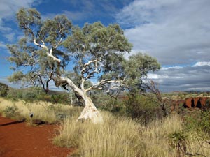
Classic outback photo


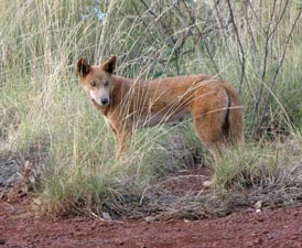
The dingo who sang in the night

The walk as we did it was only 7 km long, but that distance packed in a wide variety of landscapes, open plateau, gorge rim and in the gorge itself. This circuit has to be one of the best short walks in the country ....... and, to cap off an extraordinary day, as we were having our glass of merlot and avocado on crackers that evening, a pair of the singing dingos sauntered by – superb!

Kalamina Gorge (3km)

Overnight the dingos repeated their serenade, but much further from our campsite. The clouds had slowly disappeared and the sun was back by dawn along with a heavy dew. Thousands of dew-dropped spider webs were sparkling in the early morning light - delicate cups in the spinifex, silken chandeliers strung in branches and silvery shawls draped between trees. It was amazing to see just how many spiders there are in the bush.

We were also joined for breakfast by a female dingo, which curled up and had a nap at our feet as we ate our cereal. On the downside, our front tyre was flat, which delayed our departure, but eventually we got away and headed off down the wide red gravel roads of Karajini - our goal to explore some of the other gorges of this picturesque national park.


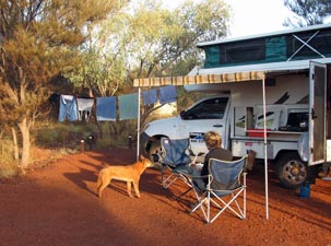
A dingo joins the fair Nello for breakfast
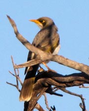
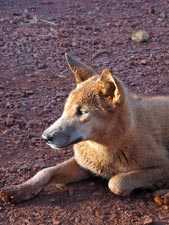

Karajini dingo

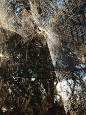
Spider art - the shawl ....

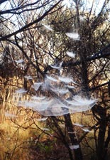
.... the chandelier ...

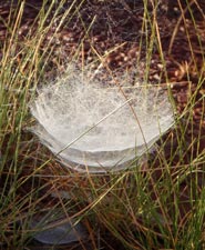
... and the tiered cups

Entering Kalamina Gorge


Waterhole at the head of Kalamina Gorge

The first was Kalamina Gorge, with walls of ca 30m high, not as deep as Dale's, but with its own charms. We descended the stone steps that led us to its floor, making a short detour upstream to visit the waterfall percolating down a wide rock stairway. A few metres further, the stream cascaded over a small rock ledge into a long translucent green pool.


View down the top of the gorge from the falls


The tiered course of Kalamina Falls

Below the pool, the gorge opened out into a broader basin, where soft grasses and reeds grew along the boggy watercourse that meandered its way across a gorge floor, comprised primarily of flat rock slabs. The vegetation wedged itself into the cracks on the rock or clung to the shallow patches of gravelly soil.


The stream flowed across a bed of flat rock...

... before entering a narrow gorge ..

... past still waterholes ....

... and swampy bogs lined with paperbarks


The rugged red walls soon narrowed and the stream flowed shallowly across a bed of rock. Warmed by the sun, it was an ideal environment for the algae which thrived and gave the water a greenish tinge. We stopped to investigate and admire the amazing colours in the sedimentary bands of rock. Beyond this constriction, grasses and sedges again appeared and a couple of narrow side-gorges split the walls to emerge into Kalamina.

The path clung to the rocks at the base of the cliff, crossing the swampy bed of the stream a couple more times to eventually reach a long pale green pool. At its far end, the gorge walls constricted again to reveal the silhouette of an arch - we had reached Rock Arch Pool and the end of the track into Kalamina Gorge.


Kalamina gorgescape

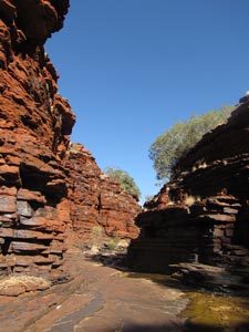
Sunlight on the layered rock walls

The gorge narrows at Rock Arch Pool

The intense red walls of a shady side-gorge

Having become connisseurs of rock pools, we deigned not to swim in the slightly soupish waters of this algae-rich pond and simply admired the setting before retracing our steps. The sun was now behind us and, with its rays illuminating the rich colours of the gorge walls, the return was even better than the outward journey.

Joffre Gorge


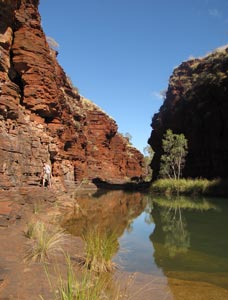
Joffre waterfall tumbles over 100m down
into the gorge

From Kalamina, we headed on, stopping briefly at a lookout over Joffre Gorge and its long waterfall. Joffre was on a different scale to the gorges that we had visited thus far, reaching a depth of over 100m. It is part of a system of very deep gorges in the Weano Sector of Karajini and gave us a preview of what we were going to explore; our appetites were duly whetted.


Karajini landscape


Looking 100m down onto the green waterhole
at the bottom of Joffre Gorge

We quickly set up camp at Karajini ecolodge, a little further on and on the western side of Joffre Gorge and then headed off to Weano to explore the big gorges.


Hancock-Weano Circuit (5km)


Deep shadows invading Joffre Gorge


There are a number of tracks in this area and we combined some to create a mini-circuit of the gorges. The first stop of our walk was the Junction Pool Lookout, 100m directly above a long waterhole at the intersection of Joffre, Hancock, Weano and Red Gorges. Less than 50m further on, Oxer Lookout gave an impressive panorama of this meeting of gorges.

We could see right up the deeply shaded throat of Joffre Gorge, following it as it merged into Red Gorge, aptly named as the sun lit up the higher parts of its walls in brilliant shades of red. Behind, to the north, the narrow cleft of Weano Gorge meandered down through the rolling spinifex hills to open out into Red Gorge. Behind, to the south, Hancock Gorge similarly curved its way to merge with the others - overall, an incredible display of the power of running water.


View of Red Gorge from the Oxer Lookout


Nearing the rim of Hancock Gorge

We wandered back along the ridge in between Hancock and Weano Gorges, before turning south to follow a path that led, increasingly steeply, down into Hancock Gorge. A metal ladder on the rock wall quickly took us the last few metres down to the gorge floor.

From the bottom of the ladder, we followed a series of well-spaced yellow dots, skirting a long reflective waterhole via a narrow ledge. The dots soon turned to blue (the walks here are colour-coded to indicate the degree of difficulty; green is for anyone, yellow is rougher, blue is getting seriously difficult and red means only expert well-equipped canyoners should proceed).


A red, yellow and blue rock - only in the Pilbara

The gorge walls gradually narrowed and we reached a point where we had to take off our sandals and wade through a thigh-deep waterhole in a passage only a few metres wide. It was only the start - the next waterhole was narrower, longer, deeper and colder - it was time to leave our packs, change into our bathers, and brave the icy water if we wanted to see more of this gorge.


Descending the ladder into Hancock Gorge


A still dark pool in Hancock Gorge

The path follows a narrow terrace alongside the pool

Emerging on a stony beach that transformed quickly into a small rocky cascade, we reached a small sunlit chamber. Here the stream sped rapidly down a narrow rock chute less than a metre wide, bubbling its way into the unseen depths of the gorge beyond - we had reached a section called "the spider walk" for the manner in which it has to be negotiated. Only having wet bare feet for traction, we called it a day. From here, exploration of Hancock Gorge enters the realm of the canyoner, equipped with wetsuit, helmet, ropes and rubber boots. Still, it was incredible to have come this far and to really appreciate the beautiful sculpture of water on stone.


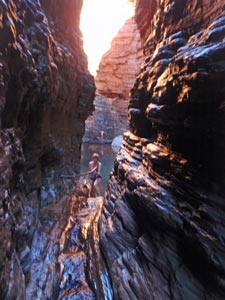
Wading through the first narrows


The fair Nello swims through the second narrows

The aptly named Spider Walk

Dried and changed, we retreated from Hancock Gorge and set out to explore neighbouring Weano Gorge. Instead of dropping directly into it, we followed a track outward along the spinifex covered slopes that line its rim, past giant termite mounds and small shrubby acacias with sweetly scented golden blossoms. This led us to the upper section where the gorge was just beginning to deepen, its wide floor covered with grasses, sedges and paperbarks that lined a marshy stream.


A stroll across the spinifex


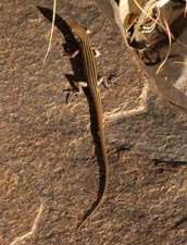
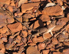
Well-camouflaged dragon

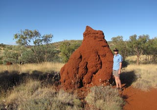
Nello and the giant termite nest


Entry to Weano Gorge


Reflections in the darkness of Weano Gorge

The yellow dots took us deeper into Weano, passing several waterholes that reflected its rich red walls when the the sun broke in. These walls became narrower and higher as we penetrated further, until we finally reached a point where the waterhole blocked the width of the gorge floor - sandals off and a cold wade.


A tranquil tree lined pool in Weano


On the track again after a bit of a wade

At the next waterhole, we inched our way around the base rocks to reach a point where the gorge narrowed dramatically and the stream disappeared into a narrow crack. This was the point to leave packs, don swimwear and enter a world of red - we followed the stream into the crack, skirting a small 5m diameter pool to enter an even narrower slot, less than a metre wide and 50m below the gorge rim. The stream at our feet raced down the narrow rocky chute to disappear out of the opening at the end of the crack.


In the Upper Weano Gorge


Sunlight on the gorge walls

When we reached the end of this slippery passage, we could see that it had tumbled down a 5m waterfall into a wide and deep circular pool, lined with sheer sunless rock walls. In the strange reflected half-light, the walls seemed redder than ever. We had reached Handrail Pool and it was an eerily beautiful sight. The way down into this barren amphitheatre was via a metal hand rail (hence the name) and then a knotted rope.


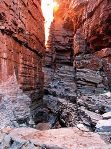
Narrow chute deep in Weano Gorge


Nello exiting the chute ...

... to reach Handrail Pool


The gorge continues at the end of Handrail Pool

The water of the pool was frigid and we hesitated, but you don't come this far without swimming - not so much for pleasure but for achievement. It was a very short dip and getting out was better than getting in. At the far end of the pool, the gorge continued into another narrow water-filled crevice and on to eventually join the water flowing down the other gorges. We left it to run its course and, hauling ourselves up the knotted rope, retraced our steps to climb out of the gorge via a set of stone steps and complete the circuit back at the Oxer Lookout carpark. We were just starting to warm up by the time we arrived.


Walks end - back at Oxer Lookout


Heading back to camp across the Karajini savannah

What an incredible landscape these gorges form - we were left with a sense of awe at their raw beauty and the power of the forces that created them. We were still waxing lyrical about our day as we ate our last candlelit dinner under the intensely bright stars of a Karajini sky.

Hamersley Gorge

It was good to see the sunrise as, for the first time on our trip, we had felt cold as we slept; the clear night sky had sucked the warmth out of the land. However, the morning warmed up quickly and we were on our way, making a 50km detour to the mining town of Tom Price to get our flat tyre repaired - strangely, it did not have a puncture - the outback is full of mysteries. Still, it gave us a chance for cappuccino and emails.


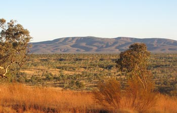
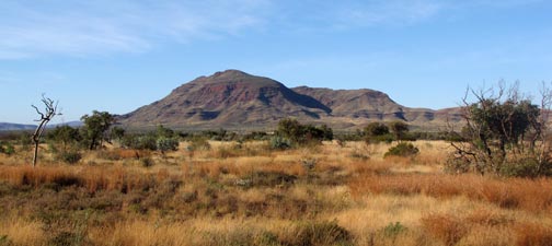
Mt Bruce - at 1235m the second highest mountain in Western Australia

Heading north, we had one last stop in mind - one last gorge in Karajini - Hamersley Gorge. Hamersley is very different again, not as deep, but with multi-coloured walls that showed dramatically the tortuous folding of the sedimentary layers that form the rock here. To cap it off, Hamersley has a series of easily accessible pools within a very short distance.


The twisted layering of the rock strata in Hamersley Gorge


View downstream into the gorge proper

A cool dip in the top pool

The uppermost, a tiny 2m diameter spa pool beneath a small waterfall set in a smooth-sculpted rock channel lined by jagged, tilting shards of layered shale, flowed into a clear, deep green rock pool. Several cascades, further down, the stream formed a long waterhole, shallow at one end, but becoming very deep and cold as it entered a narrow section of the gorge. It was a particularly pleasant spot to spend an hour or two before heading on.


Spa Pool in the sloping rock slabs


The fair Nello has a spa

The gorge above the spa pool

The main waterhole at Hamersley

View from behind the spa falls


View from beneath the spa falls

The long pool in Hamersley Gorge


Looking back towards the main Hamersley Gorge

Thus, we finished our time in Karajini with a spa, a cool soak and a one last couple of laps between the red rock walls that had become so familiar over the past few days.