Canoeing the Ord

The Ord is the biggest of Australia's northern rivers. In the wet season it carries a massive amount of water from the Kimberley out to the Indian Ocean, cutting through the rugged Carr Boyd Ranges on its way. In 1971, a dam was built in a gorge of these ranges to store and make use of the water for irrigation and power. Thus was born Lake Argyle, 18 times the size of Sydney Harbour and Australia's largest man-made lake. It is a magnificent body of water and also means that below the dam wall the Ord River now flows at a fairly constant level through gorges and landscapes not accessible by vehicle. The best way to explore this area is by canoe, a 55km trip from Lake Argyle to the town of Kununurra. We spent the night in town, where we hired a canoe and equipment from Go Wild Adventure Tours, and next morning headed back out to Lake Argyle with Maka and Bec in their minibus. Stopping at the picnic area below the dam wall, we quickly packed our gear into the canoe and secured the load ... ahead lay the gorges of the Ord and it was time to explore.


Morning view over a small part of Lake Argyle and the dam wall


Looking down the Ord River below the dam wall

Ord River Dam to Cooliman Camp (23 km)

Farewelling Maka and Bec, we pushed off from shore and, aided by the strong flow of the three valves of the Ord hydroelectric plant, headed quickly downstream away from the dam wall holding back all 10 million megalitres of Lake Argyle. Maka had pointed out that, if it broke, we would be in Kununurra in 25 minutes! We were planning a more leisurely three-day trip.


Water surging out of one of the dam valves

Tall red sandstone cliffs lined either side of the river as we got into a steady rhythm of paddling. It was a good morning to be out; a bit of cloud to keep the heat of the sun off, a breeze at our backs and the soft twitters and piping of the bird species that lived in the trees and reeds lining the river's banks. Egrets and cormorants sitting on branches overhanging the river watched us pass by.


The expedition is underway

Egrets on the river's edge

The sheer red walls of the Ord Gorge

Following a large curve through the gorge, we emerged into a more open reach, lined with gently sloping spinifex covered hills to the east and flatter terrain to the west. At times, our view consisted solely of the reeds growing out from the bank. The channel narrowed and the current flowed more quickly to sweep us past overhanging paperbarks and the odd freshwater crocodile, startled by our sudden appearance.


A broad reed-lined reach of the Ord


Paperbarks in a narrow rapid section of river

Osprey checking out the passers-by

Again the river opened up as it curved around a broad bend with spectacular views of the rugged ridgelines ahead. Brightly coloured bee-eaters flew from tree to tree, a flash of metallic blue skimmed across the water in the shape of a kingfisher and a majestic osprey deigned to watch us pass by from its perch on a dead tree before soaring off into the distance. The river was showing us its magic.

Passing two sets of pandanus and tree-covered islets, first on the right, second on the left, we turned southwest and into the face of the breeze. However, the river current and a few extra paddles brought us around the next curve to again head northward - it is much better paddling with the breeze than against it.


Upper Ord riverscape

Passing a low mudstone cliff, we began to hear chattering sounds from ahead and soon found ourselves alongside a colony of flying foxes, suspended from tree branches along the river bank, squabbling continuously amongst themselves as they passed the day away, contemplating their next nightly feed of fruit.


Flying foxes hanging out with their mates


At last a sandy beach - time for lunch


The river is home to lots of freshwater crocodiles

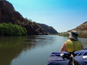
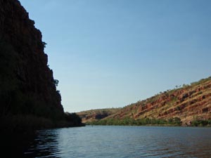
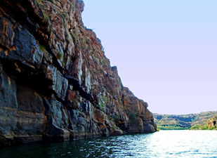
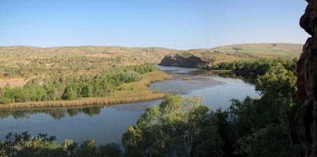
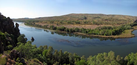
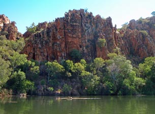
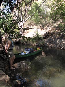
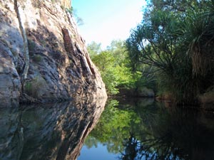
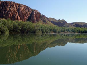
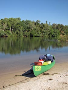
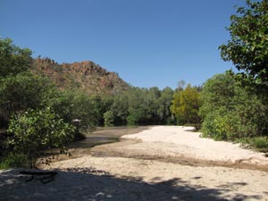
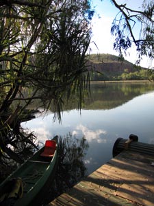
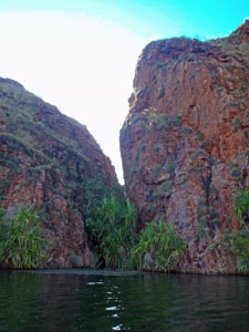
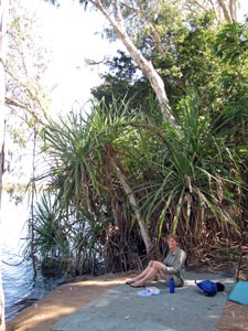
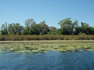
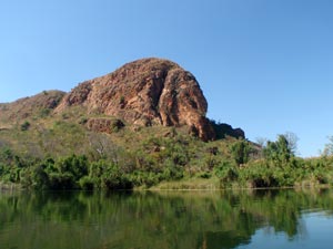
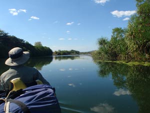
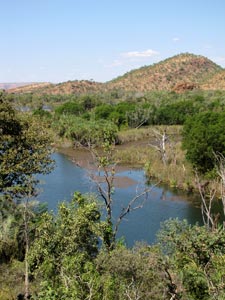
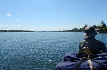
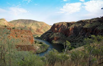
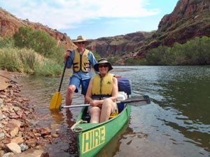
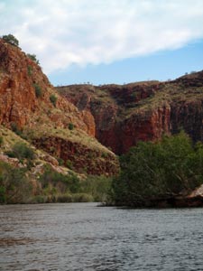
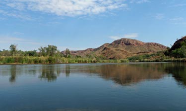
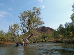
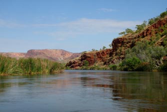
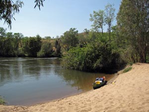
Paddling on through faster and slower sections of water as the channel narrowed and widened, we eventually came to the end of a long island. The true channel on the eastern side swept us quickly around (it was the nearest there is to a rapid on the Ord) to bring us out at a small sandy beach on the northern end of the island. After two hours of paddling, we declared it time for an early lunch break and siesta in the soft sandy shade of a paperbark tree.


Hot still day on the Ord


The cliffs of Carlton Gorge loom large

By the time we were ready to head on the cloud had burned off, and the sun shone hotly as we climbed back into the canoe to head downstream again - the atmosphere was languid with red and blue dragonflies scooting across the river surface as we rounded a slow tree-lined bend, disturbing a couple more freshwater crocodiles that were floating with only their eyes and snout visible above the surface.

Another long bend brought us northward and into the entry of the Carlton Gorge, a long passage where the cliff face of polished red sandstone plunged down into the river; tall enough to hide the early afternoon sun. We drifted slowly along the western edge of the river, appreciating the cool dark shade of the gorge wall and the scattering of blue and pink flowering nymphea waterlilies.

Gradually the cliff line faded away as Cooliman Creek flowed in from the east. Ahead lay the distinctive shape of Pelican Rock - the beacon for our campground for the night. The reflections of the orange-walled cliffs behind Pelican Rock in the still waters of the reach were amazing.


The cliffs of polished sandstone provided some welcome shade

Reflections at Pelican Rock

Pulling into the small floating jetty at Coolamine, we unloaded and headed up to the campsite, set in a shady grove of trees, with sleeping pads, BBQ, gas burners, sheltered table, spring-fed water supply and shower and toilet built like a throne above the river - very comfortable and welcome after a long day in the canoe. We celebrated our first 23 km on the Ord River with a cold beer from the esky.


Coolamine campsite


Osprey surveying its domain


The late afternoon redness of the escarpment


Evening view back up the Ord toward Carlton Gorge

After setting up, we did a short but steep climb up past a curious chimney in the rock face, home to a squadron of dragonflies and a small colony of insectivorous bats, to the top of the sandstone ridge behind the campsite. From its rugged and spinifex covered heights, the views both up- and downstream in the late afternoon light were superb - a fitting end to our Ord River introduction. We had the campsite to ourselves that night and slept the good sleep of the physically tired, soothed by the sound of the insects and frogs, plus the occasional shuffling of a curious macropod.


Cooliman Camp to Stonewall Camp (9km)

Dawn arrives early on the Ord and with the dawn comes the chorus of birds that inhabit its tree-lined shores. Unlike yesterday, there wasn't a cloud in the sky and barely a breath of wind. After breaking camp and loading the boat, we climbed back up to the sandstone ridge for a second look at the sweeping panorama from its heights - very different in the morning light with a reversal of light and shade on the cliff faces. The osprey on the rocky crag that we had spied yesterday evening was there again surveying its domain.


Morning view of the Ord from the escarpment

Entry to Pelican Rock Creek

Even though the climb was short, we were already sweating, so what better way to cool off than a quick paddle around the corner and into the still shady waters of Pelican Rock Creek. We tethered the canoe next to a small cascade and followed the creek for a few hundred metres further up the gully, passing a series of deep clear pools and gentle cascades beneath a narrow canopy of rainforest trees, until we reached our objective.

Just before a low rocky gorge lay a perfect little rock pool at the base of a small spring-fed waterfall, shaded by the overhanging branches of a tree and guarded by the webs of orb spiders. The sun was just creeping over the edge of the rock walls and the cool clear water of the pool was wonderfully refreshing - the perfect place for a skinnydip!


Canoe tethered in Pelican Creek


The fair Nello takes a dip beneath the waterfall


The still waters of Pelican Rock Creek

We lingered until the sun found our shady rest spot, signalling it was time to move on - back out into the river for a 3km paddle along a broad reach, weaving our way around the thick mats of water weed.

The canoe glided across the still reflections of cliff and river verge, and over a strange meadow of water weed. The long straps of weed, leaning gently with the current, were sometimes covered with filamentous green algae, giving the illusion of passing over a miniature subaquatic pine forest.


Reflections of cliffs and riparian forest

Soon we noticed a stump in mid-channel, marking the entrance to another creek flowing in from the west. We pulled in and tied up beneath a large overhanging paperbark on the left side of its entrance. From here, a slightly overgrown track led us higher up the creek for 20 minutes, past vine-covered trees, through thick grass, beneath a canopy of rain-forest trees and pandanus to a point where the two lines of sandstone cliffs merged on either side. Suddenly, we were at the end of the cleft, surrounded by sheer red 60m cliffs and greeted by the sight of a silver stream of water cascading 30m down into a large deep plunge pool below. We had reached Herbie's Hideaway and immediately thanked Herbie for finding it - an idyllic spot to pass an hour or more, swimming in the deep, crystal clear pool or having an invigorating hydrotherapy session beneath the tumbling water of the falls.


Snakebird on the marker stump

Vine-clad forest on the track to Herbie's

Herbie's Creek in a sliver of rainforest

The idyllic Herbie's Hideaway

From Herbies, we again pushed onwards, wending our way between mats of floating weed for a further 3km to reach a sandy bend in the river. Sandy Creek trickles out here through a series of shallow channels lined with figs and paperbarks. Sand is a precious commodity on the Ord, so we stopped here for our lunch break and siesta beneath the dense shade of a fig.


Stopped at Sandy Creek


Just another superb Ord riverscape

Sandy Creek trickling through its bed of white sand


The pier at Stonewall campsite


Ord River catfish

The sun was getting hotter and, even after a siesta (or perhaps because of it) our energy felt drained. It was an effort to set off again on the Ord, paddling towards a blocking line of red cliffs. These forced the river to flow eastward, taking us into the face of a breeze.


Ord River reflections (from Stonewall campsite)

However, our incentive was already in sight, at the gap where the large Stonewall Creek flowed out into the Ord. It marked our second campsite for the trip, a drier habitat exposed to the north, but with large shady trees, sleeping pads and a large shaded octagonal eating/cooking area. Once again, the late afternoon reflections were superb and the beer was still cold in the esky.


The northern bowerbird ...


... and his stone-decorated bower

Sleeping pad at Stonewall campsite

It had been another great day on the river and that night we ate by candlelight using the reo-modernist welded candelabra (there is a nice touch of this artwork at both campsites) before heading down to the jetty. With nary a breath of wind and a moonless sky, we lingered there watching the unfamiliar stars in the northern sky twinkle as their reflections in the glassy river surface twinkled back; a merging of sky and water - magic!


Stonewall Camp to Kununurra (23 km)

The dawn chorus of river birds woke us and we got up before the sun had risen above the ridge across the entry to Stonewall Creek - today would be a long day of paddling, as we had the same distance to do as the first day but with a much slower current. We were on the water by 7am, pushing northward with a gentle breeze at our backs. It was very pleasant, but that did not stop us seeking out the deep shade of the eastern bank, where the red sandstone cliffs plunged straight into the deep waters of the Ord. We paddled slowly here, giving us time to admire the structure of the cliffs, with its blocks, crevices, gaps and overhangs, any available nook colonised by a tree, shrub or clump of spinifex.


Sea eagle soaring high


That's how the light gets in


Morning tea at a river landing


In the morning shadow


More reflections of a rocky shoreline

After a couple of kilometres, the cliff-line faded away as the river took us in a north-easterly direction. Here we passed a section of flat densely vegetated shoreline, the drainage area of Rainforest Creek - we located the hidden entry to the creek, but not wanting to haul our canoe over the log that guarded it, pushed on. Soon, a new cliff-line of red, chunky sandstone appeared on the western bank. It was home to a colony of brushtailed rock wallabies, but the local residents did not deign to show themselves as we passed.


Ord riverscape in red and green

Rock wallaby habitat

The river was now becoming quite wide as the effects of the Diversion Dam downstream came into play. A brisk breeze at our back pushed us on as we paddled across the underwater forests of water weed - no longer the thin strapped species of higher upstream, but one with a more leaf-like shape. The landscape about us was becoming increasingly flat and signs of civilisation were appearing. The intake pipes for irrigation water came up on our left and small moorings of private landholders started to appear on the right. We veered slowly across to the western bank and took advantage of one of these landings for a break, watching the bee-eaters and flycatchers hawking for insects above the water.

The day was beginning to get quite hot as we pushed on once again - striking a steady rhythm of paddling on the sluggish broad river waters - it was a long haul with little to see above the trees lining the river - a time for reflection and meditation to the steady rhythmic splash of the paddles. Slowly rounding another wide bend in the river, we passed through a mat of flowering water lilies, wide footed jacanas stepping from pad to pad in search of insects.


Fringe-flowered waterlilies


Water lily mat and reed beds

Jacana foraging on the lily pads

From the waterlilies, we could see a jetty on the opposite bank and made our way across to it to moor the canoe. We had arrived at the Zebra Rock Gallery, where artwork made from this spectacularly multicoloured layered rock can be viewed and unfortunately purchased (I knew that I should have left my credit card behind). It was a good break to visit the gallery, but in the meanwhile, the breeze had changed direction and blew into our face as we pushed north-easterly toward Elephant Rock, the southern end of an isolated sandstone ridge in this flat landscape.


The aptly named Elephant Rock


Entering Emu Creek

The wetlands of Emu Creek

This took us across the river yet again to reach the entry of Emu Creek, a broad wetland fed by the Ord. We paddled up the still waters of the creek for a few hundred metres looking for a landing spot - a one metre wide bit of muddy bank beneath an arch of spiny pandanus. With a bit of slipping and getting feet stuck in the mud, we moored and followed a short track up to a large rock overhang on the south-eastern end of Elephant Rock.

Here, amongst a city of delicately constructed wasps' nests, were some ancient aboriginal art works painted on the rock wall. It was a detour well worth making.


The rock art overhang at Elephant Rock


Aboriginal rock art ...

The guardians of the rock art

A slightly different style of drawing


Brahminy kite


The magnificent Brahminy kite high in a dead tree opposite watched us slowly paddle out of the creek and back into the river. The fickle breeze sometimes pushed us along, sometimes blew into our face and other times left us altogether to swelter in the hot sun as we headed steadily northward toward the entry of Lily Creek Lagoon.

Any breeze is better than none to cool you down on the river. This section became the part where your sole purpose remains to complete the mission.


By the end of the trip the Ord had become very wide and very slow


Flying fox asleep in the tree

A waft of ammonia drifted across the water, followed by an increasing chatter and squabbling noise - we had reached the entry to the lagoon and the large colony of flying foxes that call it home, hanging upside down in clusters from the tree branches. Keeping left after leaving the river, we wound through the narrow entry to enter the large lagoon and, across it, the sight of the buildings of Kununurra.


Black-faced ibis

Clouds over Lily Creek Lagoon

All that remained was one last push across the glassy waters of the lagoon, through a forest of dead trees, to reach the landing and finish our 55 km paddle down this great northern river of Australia. We were very tired, very sweaty and very happy. Canoeing slowly down the Ord and spending a couple of nights on its banks was a great way to appreciate its landscapes and wildlife and get to some amazing places that you could never otherwise visit.

Thanks Maka and Bec - this has been a magnificent start to our adventure in the Kimberley.