

| Takachiho Gorge |
Getting There |
It rained overnight, marking the end of the fine weather we had enjoyed on our six-day bike ride. However, that was not a problem, as today was a moving day - by train from Izumi to Kumamoto to pick up a rental car and head inland into central Kyushu. We were heading for Takachiho, a mountainous area of Shinto mythology and an "olle" walking trail. The olle trails were first set up on the Korean island of Jeju, as a way of getting people out to experience nature, but also emphasising the culture and history of the region. Kyushu has picked up on this and has now set up a number of olle circuits. Other than that they are sign-posted day-walks, I knew little about them, so this seemed a good time to find out, as this particular walk takes in the wonders of Takachiho Gorge, a narrow slot formed by the rapid cooling of an ancient lava flow from the biggest volcano in Kyushu, Mt Aso. |
|
Speaking of Mt Aso, originally we had planned to hike around it, as it has one of the largest calderas in the world. However, the Nakadake crater within Mt Aso blew its top last November, spewing ash over a large area and remains active, sending up clouds of sulphurous steam. For OHS reasons, no one is allowed within a kilometre of the crater, but you can still get within a few kilometres by car. Thus we found ourselves heading out from Kumamoto along the narrow and winding 30, 40 or 50 kph speed-limited roads to drive up the bare and barren slopes of Mt Aso. The mountain meadows had been scorched black due to "noyaki", a traditional spring burning used to rejuvenate the grasslands. |
|
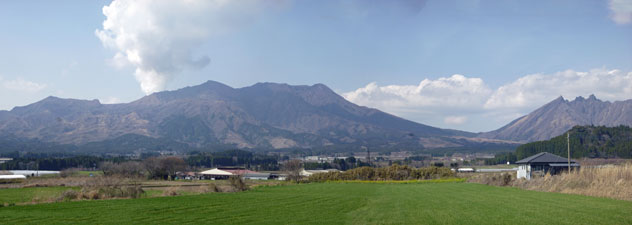
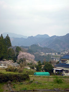
 The extinct cone of Kijimadake |
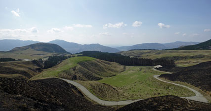 The patterns of noyaki - the traditional spring burning of mountain grasslands |
As we rounded the final bend and entered the caldera, we could see the large clouds of steam being belched into the sky from the flattish and wide central crater - fantastic. We stopped in at the Volcano Centre below the extinct cone of Kijimadake and sat in the sun (which had by now returned) enjoying the spectacle - where else can you watch an active volcano while eating an ice-cream. |
|
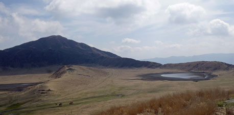 Kusasenri Plain and lake within the Aso Caldera |
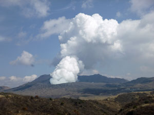 Nakadake Crater venting sulphurous steam |
Then we headed on, enjoying this spectacular landscape of steep hills and valleys to reach Takachiho and our Japanese inn. Here we could maintain the tradition of an onsen before dinner, followed by a feast of sushimi, shabishabi pork, miso soup, assorted pickles and salads, smoked fish and tempura vegetables. Life is becoming increasingly hard in this land of the rising sun. |
|
|

Takachiho Olle Course (13.5 km - 460m ascent - 470m descent) |


|
After our 10-course traditional breakfast, we drove into Takachiho town from our mountainside inn to start the Takachiho Olle Course. Counter to expectations, it was a fine warm day - ideal for walking. We found our way to the Takachiho tourist information centre, where the walk begins and set off to follow the red and blue ribbons, with stylised wild horse, that mark the route of this trail, along with a curious blue or red symbol (depending on which direction you walk the trail). |
|
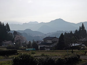 Takachiho evening light |
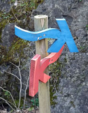 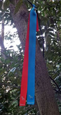 The red and blue markers of the Takachiho Olle Course |
|
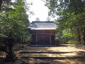
The first section wandered through the town, but, as we were to soon find out, the Japanese are very discrete with the placing of these marker ribbons. After a couple of false starts, we got used to what to look for, and soon arrived at our first cultural/historical site - the Takachiho Shrine, established 1200 years ago and an important site for Shinto mythology. |
|
|
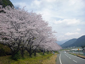
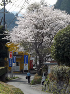
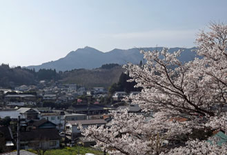 Cherry blossom in Takachiho town |
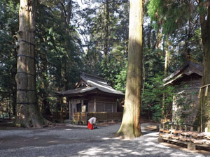 Takachiho Shrine amongst the cedars |
|
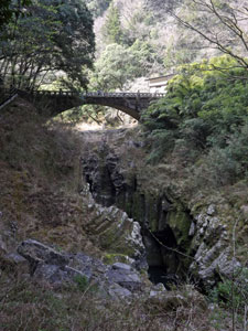
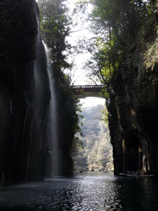
The setting of the shrine was superb - approached by a set of steps, it is a plain but ornately carved timber building set amongst a magnificent grove of tall cedars, a site whose ambience exudes tranquility. We wandered slowly through the grounds before finding our olle ribbons at the back and heading off on the track, a set of several hundred steps that led us down through the quiet forest and into the upper part of Takachiho Gorge. The enormous span of the concrete road bridge crossing the gorge a little further upstream brought us quickly back from medieval Japan to the modern era. |
||
|
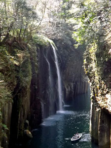
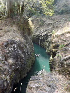
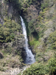
We were now following a path that wound its way along the rim of the inner gorge, where the turquoise water of the Gowase River flows through sheer-sided basalt walls. First on one side, then criss-crossing the stream by old bridges, we followed the narrow inner gorge as it deepened. The 17m drop of the Manai Waterfall, tumbling out of a side stream into the gorge, made a wonderful spectacle.
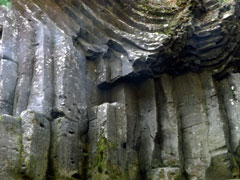
Just after the waterfall was a place where you could hire a rowing boat to experience the gorge from within. It was a good idea, but, as we discovered, putting lots of people into a narrow gorge with a fast flowing current and with the rower facing backwards to the direction he is rowing can lead to only one thing - lots of bumps between boat and boat and boat and rock wall (why not rent canoes where you can see where you are going?). Still, it was worthwhile, just to see the falls close up and to glide along the clear turquoise water beneath the hexagonal basalt columns of the gorge walls.
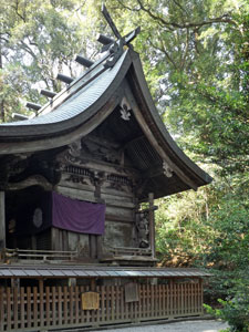
As we left the boat ramp, we noticed that the crowds were building up in the gorge area - people had already begun queuing for the boat hire. We had been there just at the right time and it was definitely time to head on. The ribbon markers led us up the winding road on the southern side of the gorge to reach the entry of an old shrine, another of the many sacred Shinto sites in this area (after another short "wrong-track" due to misreading the direction on one of the curious markers). From the cherry blossoms of the entry, a track zig-zagged up through bamboo thickets to reach the shrine set in amongst the cool conifers on a ridge of the surrounding hills. It was small and peaceful. We stopped for a spot of reflection before heading on. |
|

 Heading out of town |
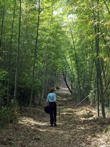 In the bamboo forest |
 Ancient shrine amongst the trees |
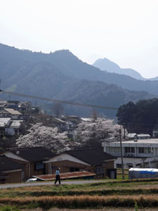
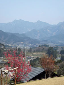 View over Takachiho |
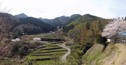
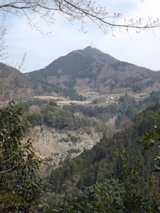
The track left the forest to enter an area of fields and paddies on the steep slopes of the hills behind Takachiho. To the north lay a spectacular vista of the mountains backing Takachiho town - it was so nice we stopped for an early lunch in a small pavilion on a grassy ledge to take it all in. |
||
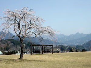 The old cherry tree |
 |
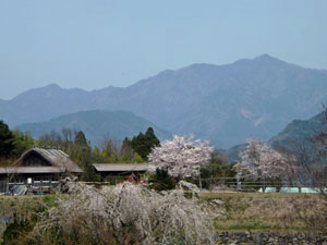 Rural landscape |
|
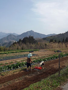
The after-lunch route led us higher up the slope, past women tilling the soil in their small fields, and up past a small conifer grove with lines of low pine log trellises beneath their shady canopy - we were passing a shitake mushroom farm. Dropping slightly we passed more terraced fields before picking up the piste of an irrigation canal that led us along a contour in the shade of giant bamboo.
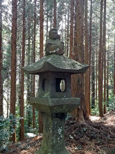
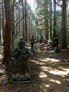
Then the markers pointed upwards. We climbed steeply to pass through open-canopied deciduous forest that was just starting to leaf up, and reaching the top of the ridge and the fir forest at the same time. Here we found ourselves in front of the entry to Mukoyama Shrine, with its long path beneath the trees, lined with stone lanterns and statues, heading up the spine of the ridge. We followed it, climbing all 200 stone steps along the way to reach the shrine - a natural timber building, smaller than Takachiho Shrine, but with a greater sense of solitude and tranquility. We were the only people here - in fact, we hadn't met another walker since leaving the gorge.
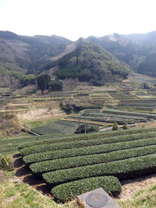
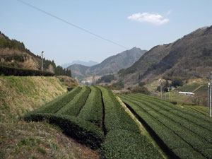
Retracing our steps back to the shrine entrance, we picked up a narrow footpath that headed quickly down the far side of the ridge into the next valley - the Maruono Tea Garden. All along, manicured rows of low tea hedges lined the lower slopes and valley floor, guarded by lines of fans on tall poles, now gently turning in the breeze, but ready to blow the frost away on a cold still winter morning.
Leaving the tea gardens, we began a gentle descent of the valley and then a more rapid zig-zagging descent back into the Takachiho Gorge. Yellow butterflies flitted across the path as the soft roar of the long waterfall opposite filtered through the trees - the weather was almost balmy. |
|

We were now in a wider section of the gorge, below the old lava flow. It was still impressively deep as we crossed the Gowase River once more on a suspension footbridge, before climbing steeply up the north face of the gorge along a grassy footpath to emerge at the top. All that remained to complete the Takachiho Olle was a short walk through the cherry blossom lined streets of Takachiho. |
|||
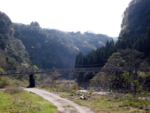 Suspension Bridge over the Gowase River |
|
|
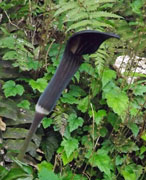
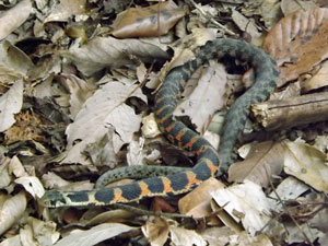 Yamakagashi -venomous but not dangerous |
|
I think I understand the concept of "olle" now - a mix of natural, rural, historical and cultural, designed to be experienced while getting a good dose of exercise and fresh air. If Takachiho is typical of this type of walk, I like it. |
|
|


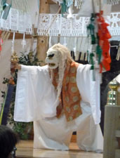
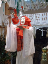
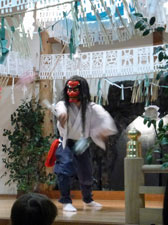
Footnote: To complete our cultural experience in Takachiho, we returned to the shrine that night to watch a performance by Kagura dancers. Kagura is an ancient Shinto dance form, where masked dancers tell the stories of Shinto mythology - in our case, parts of a cycle describing how the sun goddess hid in a cave and had to be tricked out of it by the other gods in order to bring light back into the world. Unless you are a fan of slow repetitive dance, I would describe it as more interesting than entertaining. |
||
 |
 |
 |
