Mount Hotham Revisited (4 more day-walks)

In 2009, our bushwalking club spent the week between Christmas and New Year walking in the Mt Hotham area. The fair Nello and I had such a good time then, that we decided to to join them once again when club member, Barry, organised a similar week of walking three years later. As before, we based ourselves in a comfortable mountain lodge and undertook a series of day walks of varying length to discover different parts of the alpine landscape under a generally benign weather system of cool nights and pleasantly warm sunny days. Three years ago, I was struck by the superb mountain sunsets and we were not disappointed this time.


The burnished gold of a glorious alpine sunset

This page adds a few more day walks that, in the main, cover different areas to those described in the original Mount Hotham Day Walks page. Thanks again to Barry for organising a superb week of walking and to all our fellow club members, who made this week so enjoyable.


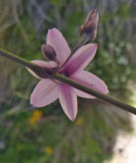
Bungalow Spur – Harrietville to Hotham via Feathertop (21.5km - 1560m ascent – 480m descent)

After Hannell’s Spur to Kosciuszko, this is probably the biggest one-day ascent you can make on a walk in Australia. Feathertop is the signature walk of the Hotham area and the club had decided to offer two walks to it, one taking the Razorback Ridge from Hotham and then descending the Bungalow Spur to Harrietville and the other doing the reverse, from Harrietville climbing up the spur and then returning to Hotham along the Razorback. This allowed a car-swap between the groups so that everyone got back to our base with minimal car travel.

I opted for the climb - it seemed a good challenge to start off our return to the Hotham region. Our group of six were up early for the drive down from our lodge at 1750m to Harrietville at 500m, and immediately noticed the extra warmth down in the sheltered valley. Warmer clothing was quickly discarded before we set off from the trail head.

The track led us quickly into a shady fern-filled gully beneath a canopy of tall eucalypts. Leaving the creek bed, a short sharp climb took us higher up the slope to begin a steady mid-slope traverse that followed the gully upwards into the tall forest. Above, the diverse melodies of forest birds drifted down from the canopy, as we crossed the creek to start following a parallel spur outwards, climbing steadily with every step. Rounding Picture Point, we crossed the spur to head back in towards the mountains – before we realised it an hour had passed and we had ascended 400m – it was time for a short break in the shade and we appreciated doing this climb in the early morning.


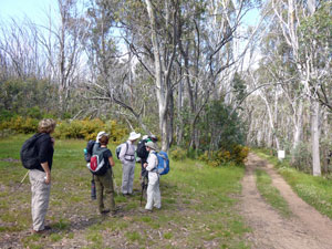
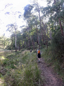
Setting out from Harrrietville


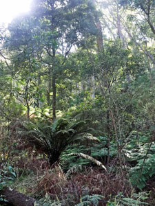
A ferny gully at the base of Bungalow Spur

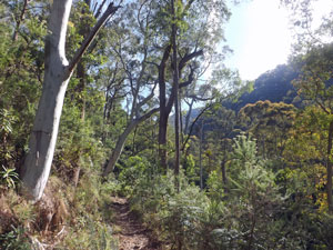
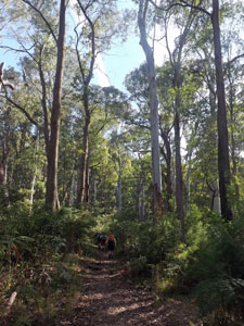
Shady forest of alpine ash and peppermint gum

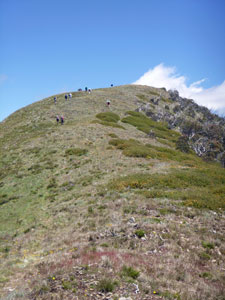
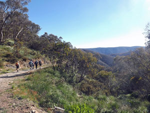
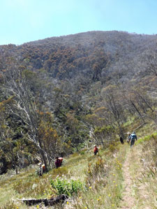
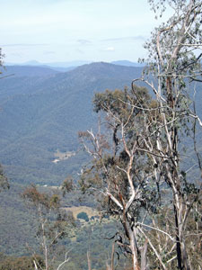
The views unfold as we climb


A few more sharp turns and steady climbs brought us to Tobias Gap and the spine of Bungalow Spur. From here we pushed on up the spine along a track lined with a lush undergrowth and a scattering of pink-flowering trigger-plants, blue-clustered dianellas and orange pea-flowers.

The bird song choir continued, highlighted by the long-drawn call of the whipbird and the mournful wail of a black cockatoo – it was turning into a great climb and soon we were passing the ruins of Feathertop Bungalow (from which the spur and track we were on derived their names) and 1000m of ascent.


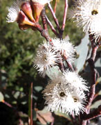
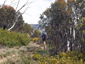
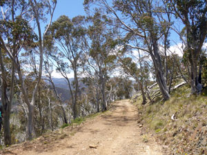
The beauty of the eucalypt forest

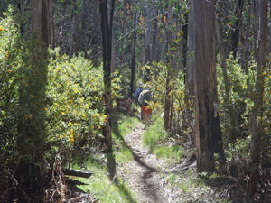
Tall eucs with understorey of thick shrubs

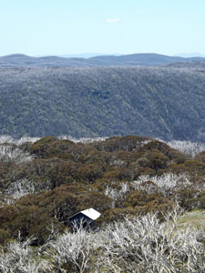
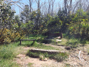
The site where Feathertop Bungalow once stood

It had been a steady and relatively easy climb to this point, but from here the gradient steepened, just as we reached the more open areas of burnt forest. Thus it was a hotter and sweatier group that crested the hill to reach the pleasant site of Federation Hut beneath the rounded dome of Little Feathertop.


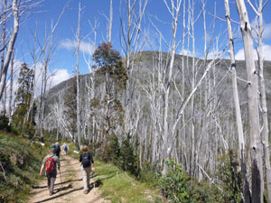
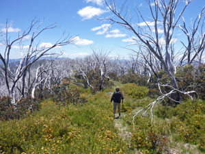
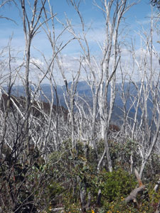
Entering the realm of fire-damaged snow-gums

It was such a nice place, that Cynthia, Zabetta and I decided to stop for lunch, joining some of the other bushwalking club group who had already arrived from the opposite direction. The others pushed on towards the peak of Feathertop, planning a higher lunch venue.


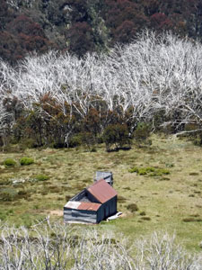
The new Federation Hut (rebuilt after the 2003 fires)

Lunch spot beneath the dome of Little Feathertop

Relaxed and refueled, the three of us continued on to join them, crossing the slopes of Little Feathertop, scattered with clusters of snow-daisies, to reach the saddle and the junction with the Razorback Track.


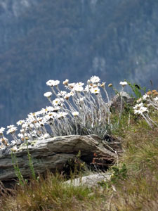
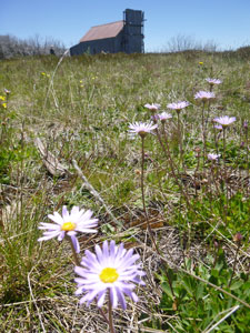
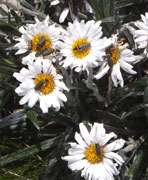
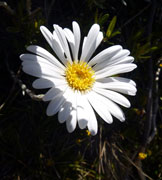
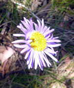
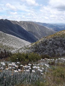
Snow daisies and silvered gullies

View across to The Razorback from Federation Hut


From here we set out across the open slopes to make the steep climb to the top of Feathertop – up through the shaly rocks and fields of snow daisies, where soldier beetles congregated in their thousands.


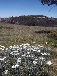
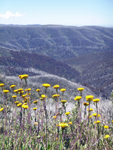
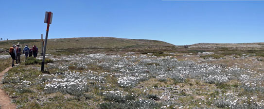
Daisy field on the ascent of Feathertop


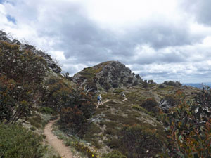
Zabeta crests the peak


Ridgelines defined by the ghostly trunks of
burnt snow-gums

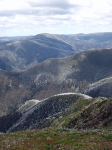
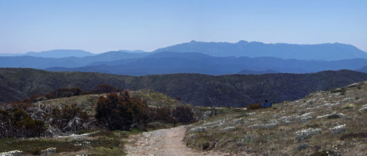
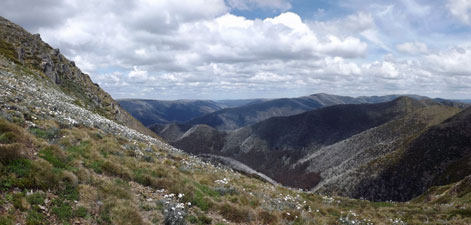
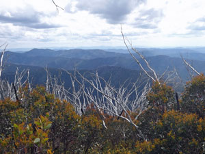
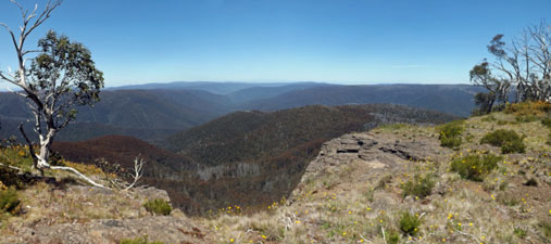
A cold southerly wind pushed us onward as thicker clouds began to invade the sky. Still, it was great to be back on this dominant peak with its panoramic views in every direction - out over the silver-tipped spurs to the Bogong High Plain, back along the sharp undulations of The Razorback to Hotham and across to the blue-tinted profile of Mt Buffalo.


Descent of Feathertop (with views towards The Razorback)


A cluster of
snow daisies


Time was getting on and we still had another 10km to go – we quickly descended to the saddle and set off along the Razorback. This track has been described in the first Hotham pages so I won’t go into detail, suffice to say it was nice to see the regenerating snow-gums had put on quite a bit of growth since our time here three years ago – many full of rich honey-scented blossoms that added a pleasant fragrance to the last stages of our walk.


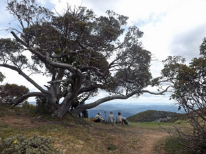
Rest break beneath the big snow gum


The path home beneath The Knobs


Regenerating snowgums (10 years after the fire)

Some more post-fire recovery

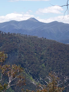
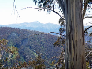
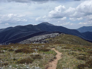
View back along the ridge to Feathertop

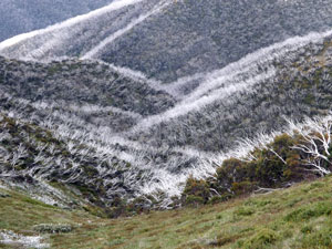
The silvered look will still be around for a few more years

It was a welcome sight, however, to round that last daisy-covered slope and see the end of the track. While the climb had proved easier than I anticipated, the extra 10km at the end of it had sapped my energy somewhat. It was certainly good to be based at a lodge where a hot shower and cold beer were waiting. Thanks Chris and Cynthia, Zabetta, Lorraine and Cynthia for your pleasant company on this epic walk.


The Twins (9km - 510m ascent – 510m descent)


The Twins are the two high points of a prominent bulge in the Barry Range to the west of Hotham. The walk to them is only a short one, but after our mammoth effort in climbing from Harrietville to Hotham via Mt Feathertop, it was just what our tired bodies needed. We had woken to a thick fog enveloping the mountains, but not long before 10am it began to lift and by the time we reached the start of the walk at the Dargo Plains Road junction, the sun had burned off the remnant clouds to reveal a fine blue sky day.

Sunscreen rubbed in, our group of nine headed off to follow the route of the Alpine Walking Track westward along a gravel fire trail, climbing briefly to cross the old ski tow below Mt Saint Bernard, before starting a long and steady descent through the regenerating forest. The track was lined with wildflowers in shades of blue, yellow, orange and white and already our legs had regained some of their spring.


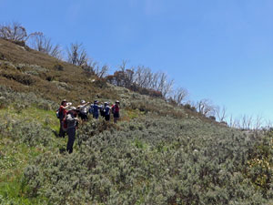
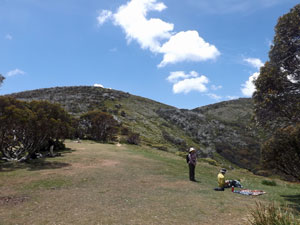
Setting off for The Twins


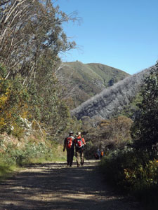
Heading towards the big climb


View down the slope to the road below


The cairn marker on the first Twin

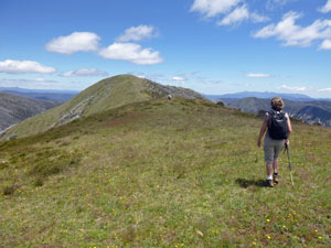
Soon we could see the bluff shape of The Twins rising ahead through the skeletal white trunks of the burnt forest. It looked somewhat daunting and, at a small saddle at its foot, we took a short break before commencing the climb. A faint track led us straight up the scrubby slope and, when it faded away, we continued our direct assault picking our way through the low shrubs and regenerating trees.


Almost at the top

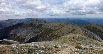
Some slopes are not as hard to climb as they look – this was not one of them. However, a steady pace brought us to the crest and its magnificent views back towards Feathertop and Hotham and their silver-fringed spurs.


The fair Nello sets out for the second Twin


Taking in the view of distant Feathertop


Flower speckled meadow of the ridge


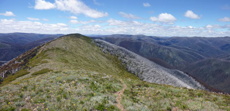
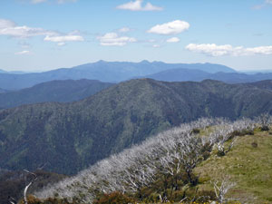
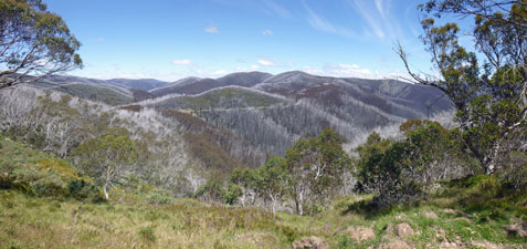
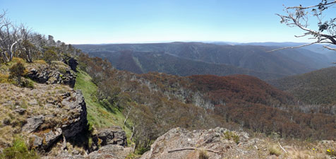
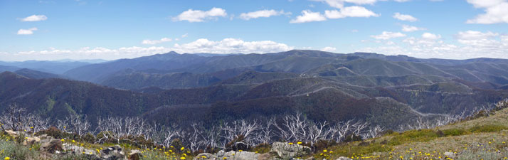
The grand panorama of the Victorian Alps from The Twins
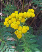
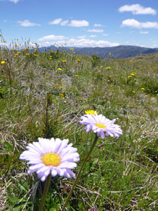
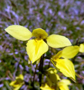
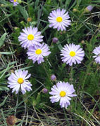
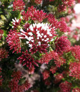
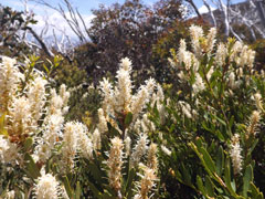
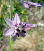
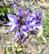
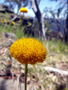
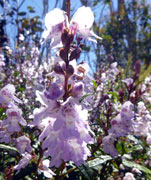
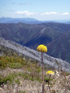

Ahead lay the grassy undulated tops of this mountain, dotted with yellow-orange everlastings. We climbed to the marker on the first Twin and, from its rounded dome, admired the views ahead to the higher second Twin and the long lines of blue-on-blue mountain ranges that formed the horizon behind it.


Billy buttons


View back to the first knob of The Twins

A short climb brought us to the trig on its apex, a great spot for lunch and to sit in the sun and admire this 360 degree alpine panorama, cooled by the south-westerly breeze.


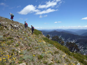
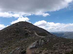
Climbing the bigger Twin

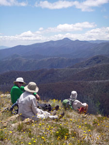
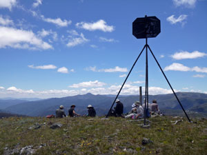
Lunch on the high point

Looking over the ranges towards Mt Buffalo

Lunch over, we continued on westwards, heading toward the distant bluff massif of Mt Buffalo (or is it the buff massif of Mt Bluffalo) as we started a much more gentle descent of The Twins. An old disused 4WD track took us down through regenerating snow-gums, thick green epicormic growth at the bases of stark white trunks burnt in the fires of 2003. Almost ten years on and the new growth only 2-3m maximum in height – the trees recover slowly in the high country. The wildflowers, on the other hand, provided a superb display of colour.


The descent was considerably easier than the ascent

The fire trail back

Mt Feathertop

We soon reached the fire trail and followed its broad gravel path around the base of The Twins to reach the point where we had left it to climb the mountain. All that remained was a long a steady climb back up to the cars – perhaps the only tedious part of the walk.


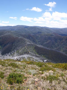
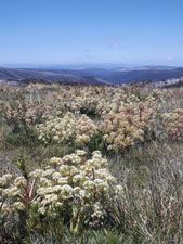
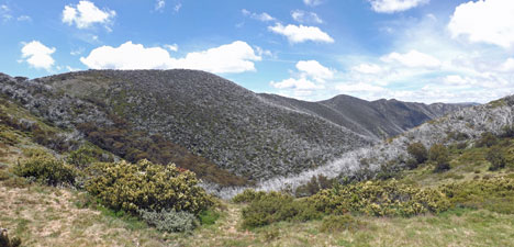
View towards Buckland Gap - silver-tipped spurs of a regenerating forest


A magnificent eucalyptus

All in all it was a great walk, short but taking in a variety of landscapes and offering panoramic views of the high country from a perspective we had not seen before. Thanks Terence and Victoria, Mark, Michelle, Chris, Cynthia, Stephen and of course the fair Nello, who was testing her ankle out for the first time after a serious sprain a few weeks earlier. It passed!


The Huts Walk (14.5km - 710m ascent – 580m descent)


Like many parts of Australia’s high country, mountain huts have played an important part in the history of European exploration and settlement in the Hotham area. The Huts Walk visits three of these huts, each with a very different story relating to history old and recent. After an early start to see whether the sunrise was as good as the sunset, today I joined the club walk along this track to check these huts out.


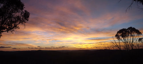
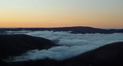
Valley-hugging cloud in the pre-dawn light

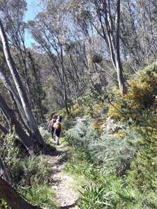
Setting off down the Davernport Access Road

Deep in the valley of the ski fields
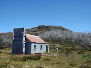
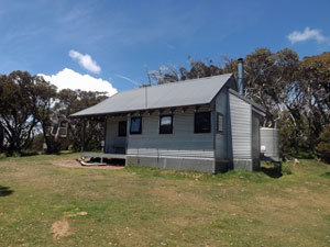
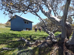
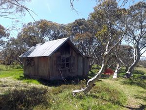
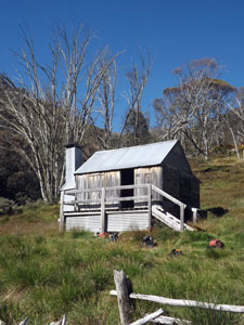
The start of the walk was just below our lodge and we were quickly heading down the broad but stony Davenport Access Track, passing through snowgum forest that had escaped the 2003 fires and descending to the base of the Hotham Ski Field at Swindler’s Creek.

Once there, we followed the creek downstream to reach the site of Silver Brumby Hut, picturesquely set in a grassy flat near the babbling creek surrounded by steep timbered slopes. Perhaps exaggerating slightly, this area is known as The Plains of Heaven. Its situation was not surprising really, as this hut was built in 1992 as a replica of a mountain stockman’s hut for the film “The Silver Brumby”. In fact, the present hut is a replica of the replica, so its historical value is somewhat diminished. Nonetheless, it gives an idea of how the stockmen of the 19th century lived.

 
Silver Brumby Hut


Swindler's Creek

On the trace of the Cobungra Ditch

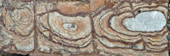
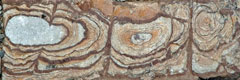
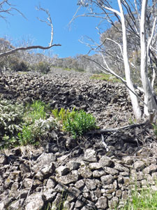
Stonework for the ditch at the base of scree


Doubling back up the creek and a short way back up the access road, we reached the turn-off for the Cobungra Ditch Track. A set of stone steps took us quickly down to the “ditch”, the remnants of a long canal cut into the side of a steep slope to redirect water for gold-mining operations of the 19th century. It was pleasant walking as we followed the wild-flower lined narrow footpath along the flat course of this old waterway, in the shade of arching snow-gums and past remnant sections of stone wall that were built from boulder scree. It was a fascinating journey into times long gone.

Curving our way around the slope, we arrived at a junction where a new foot track eased us down the steep slope, via a series of zig-zags through open forest, to reach Swindler's Creek once again. We crossed a wooden bridge above a series of white-foaming cascades where the creek cut through the dark rock and immediately began the climb out on the far side.


Descent into the upper Swindler's Valley

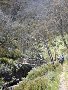
Bridge across Swindler's Creek ....

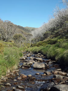
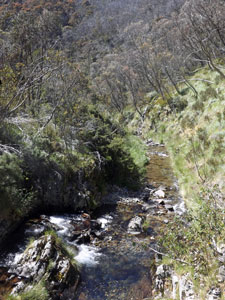
.... and the creek itself

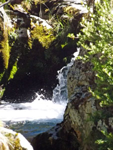
Part of the cascades


Flower-filled meadow at Spargo


Looking down on Spargo's Hut


Snow daisies and snow-grass meadow

The sun beat down through bare snow-gum trunks, deprived of a canopy since the 2003 fires, but ringed by low dense thickets of new lignotuber shoots and an understorey of flowering shrubs and herbs. We zigged and zagged our way steadily upwards – strange how the slope seems steeper on an ascent – before emerging at the grassy flat housing Spargo Hut.

Now here was the real thing; built 85 years ago by Bill Spargo as a base for his prospecting activities, it has survived two massive bushfires and stands as a genuine example of mountain hut architecture.


Spargo Hut - built in 1927

After an inspection of the interior, we sat down and enjoyed a long lunch and the array of daisies, buttercups and orchids that dotted this small grassland.


Climbing up to Swindler's Spur from the hut

The climb then continued, as we followed a fainter path up the scrubby slope, stopping to admire the extensive views opening up of the Dargo High Plains to the south. Reaching a broad grassy saddle, with views across the valley to the apartments and ski runs of Hotham Heights, we picked up the line of orange snow poles and continued upwards to the point where we could see Derrick’s Hut, in its grove of ancient snow-gums beneath.


A silver-topped dome above Spargo Hut


The interior of Spargo Hut


Alpine daisies above the Cobungra Valley


A local bird of prey (x100)

We headed down the slope to it and declared the shady grass beneath a particularly large and gnarly snow gum a good place for a rest. These trees had escaped the 2003 fires and were a magnificent reminder of what the high forest was like before.


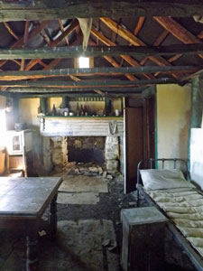
Looking down on Derrick Hut

The hut itself was built in 1967 as a memorial to Charles Derrick, who died nearby when caught in a blizzard on a cross-country skiing trip from Falls Creek to Hotham – a more recent history and a reminder of the respect these mountains demand.


Derrick Hut amongst the gnarly old snow-gums

With a cooling breeze at our backs, we followed the route of the Australian Alpine Walking Track from Derrick back along the snow poles, crossing a broad alpine meadow, spattered white with snow daisies, to reach the gravel road on Machinery Spur. This led us directly back to the trailhead, passing the top stations of several ski lifts and providing a magnificent panorama of The Razorback and Mt Feathertop to the north.


Crossing the daisy fields below Mt Loch


The road home down the western Machinery Spur - back by the Buffalo massif


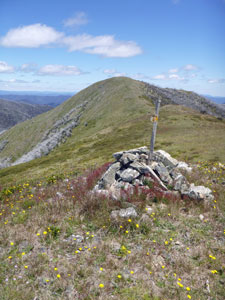
Panorama of The Razorback and Feathertop from Derrick Col


It was a great way to finish a varied and enjoyable walk. Thanks to my companions, Barry, Duran, Kiria, Mark, Michelle, George, Lorraine and Quentin for your pleasant company on yet another great outing in the Australian high country.


Tabletop Mountain (11.5km - 390m ascent – 390m descent)


As it name indicates, Tabletop Mountain is a mesa connected to the main Hotham range by a broad saddle. It was largely unburnt during the 2003 fires and gives an idea of what the mature snow-gum forest was like.

The fair Nello and I joined a group of 14 from the club for this walk, which made it quite the expedition. Setting out from the JB Plains trailhead, we made a brief detour to have a look at JB Plains Hut, an old cattlemen’s shelter from the days when cattle were brought up to graze the summer pastures of the high country – a romantic period of Australian history for some, an ecological disaster for the alpine environment for others.


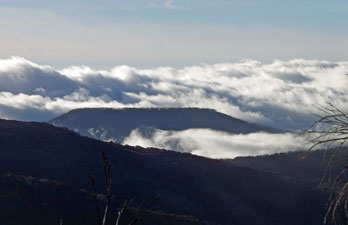
Tabletop Mountain framed by early morning cloud

JB Plains Hut

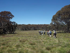
Crossing the snowgrass flats

From the hut we rejoined the faint track, which led us southwards across the snow plain, the occasional wind-gust rippling across the grass tussocks. Passing through groves of lovely snow-gum and snow-grass flats, we reached the edge of the plateau and descended steeply to a couple of curious marshy hollows within the forest that drained southwards. This was the headwaters of Table Creek.


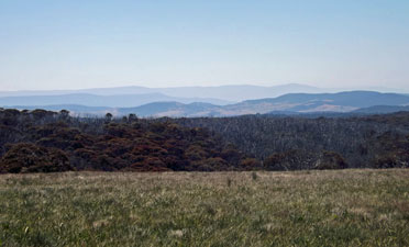
View across the flats towards the Dargo High Plain

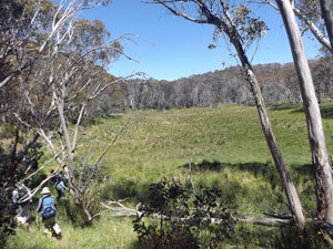
A grassy hollow near the headwaters of Tabletop Creek

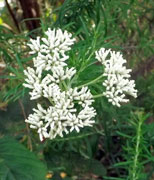
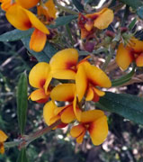
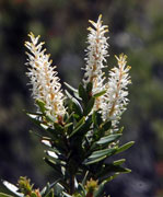
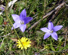
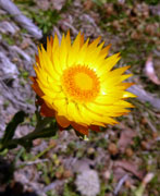
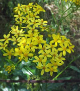
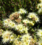
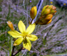
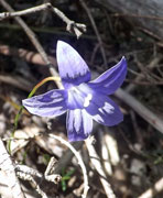
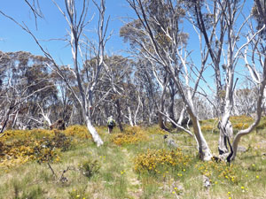
Orange pea-flowers on Tabletop

From here, we wandered along a narrow track across the broad saddle beneath the tall eucalypts. All along, yellow, blue, pink, orange and white wildflowers were scattered through the grassy forest floor. It was very pleasant walking. The slope changed from gradual descent to gradual ascent. The slope increased and soon we were climbing up over the northern end of Table Mountain to reach the scrubby open snow-gum forest on its flat top.

The faint grassy foot track led us across the mesa through the low orange-flowering shrubs, reaching a picturesque viewpoint at the cliff edge on its eastern side, down into the Precipice Creek and Dargo River valleys. The blue flatness of the distant Dargo High Plains formed the southern horizon.


View south from the rim of Tabletop Mountain


Here the track disappeared, so we pushed on, picking our way around dense shrubbery and fallen trees, as the two cliff faces closed in to funnel us into the southern end of Table Mountain. It was marked by a shady rocky promontory, with views across the valley to the high plains and a cooling breeze – the perfect place for lunch.


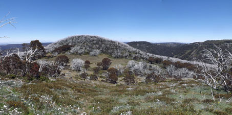
Another fine view from the plateau of Tabletop Mountain


Lunch over, we reformed the convoy and made our way back along the same route, across the mesa, down and across the saddle, up onto the snow plains and back to the trail head. It was a very pleasant walk and one that showed us different landscapes to the other walks we had done here. Thanks Barry, for leading the walk and thanks to my 12 other fellow walkers for being such pleasant company.


One last glorious Hotham sunset