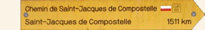
Chemin de Saint Jacques (Le Puy to Les Faux)

Getting There

After a long train trip from Montpellier, with several changes, it was late afternoon by the time that we arrived in the spectacular setting of Le Puy, with its 12th century chapels and 19th century massive statues of Madonna and Child perched high on top of old volcanic plugs.

From the station, we climbed up to the dominating presence of the Cathedral de Notre Dame du Puy to obtain our creanciale - the pilgrim's passport to mark their passage along the way to Saint Jacques de Compostelle. We had arrived to start the first part of the Chemin de St Jacques, the medieval pilgrims' route that ends over 1500 km away in the north-west of Spain. Ever since Bishop Godescalc set off for Santiago in 951 AD to visit the tomb of St James, pilgrims have been setting out from Le Puy on a long journey in search of something. It was mind-boggling to think how many feet had headed off from this point and we needed a little time to let the history of the path we were about to take sink in.


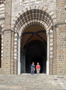
The steps of Notre Dame Cathedral
- our pilgrimage starts

After getting our papers and briefly looking at this starkly beautiful building, we went to the top of the stairs where, for over a thousand years, pilgrims have begun their long trek to the tomb of the Apostle James.


16m tall statue of Notre Dame de France at Le Puy


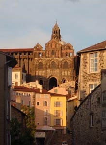
Afternoon light in the streets of Le Puy

We took a deep breath and followed their footprints, descending the 134 steps of the cathedral and through the narrow cobbled streets of Le Puy. A kilometre later we stopped - we had arrived at our gîte (hostel) for the night and it was getting very late. The symbolic start was done - the real walking would begin tomorrow.

Stage 1 - Le Puy to St Privat d'Allier (23.5 km - 610m ascent - 440m descent)

Our gîte in Le Puy was right on the route de St Jaques and, having already wandered down from the cathedral yesterday afternoon, we stepped out the door and headed off on our own. For the catholic pilgrims, it was a mass start - literally. The pilgrim's mass was at 7 am, after which everone heads off down the 134 cathedral steps and on their way to Santiago, 1500km away. An emotional event, which we would have felt a bit out of place in attending. For the present, we were on our way on the GR65 (route de Grand Randonée number 65 or the Via Podiensis, as the track from Le Puy to just before the Spanish border has been known from antiquity) and the morning was cool and overcast.

The track climbed quickly up through the houses of Le Puy, before levelling out and heading off into the lush green countryside. For a while we followed the gentle rise and fall of a country road, through green fields, speckled with the whites and yellows of spring flowers - buttercups, daisies, dandelions and others.


Au revoir Le Puy

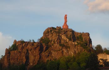
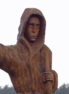
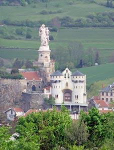
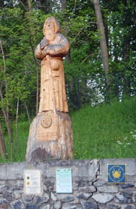
St James watches the walkers setting off
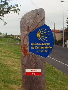
Let the walk begin!

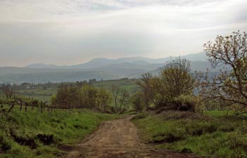
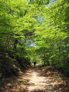
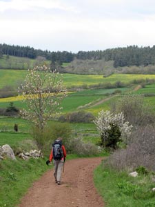
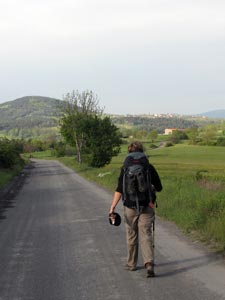
Out in the countryside at last


A yellow field of canola


Leaving the hills of Le Puy behind

Crossing the sealed main road, the path changed to a bed of orange-brown scoria which showed the volcanic origins of this landscape. It led us to the village of La Roche, its dark brown stone houses beautifully situated above the Dolaison River. Skirting the village, we followed a rough footpath along the high rim of the river valley, silent but for the softly continuous call of a cuckoo.


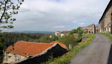
Passing through the village of La Roche

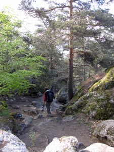
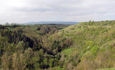
Wooded valley of the Dolaison River


Path alongside a drystone wall

Patches of sun came and went as this path took us along a narrow undulating country lane, past lichen covered stone walls that held back the blueish conifers, until it emerged in the village of St Christophe, with its 11th century church of dark brown volcanic rock. Along the way we passed several ancient stone crosses - markers of the original pilgrimage route.


The 12th century church at Saint Christophe-sur-Dolaison

Passing beneath the main road to leave St Christophe, we entered dairy country, traversing a string of tiny hamlets, with their large stone barns and houses, fat, contented cows grazing thick green pastures and distinctly rural aromas. The GR65 switched from road to road, first a muddy track between the dandelion-spotted fields brought us to Ramourouscle and its old Templar quarters, then a quiet sealed road led us past the old Chapel of St Roch, before climbing up through the village of Montbonnet and its welcome Bar/Snack. We had covered two thirds of the day's walk and it was time for a long lunch, sheltered from the cold wind.


Stone cross marking the medieval pilgrimage route


Volcanic rock farmhouse in Ramourouscle

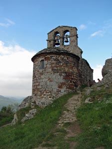
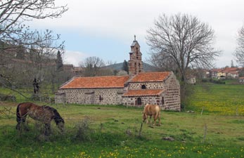
10th century Chapel of St Roch near Montbonnet

From Montbonnet, we took a small dirt road westward and the sun finally emerged to stay a while, as we wandered past the lush green fields, accompanied by the twittering of hedge-birds. Ahead the hills were covered in a patchwork of pale green deciduous trees, just coming into leaf, and dark green conifers. With the sun on our backs, we climbed steadily up into the spruce forest of La Baraque, content to be passing through a very different landscape and reaching, at 1230m, our high point for the day.


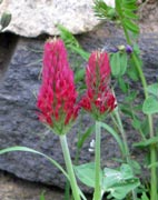
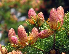
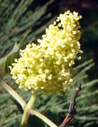
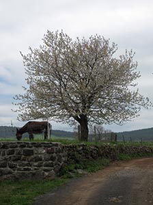
Donkey with blossoms

On the road from Montbonnet

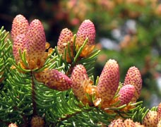
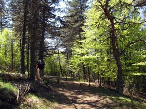
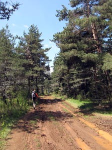
In the spruce forest of La Baraque

The descent started soon after we passed the little Lac d'Oeuf. We found ourselves leaving the forest behind and passing once again through the lush rural landscapes of central France, Ahead the red roofs and dark-stone walls of the houses announced our arrival in Le Chier, a curiously, but aptly, named village (look it up on babelfish), where the rich rural aromas of dairying enterprises were particularly strong.


Descent through the dandelion fields towards the Allier Valley


The rural hamlet of Le Chier

Sidestream of the Allier

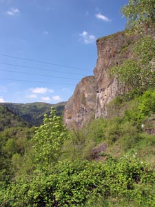
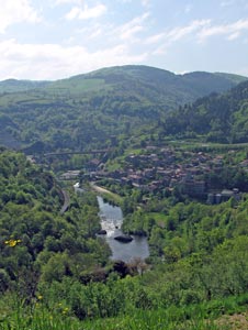
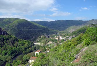
St Privat-d'Allier perched on the edge of the Allier Gorge

From Le Chier, with cloud regaining the sky, we descended steadily down an earthern road and then rapidly along a narrow winding footpath to reach the town of St Privat d'Allier, in its superb setting across from the forest-covered walls of the Allier Gorge.


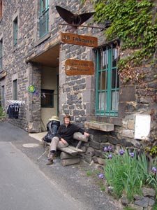
In front of our gîte at St Privat

We had reached our home for the night at a gîte in the town, which quickly filled up with fellow travellers, some of whom we had crossed paths with during the day. After a hearty Menu de Randonneur at the local restaurant, we would be sleeping very well.

Stage 2 - St Privat to Saugues (19.5 km - 720m ascent - 630m descent)

The morning cloud hung heavily in the sky as we set out from St Privat, climbing up to the Calvaire above the town, before following a footpath westward with views over the town and green-clad gorge beyond. A short descent brought us to the first big climb of the day, up a cobbled track through the hamlet of Combriaux and upwards to the hilltop village of Rochegude.


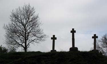
Early morning at the Calvaire above St Privat

Parting view over St Privat


Forest near Combriaux and two fellow pilgrims on the track

Rochegude is dominated by its ancient chapel and tower (the remnants of an old 13th century castle) perched on a rocky outcrop high above the Allier Valley. The castle was an important stop-over on the medieval pilgrimage route and its tower gave a wide panorama of the valley of the Allier beyond, which was clearly why it had been built. Above the valley the sun was breaking through and the cloud cover dispersing - it was turning into a glorious day.


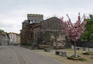
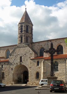
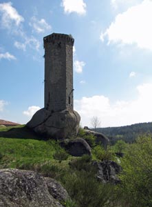
15th century Chapelle St Jacques at Rochegude

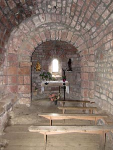
Interior of the chapel

Rochegude Tower (all that is left of the castle)

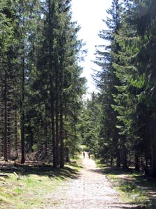
Descent of the spruce-covered spur

From Rochegude, we picked up a winding rocky track that descended quickly along a spruce-lined spur to the flats of Pratclaux below. We followed the GR65 on its course along sealed road, dirt track and stony footpath, as it crossed the flats, its bright green wheatfields criss-crossed by high voltage lines, before picking up the main road to zig-zag down to the village of Monistrol d'Allier.


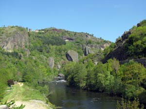
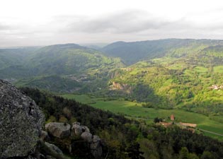
Panorama of the Allier Valley from the Rochegude Tower

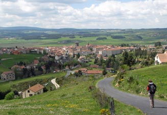
The village of Monistrol d'Allier

The village had a superb setting with its old stone houses lined along the bank of the Allier beneath volcanic cliffs on the far side of the river. Crossing the river on a high metal bridge, we were welcomed by an old black labrador, it was time for a hot chocolate and some biscuits in the morning sunshine - an energy kick needed for the big climb ahead.


The Allier River at Monistrol

Leaving Monistrol, we picked up the Montée de Madeline, a sealed road that took us up steeply beneath the basalt cliffs to the little Chapel de la Madeline, built into a small cave in the overhanging rockface.


17th century Chapelle de la Madeline in its cliff side niche


Cliffs of the Allier Gorge


View back down over Monistrol d'Allier


Escluzels

A set of even steeper steps brought us to the hamlet of Escluzels on the rim of the gorge. Our climb did not stop here though, as we pushed up through farmlands to find a wide dirt track that zig-zagged its way up through the fresh new leaves of a deciduous forest returning to life.


The incredible greenness of the French countryside


The climb up to the Gevaudan Plateau

Finally, grassy fields began to appear again as we reached the hamlet of Montaure on the edge of the Plateau de Gevaudan. Wandering across the wheat fields, cattle and sheep pastures of this gently undulating plateau, we recalled the story of the Beast of Gevaudan, which terrorised this region in the mid 1700s, devouring 22 women and children - hard to believe in such a tranquil setting.


The hamlet of Montaure

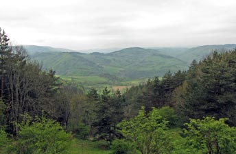
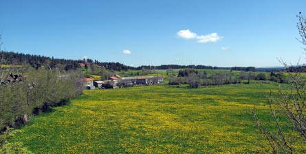
Rural scene on the Gevaudan Plateau

Passing quickly by the rural fragrances of Rozier, we stopped at Chez Néné in the next village of Le Vernet for a long lunch break, with local cheese and charcuterie. We were now nearing our goal and a gentle climb along a dirt road, took us up to Rognac, at 1130m the high point of the day. Soon after, the GR65 became a steep stony track that led quickly down to the town of Sauges, its red rooftops glowing in the afternoon sun.


Entering the village of Le Vernet

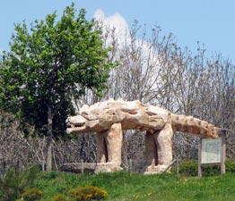
The fearsome Beast of Gevaudan!

Descent into Saugues


Saugues streetscape


12th century romanesque Eglise St Medard


Interior of La Chapelle des Penitents


13th century Tour des Anglais

We found our gîte for the night, cleaned up and explored the old part of town a bit - Tour des Anglais, Cathedral, Chapel des Penitents, all part of a centuries old history - before returning for dinner. The gite was full and, along with 21 fellow randonneurs, we sat along a long table with our hosts to discuss the day's proceedings and enjoy a very filling and delicious sample of French home-cooking. Merci Mme Martins, that will keep our energy levels up for tomorrow.

Day 3 - Saugues to Les Faux (27.5 km - 650m ascent - 330m descent)


Pilgrim carved from a tree trunk near Saugues

Over a breakfast of home-made bread and jam with a steaming bowl of café au lait, the friendly Mme Martins had told us that our first two days were the hardest on the whole French section of the Chemin St Jacques. Consequently, we were feeling relatively pleased with ourselves as we set out to cross The Margeride region on this, the longest section of our walk.


Foggy morning over our gîte

The fog begins to lift

The morning fog was already starting to lift as we headed out of Saugues and, by the time we had completed the steady climb up to Le Pinet, the sun had definitively broken through. Once more the landscape was dominated by rich green fields, speckled gold with dandelions, and country roads lined with violets and many other wildflowers.


Countryside near Le Pinet

La Seuge Rivulet


Predator and prey


Track through the spruce grove

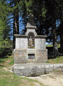
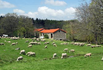
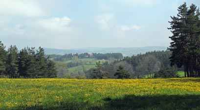
As we reached La Clauze, we stopped for a brief rest to inspect a 12th century tower perched alone on a large granite block, where once a castle stood. From here the path undulated for several kilometres through a now familiar broad, green French rural landscape of lush lowland pastures and low, forest-topped hills, dotted with a scattering of villages and hamlets - we were in danger of becoming immune to its postcard perfection.


More classic French countryside


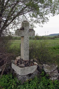
Old stone pilgrims' cross


12th century tower at La Clauze


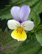
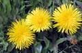
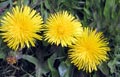
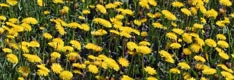
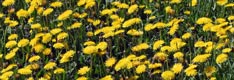
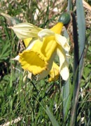
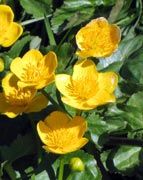
Dandelion-filled meadow at Le Falzet

Mare and foal - now that is cute!

A hot chocolate break at Le Falzet, lunch after a short steep climb and descent at Chazeaux, and finally we find ourselves climbing steadily into a different landscape. It was good to be back in the forest, beneath the cool shade of a mixed deciduous-conifer woodland .... so good, in fact, that we stopped for a siesta.


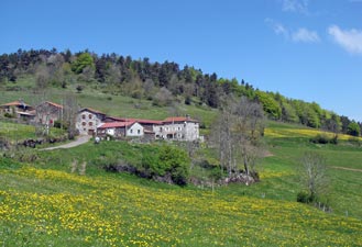
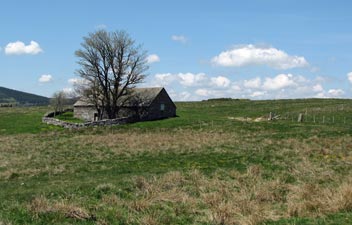
Stone cottage in the Margeride

Mixed forest west of Chazeaux

Passing through a pine plantation


Fountain of Saint Roch - on the site of a
13th century hostel for pilgrims

Starting again was a hard decision, but we pushed on through a tall and shady pine plantation to enter the fields of Le Sauvage, an isolated farm with large stone buildings and overnight stop for pilgrims. It was a good place to top up our water supplies, before pushing on beneath the pine forests that formed part of a winter cross-country skiing area.

Emerging from here onto a main road, we passed the fountain and chapel of Saint Roch, two more sources of sustainance for the medieval pilgrims who passed by here centuries ago. We also left the Department of Haute-Loire and entered that of Lozere. The kilometres were accumulating and the soles of our feet were taking a pounding on the flat, hard surfaces of the route.


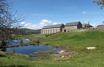
The Domaine du Sauvage - a fortified farm
once used by the Knights Templar

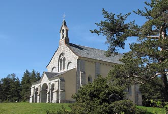
Chapel of St Roch on the border of Lozere

From the chapel, the track descended briefly on a rocky path and then a narrow dirt road, before finally we reached the turn-off to the Les Faux, only 900m off the GR65. It was a very long 900m that brought us to peaceful little village of Les Faux and the Oustal Parent, 27 km from Saugues and our home for the night.

The terrain had not been difficult, but the long distance had taken its toll and for me it had been the hardest day so far, contrary to our expectations of the morning. It had also been a day of criss-crossing with fellow walkers - French, German, Australian, Quebecqois - gradually passing a bit more than the time of day and getting to know each other better.

It was also the day, our old friends from Montpellier, Karen and Daniel, planned to join us - it was great to see their car pull up as we relaxed with a cold beer in front of the hotel. Enjoying great French country cooking with friends in such a setting was the best tonic to chase away the aches and pains of the day.