
| Guatemala |
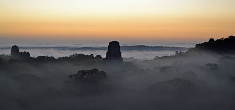
Tikal |
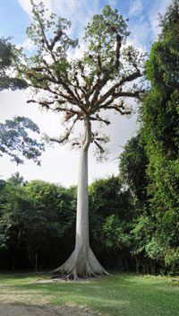
It was time to say goodbye to Belize and hola to Guatemala. A quick trip by minivan took the group from San Ignacio to the border, where, after minimal hassles, we crossed into Guatemala, climbed into a larger mini-bus and headed off across the rolling green landscape towards Tikal. Tikal is the jewel in Guatemala’s tourist crown – twice world heritage listed, once for culture and once for nature. This ancient Mayan city, occupied for 1500 years from 650BC to 900AD, and surrounded by the rich, dense rain forest of the national park, was our destination. |
 |
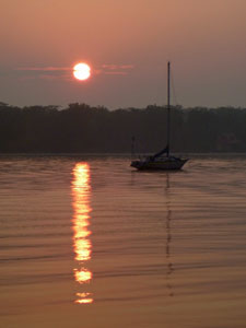
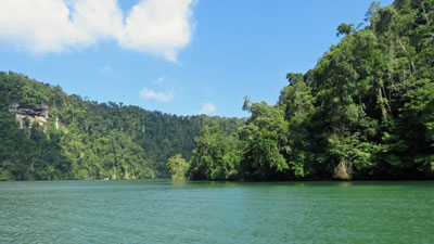
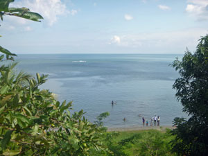
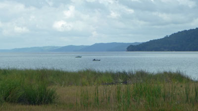 Lago Peten Itza south of Tikal |
|
On arrival, we headed for the camp ground (tonight we would be sleeping in tents under thatched roofing), unloaded what we needed, ate lunch and, under a grey sky, headed down the wide clay track towards the archaeological site. Aquilino was keen to show us his part of Guatemala – he was born near here and worked in Tikal when younger. |
|
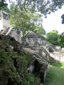
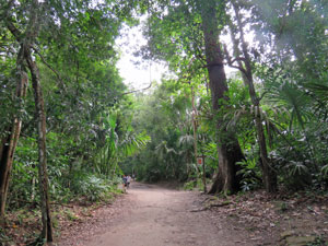 Jungle path on the way to Tikal ruins |
 Site of the ancient plaza |
|
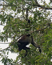
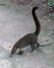
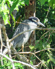
The scuffling of coatis in the undergrowth, the gruff roar of a howler monkey and tree-top antics of a troop of spider monkeys in the lush green canopy made it clear that we were deep in the Central American rain forest. |
||
|
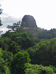
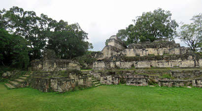
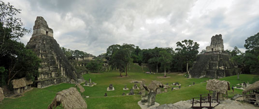
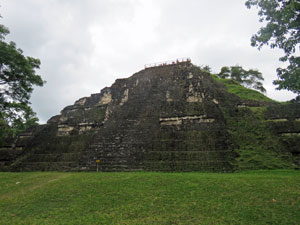
It is difficult to anticipate the first sight of the ruins of Tikal – Aquilino introduced us slowly, first walking us through the open grassy area of the market place, then through the residential areas of the Acropolis Central, before bringing us out at a superb viewpoint over the Grand Plaza, dominated at each end by the 45m high pyramidal forms of Temple II and the Temple of the Gran Jaguar, rising above the jungle surrounds. One could but imagine the glory days of Tikal from 700-900AD.
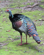
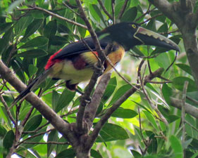
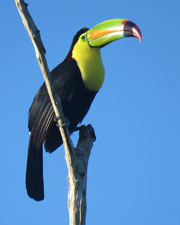
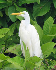
From here, we wandered amongst the ruins, while toucans, ocelated turkeys, coatis and monkeys reminded us that this is also a National Park for the protection of the wild-life.
|
|
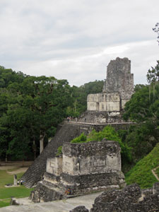
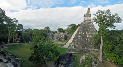
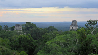
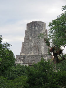
Leaving the Grand Plaza, Aquilino led us past more temples and palaces, some still buried under dense forest vegetation. Climbing 75m high Temple IV, we were rewarded with views of the other edifices towering above the green expanse of jungle that stretched to the horizon. |
||
 |
 View across the plaza from the North Acropolis |
 |
|
|
|
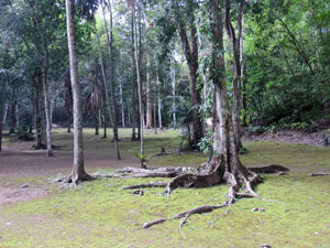
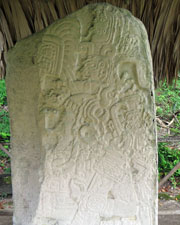
A final visit to Mundo Perdido, the first discovered (in 1848) and earliest part of the city, dating back to 1500BC, finished our day of exploration. From the top of the Grand Pyramid, there were more sweeping views of temples rising high above the green forest canopy. The sun was now setting and, by the time we got back to our campsite, darkness had settled thickly over the buildings and forest of Tikal. It was an impressive site and Aquilino's enthusiasm for it and the culture of his Mayan ancestors brought it all to life – thanks Aquilino. |
||
|

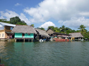
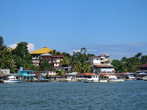
Rio Dulce |
The next morning, some of the group woke very early and headed and headed back into Tikal to view the sunrise from Temple IV. Others, including the fair Nello and I, slept in – until 5.30am, that is, when the throaty growls of the howler monkeys woke us.
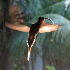
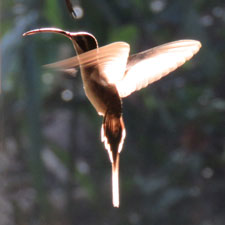
It was the diesel generator kicking in at 6.30am that finally got us moving. It was a good time to be up, rewarded by sightings of woodpeckers, toucans and the beautifully fragile hummingbirds. |
|||
 |
 |
 |
 |
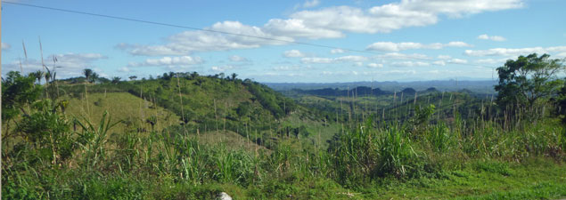
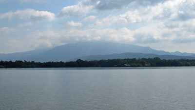
It was, however, time to move on. The route to Rio Dulce lay ahead, but first we made a stop to visit Flores, a pretty town on an island in Lago Peten Itza. Then it was a 4-hour trip across the landscape of the Mojotes, a series of low limestone hills rising sharply out of the flatter lands, covered in rich rain forest and patchworked in parts by farmland and pasture – a fascinating green and textured landscape. This is the end of the Yucatan, where the flat limestone plain crinkles as it butts up against the Ring of Fire. |
||
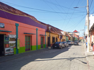 The pastel-coloured houses of Flores |
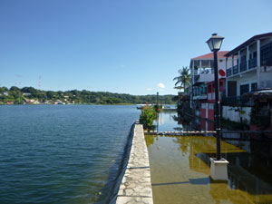 Lago Peten Itza rising |
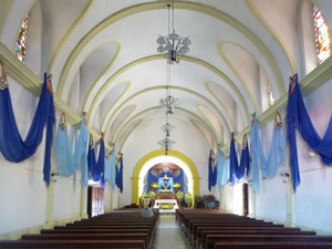 Interior of Flores Cathedral |
|
||
|
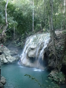
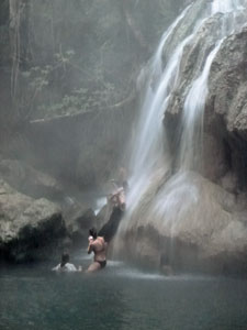
The Ring of Fire is volcanic, and we knew we were near, when we stopped at Finca Paraiso. Here hot springs bubble up to the surface before flowing down over a 10m waterfall and into a creek. It was a beautiful site in the rain-forest, managed by the local Mayan village community. We both love hot springs, but a hot waterfall was something extra special to finish a great day.
|
|
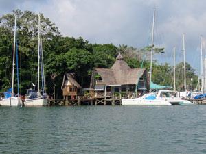
Half an hour later, including a 5-minute boat trip, we were at our very comfortable hotel on the shore of the Rio Dulce. It was time to enjoy our dinner, with the surprise of one extra-large Guatemalan chocolate cake at the end – Happy Birthday, Odile! |
 Rio Dulce sunrise |
|
 Our lodge at Rio Dulce |
 |
|
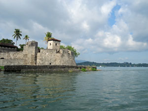
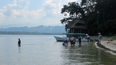
The following morning, we ate our breakfast on the deck of the hotel overhanging the clear waters of Rio Dulce. By lunchtime, we were on the shores of the Caribbean, eating Tapado (the Caribbean version of bouillabaisse), to the soft accompaniment of reggae music. A lot had happened in between. After breakfast, we all clambered in to a Guatemalan long-boat to head a short distance upstream to take a peek at Lago de Izabal, the largest freshwater body in Guatemala. You know a lake is big when the horizon is just water. The lake is guarded by the fort of Castillo de San Felipe, built by the Spanish in the 17th century for protection from English pirates.
|
|
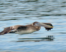
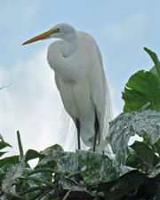
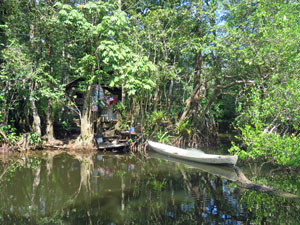
Then it was a 180° turn to head down the broad course of the river, with a large rooster-tail in our wake – passing small islets where herons roosted and cormorants nested, marinas full of ocean-going yachts and small Mayan fishing villages sitting precariously between river and rain-forest. Many gringos from North America moor their big yachts here because it is much cheaper than at home and the juxtaposition of the first world with subsistence villages seemed a bit bizarre. |
|||
 |
 |
 |
 |
|
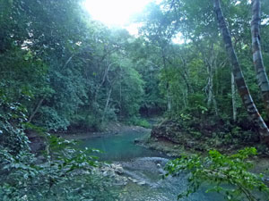
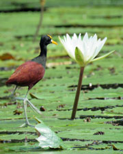
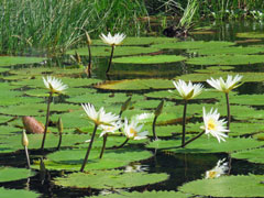
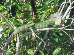
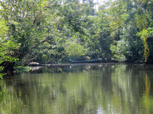
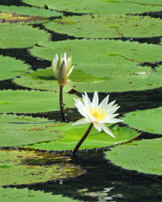
Speeding on, we crossed the lake-like basin of El Golfete, framed to the south by the fading-blue silhouette of the Guatemalan mountains. Near the end of El Golfete, we slowed down to explore some of the small canals and lagoons that fringe the Rio Dulce – overhanging trees reflected in still water, flowering beds of water-lilies, banyan roots dangling down into the canal edges, colourful air-plants, bright green iguanas and numerous water-birds. This was the Rio Dulce as it once was. |
|
|
|
|
|
|
|
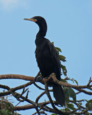
Leaving the canals, our captain fired up the outboard and we sped along as the river narrowed, to follow its winding course through a jungle-clad limestone canyon - all along, the stately herons watched us pass by, like spectators at a boat race. Then, as quickly as we entered, we emerged from the canyon. Ahead, the river widened and a large flat expanse of water filled the eastern horizon – we had reached Amatique Bay in the Caribbean Sea. On our left, houses began to appear, as the captain slowed down and pulled into the pier. We arrived at our destination – the little town of Livingston. |
||
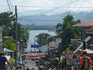
 Approaching the town of Livingston |
 |
 Looking over the Caribbean Sea from Livingston |
|
|
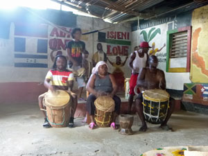
Livingston is the home of the Garifuna people – descendants of African slaves and Caribs – and they have their own language and culture, defined in part by music based on drums. It is more Caribbean than Central American, which is why, after wandering through the town and listening to a Garifuna drum quartet, we found ourselves in a restaurant eating their traditional fish soup to the sound of reggae – beautiful. After lunch, we returned to our hotel at Rio Dulce, much quicker than our outward journey. Our captain opened up the throttle and, with the wind in our hair, the boat lifted its nose and covered the 48 km in 45 minutes. It had been another great day in this special corner of Guatemala. |
|
|

Guatemalan Highlands |
Once again it was time to move on, as we were headed for the western highlands of Guatemala. It was a long drive. Leaving behind the lush green forest and farmlands of the Caribbean Coast, the landscape gradually became drier as we followed the Motuga River up though the Valle del Orno. Here, cactus and sparse-leaved scrub replaced the verdant vegetation of the coast. However, the river provides water and this region supports the production of much of Guatemala's fruit and vegetables. |
At the end of the valley, we began to climb up into the highlands of Central Guatemala. It was a slow and tedious climb, as long stretches of roadwork were being carried out on precipitous slopes to improve transport from east to west. Luckily though, once through the roadworks, we could enjoy their fruits, as a 4-lane highway swept us through the mountainous terrain and into Guatemala City, a sprawling megapolis of 4 million people. Aquilino kept the journey interesting with more excerpts from the fascinating history of Guatemala, both old and recent.
|
|
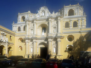
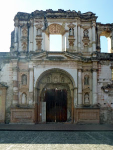
Forty minutes after leaving the big city and 9 hours after leaving Rio Dulce, we arrived at the city named at its foundation in 1542 as "Muy Noble y Muy Leal Ciudad de Santiago de los Caballeros de Guatemala". For over 200 years it was capital of Colonial Central America. Today it is better known as Antigua, and is World Heritage listed for its colonial architecture. It was time for a stop, but just overnight. We were heading further west, though in a few days we would return to give this old city the attention it deserves. |
|
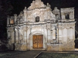 The colonial buildings of Antigua by night |
 |
|
|
Chichicastenango |
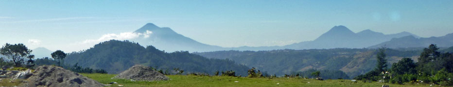
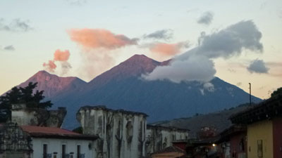
After breakfast on the roof-top terrace of our colonial hotel, from where we could see the three volcanoes that comprise the Antigua skyline, we boarded a new mini-bus for the three hour trip to Chichicastenango. I should enlarge by saying, three hours of winding our way across the steep ridges and valleys of the Western Highlands, past fields of vegetables and corn, and plantations of coffee - this is a rich and fertile land. |
|
|
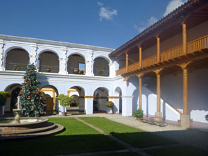
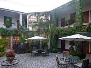 The interior courtyard of our hotel in Antigua |
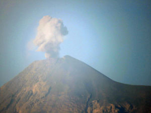 Volcan Fuego |
|
It is also the home of Guatemala's famed "chicken buses", old North American school buses cut down, chromed up and given supercharged Caterpillar diesel engines. These over-powered machines, filled with people and produce, speed up and down the steep and winding highland roads to keep the local economy ticking. |
||

Our under-powered mini-bus took longer to reach Chichicastenango, home of the oldest and largest market in all Central America. It probably pre-dates the Spanish and is a colourful assemblage of clothes, materials, artisanal craft, fruit and vegetables. Here it is bargain or pay a premium. For the fair Nello and I, it was "estamos solo mirando (just looking)". Bargaining in crowded markets for goods we're not sure we want is not really our thing. |
||
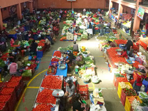 |
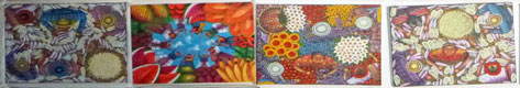
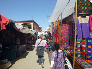 Market scenes in Chichicastenango |
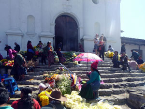 |
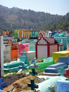
That said, the old colonial church, where the Mayan villagers practice a syncretic form of Catholicism mixed with traditional Maya beliefs was interesting, as was the pastel-shaded polychrome cemetery. The Mayans like their deceased family members to rest in colourful places. |
|
|
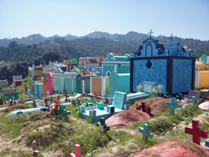 The polychromic cemetery of Chichicastenango |
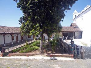 Courtyard of the old Spanish convent |
|
Once all of the group were marketed-out, we hopped back on the bus and headed for the small Mayan village of San Jorge de Laguna high above the shores of beautiful Lake Atitlan, where we would spend the night in the house of a Mayan family. |
||
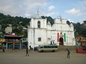 Church at San Jorge de la Laguna |
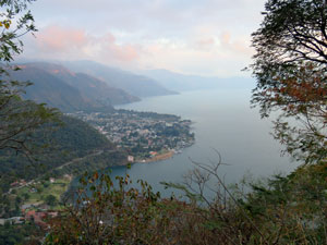 Looking down toward Panajachel |
 Evening falls over Lago Atitlan |
It was an interesting, if slightly comfort-stretching experience, that tested our limited Spanish. We managed, and it was also fascinating to listen to the family members speak to each other in Kaq Chikel, the local Mayan dialect (I wonder what they were saying about us). Thanks, Daniel, Majella and children for sharing your home with us. |
||
|

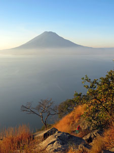
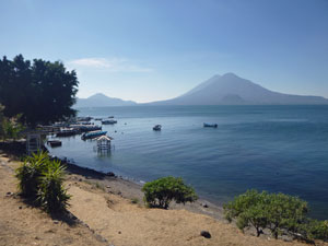
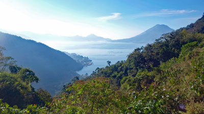
Lago Atitlan |
Guatemalans consider Lago Atitlan to be the most beautiful lake in the country, and here we were in the late afternoon sunshine, sipping a beer on a deck in the lake-side town of Panajachel, and looking out over the silver-sheened waters of Atitlan to the imposing presence of the volcanoes - Toliman, Atitlan and San Pedro. The Guatemalans are right. |
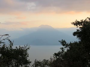
 Volcan Toliman in the morning light
|
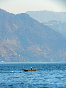
Who would have thought though, that beyond the smooth waters of the wind-shadow created by the steep hills backing the lake, there were foam-tipped waves and a short chop of up to a metre generated by the strong nor-wester ….. or that half an hour earlier we were thumping our way across these rough lake waters in a small water-taxi. It was an adrenalin-filled ride, as the bow lifted on one wave to smack down with a spine-jarring thump on another. It was thirty minutes of thump and crash from the town Santiago back to Panajachel before gliding into the smooth waters close to the hills.
|
 Never far from a volcano
|
That morning, we had begun our day with a similar adrenalin kick. After a short climb up to the Roca Roja viewpoint to catch the dawn light, we said "adios" to our host families in San Jorge, and hopped into the back of a pick-up, for the hairy ride down the steep and winding road to Panajachel. This is how the locals travel around the lake, so it completed our small sampler of local life. |
|
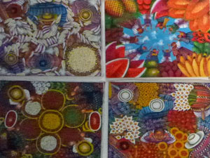
After checking in to the hotel, Aquilino took us down to the port, where we clambered in to our water-taxi for the smooth half-hour ride to San Pedro, a small craft-centred village on the western shore of the lake. It was while we were looking at the colourful Mayan art and textiles, and seeing how the weavers work their magic from raw cotton to finished product, that the wind sprung up.
That led to an interesting boat ride across the face of the waves from San Pedro to Santiago – with the waves crashing in and the boat rocking and rolling, all those on the port side got a good soaking. The fair Nello and I were on the port side. |
|


That said, with sun and wind, we were dry by the time we had had lunch and explored this little lakeside town, and were ready for the thump and bump of our return to Panajachel. The cold Guatemalan beers overlooking this beautiful lake were the perfect way to end the day. |
|
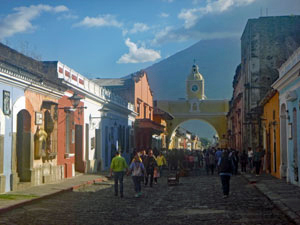
Antigua |
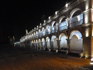
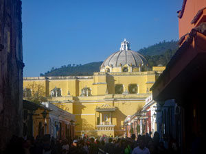
Everyone got a good sleep in this morning. We only had to leave Panajachel at 10 a.m to retrace our steps across the steep valleys and ridges of the Guatemalan highlands to Antigua. It was time for Aquilino to show us this World Heritage listed town, and we headed off to wander the cobblestone streets, past pastel coloured buildings with wrought-iron covered windows and large wooden doors, most of which hid the treasures of lovely, cool and shady courtyards inside. The capital of all Spanish Central America from 1541 to 1776, almost destroyed by an earthquake in 1773, Antigua is a fascinating place to visit. |
||
|
|
|

|
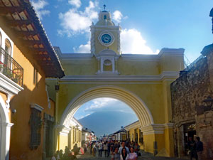
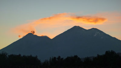
Being the former Spanish capital, it is filled with the symbols of power – public buildings and churches with magnificent facades – all this beneath the silhouettes of Agua, Fuego and Acatenango Volcanoes. It is indeed a magnificent setting.
|
|
That night, all went out to dinner – this part of the tour was over …. Some were leaving to head home and some, including ourselves, were heading on to more Central American adventures. It was also time to farewell our guide and friend, Aquilino, whose knowledge and passion for his Guatemala made this time much more than just a road trip. Thanks Aquilino and thanks to all our compañeros who made this journey a pleasant and fun-filled trip – Pamela and Gosha, Mike and Odile, John and Liz, Graham and Steph, Meghan, Clarity, Kate, Miles, Peter and Kevin. It wouldn't have been the same without you. |
 Dawn rises in Antigua |
With a spare day in Antigua before the second half our Central American adventure begins, the fair Nello and I headed in different directions. I opted to do a climb up to the lava fields of Pacaya, one of three active volcanoes in Guatemala and Nello headed off to learn the art of chocolate-making. I'm looking forward to the results. The days of climbing up to the rims of volcanoes seem well over in Latin America. After a couple of incidents, OHS has kicked in and hiking on volcanoes is strictly regulated. Thus, after an hour's drive south of Antigua in a mini-bus, our little group of six found ourselves following our National Park guide, Cosel, up through the scrubby forest on the lower slopes of Pacaya. Our departure was accompanied by the loud hissing of steam from the 25 megawatt geothermal plant installed there. |
Pacaya is a popular place to visit and we tick-tacked with a few other groups, including some on hired horses, as we slowly headed up the 400m climb. A strong cold north-westerly wind, the remnant of the big freeze in North America, whipped across the slopes and, for the first time since arriving, I felt cold. |
||
 View of distant Guatemala City |
 |
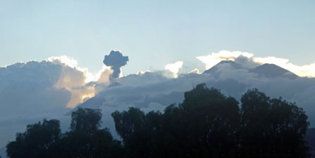
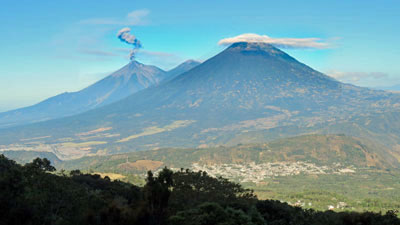 Volcan Fuego sends out a demonic plume, while Volcan Agua wears its saintly halo |
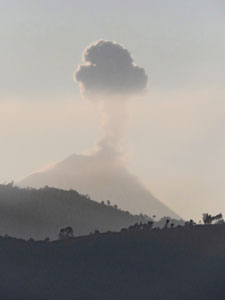
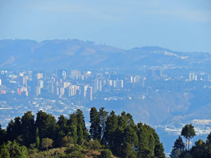
As we climbed up past the ash bed of the 2010 eruption, views opened up over ridges to the tall buildings of Guatemala City, only 25km away. More spectacular, though, were the views to the north of the perfect cone of Volcan Agua and, beyond it, Volcan Fuego, which has been continuously active for over 80 years. As if on cue, it sent up a big plume of smoke as we watched. |
|
|
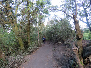 Track up through the forest of Pacaya |
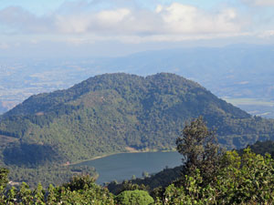 Looking down on Laguna de Calderas |
|
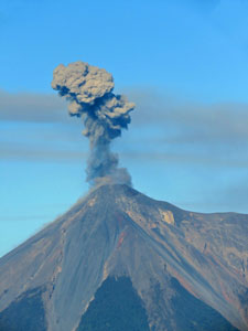
Some more steep climbing led us out of the low forest and into the open on top of the cinder cone of La Meseta. Beyond, the black silhouette of cloud-capped Pacaya dominated the jagged lava fields of the 2014 eruption. Higher up the slope, smoke seeping from fumaroles was swept away by the wind. As we took in the scene, gaps in the cloud revealed the top of the volcano and its two smoking vents – spectacular. |
||
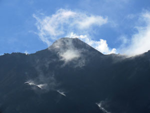 Steamy vents on Volcan Pacaya |
 |
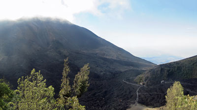 View over the black slopes of Pacaya from La Meseta |
|
|
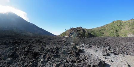
We wandered down to have a closer look at the lava-field, a jagged black landscape still hot below the surface, even more than three years after the last eruption. At one point, we stopped to do the party trick of toasting a marshmellow in a lava vent. After crossing the lava, we headed back down via a different and more open route, with scenic views over the lowlands to the west. It had been an interesting and enjoyable half-day, but now ….. where is that chocolate? |
|

 |
 Farewell to Antigua |
 |
|

