Ramblings in The Maritimes

Getting There

Our walk in Saguenay was our farewell to Quebec, and also to the sunny weather of the last couple of days. We set out under grey overcast skies, catching the early car-ferry across the fiord from Tadoussac and then continuing east to Saint-Simeon, where we caught an even bigger ferry for the 28km crossing of the St Lawrence to Rivière-Loup.


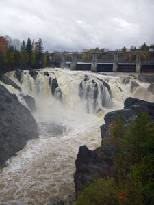
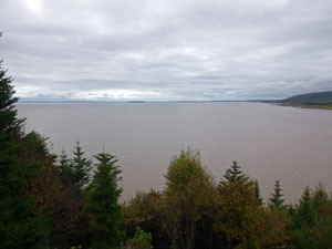
Crossing the St Lawrence River

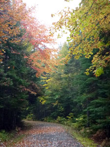
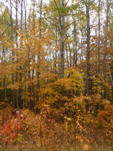
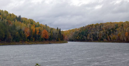
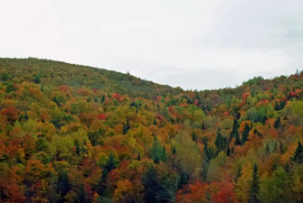
Appalachian forest brightening up a dull grey day

We headed southwards and soon crossed the provincial border, leaving francophone Quebec and entering bilingual New Brunswick. For us it was the most interesting of the Canadian provinces – with a third of its population descended from the Acadian French colonists, it is officially and practically bilingual. We never quite knew which language we would be greeted with. And so we drove across it, skimming the US border and the Appalachian Mountains, aglow with the reds and oranges of their autumn colours, listening to chansons françaises, American country music and Acadian music – a very listenable fusion of french lyrics and country tunes. This is what should happen when two great cultures meet.

After a long, but entertaining drive, we reached Moncton and checked into our heritage listed hostel for the night. We were here because it is close to The Bay of Fundy, which boasts the highest tidal ranges in the world (over 15m), and that is something worth seeing.


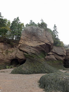
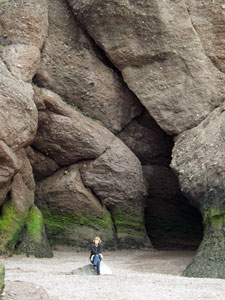
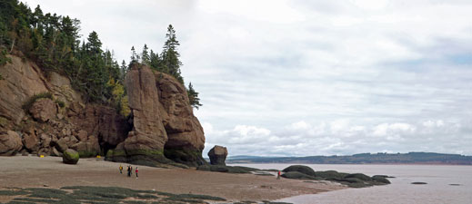
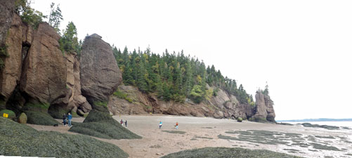
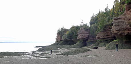
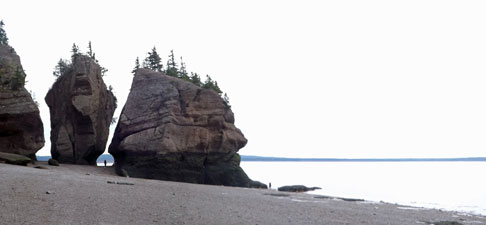
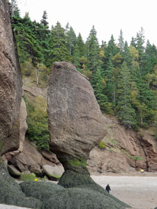
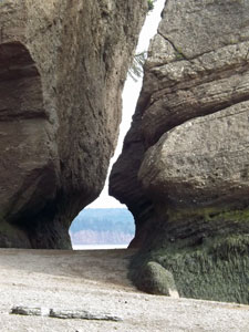
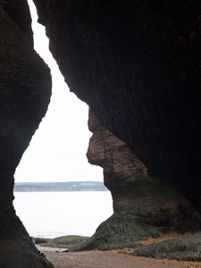
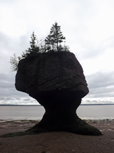
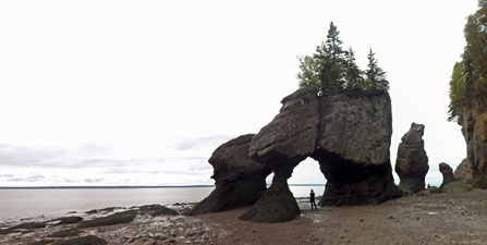
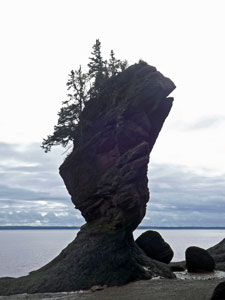
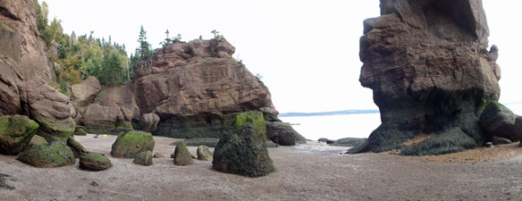
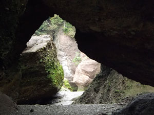
The Flower Pots – Hopewell Rocks (Big Tide in the Bay of Fundy)


The next morning, still grey, we made the short drive down to Hopewell Rocks on one of the two end branches of the Bay of Fundy. Here the tides have sculpted the sandstone and conglomerate cliffs, cutting out sea-caves and carving strangely-shaped columns of rock. Twice a day the monster tides roll in and out eroding away a bit more of these columns to create the precarious stacks with bases thinner than their tops. Many of them have a crown of stunted conifers, to which they owe their nick-name of The Flowerpots.

The Flowerpots are a major tourist attraction and each year, many thousands of people come here to walk on the sea-bed around the bases of the columns and cliffs at low tide. Then for the next few hours you watch the chocolate brown tide come in and cover the sea-floor, lapping the cliffs and isolating the columns.


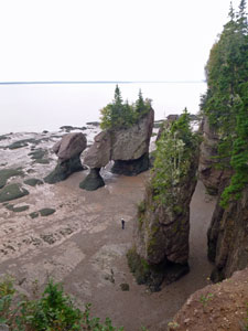
Low tide at "The Flowerpots" ....


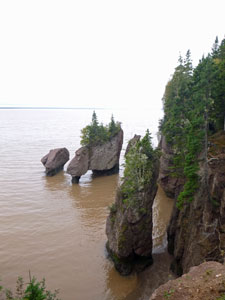
.... and six hours later and 11m higher

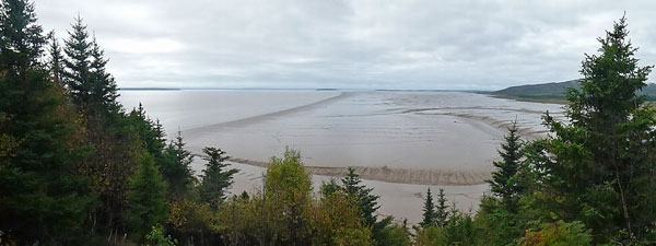
Tide crossing the mud flats of The Bay of Fundy

After the tide rolled in

We joined them and, fortunately, at this late date in the season (early October) the numbers we joined were far fewer than in mid-summer. It was interesting to see the broad mud-flats at low tide (which give the water its swim-discouraging hue of pale brown) and it was impressive to walk on the sea bed around and beneath the 30m high columns and arches, their bases strangely twisted and ringed by green fronds of sea-weed.


We walked as far as the headland from where the wide mud-flats began before heading back – the tide had turned and this would all be soon several metres under water. The photos here show the impressive rock formations and, if you compare the size of people to the erosion of the base of these rocks, you can get an idea of the tidal range.


Beach walk around the Flower Pots at low tide


The tide rose 11m on the day we were there, which is impressive – more impressive than actually watching it happen. The sea-bed near the cliffs is quite steeply sloping, which dilutes the impact of the incoming tide as there is not much horizontal movement (unlike the spectacle of a big tide where the seabed is very flat, such as Mont St Michel in France, where you would have trouble outrunning the incoming water as it races across the flats). Hopewell Rocks is more a before and after spectacle, but we enjoyed our visit and headed back to Moncton content and ready to move on.

Our main objective for this long foray into the maritime provinces of Canada was Cape Breton Island and that was still a long way away.


Cape Breton Island


Cape Breton coastline near Cheticamp

We did a couple of walks on Cape Breton Island, in the Highlands National Park and at the northern tip of the island, and these are described separately on the next page.


The route home - crossing New Brunswick

The windscreen wipers spent a lot of time beating time to the music on our way back from Cape Breton. We headed back towards Moncton, before turning north to follow the coastline up to the pretty Acadian village of Bouctouche. We were chasing the sun and the autumn colours and the former was a very rare commodity these days.


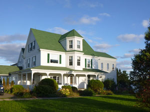
Old convent turned B&B in Bouctouche

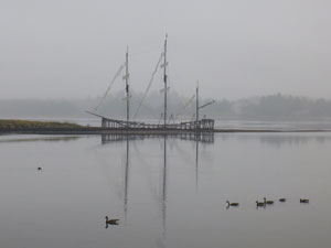
Reflections in the River

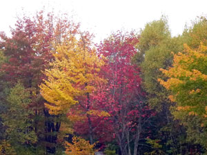
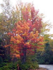
Autumn colour on the Acadian Coast

Our plan was to use Bouctouche as a base to visit the Kouchibouguac National Park and do some mountain-biking on its network of cycle paths by sea and forest. The rain put paid to that and, when we reached the park, we discovered that it had all but closed down and no bikes could have been hired anyway. Over the past week, the tourist infrastructure in eastern Canada has been slowly shutting down and within a week it would be taken off the respirator.


Bike path in Kouchibouguac


The colours of Kouchibouguac

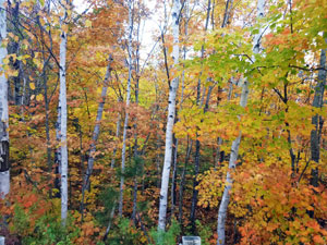
It was a shame we couldn't do the bike ride, as the season was late on coastal New Brunswick and the autumn foliage in the park was a vibrant mix of red, orange and yellow tones – possibly the best we had seen.


A splash of pink and orange


Edge of the forest in Kouchibouguac National Park

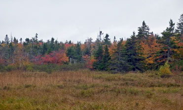
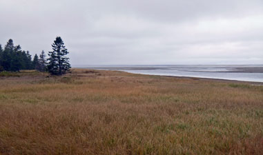
Coastal marsh in Kouchibouguac

And so it was – weather bad, foliage good – as we wandered on, crossing the centre of the province on country roads beneath the golds of the upland trees, that lightened up the mist and rain. However, when we finally reached the valleys of the Tobique and St John Rivers, the colours of autumn were fading and many of the trees now stood bare-trunked – a grey fringe on the landscape.


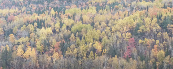
Crossing central New Brunswick


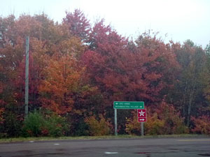
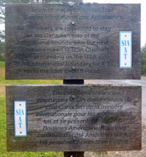
Sign for the International Appalacian Trail


It was definitely time to be moving on, with single digit maximum temperatures and snow flurries forecast. We had one last plan to catch some colour and that was to walk the start of the International Appalachian Trail. It was in these mountains on our way to Cape Breton that we had been impressed with the richness of the autumn colours. What difference would a week make?


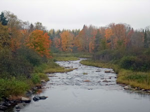
Shores of the St John River


The last remnants of autumn colour in the Appalachians of New Brunswick

A lot apparently – the forest had a distinctly washed out look, as the autumn leaves fell to be replaced by the greyness of bare tree trunks. There were still some splashes of yellow and orange, but the fall colours for 2012 were on their way out. So were we. We had driven up to the Fort Fairfield border post between USA and Canada, where the International Appalachian Trail starts. However, with the thermometer showing 3°C , the skies grey and forest not that inspiring, we decided it was time to go.


Grand Falls / Grand Saute


After a short detour to Grand Falls, to see the largest waterfall east of Niagara (the falls themselves were impressive, but who would build a big barrage a few metres back from their biggest tourist attraction – c'est monstrueux!), we headed on towards Montreal airport, this time the wipers beat time to the sleet falling slushily onto the car windscreen. It had been good but it definitely was time to leave eastern Canada.