Crossing the Julian Alps (Kranjska Gora to Trenta)


Day 1 - Kranjska Gora to Dom v Tamarju (13 km - 530m ascent - 230m descent)

At last the day had arrived to set out on our grand adventure in this region - a six day crossing of the Julian Alps from Kranjska Gora to Lake Bohinj. We had not planned long days of walking, partly in deference to the weather patterns, where mornings tend to be clear and afternoons to have cloud build-up with the potential for rain and thunderstorms, and partly because we wanted to enjoy each day and have time to explore the areas around each of the mountain huts we would stay in.

Thus we set out on a strange day, where the sun shone in the valleys, but grey cloud hung closely to the mountain tops, obscuring some of the peaks and providing a hint of menace. We retraced our footsteps of two days ago, following a curving street through the centre of town and past the chapel, then picking up the rail-trail cycle path that provided a smooth asphalt route past the ski-fields. As we neared the tiny station at Podkoren, the two-carriage hiking train pulled in for a rest on its bench seat.


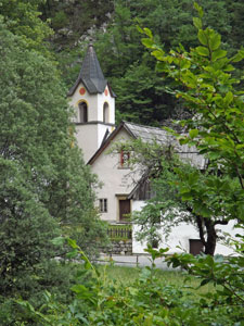
The church in Kranjska Gora

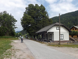
Disused railway station in Podkoren

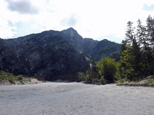
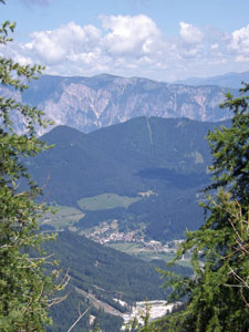
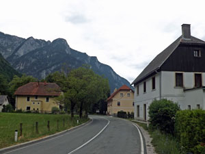
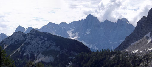
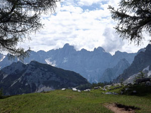
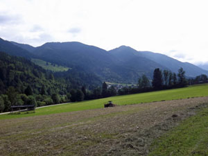
View over the fields to the Karavanke Range

After having used it for the past three days, we were a bit jaded with walking on this cycle path and were pleased when, a short distance on, the no. 9 walking trail headed off on a gravel track to slowly edge its way across the ski-fields. This was an interesting concept - ski-field in winter, hay-field in summer. In fact as we wandered across these grassy meadows with views back down the valley to the tree-clad slopes of the Karavanke Range, the local farmers were out and (literally) were "making hay while the sun shines". Old narrow hay-racks dotted the grassy slopes, as did the odd piles of plastic covered hay bales, a mix of old and new technologies.


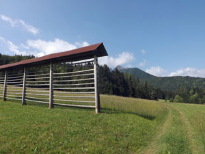
Hay rack on a ski run

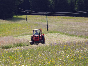
Slovenian farmer making hay while the sun shines

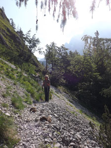
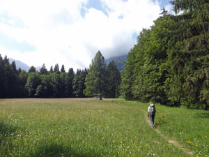
Crossing a meadow in the Planica Valley

Just after the eagle-eyed Nello spotted a fox crossing the meadow, we entered the forest to follow a dry limestone-white creek bed upwards. We were now curving into the Planica Valley and, leaving the shade of the forest, found ourselves again crossing a meadow thick with grasses, herbs and wildflowers. Beautiful meadow one day, hay bale the next - such is life.


Limestone bed of a dry creek


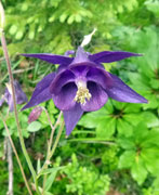
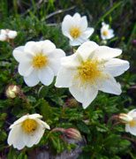
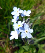
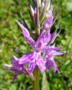
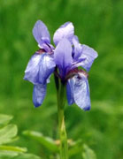
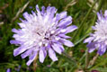
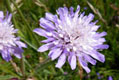
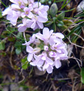
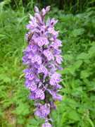
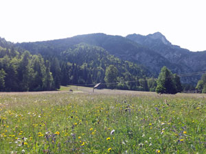
Flower-speckled meadow below 1745m Cprinik

The track through the meadow emerged at a large winter sports complex and a convenient place for a coffee break. We had reached the Planica ski-jump area, with its three massive ski-jumps (where world records are regularly broken) and, from the huge construction work under way, soon to more jumps. Looking up at the big jump, I could not imagine zooming down on skis to hurtle off the base and fly over 200m through the air.


The big ski jump at Planica


Wide stony path through the forest


The broad stony creek bed near Planica ski jumps

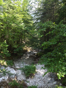
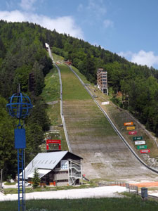
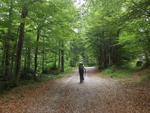
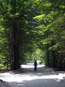
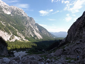
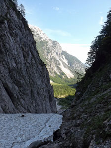
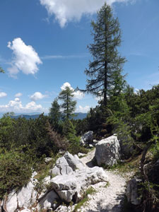
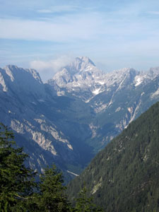
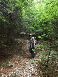
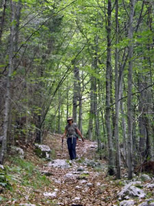
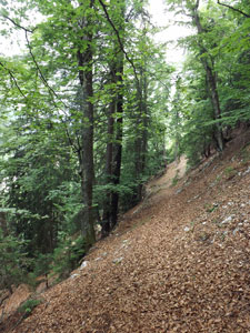
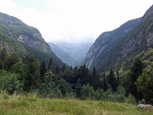
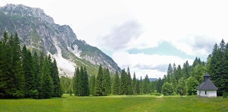
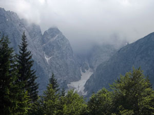
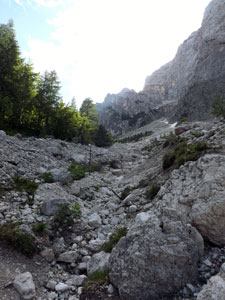
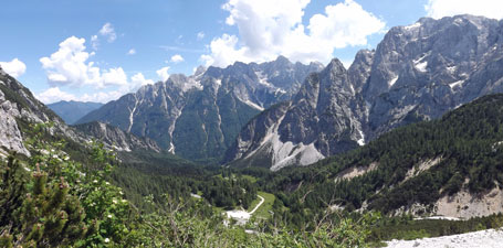
Leaving the ski-jumps behind, we crossed a dry creek, its stony bed the colour of old bones and backed by the sheer walls of the valley. From here we veered right to follow a broad, loose-stoney path through the beautiful forest of the Planica Valley, in parts under the luminous-green of beech canopy, in parts under the darker greens of spruce and pine. The valley was slowly being wedged by the sheer rock walls of Slemenova Špica to the east and Ponca to the west. Occasionally, a gap ahead would reveal the cloud-covered head of the valley and the sheer rock walls of the peaks backing it.


Beech forest of the Upper Planica Valley


In the forest of Planica


The beautiful setting of Dom v Tamarju

Finally, the track emerged into a grassy clearing backed by the walls of Mojstrovka, at the end of which lay the attractive brown wooden Dom v Tamarju - our home for the night and our first experience of a Slovenian mountain hut. It was a pleasant and comfortable place to be. We had the afternoon to relax and enjoy this tranquil and spectacular setting. Despite the clouds still hovering ominously over the mountain tops and hiding the face of Jalovec, the sun shone on the grassy meadow of Dom v Tamarju and we soaked it up.


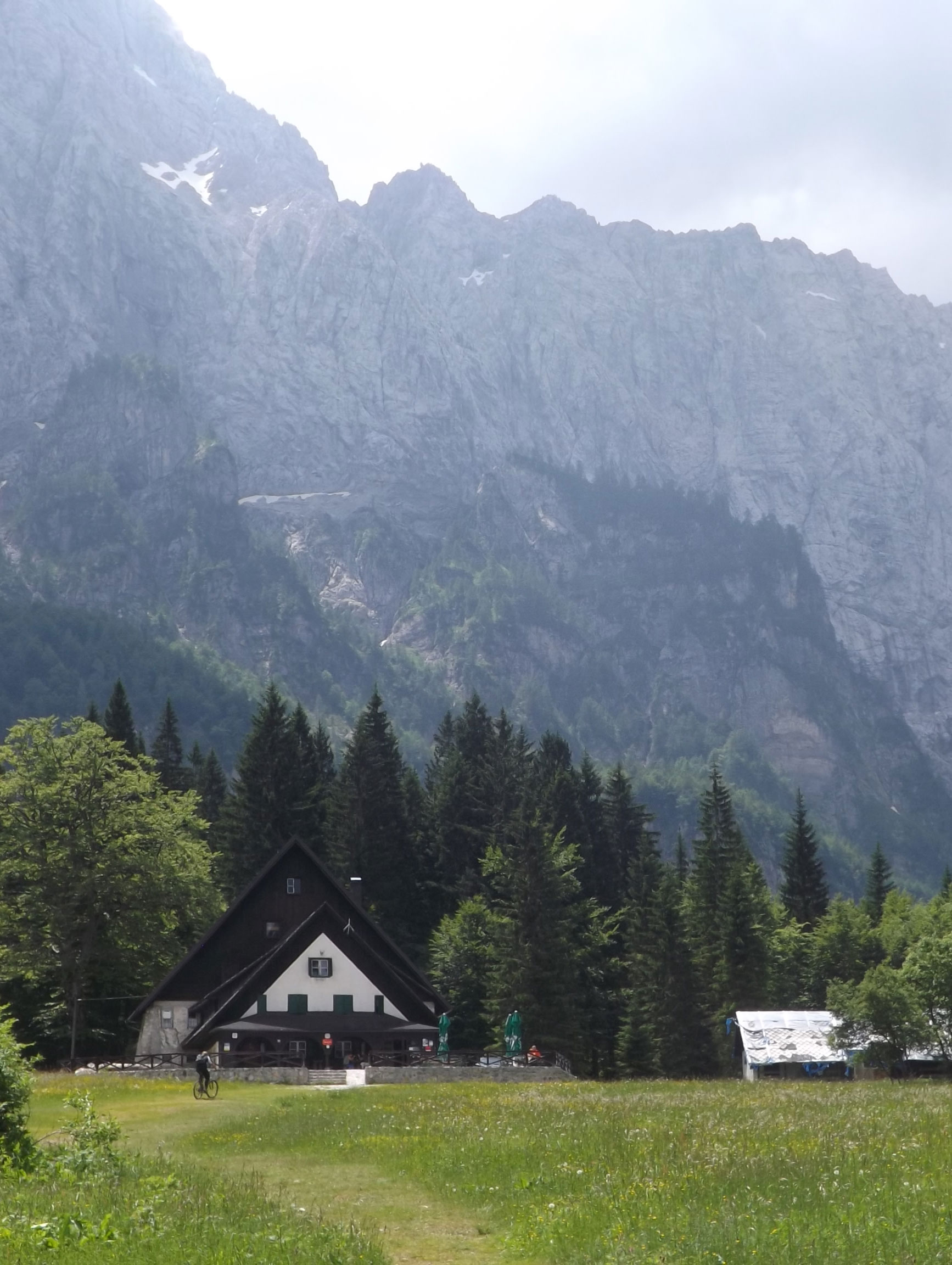
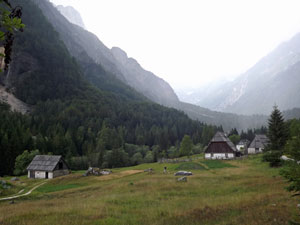
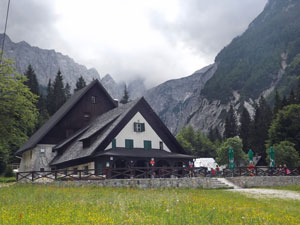
Close up of Dom v Tamarju

Looking past the chapel and down the Tamar Valley from the mountain hut

Nearby, pouring directly out of the cliff-face below Ponca was Izvir Nadize, a spring that transformed itself immediately into a waterfall and then within 100m of reaching the valley floor disappeared into the limestone rocks of a stream bed. Here was the true source of the Sava River (the waters flow underground to bubble up at the Zelenci Pools) and, as such, was well worth the visit. It was a short walk, but a steep climb with a few steel cables at the end for good measure. The spring was wonderful to see as the water surged up into a small pool before tumbling away down the mountainside.


Water from the spring Izvir Nadize pouring
out of the rock face

The water would also have been close to the purest that I have drunk. The bonus of the climb was the glorious view across the valley to the rock walls of Slemenova Špica, our somewhat daunting destination tomorrow.


View of the rock walls of 1911m Slemenova Špica from the spring


The water of Izvir Nadize tumbling down
to the valley floor


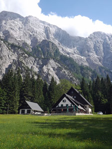
Dom Tamar and the silvery walls of Mojstrovska

Back at the hut, we watched the shadows creeping quickly across the meadow as the sun disappeared early behind the heights of Ponca, though for a long time it still lit up the limestone walls of Mojstrovka on the eastern side in a mercuric sheen - magical!


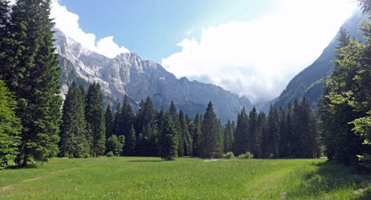
The beauty of the Tamar Valley

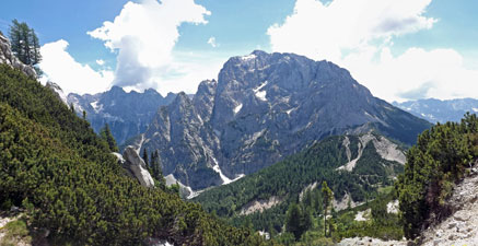
View towards cloud-covered Jalovec

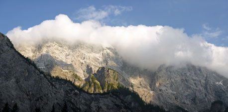
Cloud clinging to the rocky tops of Mojstrovska


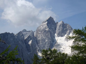
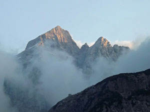
At last, the 2645m peak of Jalovec emerges from the cloud

Then it was time for dinner and bed - we would need to start early tomorrow for the big climb up to Sleme. Just before retiring, I went out to take one last look up at the mountains - the sharply defined rocky crest of Jalovec was beginning to appear as the clouds slowly dispersed. Tomorrow promised to be a good day.


Day 2 - Tamarju to Postarski Dom (10 km - 1010m ascent - 420m descent)

The promise was kept - it was a perfect cloudless morning - I wandered outside to find the valley floor still deeply shaded by the rock walls to the east, but at the head of the valley the sun illuminated the face of Jalovec. It is indeed an impressive mountain. We ate breakfast, packed and headed off soon after 8am, hoping to make the most of the good weather.

The path left the hut and immediately entered the forest to take us steadily up the valley beneath a canopy of beech. The air was crisp in the shade of forest and mountain as we crossed a dry river bed and a little later emerged into the open to follow a faint track across the rocky floor of the Tamar Valley. To our right, the valley continued up to its head, where the walls rose steeply towards the sunlit peak of Jalovec - it would dominate the morning's walk.


Early morning on the crystal-like peak of Jalovec

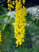
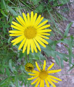
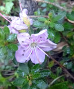
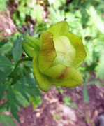
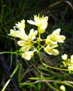
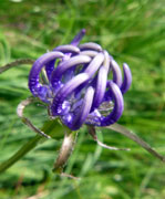
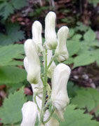
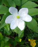
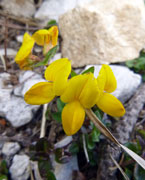
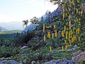
Alpine laburnum lighting up the shade

Our route, however, lay directly ahead, and we could see the tiny figures of two other walkers on it - heading up to a steep snow-filled couloir. We soon left the scree to join them on the icy snowdrift, which flowed down a narrow gap between sheer rock walls. It was a place where the sun never shone and the snow remained long into summer. It was also hard work, step by step, making sure of each footing before taking the next. We were pleased to see the marked track heading off to the left up a snow-free, but very steep gully which brought us to the top of the cliffs.


Our route up the icy couloir


Who's that?


Morning shadows over the Tamar Valley

The track now headed up through a lovely forest on the lower slopes of Mojstrovka, the soft brown leaves underfoot and a perfect chilly stillness in the shadow of the mountain. As we emerged from the trees, a noise caught our attention - three chamois were bolting up the rocky slope ahead. One stopped and for a moment we sat watching each other, before, with a great leap, it headed off to join its fellows. That was worth the climb!


Leafy slopes above the couloir

Crossing the rocky slope, we reached a steep and deep limestone channel, scoured by melting snow. We followed it up for a while, before continuing the climb on a loose scree track amongst stunted larches and a green carpet of prostrate shrubs and flowering herbs. The shadows were now retreating fast and the sun broke out above the sheer rock walls of Mala Mojstrovska - it was time to stop and unzip the legs of our pants. Even in the cool we were damp from the effort of the climb.


Looking back down the couloir


Aaaah hikers - I'm out of here!


A glance back towards the pyramid of Jalovec

Rocky gully heading up to Slatnica Pass

Climbing the gully below Mojstrovska ...

... and the route ahead to the pass

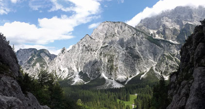
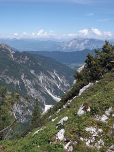
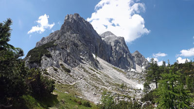
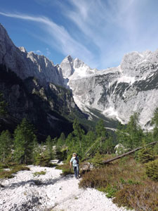
Passing a bell-tinkling flock of sheep, we left the ascent gully to begin climbing up the grassy slopes of Slemenova Špica - a steep zig-zagging path up through the larch trees that finally brought us out at Slatnica Pass. From here, the eastern horizon opened up with views across the sheer face of Mojstrovska to Špik, Škrlatica and the northern Julians peaks - a superb panorama in the warm morning sunshine.


At last, the view eastwards from Slatnica Pass

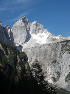
Looking across the Vratca Pass towards the massif of Škrlatica (2740m)
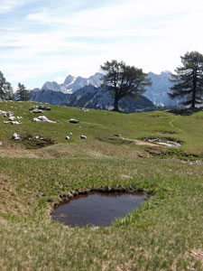
The pools of Sleme

Our climb was not quite over though. We pushed on up to Sleme - a high meadow with a series of pools, sadly mostly dry and the others fouled by the sheep, but in its all still a beautiful and tranquil spot with views to the Julian peaks in the east and to Jalovec in the west.


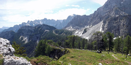
Looking at the route ahead - from Sleme meadows to Vratca Pass

A final push up the steep grassy slope brought us to the high point, Slemenova Špica, 800m above Dom v Tamarju where we had set out, and from where we could look across the Karavanke range to the snow-capped peaks of the Austrian Alps. The fair Nello found a nice shady spot, relatively free from the waft of sheep droppings and we stopped for a lengthy break to take it all in.


Looking down the Planica Valley


View out over the Planica and Sava Valleys


View from Sleme towards Škrlatica

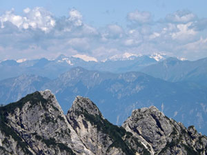
The distant mountains of Austria - from Slemenova Špica

Then it was back down, this time keeping south to follow a narrow footpath that picked its way down through the rocky limestone jumble to traverse the steep and rocky slopes high above the Mala Pišnica Valley. The path provided glorious views down the valleys and past a couple of precipitous gullies, while at the back, the distant snow-capped peaks in Austria rose above the Karavanke Range.


A last look at Jalovec

The cliffs of Slemenova Špica and the Karavanke Range


The track to Vratca


The pyramidal north face of Mala Mojstrovska

We turned to climb back up to the Vratca Pass, at times facing the impressive grey walls of Mala Mojstrovska, now looking distinctly pyramidal. We had now reached the Velika Pišnica Valley (at the base of which lay Kranjska Gora) and found ourselves looking directly across to the grey bulk of Prisank and down to the Vršič Pass way below.


Looking back toward Velika Mojstrovska


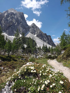
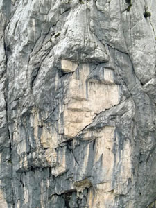
View of 2547m Prisank from Vratca Pass

Looking down the north side of the Vršič Pass (with Škrlatica and Prisank behind)

We followed a narrow and loose-gravelled rocky path down the slope, across scree and to the pass itself. On this sunny side, the heat was bouncing off the limestone - it was hotter work than the climb up in the shade. It was lunchtime when we reached the pass, so we wandered over to the Tičarjev Dom mountain hut for a bite to eat.


Ajdovska Deklica (The giant girl)

Tičarjev Dom is a large and busy mountain hut, so we decided to make one last 15 minute climb up a gravel road to Postarski Dom, smaller, newer, quieter and with magnificent views from its saddle beneath the massive bulk of Prisank - it was more our style.


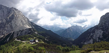
The setting of Postarski Dom mountain hut on the flank of the Vršič Pass

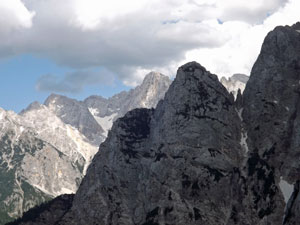
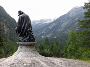
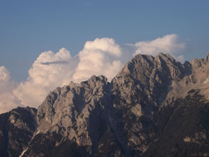
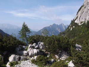
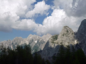
Three aspects of the Julian Alps

After settling in and resting up, there was still time for a bit of an explore up to Vršič Peak just behind the hut for its all round views of the mountains and down the Trenta Valley to the south. However, the cloud that had been building up since late morning was now taking over the sky - a cool wind began to blow and a few drops of rain began to fall. It was time to retreat into the comfort of the hut and reminisce about our magnificent day in the Julian Alps.


Day 3 - Postarski Dom to Trenta (17 km - 320m ascent - 1380m descent)
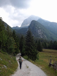
Over breakfast, we had a slight change of plan for the day's walk. Instead of heading down directly to Trenta, we opted to do the balcony walk below the rock walls of Mojstrovska, to take advantage of the views on offer, and then loop back along the upper Trenta Valley to rejoin our original trail. It was a curious morning weatherwise, with much more high cloud hanging around than before and some peaks already capped with cloud of their own making.

We set off, wandering down the gravel road to the Vršič Pass and then dropping off the other side of the main road to descend through scrubby pines to the cliff face. Here we were faced with an unexpected ascent as the track kept close to the rock walls of the mountain, climbing up to a narrow terrace with views down the lower Trenta Valley.


View of Bovški Gamsovec (2392m)

Ahead lay the pyramidal form of Bovški Gamsovec and back across the valley was the grey bulk of Prisank. The more distant peaks were already disappearing into the thick morning haze. Strange - yesterday we could see the distant snowy peaks of the Austrian Alps, today we can barely see across the valley.


Leaving Vršič Pass

On the traverse below Velika Mojstrovska


Crossing scree on the slopes of Mojstrovska

The track seemed unable to decide on a contour, climbing and descending over rocky spur and gully at the base of the cliffs. We were working up a sweat and it was only early morning. Eventually, it found a contour, moving slightly away from the rock face to follow a smooth path across the steep, pine and spruce covered slopes. Occasionally gaps opened up to give hazy views of valley and mountains. We could see the village of Trenta way below - our destination seemed a long way away and a long way down.


Hazy view down the Trenta Valley


Trenta lies at the base of this valley

We pushed on relatively quickly across this steep slope, descending gently, climbing sharply to round a bluff cliff face, then descending again until we came to a fork in the track. We kept left to reach a small log cabin in a clearing in the pines - it was the perfect place for a break.


The balcony track high above Zapoden


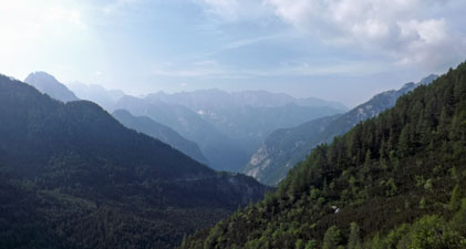
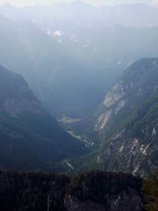
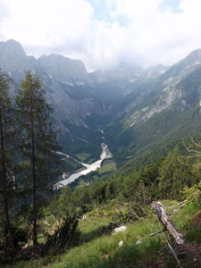
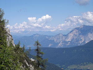
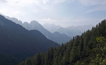
The ridges of the Julian Alps disappear into the haze

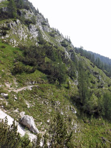
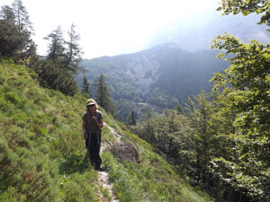
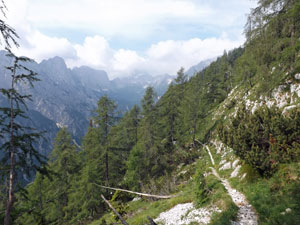
Crossing the slopes below Travnik

From here the track turned south and the descent began in earnest, as we headed steeply downhill on a track lined with the soft brown leaves of beech. We had entered the realm of deciduous trees and the deep layer of leaves covering the trail was soft underfoot, as we wound down via a series of zig-zags alternating with more direct lines down the long spur. It seemed endless, and the glimpses of green meadow on the valley floor never seemed to get closer. My knees creaked "enough", but the track kept on relentlessly down the steep spur, until finally after an hour of constant descent and 700m lower, we reached the floor of the Upper Trenta Valley.


Looking up the Zadnja Trenta Valley


Starting the descent to valley at Zapoden


... 400m lower and still going ....


...almost there, 700m below the traverse

It was time for another break to soothe our battered knees. However, we noticed that the sky was becoming distinctly clouded in and greyer. It was time to head on, down the gravel road to Koča pri Izviru Soča (the hut at the Soča Source). As we hurried along beneath tall conifers and past meadows and farmhouses, the first peals of thunder rolled down from the heights. We looked back to see rain falling on Jalovec behind us and approaching fast - the race was on.


The road to Koča pri Izviru Soča

As the thunder pealed, we were glad to be down in the valley and, as the big drops of rain began to fall, we were glad that the hut was just around the corner. We didn't quite get in dry, but we avoided a soaking and took the occasion to enjoy a bowl of hot soup as the rain fell outside.


Farmhouses in Zapoden (with rain on the way)


Prisank rises yet again

Then it lifted as quickly as it started, so I took the opportunity to make a 15 minute side-trip up a small rocky gully to see the source of the Soča River - a cave containing a deep amethyst blue well of water, that flowed out beneath the rocks to rush away down the limestone bed of the gully on its short journey to the sea. With its clear blue-green colour, the Slovenes consider the Soča their most beautiful river. Having returned to the hut, our new quest was to follow it for a while on the Soska Pot (Soča Path), which headed off into the forest to wander high above the rushing water. For the most part you could hear it, but only rarely could you see it, at the bottom of its densely forested valley.


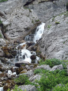
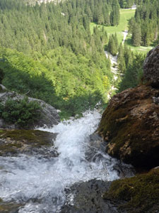
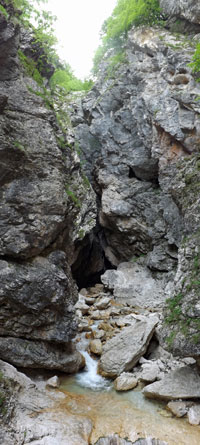
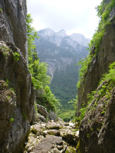
Looking out the gap of Izvir Soče (source of the river)

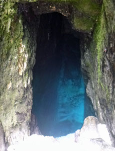
The clear blue pool of the Soča source

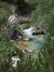
The Soča River below its source
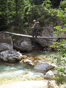

Statue of Julius Kugy - famous Slovenian mountaineer


Looking down the Trenta Valley

The Soska Pot then joined the main road, climbing slightly alongside it to reach the monument to Julius Kugy, a pioneer alpinist and promoter of the Julian Alps. It was actually a very moving monument, with the statue of Kugy seated and looking up to his favourite mountain (and ours) - Jalovec. The thunderstorm seemed to have cleared the haze, so at least now he could see it again. Heading on, we took a stepped path down a steep slope to reach the Mlinarica Gorge, where a side river to the Soča has carved out an incredibly narrow and deep gorge in the limestone. Unfortunately, the track stopped at the viewing platform at its entrance - impressive nonetheless.


Entry to the Mlinarica Gorge

Suspension bridge across the Soča
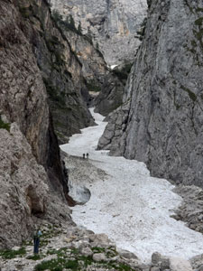
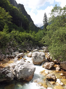
Limestone boulders in the Soča

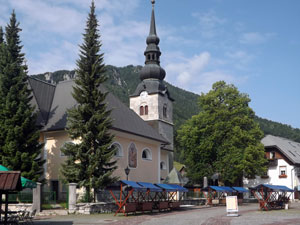
The church of Sveta Marija

Backtracking to cross the Soča on a swaying suspension bridge, we continued our way along the Soska Pot. Maybe, it was third day blues, maybe we had just spent too much time in the same sweat-soaked walking gear, but this section was a bit disappointing, again being more a walk in the forest with the odd glimpse of the river. We had hoped to get a little better acquainted with the Soča on the way down.

A final climb and zig-zagging descent brought us to our last crossing of the river and into the village of Trenta. We headed to the National Parks Information Centre to check out accommodation - a pleasant surprise, as we ended up in a room in a house in the village with hot shower, kitchen facilities and a chance to do some handwashing. After three days, the shower was bliss.


Houses in the village of Trenta

Clean in body and clothing, we headed off for our customary end-of-walk beer and found ourselves on the verandah, surrounded by the steep walls of the Julian Alps rising out of the grassy valley meadow, sipping a cold Zlatorog, all while listening the the background strains of Johnny Cash and Dolly Parton. It was a little surreal, but it mellowed our moods and we began to appreciate our good fortune in being here once again.

It was probably as well, as tomorrow would be the day of the big climb, 1400m up to the tops of the Julian Alps.