Hiking the Northern Albanian Alps

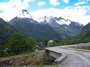
Getting There - Shkoder to Valbona

After an evening watching the promeneurs strut their stuff down the tree-lined pedestrian mall of Shkoder, we retired early. Tomorrow we would be off to the Albanian mountains and pick up time was 6.30am.

At the appointed hour we met our guide, Bledar, and fellow hiker, Ryan, and climbed aboard a local micro-bus, for the start of our journey to the Valbona Valley. Following the fertile flats for a short distance, we turned off and headed further inland on an increasingly narrow and winding road up the side of the Drin River Valley. The Drin was transformed by a massive hydroelectric scheme in the 1980s and we found ourselves above the waters of a series of reservoirs. Reaching the last massive concrete wall, the microbus disappeared into a dark and winding tunnel to emerge 750m later at the edge of Lake Koman and loading point for the local ferry.


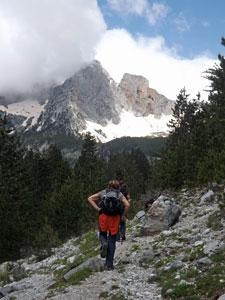
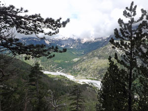
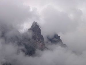
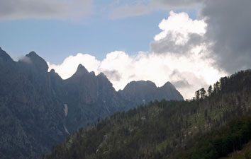
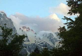
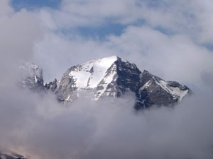
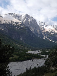
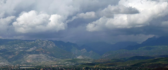
Storm clouds over the Accursed Mountains

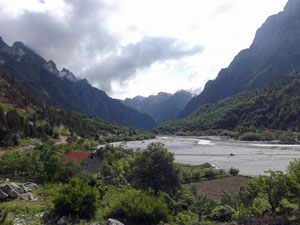
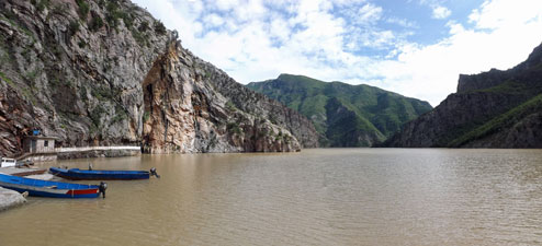
Starting point for our ferry trip at the Koman Reservoir

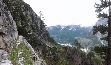
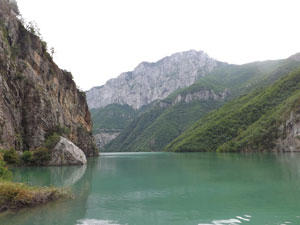
Leaving the dam wall behind to head up Lake Koman


The walls of the Drin River Canyon


A lakeside ferry stop

The ferry was a classic example of Albanian ingenuity, with the top half of a bus (seats included) bolted to a wide flat-bottomed steel barge creating comfortable seats and walk-around deck for passengers. It was our transport for the next 3 hours as we headed up the Drin River Canyon which walled in the very long and narrow Lake Koman.


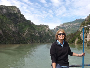
The fair Nello, with the wind in her hair

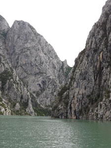
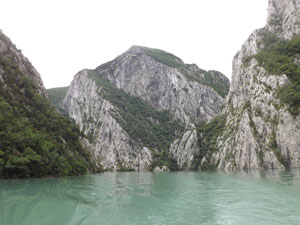
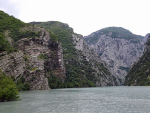
Steep walls and twisted strata

It was a spectacular voyage indeed, as we passed through a series of sheer-walled limestone gorges separated by the lush green of forested slopes. Every now and again, we stopped to drop off or pick up a passenger, from lakeside village or obscured house on the plateau high above. There are no roads to much of the lake and the ferry is the sole means of transport. If we did nothing else on this trip, the ferry was worth coming here for.


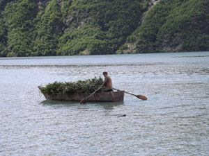
Local transport on Lake Koman

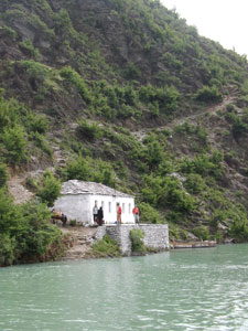
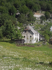
A small farm on the lake shore

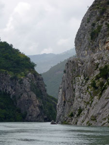
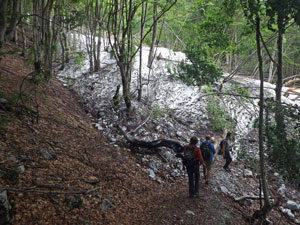
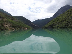
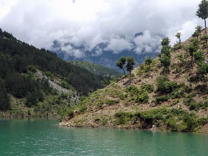
Some sections of the gorge were sheer-walled and rugged, while others (below) were more serene where still green waters reflected the forest-clad slopes


The road into the Valbona Valley

A few drops of rain began to fall as the ferry docked at the far end of Lake Koman, where we quickly jumped aboard a waiting microbus and sped off through a winding red-rock river valley to the town of Bajram Curri. After a bite of lunch, we had one more micro-bus trip, from Bajram Curri up the beautiful and very narrow Valbona Valley. With fifteen people and a variety of baggage and sacks aboard the 10-seater bus, we cranked our way slowly up the valley, following the course of the ice-blue coloured Valbona River, as it rushed down towards the Drin.


Dunishe - our home for the night


An old water mill near Dunishe

All around the peaks rose steeply from the valley floor, sometimes capped by mist and cloud, more distant peaks capped by snow. Already, the mountains of northern Albania were showing their dramatic landscapes.


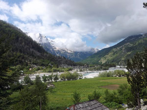
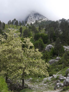
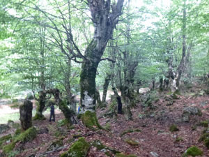
The forest of the Valbona Valley

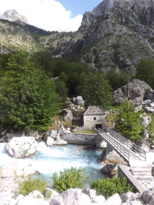
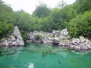
The clear green waters of Lake Xhemes

Finally, we reached our destination, a comfortable traditional stone walled, shingle-roofed guesthouse in the tiny hamlet of Dunishe, with the peaks of Kollates and Pecmares towering over a thousand metres above us on either side. It was already mid-afternoon, so Bledar suggested a leg-stretching short walk down through the forest to Lake Xhemes - tiny but with the clearest blue-tinted water that reflected the limestone rocks of its surrounds. It was a good introduction to the valley, but we are here to see the mountains and that means climbing. Tomorrow, we would hopefully be looking down on the valley from high above.

Day 1 - Rruga e Puntorve - the Workers' Trail (8 km - 940km ascent - 940 km descent)

After a hearty breakfast, in which everything was home-made, from the butter to the blood sausages, we set out on our first walk, the Worker's Trail. This track was cut into the steep-walled mountains behind Dunishe by miners searching for bauxite deposits. They didn't find any, but left a rather incredible trail for the enjoyment (and occasional bouts of acrophobia) of hikers to come.


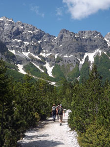
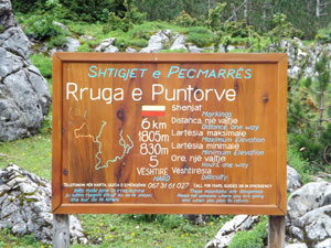
Rruga e Puntorve - The Workers Trail

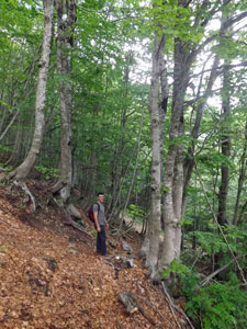
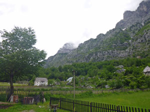
Leaving the hamlet of Dunishe

Passing through the valley forest

Mists drifted about the peaks as Bledar led Ryan, the fair Nello and myself out from the guesthouse and onto the path. Almost immediately we were climbing steeply up through the forest in a direct assault on the lower slopes. The birds were singing, the wildflowers were blooming and life seemed good. We soon discovered that there are only two directions in the Albanian mountains - up and down. Fortunately, there is some variation in gradient and on entering a tranquil grove of old beech trees, we climbed more steadily on the soft brown leaf litter past mossy rocks and tree trunks to reach the base of a long snow gully cum avalanche couloir.


Nello and Ryan climbing the big snowdrift

The workers had again decided that the quickest way up a mountain is a straight line, so we began a steep climb up the rocky rubble of the snow gully, soon reaching the remnant drift flowing down from high above. The cloud cover was keeping in the humidity and, even though the weather was cool, we were soon feeling the dampness of unevaporated perspiration. The drift widened to fill the gully, so we continued the climb on the snow, the rubble on its surface exposed by the melt helping to give some grip.


Looking back down to the Valbona River

Nearing the top, we climbed out of gully to follow the track on a long and rising traverse across the upper slope of the mountains, We had bypassed the first line of cliffs and were now above them, slowly picking our way towards the upper cliffs. The track was narrow and the slope, with its scattering of pines and shrubs, steep. It led us to a narrow spur, where a series of zig-zags brought us quickly up to an even higher traverse. From this point we could look down to the braided threads of the Valbona River, now several hundred metres below us.


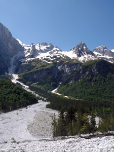
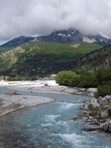
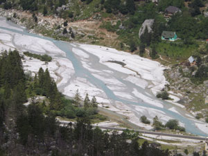
The braided course of the Valbona River

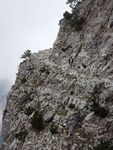
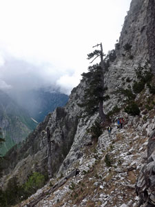
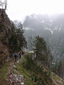
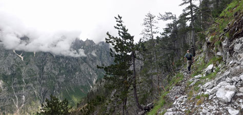
Steep traverse across the slopes of Pecmares

While the course and construction of the Workers' Trail is impressive, at times the current state of the track was less so and parts required a tricky negotiation where the rock surface had crumbled away or rocks had fallen from above. It was long way down this steep slope with little to stop a slide towards the cliffs and several times one of us sent a shower of stones rattling down towards the void. Rounding a narrow point, both climb and slope became even steeper as the track worked its way up through steep gully or spur. Views up an down the valley were expanding to provide impressive vistas, occasionally lit up when the sun broke through a gap in the clouds.


A steep rock wall on the Workers Trail


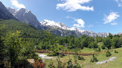
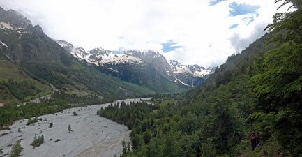
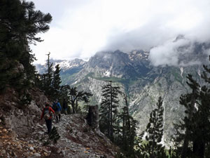
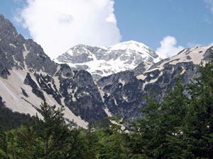
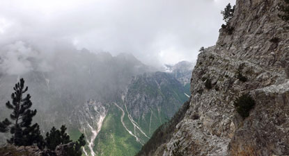
The vertical landscapes of Northern Albania

The peaks across the valley in swirling cloud

For those of us who prefer their exposure weak with milk, this section of the track was becoming quite challenging, with almost sheer drop-offs and a narrow and at times crumbling track. The rock here was also very crumbly and provided unreliable hold. My exposure metre was nearing the red-line on occasions, but that was my problem. Bledar seemed to have mountain-goat blood, while the fair Nello and Ryan strode on unperturbed. I was marching on pure adrenalin.


Bledar on the Acrophobia Track


Pine tree clinging to the rocks


View across the valley to the crags of Kollates

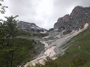
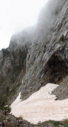
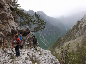
A series of short and sharp zig-zags next to a steep snow-drift and a couple of longer exposed sections brought us to a spot below the rocky peaks of Pecmares. We had climbed almost 1000m and it was a point were we could look past the sheer rock walls of the mountains down to the Valbona Valley or across the valley to watch the mists drift by the craggy peaks of Kollates opposite. A magnificent place and a good spot to have lunch and take in the grandeur of the Albanian mountains.


Looking down the Valbona Valley


The upper slopes on the Workers Trail


Descent from Pecmares

Finally, it was time to descend and going down seemed to be almost a different track then coming up. During the climb, we were mainly looking into the face of the mountain, but on descending, the valley and rock faces opened up to even more superb vistas. While eating lunch, we had watched the mist rising from the valley floor as the sun warmed it, wisping into the clouds above. Now we watched the clouds becoming heavier and greyer with moisture. As they say, what goes up must come down and so it was as the raindrops began to fall, not too heavily and interspersed with clearer periods.


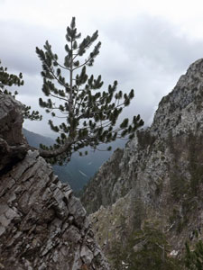
Scattered pines on the steep slopes of Pecmares


Mists rolling in on the big snowdrift

When we reached the big snow-gully, Bledar made a quick descent with a series of Albanian boot-slides down the long drift. We tried to emulate him with varying and somewhat comical degrees of success. A quick walk down through the forest with a wet and cold backside and we were back at the guesthouse, full of admiration for the workers who made this trail, full of admiration for the magnificent views and sheer-walled mountain scenery and with a modicum of admiration for ourselves at having negotiated this somewhat difficult and sometimes precipitous route.


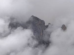
The clouds swirl about Kollates

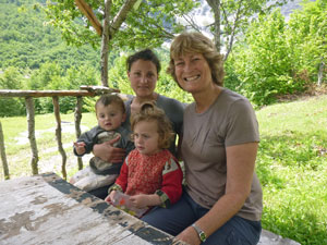
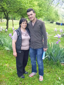
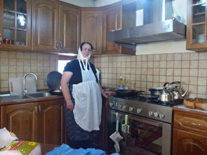
Our hostess at Dunishe

We beat the heavy rain in by a few minutes and our hostess greeted us with a cup of hot Turkish coffee, to sip under the verandah and watch the changing mountain weather - rain, sun, cloud. A hot shower, a warm meal of fresh caught trout and a bottle of Korca beer to reminisce on the walk followed. It is a simple and good life in the Albanian mountains.

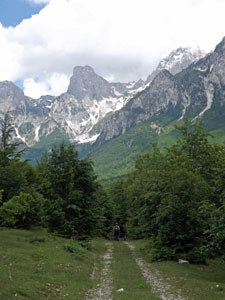
Day 2 - Kukaj and beyond (14 km - 970m ascent - 740m descent)


Our hostel in Dunishe beneath Pecmares


Water mill by the Valbona River

It was a joy to see the sun streaming in through our bedroom window when we woke this morning. By the time we set off for today's walk, cloud was forming about the tops, but it was white and fluffy and the day was full of promise. Bledar led us quickly away from the guesthouse and past the other houses and fields of Dunishe village. Entering the forest, we briefly followed a babbling stream before climbing up to the road and heading up it for the next 500 km.


A typical farmhouse of Valbona


The ice-blue waters of the Valbona River


Farmland beneath the Kollates Mountains

Just before the village of Valbona, we left the road to cross the rushing clear blue water of the river, stopping to admire its twisting path through the broad expanse of gravel beds beyond. Once over the bridge a dirt road took us past the fields and houses of Valbona, with views over them towards the magnificent cirque of mountains at the head of the valley.


View eastwards down the Valbona Valley


The rugged beauty of the Northern Albanian Alps


View westwards towards the Upper Valbona Valley


Start of the climb at Valbona Village

Passing the old Albanian army hotel, across from the ruins of the Communist Party mountain resort, we turned to start a gentle climb up besides the rushing waters of the Kukaj stream.


Cloud swirling around the rocky summits


The sounds of the stream and the songs of the forest birds accompanied us up to the location of Kukaj village - in reality two farmhouses set amidst fields for corn and vegetables and meadows for the sheep and goats. However, we did notice that even the simple life in the remote villages of Northern Albania has room for satellite TV. The setting of the village was superb, with the dark shape of the Pecmares mountains at the opening of this high valley and the snow covered peaks of the White Cirque at its head.


Following the Kukaj Stream upwards


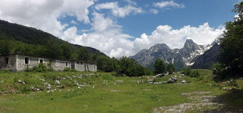
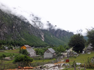
Isolated farmhouse in Kukaj

Some mountain sheep


Mali Majar (2529m)


The Kukaj Stream lined by beech

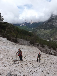
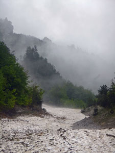
We left the village to continue the climb, following the track further upstream, past a flock of sheep being shepherded by two young boys, and then headed into the forest. After filling our water bottles, we turned way from the stream to head up a white limestone scree slope, before crossing several deep erosion gullies. Here avalanches had ripped down trees and carved big gashes as they thundered down the slope last winter, dragging tonnes of loose limestone rocks and boulders with them. It was impressive to see the force they can generate.


Jezerces - highest mountain in Northern Albania

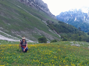
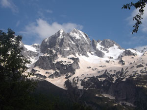
Crossing the deep remnants of one of the avalanches, we started the climb in earnest, heading steeply up beyond the trees to a flower-speckled meadow above. Out to our left a new peak appeared - the domed top of Jezerces, at 2692m, the highest peak in northern Albania. Its dome was covered in the pure-white of freshly fallen snow, a vivid contrast to the pinkish-tan tint of the old snow in the lower foreground mountains. The pattern of old and new snow and the clouds drifting around their peaks made this cirque of mountains an impressive vista.

View back down the meadows of the upper valley

We pushed on - the track zig-zagging its way up these steep grasslands, passing through the occasional grove of trees as it followed a narrow spur up towards the bare-faced mountain tops.


The climb continues


Cloud closing in on 2495m Kokerhanes

Emerging from the last such grove, we found ourselves below the rocky surrounds of the pass into Montenegro, surrounded by the high alpine pastures. Far ahead, a mule stood watching us, casually flicking its tails to chase the flies away. We were nearing our target destination, a shepherd's hut set in a hollow below the pass. We arrived to find the shepherd busy with repairs - sadly like the trees below, this hut had been badly damaged by an avalanche in the heavy winter just past.


The pass into Montenegro

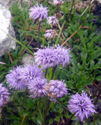
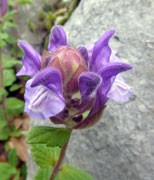
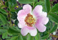
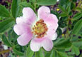
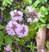
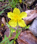
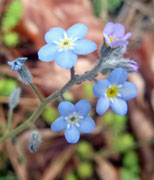
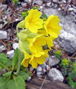
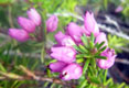
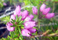
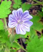
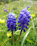
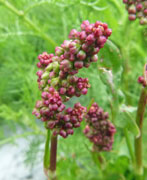
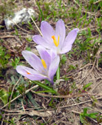
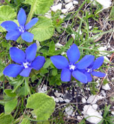
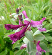
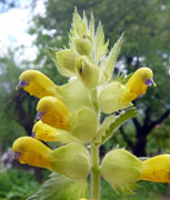
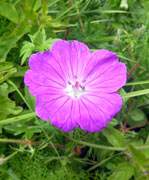
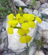
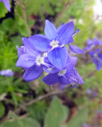
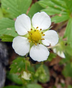
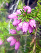
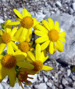
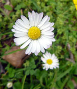
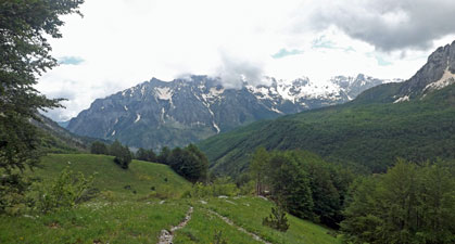
In the flower-speckled alpine meadow

We retired to enjoy a slow lunch on the grassy meadow, amongst the buttercups, hyacinths and other high alpine flowers, looking down this beautiful valley to the cloud-topped Pecmares massif and across to the rocky pyramid of Thate. Despite sitting in the sun, we also found ourselves watching the rain-clouds forming over the Valbona Valley below and dropping their loads. It was time to start heading down again from this beautiful spot - down through the meadows and the trees, down across the avalanche gullies and the flattened tree-trunks and on toward the village of Kukaj, serenaded as we walked by a solitary cuckoo.

It was here that the rain caught us and drove us to shelter for a while beneath the dense canopy of a stunted beech. Eventually it lightened and then stopped, as we headed on past the two farmhouses. This time however, we took a different path, now heading up the valley through the pine and broad-leaf forest towards the village of Rrogam. Reaching a clearing, the views out over the fields of the village and broad gravel bed of the Valbona River to the snow-dappled peaks beyond were superb.

Crossing the remnants of a big avalanche


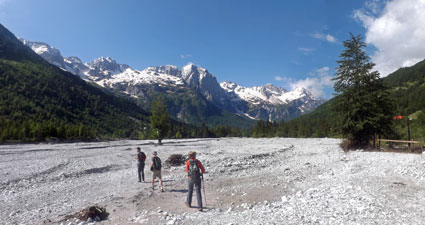
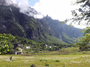
Looking up the Valbona Valley towards the hamlet of Rrogam

Bledar pointed out our accommodation for the night - it was his home and family-run guesthouse! Soon we were walking through the plum orchard and fields to the guesthouse and relaxing on the verandah sipping hot coffees, as we gazed out at the magnificent alpine scenery about us - peaks in every direction. The sun had re-emerged and the setting of this place was straight off a chocolate box.


Ismet Sali Brucaj (2527m) in the afternoon sun

The superb rocky pinnacle of Zaphores (2398m)

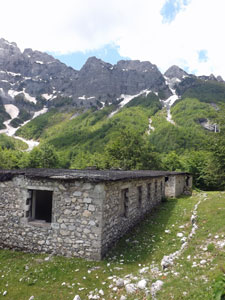
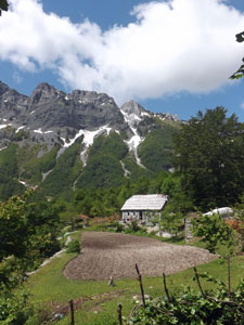
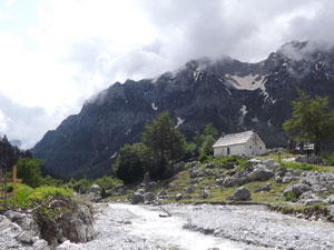
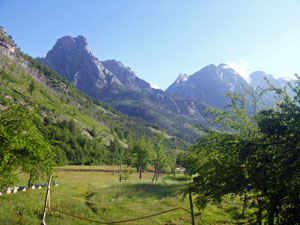
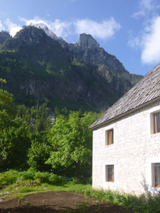
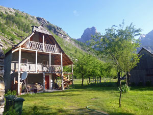
Our guesthouse in Rrogam (Hani Kol Gjorni)

The walk today had been very different then yesterday - not at all precipitous, but showing a broader range of the alpine landscapes from high grassy meadows, to deep snowy cirques. They complemented each other perfectly and whet our appetites for another day of exploration of this little-known part of the Balkans.

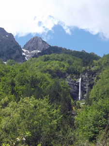
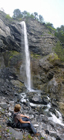
Day 3 - Upper Valbona Valley and Rragami Waterfall (16 km - 410m ascent - 410m descent)

When we got up, the sun was shining brilliantly on the snow-capped peaks of Valbona. It looked like it would be a perfect day for our last walk in northern Albania. Bledar had planned a walk up to the head of the Valbona Valley to visit a 40m waterfall - a popular destination for Albanians who come here for week-end breaks. We stepped out of the front gate of the family guesthouse and onto the ultrawhite and broad gravel bed of the Valbona River. It would be our walking highway for much of the day.


Heading up the Valbona River bed towards Mali Majar and the peaks of Zaphores


Mali Majar (2529m) and the pine-scattered meadows


White gravel scree descending from Zaphores

The peaks surrounding us seemed luminous in the clear light, as we headed up the gravel bed, crossing the thin and shallow braids of the river a few time as we did. Ahead lay the tops of Mali Majar and Zaphores stretching northwards to the Thethi Gap - an inspiring alpine vista. We pushed on beneath the flat-topped pillar of Ismet Sali Brucaj to reach the asphalt road up the valley, following it briefly to its end at a hotel and camping ground.


The western face of Brijasit

It was now back to the white gravel of the river bed as we entered the broader head of the valley. The track took us up through the stunted pines that colonised this seeming wasteland of stone and rock to reach a pretty green meadow and and old ruined buildings. At this point Bledar noticed a group of four hikers heading off on a path above us to our right - it was a route to nowhere, so we called them down and Bledar set them on the right path for their destination, the Thethi Gap. The moral of this aside is, if you don't have a guide, at least take a map when you walk in the Albanian Mountains.


Path through the stunted pines

We headed on, passing grassy meadow, forest grove and farmhouses, both ruined and occupied, before once again taking to the gravelly river bed for rapid progress. We were now passing beneath the sheer rock wall of Mali Majar (The Big Mountain) and the more delicate peaks of Zaphores, high-lighted by the two-toned patterns of old and new snow. A little further around we could see a thin silvery thread in the green forest way below the silhouette of the Thethi Gap - it was the Rragami Falls, our destination for today.


The Thethi Gap high above Rragami Falls


Ruins in the upper valley

Arriving at the highest village in the valley, we climbed up from the river to wander past the fields and vegetable gardens and reach the little outdoor rest stop one of the families had set up next to their house. It was time for a cool drink of lemon, while taking in the warm sunshine and alpine vistas. The fair Nello had time to make friends with the two young children of the household, who were similar ages to our own grandchildren.


Nello with her new friends


Heading on, we made our way through the forest up to the ruins of an Albanian military station, established in the times when the army was more interested in controlling the people within then any enemy without.

Bledar told us a little about that dark period in Albania's long history - it made us appreciate our own circumstances. The military had chosen well with regard to views as the ledge on which it was built offered superb views down the valley.


The parade ground of the abandoned military station


Farmhouse cum coffee stop ar Rragami


Closing in on Rragami Falls

We pushed on upwards into the forest to reach a rushing tumbling series of cascades - sadly, too rushing and tumbling to permit a safe crossing. With the not-so-distant falls enticing us, we looked for a safer crossing upstream and downstream without success, so Bledar led us back through the forest for lunch at the army base to take stock. His new plan was to follow an old path even higher, find a crossing and then descend through the forest to rejoin the track to the falls on the other side. It worked - local knowledge is everything in these mountains.

A climb up through the forest on slick brown leaf-litter brought us to a point just below the base of the falls, and a short series of stream-hopping and rock clambering brought to the waterfall itself. The silvery thread seen from afar had morphed into a powerful jet of water that sent out horizontal sheets of mist (and waves of negative ions) as it hit the plunge pool below and flowed on in a series of rushing cascades - impressive and well worth the effort of finding a crossing to get here.


Admiring the waterfall


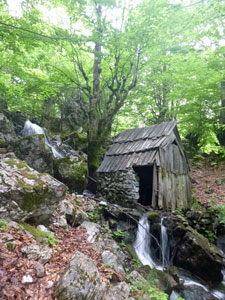
Bledar in the forest


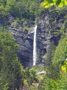
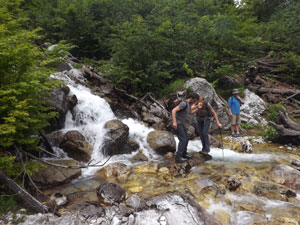
Stream-crossing on the way to the falls


Heading back down the valley

We lingered for a while, before noticing that the cloud that had been building up was now getting darker. It was time to turn and head back, following the path down through the forest to the village and gravel river bed and back to the guesthouse. One last chance to wander along this rocky white route and appreciate the grandeur of the Albanian Alps.


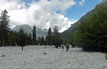
Return to Rrogam along the gravel river bed
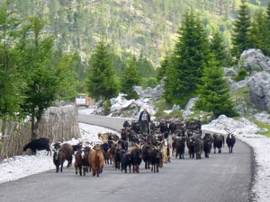
The goats come home

A highlight of each day was the chance to just sit on the verandah after each walk and watch the tranquil tempo of life in the deep valleys of Albania - the tinkling bells as the flock of goats returned, the cows bringing themselves home after a day, the farmer preparing the frames for his beehives. Perhaps life is harder than in the big cities, but stress levels seemed much lower. That night Bledar's Mum cooked us a traditional Albanian feast, with succulent goat meat as the main course. It was a fitting way to end our time in the mountains of northern Albania.


Evening silhouette of the Albanian Alps

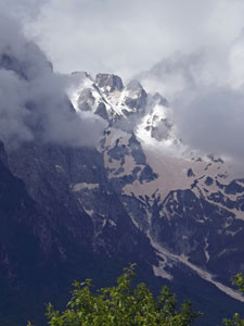
A mantle of cloud descending on the snow-clad summits

The next morning we said our good-byes to the family and boarded the valley micro-bus for the drive back down to Bajram Curri. By the time we arrived we had set a new record with 16 people in the 10-seater bus, all of whom knew each other and chattered away on the trip down - such is the closeness amongst the valley inhabitants. At Bajram, we switched to a larger mini-bus and headed off for the 5-hour trip to Tirana. The bonus for us on this trip was a chance to travel through the rolling high valleys of Kosovo for an hour.

It was the quickest way out of the northern valleys of Albania (passing, before the border, some of the many dalek-like concrete machine-gun bunkers from the isolationist days of communism) and is done to connect to the Highway of Nations, an impressive recently completed 4-lane highway between Albania and Kosovo, with numerous high bridges and one 6km long tunnel carving a direct route across the Albanian mountains to the flat central plain.


Bledar and his Mum

Here traffic slowed once again as we entered Tirana to find our hotel, say goodbye to Bledar and Ryan and get ready for the next phase of our Balkans crossing. The walking in the north had been a fantastic insight into Albanian alpine landscapes, local cuisine and village hospitality - all were great. Thanks Bledar for being an excellent guide and sharing your love of the mountains with us and thanks to your family and the ladies of Dunishe for their warm welcome at the guesthouses and the delicious Albanian cuisine that we ate.