Ausangate Circuit (part 2)

Day 3 - Finaya to Pucacocha
(14 km - 600m ascent - 440m descent)

We woke up to a cloudless sky, but the snow had frozen and the landscape had a distinct wintery feel to it in the pre-dawn light. However, the sun soon emerged above the mountains to the east, melting all in its path. As we sat outside eating our breakfast in the warm morning sun under the curious gaze of a young Andean girl, small mountain mice scampered between the pinkish granite rocks; it seemed that the day would be perfect.


Early morning after the snowfall


Andean mouse enjoying the sun

Girl from Finaya and friends watching the strange trekkers

Leaving the community of Finaya

With Yamil and Lydia leading the way, we set off once again, skirting the rocky hillside to enter a second flat boggy valley, the Pampa Jatunpata. The alpacas were already out grazing as we strolled around the edge of the marshy flats before crossing their upper reaches for our first climb of the day. Below us, an alpaca-herder was leading her animals across the icy river for the day's grazing.


The marshy flats of Pampa Jatunpata


Heading out for a day in the pampa - mixed flock of alpacas and sheep

Small cascade on the Rio Jampamayo

Climbing up alongside a small waterfall and the rushing mountain stream of Rio Jampamayo, between darkly-silhouetted rocky peaks, we reached a second long marshy plain; we were in the Q'ampa community lands and it felt good to be walking on relatively flat terrain at this altitude.


One last look at 5808m Nevado Santa Catalina from the east

Heading across the high valley toward Pico Tres Marias

We headed northwards toward the impressive profile of the 6090m Picos Tres Marias at the head of the valley, passing a flock of Andean ducks enjoying a morning swim in the wetlands and stopping briefly to have a snack next to a rocky outcrop where vizcachas scampered amongst the boulders. Across the green plain lay the stone huts and corrals of Q'ampa, the hills behind still partly covered in snow from the previous night.


The upper Q'ampa Valley and Pico Tres Marias


Heading towards the glacier lined pass between Nevados
Colloque Cruz and Tres Marias

From here the real climb began, gently at first, following alpaca tracks up through the well-grazed and well-fertilised slopes, ever closer to Pico Tres Marias and the snow-covered glacier in the saddle between it and Nevado Collaque Cruz. A cold wind began to blow as we gained altitude and it was time to don warmer gear. Dark clouds also began spilling over the white peaks of Ausangate and Collaque Cruz, giving the landscape a cold and menacing appearance.


Closing in on 6080m Pico Tres Marias


Vicuñas watching us very very carefully

The track now turned westward and climbed more steeply toward the 5650m icy peak of Puca Punta. Far below we could see Laguna Ticclacocha at the base of a gravel-covered glacier beneath the peak. It was here that Yamil spotted the first vicuña high above us.


Climbing up towards the sharp peak of Nevado
Puca Punto


Ominous clouds spilling over Nevado Puca Punta and its glacier


Family of vicuñas grazing at 5000m


Laguna Ticclacocha at the base of a gravel-covered glacier

As we trudged on, views opened up below us of the long glacier descending the eastern side of Campo Pass; a jumble of clear white ice and snow at the top, transforming to an amorphous mass covered in grey gravel at the bottom. We passed 5000m for the second time on the trek. I was feeling stronger and the fair Nello was struggling a bit, the reverse of our first 5000m pass; it is curious how and when altitude affects you. Our attention was distracted by a call from Silverio; he had spotted a family of seven vicuñas a little way up the slope from us. We were lucky to be able to sit and watch these graceful animals, so rare in this part of the Andes.


Bare, pink and rocky - the road the Campa Pass

Cushion-plant rock garden


The final climb to 5077m Campa Pass


Some of the many apachetas on Campa Pass


Ausangate showing its bleak side


Reaching a crest, we were about to celebrate, only to realise it was a false pass; ahead lay a long slightly upwards traverse across a jumble of pink rocks and gravel high above the glacier, dotted with rock gardens of cushion plants and forbs. Finally, a cluster of apachetas signalled the true top of Campo Pass at 5077m.

It was time for a rest in the shelter of one of the larger stone cairns to take in the view of glaciers dropping down on both sides of the pass. Soon the menace of the dark clouds materialised and tiny balls of sago snow began to fall.

It was definitely time to start the descent - firstly, traversing a steep and loose scree slope high above the second glacier on the western side of Campo Pass, then descending steeply across the dry, rocky northern slope of Ausangate. In the light snow, the peaks above us showed a very different mood of the mountain.


Glacier on the west side of Campa Pass


Descent into the snow

After a long descent, the waters of Laguna Caycocha appeared, framed by arid red-walled hills and the steep dark western wall of Nevado Puca Punta. We pressed on through the rocky landscape, descending past a set of small tarns where caracaras feasted on the remains of a dead alpaca, to reach a point overlooking the turquoise waters of Laguna Pucacocha (you may have noticed this name crop up several times - pucacocha means green lake in quechua and many lakes in the mountains have this name).


Laguna Caycocha nestled between red and grey walls


A dusting of snow on the rocky landscape above Laguna Pucacocha

The snow was now getting heavier and the landscape taking on a distinct wintery appearance. Down on the grassy flat near the lake, we could see Silverio and Cecilio setting up the tents and hurried down the last steep rocky pinch to crawl into our sleeping bags and listen to the soft patter of sago snow on the tent. Then it was time for a late lunch - it was much better to eat at 3.45pm in our dining tent then three hours earlier on the cold and windy heights of Campo Pass.


The steep walls of Pucacocha

The waters of Laguna Pucacocha still had a turquoise glow despite the grey skies


By evening, the snow had most;y melted and the sky was once again clearing, first a few stars and then the moon appearing to light up the misty silhouette of Ausangate high above. At 4630m, this was our highest ever campsite, but we went to sleep with the comforting thought that tomorrow there would be another clear sunny start to the day and that, from here on, it was virtually all downhill.


Day 4 - Pucacocha to Tinqui
(20 km - 50m ascent - 880m descent)

As seemed the norm for our trek around Ausangate, we awoke to bright sunshine - a few high clouds drifted across, but sun still lit up the snowy peak above us. Our campsite was dwarfed by he mountains all around, resplendent in the crisp morning light.


Channels draining the wetlands above Pucacocha


Looking back up the valley to Nevado Santa Catalina


Campsite dwarfed by 6370m Ausangate


The fang of Puca Punta


Breakfast at 4630m in the morning sunshine


Ausangate generating wisps of soft white cloud

We set off on the last day of our walk for a morning of reflection; reflections of mountains in the still waters of alpine lakes that is. Barely ten minutes out, we reached the the still green waters of the first small lake of the day reflecting the low frosty hills behind. Skirting its shore to the other side, we could look back on the reflections of the snow-covered peaks above the Campo Pass.


From the one shore the reflections were impressive ....

....from the other they were spectacular

It was spectacular, but things were only going to get better. From, here we rounded some low rocky hills to reach the perfectly clear azure waters of tussock-lined Cristalcocha, a tiny pool set in a small hollow, where the local shaman come every winter to bathe and cleanse their bodies in its icy waters.


5808m Nevado Santa Catalina


Cristalcocha - azure blue and crystal clear

Descending slightly from this alpine jewel, we arrived at the small, but very deep Laguna Uhurungococha, its rock walls slowly disappearing into the depths of the dark blue water. From its southern end, we stopped to admire once again the reflections of the glaciers of Ausangate.


Reflections of Ausangate


The bare walls of Cerro Parcocaya

Lydia

Peering into the depths of Uhurngococha

The route now opened out to reveal a large swamp-edged lake, where Andean ducks swam and around which alpacas grazed. We skirted this and began an undulating path across a boulder-strewn landscape of rocky hills, remnants if the glacial moraine that lined this valley. We had started our final walk back into civilisation, following the swift-flowing Canturacahuayjo River.


The Ausangate landscape:wetlands, lakes and mountains


Crossing the rocky landcape of an old moraine

Our pace quickening once we left the region of beautiful lakes, though the superb snow-covered ridge of Ccallangate and Collaque Cruz to the east still reminded us where we were. Soon we crossed the braids of the river on a couple of stone bridges and descending beside it toward the stone huts of Quecmojo, last of the isolated villages.


Walking alongside the Canturacahuayjo River


The stoney landscape near Quecmojo

The 6000m ridge s of Nevados Ccallangate and Collaque Cruz


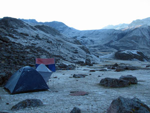
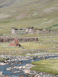
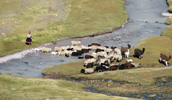
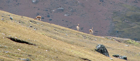
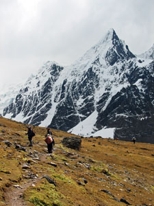
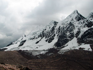
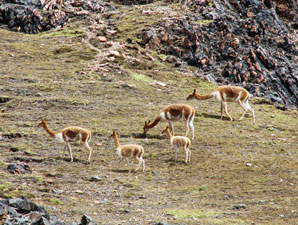
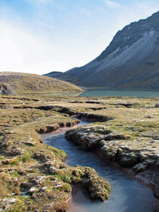
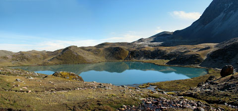
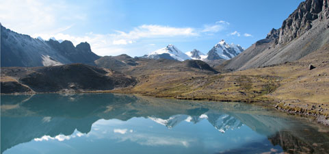
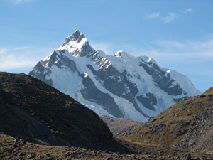
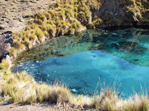
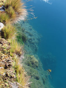
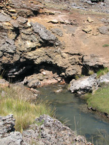
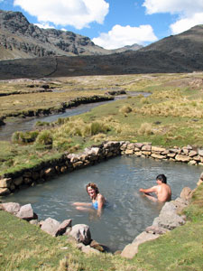
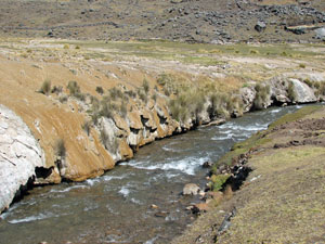
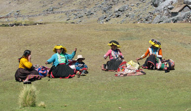
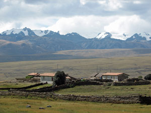
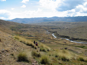
From Quecmojo, it was a but a short descent across the stoney valley to the village of Calachaca and its more modern buildings, electricity and hot springs. For the last four days we had lived with the thought that near the end of our trek we would be able to soak away the grime and tiredness in a steaming thermal pool, but it was almost not to be!

We arrived to discover that the BBC were making a documentary in the region - they had rented out the pool for the whole day and refused everyone else entry. We could but look wistfully at the steaming water without a person in it while the film crews were off flying around in a helicopter or filming a local strongman carrying boulders in the rocky field above. What arrogance to take over an area for the whole day when you are only going to use it for a very short time. I confess that my thoughts were not printable.


The valley gradually widens

Orange-coloured rocks around the hot spring source

The darkness of my thoughts dispelled somewhat when one of the local people gave us directions to another small hotspring that they used themselves. We followed the river (now called the Pacchanta) down past tan-coloured tufa beds to find it - lined with rocks and next to the icy waters of the stream - a pleasing contrast. It was a much more natural setting than the two concrete pools in the village and, zs we soaked in the hot mineral water bubbling up from beneath, I quietly thanked the BBC that we were here - but still, what !%*# arrogance!


Nello and Yamil enjoying a hot soak despite
the BBC


The church of Pacchanta framed by Ausangate


Cecilio chatting to a 103-year old lady
tending her sheep


Tufa lined edges of the Pacchanta River


One last travelling shop setting up next to our hot spring

You should never let a small hiccup spoil a brilliant day so, refreshed and well-fed, we set out once again in high spirits to join the rough dirt road that would lead us past the nearby village of Pacchanta and back to Tinqui. In almost every way but walking, our trek was over. From here the road led us on a long stretch high above the broad valley of the Rio Pinchimuru Mayo, past potatoes, oats, lupins, lucerne and other crops. We were now well out of the high mountain valleys and herds of alpacas.


More modern farming huts against the Cordillera Vilcanota


Traversing the tussock grasslands above the
Rio Pinchimuru Mayo


Potato crop - the staple food of the high Andean Sierras


Ricjer croplands of the Pincimuru Valley near Tinqui

We followed the road, crossing a slight rise from which we saw for the first time the distant rooves of Tinqui village, before gently descending past stone houses and fields. We chanced upon one old lady tending a small flock of sheep - Cecilio stopped to have a brief chat in quechua - on his return he told us that she was 103! Maybe her longevity was due to a lifetime of hard work and chewing coca leaves. Soon we entered the town of Pinchimuro, before dropping down a steep path to cross the river and find our campsite in Tinqui. It had been the longest, but easiest day's walk of the trek and our circuit of Ausangate was finished.

As we lay in the tent that night, at the altogether respectable altitude of 3800m, we listened to the distant sounds of a fiesta in the village plaza, music and singing drifting across in the wind. The people were celebrating Apu Ausangate, their sacred mountain. This trek had helped us understand the relationship between the Andean people and the great mountain and, in our thoughts, we joined in the celebration.


Return to Cuzco

Normally, this circuit takes five days to complete, but by starting the walk a mere three and a half kilometres beyond Tinqui, we were able to stagger our campsites in such a way that we did the 62 km trek in four days.


Celebrating the trek


It wasn't a bad effort, considering that Yamil told us that the trek agency in Cuzco advised him to take oxygen when they saw that we were not "spring chickens"! All but the last kilometre above 4000m, crossing four high passes of which two were over 5000m - and we didn't need the oxygen. Yamil told us that we were the oldest trekkers that he had guided around and called us "Winaywayna" - quechua for "forever young".

It was a nice compliment. Thanks Yamil, and thanks for your exuberance and good humour in showing us the mountain. Thanks also to Lydia, resplendent in her colourful mountain costumes as she quietly led us along the right tracks, and to Cecilio and Silverio for their company around the dinner table on those cold mountain nights.


Cuy al horno (yummmm!!!)

The Ausangate Circuit is more than just wonderful views of mountains, it traverses a world of beautiful lakes and deep tranquil valleys, while giving a feeling for a way of life that has change little in centuries. We felt that in doing this trek, we had not only learnt something about the high mountains and their people, but we had learnt something about ourselves and what we were capable of - which is why, on the way home from Tinqui to Cuzco, we stopped off to have a celebratory lunch of cold cusqueña beer and cuy al horno (roast guinea pig stuffed with herbs) - well, when you visit Peru, you have to try it at least once!!