Choquequirao to Machu Picchu Trek (part 2)

Day 4 - Rio Blanco to Minas Victoria (8km - 2040m ascent - 20m descent)

There was a price to pay for our pleasant afternoon off and this was to be a climb of over 2000m out of the Rio Blanco Canyon. We awoke to find mists hanging about the top of the canyon and the mountain peaks. We started the big climb without delay and were quickly into the dense vegetation on the south-facing wall of the canyon; it was not nearly as arid as the north-facing wall that we had descended yesterday. The air was still and saturated, and very quickly we were too, settling in to a steady climbing rhythm through the aromatic scents of damp vegetation. When the sun reached this densely vegetated lower slope it was really going to steam.


Breakfast in the Rio Blanco Canyon


Morning mist over the canyon


Felix starting the big climb


A brief rest stop in mosquito alley


At 400m into the climb the sun emerged from over the mountains to the east. Fortunately, the bushes were tall enough to provide shade for most of the time, though the perspiration dripped in the still humid air beneath them.


Unlike the north-facing wall, there was no distinct change in vegetation, and to mark the ascent we looked for different pointers; at 600m we took or first longish break but were soon driven on by hordes of mosquitos, at 700m we caught up with the tail of the other group, at 800m mist began filling the valley below us and drifting slowly up the slopes.

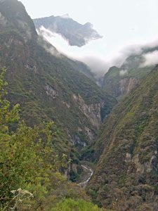
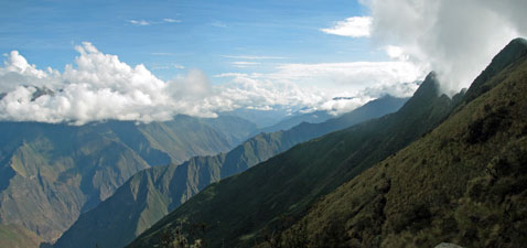
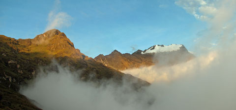
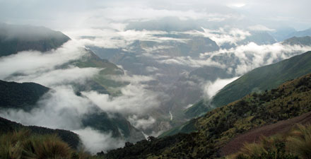
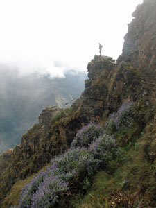
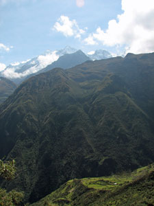
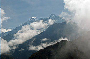
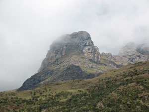
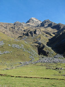
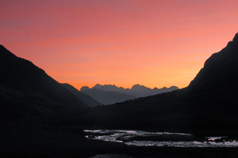
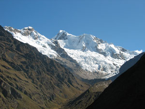
The landscape was starting to get a mysterious air as we pushed on into the clouds that had formed above, with gaps opening up occasionally to reveal the valley below or the snow-capped peaks on high.


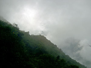
Mists streaming up the densely vegetated slopes .....

... to form clouds around the mountain peaks


Eventually, 2½ hours into the climb, we reached Maizal, a small grassy plateau 940m above our start point; it was time for a break as the cloud layer finally began to lift. We set off to follow the clouds up the slope through the verdant vegetation to reach a small hut in a clearing 1200m above the river below, an excellent spot for lunch, which we ate with the donkey, chooks, guinea pigs and cow that called this place home.


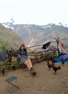
A group of old chooks at our lunch spot

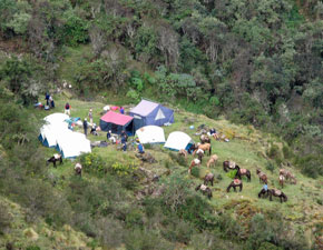
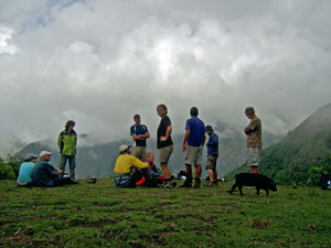
The World Expedition group take at break at Maizal
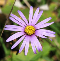
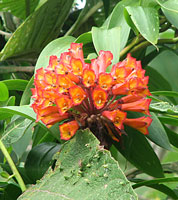
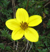
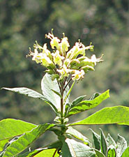
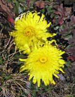
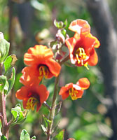
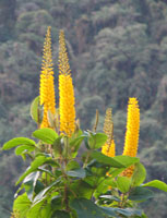
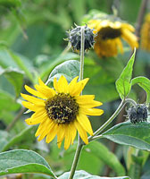


Wild sunflower


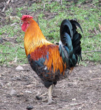
Roger the rooster (for Jules)

Lunch over, we set off again into the green void, ascending a steady and relatively gentle (by Andean standards) traverse across the steep slope, and at times even descended a little. As we climbed, the vegetation became more lush and the track more muddy; we were entering the zone of the cloud forest.


At times the green of the forest was so intense that it seemed to snuff out the colour of any flowers and it became a treasure hunt to find a a rare dash of red, pink or purple. Lichen and epiphyte laden tree trunks, ferns, vines, arching bamboo groves and dense twining shrubs lined our path. From time to time, gaps opened up views back down the path to the Rio Blanco Canyon, now way below. The vegetation was dripping and so were we. The clouds seemed to be rising as we did, but we were glad for them as they kept the sun at bay and the humidity bearable.


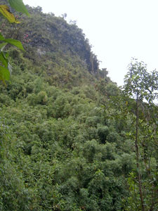
The intense green of the cloud forest


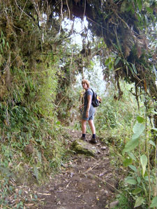
Path through bamboo and vine thickets

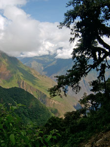
View through a gap in the cloud forest

Track beneath the cloud forest canopy

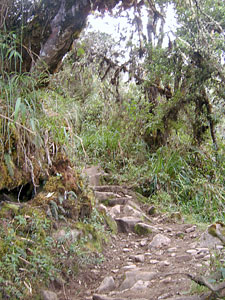
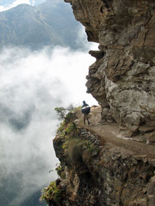
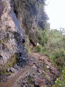
Path around the cliff base in the cloud forest


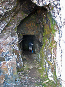
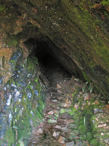
Moss-lined cave in the cliff
The path dipped a little to meander along beneath an impressive black-walled cliff, passing a couple of small caves before finally finding what it was looking for - a cleft in the cliff face that led to the next level. A series of steep short zig-zags took us up through the dark shade of the cloud forest, when suddenly the trees disappeared beneath us 1800m into the climb.


Steep slope in the puna


Looking 2000m down from our campsite to our start point
on the canyon floor

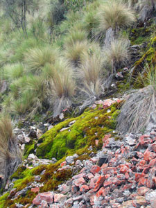
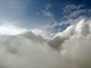
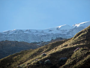
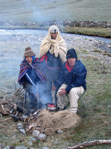
We had passed into the puna, where tussock grass and a scattering of bushes dominated the landscape. Above, the glacier-capped peak of 5700m Cerro Victoria appeared briefly through the clouds.

A short time later we reached our destination, a grassy flat at 3900m that was the site of an old silver mine, looking out over the expanse of steep green slopes and distant canyons. It was time to set up camp and, as we had climbed over 2000m in a single day, a little self-congratulations seemed in order (and our congratulations to the WE trekkers as well, sitting in their dining tent on the shelf just below us).

We sat on the soft grass tussocks watching the mist and cloud form beautiful images with the jagged spur of Cerro Victoria and at times we were even looking at the clouds from above as they swirled across the void beneath.


View back over our track toward the Apurimac Canyon

Cloud swirling about the heights of Cerro Victoria


Sons of the Inca in their mountain domain


Peering down on the WE campsite from our lofty perch .....

.... which eventually was engulfed in fog

Eventually, the mists welled up out of the valley, engulfing our campsite, so we retreated to our tent to watch the strange game of hide-and-seek played between mists and mountains. It felt a privilege to see yet another aspect of the incredible Andean environment. Eventually though the clouds won and a thick blanket of fog set in, keeping us all that little bit warmer during the night on our high mountain perch.

Day 5 - Minas Victoria to Tayaco (12 km - 600m ascent - 550m descent)

We woke up to the spectacle of being caught between two layers of cloud; mists and wispy cloud were floating in the valley below us, while above a second layer drifted about the peaks. Breakfast over, we climbed up through the damp tussock grass of the puna, dotted with small yellow flowering herbs and the odd white daisy.


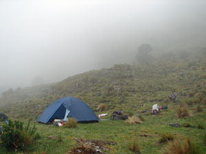
Early morning mists drifting in the valley below Minas Victoria


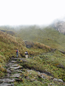
Last stage of the climb up to San Juan Pass

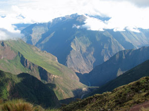
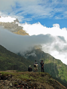
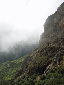
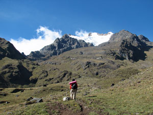
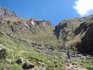
After a climb of 250m we reached 4155m San Juan Pass, marked by the stone cairns or apachetas on which local quechua people place stones each time they cross as an offering to the mountain gods; we added our own stones for or own reasons and took a twenty minute break, along with the WE group, whose path we again crossed, to watch the mists streaming up the eastern side of the pass.

There would be no far-reaching views of the mountain ranges today, but it was still an impressive display of mountain weather. To the west, where we had come from, the sky was now clear, while to the east, the valleys were filled with mists that streamed over the top of the ridges and vanished.


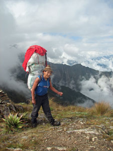
Valerio (aka superman) arrives at the pass


The mists swirl about San Juan Pass

Finally crossing the pass, we stopped briefly to explore an old silver mine just on the other side, before starting the descent through a steep landscape of rocky outcrops and tree lupins, their blue flowers luminescent in the mist. It was a very different landscape to the western flank of the pass. Eventually we dropped below the cloud layer to cross a steep pasture, dotted with lupins and yellow-flowering shrubs.


Felix exploring the old silver mine


Descent of the eastern face of San Juan Pass

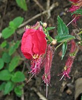
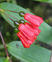
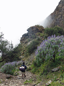
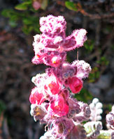
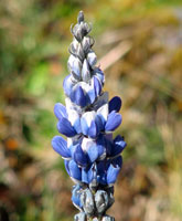
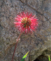
The luminescent blue of the tree lupins

Cliff face above the grassy flats of Yanama

The track through the pasture led us to an impressive sheer cliff face on the right side of the valley. From here we could look out over the valley to the green flats of Yanama village below us, with the snowy caps of Nevado Sacsarayoc high above it.


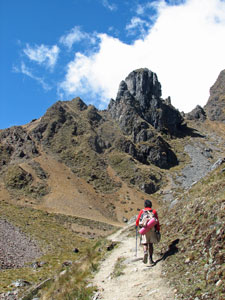
Track around the cliff face


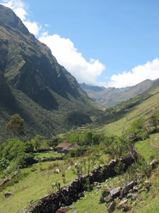
Looking down to the Yanama Valley

The mists finally clearing from Nevado Sacsarayoc

As we crossed the cliff-face on a rocky track, a mule train passed us heading up with a load of provisions for the isolated communities of these mountains. The track led us down through more green, bushy pastures, clusters of yellow slipper flowers brightening the way. The clouds had now completely left the lower valley and it was time to shed a layer of clothing in the warm sun. One final descent took us into the tranquil setting of Yanama, with its small adobe houses and stone fences dotting the lush green valley. Javier had found one such place owned by an old lady for our lunch stop and we enjoyed a long and lazy break in the sun, while Felix headed off to restock our food supplies in the village.


Mosaic of stone fences on the grassy plateau of Yanama


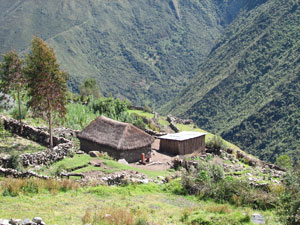
Farmhouse - Yanama village

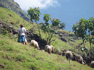
Old lady hearding her sheep

Looking up the Yanama Valley

Lunch over, we left the peaceful village to continue up the Yanama Valley. Eventually we left the last small hut behind, the valley narrowed and the track climbed steadily up the green grassy slopes.


Crossing one of many glacier-fed sidestreams

Rocky outcrop above the village

Heading into the higher Yanama Valley
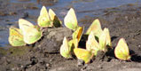
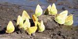
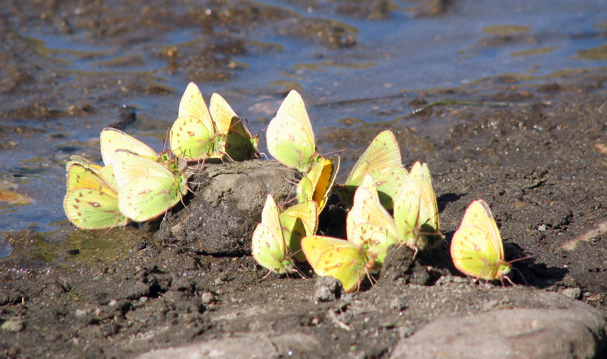
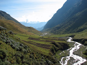
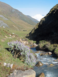
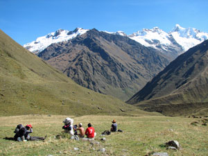
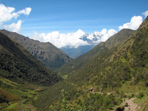
We wound our way alongside the silvery meandering stream of the fast-flowing Yanama River, fed by torrents and cascades that rushed down from glaciers high up in the mountains on either side. From below we could but glimpse their edges, shining in the afternoon sun. Patches of mauve flowering grey leaved tree lupins added a splash of colour to the grassy slopes. Yellow butterflies flitted across the path, occasionally forming small clusters to drink from pools on the track.


Silver thread of a glacier-fed cascade


Track along the grassy verge of the Yanama Valley

Bringing home the potatoes


Nello amongst the lupins

Green and mauve-spotted hillside at our campsite
at Tacayo

The edge of a glacier high above our campsite


Looking down the course of the Yanama River

Ahead lay an imposing wall at the end of the valley, but that was tomorrow's problem and we didn't want to think about that yet. With the sun sinking low, we set up camp alongside the river on the large flats of Tayaco (well, almost flat) at the head of the lower valley. At 3950m, we were actually higher than the perched eyrie on which we had camped the previous night, but in this flat end of the valley, surrounded by high mauve and green walls fringed with glaciers, it did not feel like it.


Late afternoon silhouettes of the mountains of Nevado Choquetekarpo

Yanama Valley sunset

The evening light created pastel shades on the jagged silhouette of Nevado Choquetekarpo as shadows crept across the flat, the sun setting behind a pink veil at the western end of the valley. As soon as it disappeared, the mountain coldness began to invade our bones and we huddled around the fire that Valerio, our resident pyromaniac, had stoked up. Tonight the sky was brilliantly clear and any heat was being rapidly sucked out of the earth - it was going to be cold and we were not long out of the warmth of our sleeping bags.


Day 6 - Tayaco to Colpapampa (18km - 700m ascent - 1900m descent)


Frosty morning at 3960m

It had been a sub-zero night - ice was still on the tents when we ate our breakfast at 7am, wishing that the sunlight would advance a little faster across the pampa. Eventually it burst out above the apex of the mountain behind us. How it lifted the spirits; enough to make the sight of the distant Yanama Pass a little less daunting.

Small gorge connecting two valleys at Tayaco

The sun about to burst forth above the mountain apex

We set off, with only a handful of clouds in the sky, leaving the middle valley to follow a small gorge further up to a higher valley. To the left, views were opening out to glacier topped Nevado Pumacillo ('claw of the puma'), while to the right the glacier high above Yanama Pass began to emerge. An eagle and a caracara flew low over our heads as we crossed the frosty flats, on the lookout for their breakfast. Climbing higher, we reached the green grasslands of the sloping upper valley, dotted with yellow flowering prostrate herbs and the blue candles of dwarf lupins.


First view of Nevado Pumacillo


The road up to Yamana Pass

Enjoying the views in the autumn sun


A rare photo that I didn't take


We rested for a while, taking in this superb alpine scenery in the warm Andean sun, the jagged silhouette of the pass behind, the majestic glacier-covered Pumacillo in front and the snowy peaks of Nevado Choquetekarpo in the distance at the end of the valley. To complete the scene, high above us, a condor soared across the pass.


Magnificent profile of Pumacillo


The distant Nevados Choquetekarpo


Campesino descendingfrom the pass

The jagged profile of Yamana Pass

One last steady push up the old morain below the glacier brought us out at 4660m Yanama Pass, 700m above our campsite. We met up once again with the WE group on the pass, time to add a stone to the apacheta, take the obligatory group photos and congratulate each other on reaching the high point of our walk.


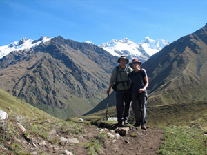
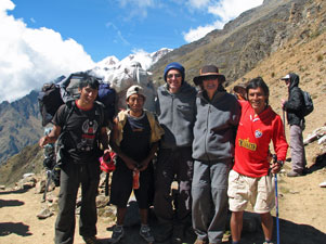
The Choquequirao- Machu Picchu trekking team on Yanama Pass

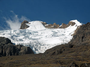
Glacier above the southern end of Yanama Pass

The views from the pass were superb; glaciers all around and, in the distance, clouds swirling around the pyramid shaped peak of 6260m Salkantay, standing tall above its neighbouring ranges. Below the valley dropped away to the distant and deep Totara River.


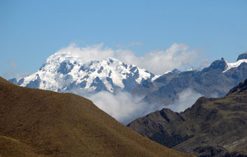
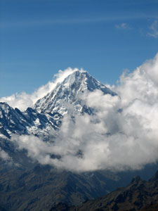
Cloud swirling about 6260m Salkantay


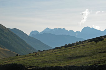
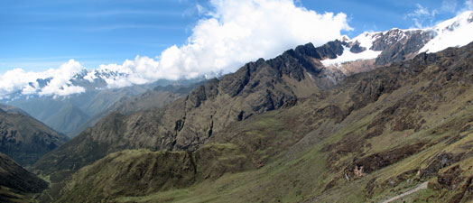
View from Yanama Pass over the Upper Totara Valley and mountains

We could not stay for too long as it was going to be a long day. The metres fell away quickly as we followed the track down through the itchu grass tussocks of the high puna, following a meandering gully to next descend the steep and rocky tussock-dotted middle slope. From there, the track took us across an area of moss-covered boulders before eventually making a long traverse along the southern slope of the valley. The loose rocky path passed by glinting mica-rich rocks, overlooking fields where campesinos were busy harvesting potatoes.


Mule train heading toward Totara


Descent into the Totara Valley from Yanama Pass


The upper Totara Valley

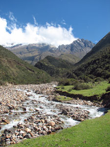
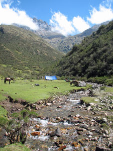
Grassy flats and babbling brook

Eventually we reached a grassy flat to cross a babbling stream, fed by springs in the slopes above. From the flat, we descended steeply alongside the stream in the welcome shade of dense shrubs - the vegetation in the valley was becoming noticeably richer.


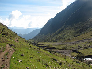
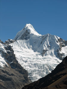
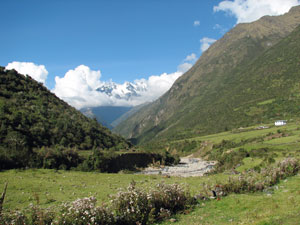
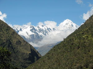
Classic "V-shaped valley with snowy peak" photo


Boulder-strewn bed of the Totara River

Our babbling brook joined a noisy torrent, rushing down a broad bed of small boulders from its glacial source. On the left bank ahead lay a grassy flat - we had reached Totara and a late lunch. It had been a long and hard morning's walk, but the superb mountain scenery had made the time pass quickly. After lunch, we crossed the Totara River via a log bridge and strolled gently downhill across the green fields to the main "centre" of this rambling village - a school house, health clinic and shop. From here the track again picked up its traverse of the southern slope of the valley, the vegetation changing to a richer, denser shrub cover.


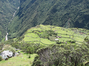
Broad valley near Totara village

The river fell sharply away from us on the left, rushing downhill in its rocky bed. We crossed a couple of seriously impressive landslides, one blocking the river to form a small lake. Another mule train passed us on the way up, loaded with supplies - these are certainly the lifeline of the residents of the remote mountain villages. The long traverse continued, descending steadily along the steep slopes that were becoming increasingly lush in their vegetation. As we crossed several fast-flowing sidestreams and more landslips, it was evident that the soil had a tenuous grip on the rocky base of these steep ridges.


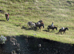
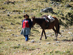
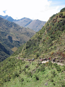
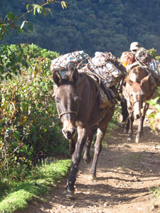
Mule train - lifeline of the mountain villages


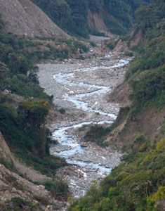
The deep and winding course of the Totara

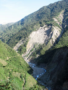
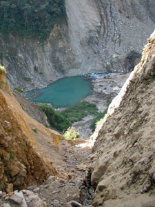
Massive landslip blocking the Totara River

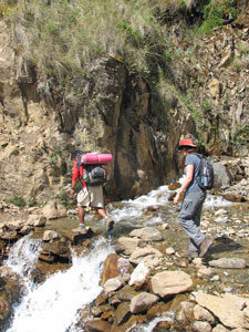
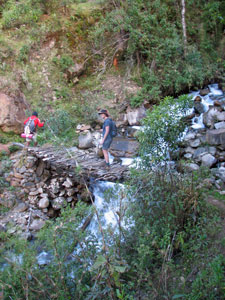
Crossing one of the many sidestreams

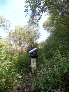
Bamboo and semi-tropical forest


Massive landslip on the lower Totara River

Finally, as the light was starting to fail, we reached the small community of Colpapampa on a flat grassy plateau high above the junction of the Totara and Salkantay Rivers. We pitched our tent in a field with the farm animals nine hours after setting off.

It was nice to relax around a candle-lit dinner in our bamboo "dining room", reflecting on the day's walk. It had been a long and tiring one, with 700m of climbing and 1900m of descending in 18km, but it had been a day of brilliant weather and scenery. Gradually we were getting an appreciation of the different landscapes of the central Andes and the lives of the people who live in the remote villages in its deep valleys.

go to part 3 .....