| Walk 17 - Greenstone Track |
|
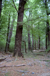
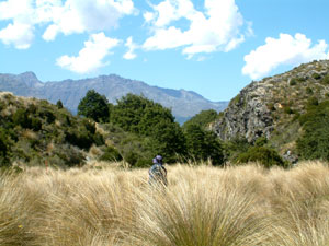
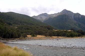
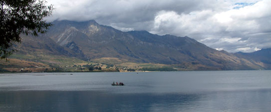
Day 3: Howden Hut to Mackellar Hut Leaving Howden Hut and the Routeburn Track behind us, we headed through a cool green beech forest (welcome relief from the 30ºC heat) along the right shore of Lake Howden, the fallen tree trunks lying in the shallow water at the edge stopping any temptation to have a swim. Lake Howden actually flows out to the north and the Greenstone Valley commences at a saddle just after its southern end. Here the valley narrowed and fell away below us, as the track continued on a level plane before descending via an old rocky beech-covered morain to the valley floor again, where it passed a grove of ribbonwood and widened out into a broad marshy grass flat. At the far end of the flat lay long and narrow Lake Mackellar with mountains rising steeply from both of its sides. Crossing the spongy surface of the flat, we reached the lake and sidled around its right shore through more beech forest.Passing the far end, we eventually entered a small clearing on the Greenstone River with the welcome shape of Mackellar Hut at its near end. |
 Lake Howden - start of the Greenstone Track |
 Ribbonwood grove and grass flats |
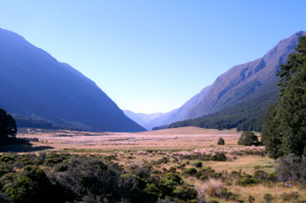
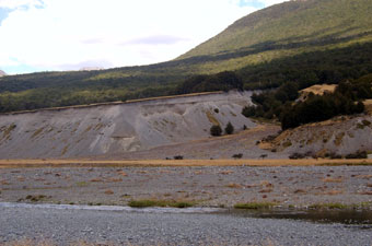
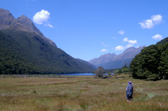 Looking down the Greenstone Valley to Lake Mackellar |
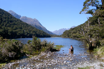
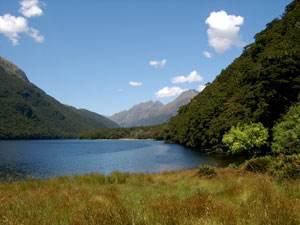 Lake Mackellar |
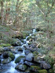
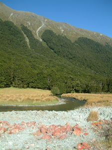
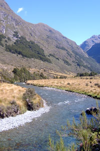
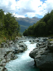
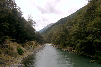
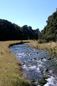 Greenstone River below Lake Mackellar |
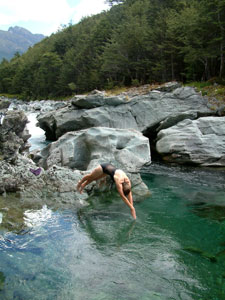
After the hot walk we headed straight down to the river, found a nice spot where the water foamed through several small boulders into a shallow pool, creating a natural spa, where we sat and soaked away the tiredness of the day. |
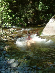 Greenstone spa bath |
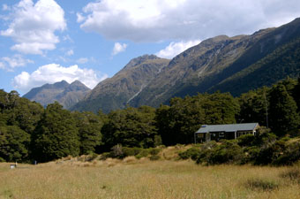 Mackellar Hut |
|
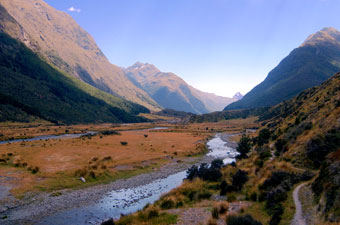
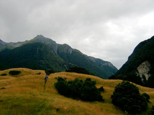
Day 4: Mackellar Hut to Greenstone Hut We awoke to the 12th day of fine weather in a row - unbelievable for this part of New Zealand and a complete reversal of weather patterns so far! It would be our fourth day of tramping in 30ºC heat, so we set off early, please to be shaded by the south-west face of the Ailsa Mountains. Crossing the swingbridge over the Greenstone River, we turned right and followed its left bank through some more thick beech forest before emerging at a small grassy flat. An early morning mist hung low over the flat, still in the deep shade of the mountains. We re-entered the forest onto a rocky, gnarly-rooted section of track that traversed the tree-clad slope just above the river, beyond which cattle grazed on the narrow well-grassed river flats. Eventually the valley widened out again, and the track left the forest to cross a much broader area of grass flats. By now we were in full sun on the flat, with impressive views of the Ailsa and Livingstone Mountains walling it in on either side. |
|
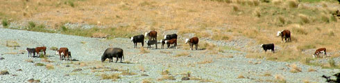 Some of the local residents |
 Red lichen covered rocks in the gravel bed of the river |
As we were strolling across the flat, a pair of keas flew 10m above our head, their plaintiff calls echoing from the valley walls as they crossed from the forest on one mountain range to that on the other. A little further on, several flashes of green feathers in the sunlight signalled a small flock of yellow-capped parakeets flitting from bush to bush. |
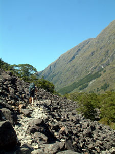 Crossing a boulder scree slope |
 Mid-morning in the mid-valley |
Back into the beech, it was easy going on a much more even path; the forest was becoming much more open with little apart from beech leaves and a few mosses on the forest floor. Small insectivorous birds, tomtits, riflemen, fantails and robins, waited for us to pass and stir up some buffet flies and midges. The robins in particular are fearless of humans, and several times on this tramp they flew and perched on our beech walking poles when we stopped. After a while we crossed a natural air conditioner; air being cooled by the large thermal mass of a boulder scree, flowing down through the gaps beneath the rocks and the cold air wafting out to cool passing trampers as they crossed the bottom of the scree slope. |
 View back up the valley |
|
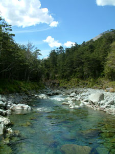
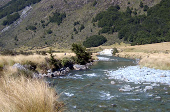 Trout stream par exellence |
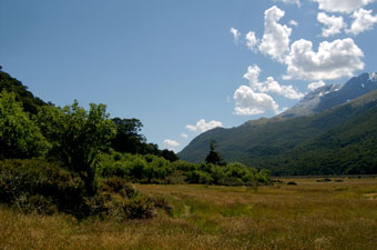
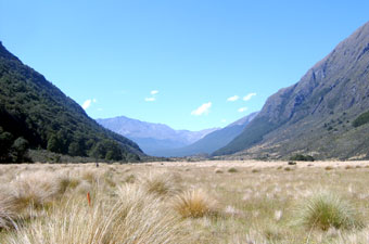 Tussock flat in the Greenstone Valley |
|
The next flat, with waist-high tussock grass, brought us close to the river where fly fishermen were trying their luck (the Greenstone is a reknowned trout river). Gradually the valley landscape took on a drier appearance, with shrubs replacing beech on the lower slopes and dry tussock/shrubby hummocks extending out to the river. The Greenstone had cut a short narrow gorge through the largest of these rocky hummocks before flowing out onto a lower valley terrace of broad shrubby grasslands. We traversed a small section of forest to cross the high swingbridge over Steele Creek, before re-emerging in the broad grassy river plain, startling a young fallow deer in the process. |
 Tall tussock and rocky hummocks 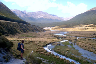 Braided steam in a wide gravelly flat |
|
 The Greenstone entering a small gorge |
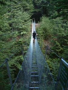 Swingbridge over Steele Creek |
|
|
||
 Section of terrace banks and wide gravel beds |
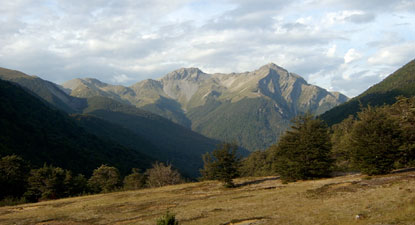
 View back up the Greenstone Valley |
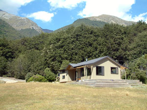 Greenstone Hut |
|
|||
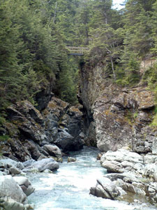 Bridge over the narrow gorge |
 A whitewater section of the river |
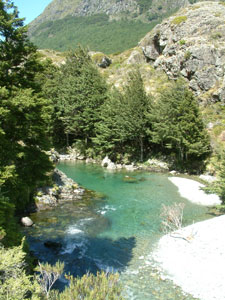
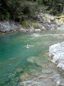
 Superb deep pool in the river |
 9.5 |
By the time we got back to the hut, it was clear that a change in weather was in the air; clouds were building up to the west and a warm northerly wind had sprung up. I'd never have thought it in New Zealand, but we actually were looking forward to a drop of rain. As always, we were an eclectic bunch at the hut; American, Swiss, Japanese, Australian and Israeli. In fact almost half were Israeli, which seems to be often the case at this time of year, with New Zealand a favourite destination for many young Israelis between completing their military service and starting the rest of their lives. We spent a pleasant warm evening out on the deck, watching the changing weather over the mountain tops to the west and chatting with Helen, the warden of modern Greenstone hut, about tramping, the life of a hut warden, the sustainability of the incredible hut and track infrastructure that the Department of Conservation has set up and maintains here, the perception of age and the meaning of life. |
 Evening shadows over the mountains - from Greensone Hut |
|
Day 5: Greenstone Hut to Caples Car Park We awoke to an overcast sky, but the rain was still holding off, despite a brief overnight shower - it looked like we would finish another walk in the dry. Retracing our steps back down to the bridge over the Greenstone mini-gorge and back up to the main track, we turned north-east. The track climbed up into an area of old morain, covered with very open beech forest. Little grew on the rocky forest floor and occasionally we crossed sections of bare scree. Dropping down, the track crossed a curious landscape of grassy humps before again entering forest and climbing (and we thought that we were going down the valley) yet again - the river seeming to fall away beneath us in the narrowing valley. |
|
|
 Lower Greenstone Valley |
 Grassy humped landscape |
|
 Another deep green swimming pool |
Continuing on, the track kept an even level as the river continued to drop down the narrow valley. We passed several ribbon waterfalls, their thin silvery streams framed by a backdrop of green mossy rocks, and several slip areas, including one large slip on the opposite bank that had temporarily created Lake Greenstone when it blocked the river a few years ago. |
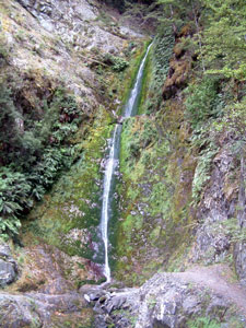 One beautiful ribbon fall ...... |
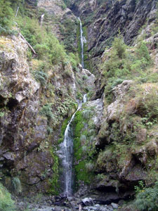 ...... deserves another |
|
||
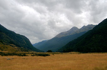 Looking up the Caples Valley |
 The Caples River |
 Darkening skies over the track end - time to go home |
|
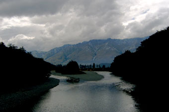
 Change coming over Lake Wakatipu |
|