| Walk 15 - Kepler Track 'Great Walk' |
|
 |
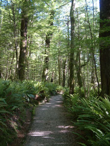
Day 1: Control Gates to Luxmoore Hut - the climb
|
|
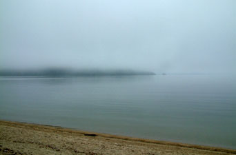
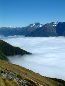
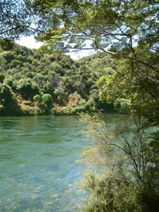
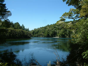
 Summer arrives in Fiordland - Brod Bay on Lake Te Anau |
|
|||
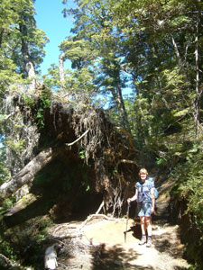 Big tree down on the track |
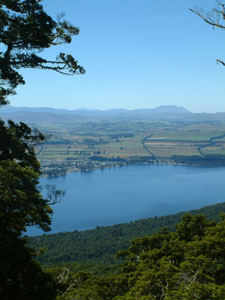 Glimpse of Te Anau through the trees |
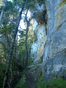 The base of the limestone bluff |
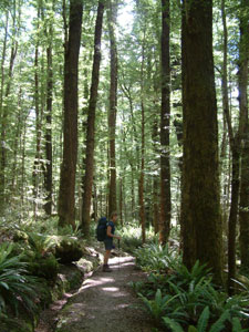
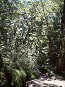 Sun-dappled forest near the treeline |
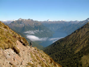
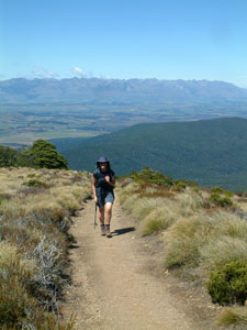 Climb over - emerging from the treeline |
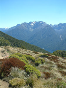
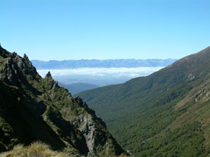
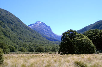
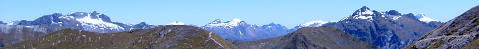
Suddenly we emerged at the edge of the tree-line on top of the tussock grass covered spine of the Kepler Mountains. Here was definitely a place to stop and take in the views, which swept in a broad vista to the east and north over Lake Te Anau and the township of the same name nestled on the lake shore, while in the west lay distant Lake Manapouri and the Takitimu Mountains. |
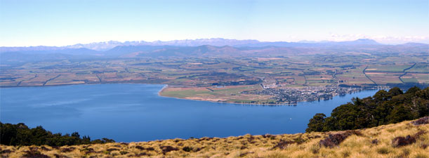 Panorama over Lake Te Anau |
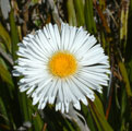
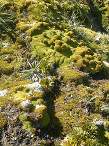
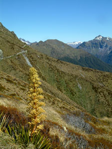
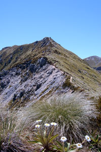
 Subalpine plant communities |
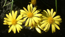
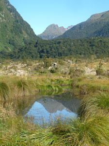
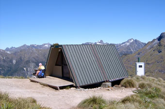
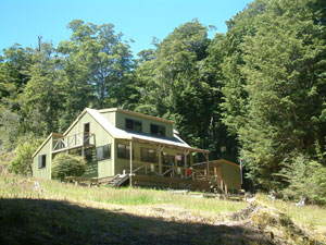
We strolled along the broad ridge, with its tussock, cushion plants and daisies, scattered tarns and alpine bogs, gently climbing the last stretch. Rounding a small hump, we were greeted by the sight of split level Luxmoore Hut, perched in a grassy bowl overlooking Lake Te Anau and the Murchison Mountains with their hanging U-shaped valleys and cirques - the glacial origins of this superb landscape were visible all around us. |
|
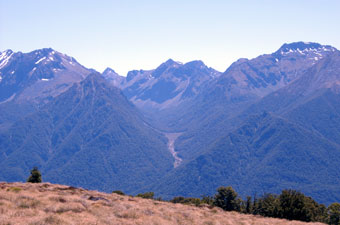 Hanging U-shaped valley in the Murchison Mountains |
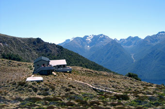 Luxmoore Hut in its dress circle position |
|
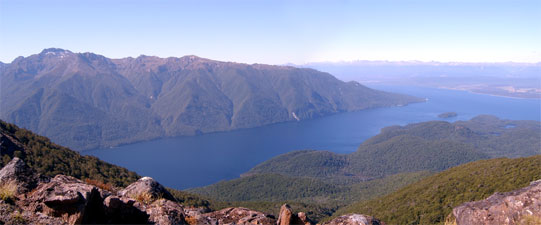 South fiord of Lake Te Anau |
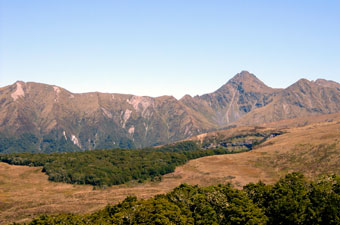 The Kepler Mountains and Mt Luxmoore |
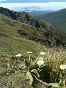
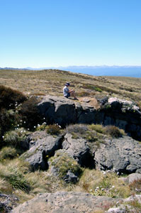 Alpine contemplation |
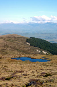 Tarn in tussock grassland |
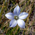
Our early arrival not only enable us to choose good bunk spots (window, lower level, individual), it gave us time to explore the vicinity of the hut and wander amongst the tarns, daisies, bluebells, small alpine shrubs and cushion plants.
|
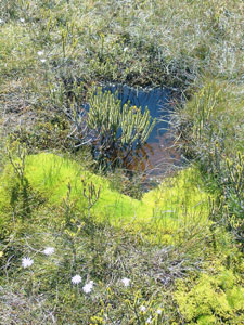 Miniature subalpine bog |
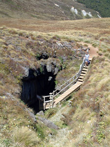 Opening of Luxmoore Cave |
The limestone rocks here are riddled with caves and sink-holes, small creeks disappearing into cracks and reappearing further downslope. Some of these caves are quite large and, armed with our torches, we explored the one open to the public. It was small, but impressively active with a many small formations (stalactites and shawls) dripping wet from the cave ceiling. Our path was blocked after about 40m, but the small stream continued on down a steeply angled fissure into the darkness. |
|
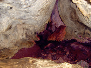 Formations in Luxmoore Cave |
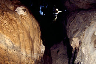 Looking back toward the cave opening |
|
Returning to the hut, we found that many more trampers had arrived, and were relaxing on the deck enjoying the views or soaking up the sun on the hut's helipad. What a pleasant summer day it had turned out to be. I was going to write how surprisingly quiet the hut had been with 50 people sleeping in its communal bunkrooms, but the fair Nello assured me that the ears were the only orifice not to contribute to the nocturnal chorus - sometimes it is good to be hearing-impaired! |
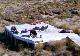 Trampers sunning themselves on the helipad |
 ... ...  ... ... ... ... |
Day 2: Luxmoore Hut to Iris Burn Hut - the alpine crossing
|
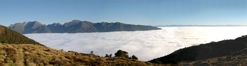 Sea of cloud over Lake Te Anau in the early morning sun |
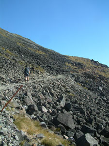 Scree and boulder slope on Mt Luxmore |
Soon we were circling around the scree and boulder slopes of Mt Luxmoore to reach a saddle on its eastern face where we left our packs for a quick scramble up to the top of the 1470m peak; time to stop and take in the 360º panorama of cloud and mountain. By the time we reached the saddle again, the warm sun had started to burn off the cloud layer and glimpses of the dark waters of the south fiord began to appear below us. |
|
 At Mt Luxmoore trig |
 Cloud starting to lift from the south fiord of Lake Te Anau |
|
 View over the south fiord |
 North-west face of Mt Luxmoore |
 Scree-binding cushion plants |
 Alpine daisies |
|
|||
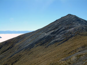
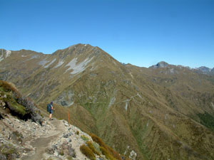
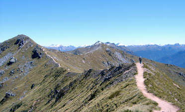
 Heading west from Mt Luxmoore |
 .. ..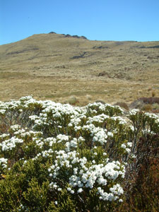 A few more alpine plants |
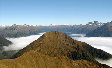
 Checking out the route around Jackson Peaks |
|
|
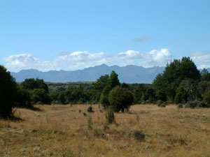
 View eastward toward Lake Manapouri (under cloud) |
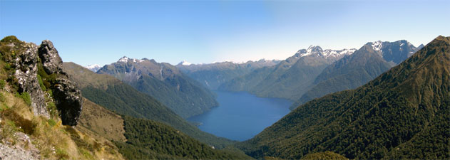 Panorama of the south fiord of Lake Te Anau in its mountain setting |
New alpine vistas continued to appear as we left the slope to follow a narrow ridgeline eastward, the tussock covered slopes plunging steeply on both sides into an enormous cirque on the south and down a steep valley to the lake on the north. The track continued to undulate and meander along this ridge before finally turning sharply south and arriving at Hanging Valley Shelter, whose narrow band of shade provided a good place for lunch. |
 Descent down from Hanging Valley |
|
 On the track along the ridge-line |
 Hanging Valley Shelter |
|
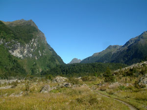
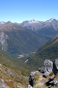 View down into the Iris Burn clearing |
 Start of the descent off the ridge |
At this spot we farewelled Lake Te Anau and greeted Lake Manapouri, whose northern shoreline now appeared in the distance to the south. The start of our steep descent to it had begun. We followed the track down the southfacing razorback ridge, lined with alpine herbs and daisies, before dropping off on the western side down a steep series of zigzag bends, plunging quickly back into the cool shade of the beech forest. As we descended the path, the beech trees framed a series of vignettes of Spire Peak on the far side of the valley. Soon we were deep in the forest, far below the ridge and following a sunlit babbling stream, as it raced down the narrow valley from the cirque above us. |
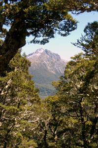 Beech-framed Spire Peak |
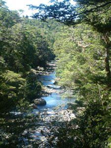
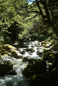 Sun-dappled mountain stream |
Resisting the temptation to soak our feet, we pushed on, descending a second series of seemingly interminable zigzags to descend rapidly to the valley floor, where a short walk brought us out to the beautiful secluded location of Iris Burn Hut, set at the end of a grassy clearing under steep rocky walls, with the impressive outline of Spire Peak looming over the head of this glacial valley. There was only one bad point about this site - the sandflies here were the worst that we had encountered so far on our trip! |
 Iris Burn Hut |
||
 |
 View from the deck of the hut |
|
||
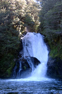 Waterfall - Upper Iris Burn |
 Spot the sunbather |
It was positively hot in this sheltered valley and, after an afternoon nap, we covered ourselves in sandfly repellant and wandered down through the cool beech forest along a track lined with native violets to the waterfall at the head of the valley. The water surged foaming white through a gap before plunging into a deep green pool and flowing crystal clear down the shallow stony bed of Iris Burn. Back at the hut again, we grabbed our bathers and wandered down to a small sandy beach on Iris Burn at the far end of the grassy flat. Surprisingly, no one else had found it, so we took the opportunity for a quick icy dip to freshen up and a relax on the sand in the pale evening light. |
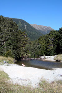 An icy dip in the Iris Burn |
|
Day 3: Iris Burn Hut to Moturau Hut - slow descent to the lake |
|
|
|
 Looking back up the valley over the Big Slip |
|
|
|||
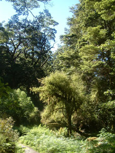 Beech forest opening |
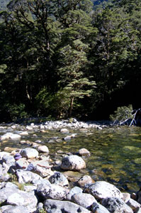
 Stoney course of Iris Burn |
 A forested section of the burn |
 Iris Burn flowing into Lake Manapouri |
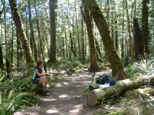 Lunch stop in the forest |
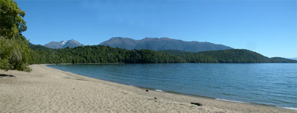
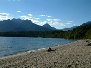
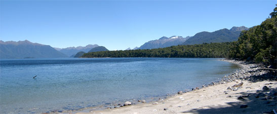 Shallow Bay - Lake Manapouri |
A short walk around the tree-lined edge of the bay led us to Moturau Hut on its grassy platform in the forest a few metres above the white sandy beach, with stunning views out over Lake Manapouri to the Cathedral Peaks and mountains beyond. After three days of walking without a shower, the lake was too tempting in the warm afternoon sun. We leapt (or crept) in for an invigorating dip in the "cold but not as cold as we had feared" water. The afternoon breeze kept the sandflies away and relaxed trampers spread themselves out over the length of the beach (if you do the Kepler in three days and rush out to Rainbow Reach, this is what you risk missing). |
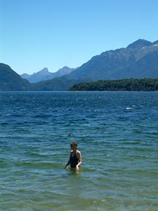 A well-earned dip in Lake Manapouri |
|
 Moturau Hut |
 Relaxing on the sandy beach at Moturau |
|
|
|
 Late afternoon sun - Lake Manapouri |
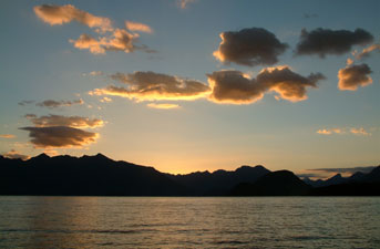 A brilliant end to another day on the Kepler |
Day 4: Moturau Hut to Control Gates - along the river It was another sunny start to the day - at least for those trampers who spent the night at Luxmoore Hut and were awaking to admire the sea of cloud below them, as we had done 2 days earlier. Down on the shores of Lake Manapouri we were underneath the cloud and woke to a grey mist blanketing the lake and forest. We were both a bit tired as we were in a smaller room this time and the phantom snorer, the nocturnal nose-blower and the five minute tosser and turner had chosen to join us, combining with a set of creaky bunks to keep even the hearing-impaired such as myself awake (NB a set of ear plugs should be added to camping gear in Great Walk huts!). It was a pity that the sandflies did not feel as tired, but, after a day of missed opportunities for them due to the wind, they were ready and waiting to attack anyone who ventured out of the hut in the early morning stillness to put on boots or whatever. |
|
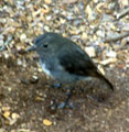
We left hastily and once on the move, they left us alone. The track took us straight back into the beech forest on the flattish lake shore, where we had the first of several close encounters with robins; these bold little birds wait for trampers to stir up the path and then hop around your feet collecting the tasty invertebrates that were exposed. We wondered whether they could be trained to sit on your shoulder and pick off the sandflies. |
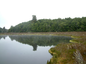 Amoeboid Mire (glacial depression) |
 ....... ....... .............. .............. |
|
Soon, we emerged at a wetland clearing where a short boardwalked side trip took us to a viewpoint over aptly named Amoeboid Mire, a swampy depression created by the melting of a large block of remnant glacial ice. Leaving the swamp to enter beech forest once again, we wound our way through an undulating moss-covered rocky, pot-holed landscape, as the track cut through areas of old glacial morain before crossing a swingbridge over Forest Burn. |
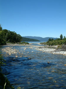
Soon we reached the steep high bank of the Wairau River which flows from Lake Te Anau to Lake Manapouri and beyond. The track followed this bank, with glimpses out through the forest silhouette of the wide, fast flowing river, until it eventually descended to a long wooden suspension bridge at Rainbow Reach. Those who had decided on an early finish to their tramp were able to cross the bridge and pick up a shuttle back to Te Anau. We who intended to do the whole circuit pushed on. The cloud had now dispersed and the cicadas had resumed their happy song. |
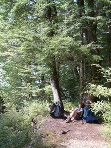 One last rest-stop in the forest |
|
 The broad channels of the Wairau |
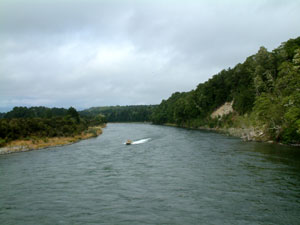 Jetboat on the Wairau |
|
 Deep quiet reach of the Wairau |
|
|
 Grassy clearing on the banks of the Wairau |
 Wairau riverscape |
|
 Nearing the end of the track |
Finally, the sight of the Lake Te Anau control gates told us that our 60 km tramp would soon be over. The early afternoon sun was warming up and our thoughts began to turn to a nice cold beer when a miracle occurred; an angel in a red bandanna appeared and offered us a cold Monteith's with lime and lemon! What better way to finish our long tramp (thanks Liz!!). |
 Nello, the angel and the beer |
 One last spot to admire the Wairau |
|
 |