| Walk 13 - Hump Ridge Track |
|
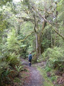
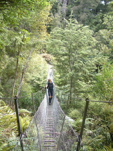
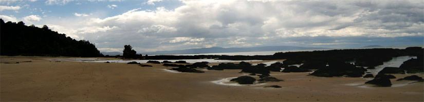
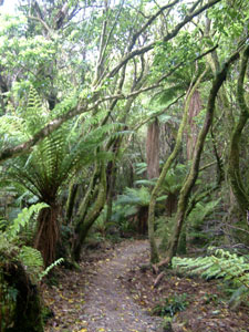
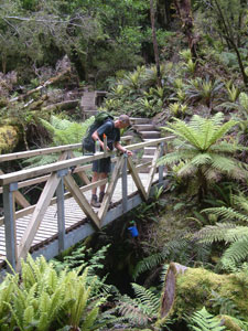
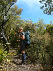
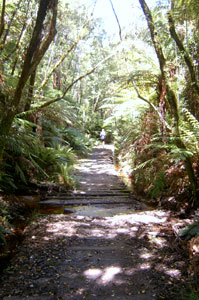
Day 1: Rarakau to Okaka Hut - the big climb The day was still and overcast as we set out from Rarakau on this 19 km stage; a short section through dense coastal forest brought us to a narrow gap in the long cliff-line of Te Waewae Bay, down which we descended to boulder lined Bluecliffs Beach. Heading westward along the beach, we crossed the industrial-strength swing bridge over the Waikoau River, past a small group of cribs (the kiwi term for a beach shack) and along a long isolated stretch of beach beneath low forest-clad cliffs. |
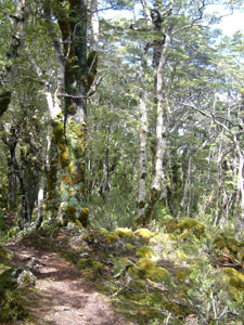
 Coastal forest near Rarakau |
|
 Stoney foreshore of Te Waewae Bay |
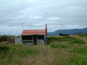 New Zealand beach house or "crib" |
|
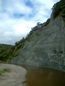 Blue cliffs of the Waikoau River mouth |
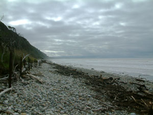
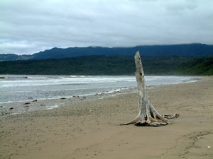
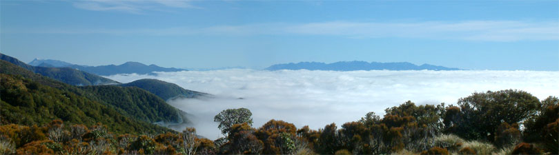
The grey sand of the beach was strewn with multi-coloured stones and lined with the bleached-white trunks and stumps of trees washed up on the shore. To the west, the cloud-covered ridgeline of Hump Ridge awaited us. |
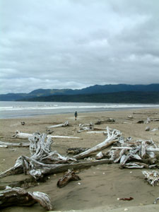 Dead trunks cast up on Bluecliffs Beach |
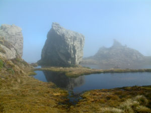
 Solitude |
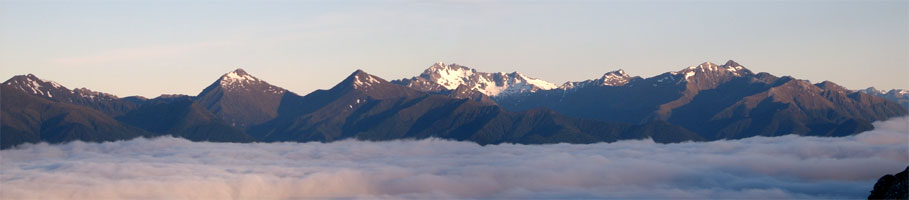
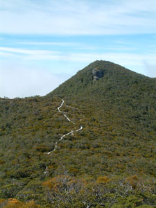
 Heading toward the cloud-covered Hump Ridge
|
|
|
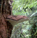 .......... .......... Some of the curious forest fungi |
|
|||
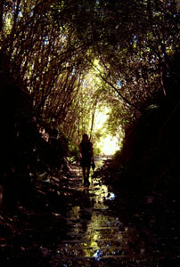
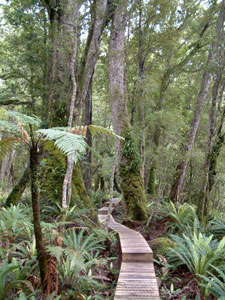 Boardwalk through the beech terrace |
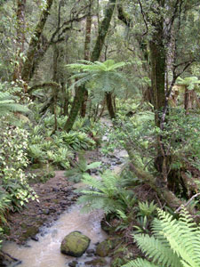 Deep in the Waitutu Forest |
 Topping up from a clear mountain stream |
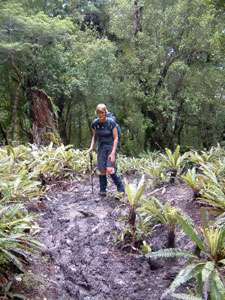 Another muddy stretch of track |
|
|||
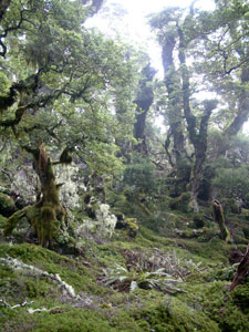 In the mossy forest below Stag Point |
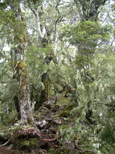 Sub-alpine mountain beech forest |
 Dwarf trees on Stag Point |
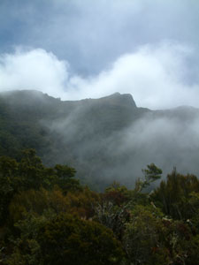 The misty outline of Hump Ridge |
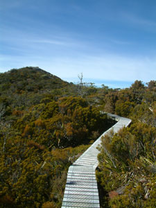
Cloudy wisps floated over from the west, sometimes obscuring, sometimes revealing a sunlit outline of Hump Ridge above us. After a rest and cuppa, we climbed back up to a circular boardwalk passing through the fragile alpine bog community high on the ridge. The alternating mist and sunlight illuminated the rocky tors and crystal clear tarns in a strange ethereal light - it was a truly special place to be. |
 Through a mist darkly |
|
 Looking up to the alpine tops of Hump Ridge |
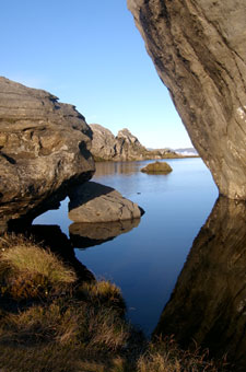
 Tors and tarns in the mist |
|
|
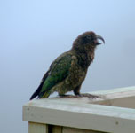 The cackling kea |
  |
|
|
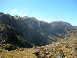
Day 2: Okaka Hut to Port Craig - mud, mud, mud We rose early to a spectacular sight - overnight Hump Ridge had transformed into a sunlit island in a sea of dense white cloud. A quick pre-breakfast climb back up to the rocky tors to better appreciate this was called for - to the north was another distant island formed by the Kaherekoau Range, while across the cloudy sea to the west, the morning sun bathed the snow-streaked peaks of the Cameron Mountains. |
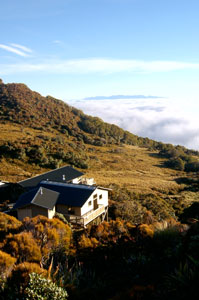 Dawn over Okaka Hut |
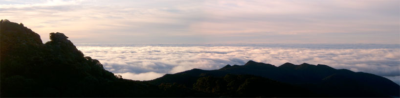 Hump Ridge Island in a sea of cloud |
|
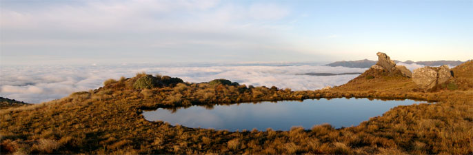 The tors and tarns of Hump ridge in the early morning light |
 |
|
It was a great start to the day and we set off for our long descent of Hump Ridge in good spirits, following another long section of boardwalk once more through the sub-alpine beech forest with its dwarfed moss- and lichen covered trunks. The change in vegetation would mostly be a reverse of our climb up the day before, with the addition of a few areas of low shrubs and alpine bog communities on some of the more exposed sections. |
 Hump Ridge and the Kaherekoau Range |
 Boardwak across subalpine shrubs |
The track undulated along the ridge, the more fragile sections on boards, with an occasional stretch of ankle deep mud. To the east the cloud persisted, while to the west it began to break up, exposing views across the green mantle of Waitutu Forest to the southern coastline and the outlines of a series of old marine terraces, once beaches but now verdant forest. To the west we could catch glimpses of Lake Poteriteri and its mountainous backdrop. |
|
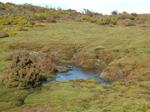 Bog community on lower Hump Ridge |
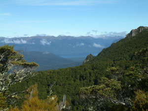 Looking across Waitutu Forest to Lake Poteriteri |
|
 Track up to Luncheon rock |
|
|
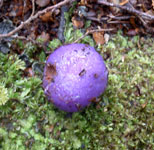
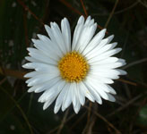
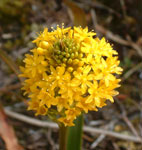
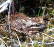 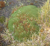 Two inhabitants of subalpine bogs |
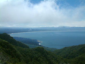 View over Te Waewae Bay from Luncheon Rock |
|
|
|||
 Lower level forest |
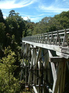 Edwin Burn Viaduct |
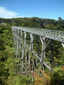 Percy Burn Viaduct (36m high) |
 Sandhill Viaduct |
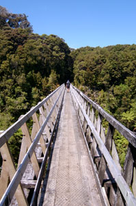
 Old tramway track near Percy Burn |
Leaving the viaducts behind, we followed the old tram track for another 4km, past the dense, spindly trunks of regenerating forest and through the occasional dark, damp cutting, until we eventually emerged at the hut complex at Port Craig. This ghost town was the hub of the logging venture and once was a thriving community based around a huge sawmill and port complex. Today, little remains but a few rusting boilers, winches, train wagons, the decaying posts of the old wharf and the occasional dead 1920s shoe. The bush has reclaimed the land from the failed ambitions of men and the sandflies inhabit this coastline in their thousands to ensure that now we only pass by. After demudding our boots and cleaning up, we wondered down to the beach where we finally saw a small pod of the elusive Hector's dolphin swimming around the old wharf pylons. This is the smallest and rarest dolphin species and it was great to be finally able to sit and watch them in the evening sun at the end of a hard day at the office. |
 Dark damp cutting on the old tramway |
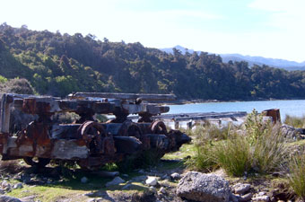 Old rail car at Port Craig |
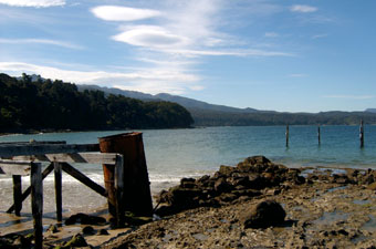 All that remains of Port Craig Wharf |
 Te Whata Point |
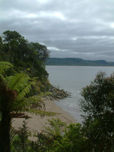
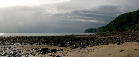
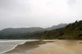
Yesterday had been the best day's weather in 3 months, the hut warden told us, but there would be no repeat. Although warm, fits and starts of light drizzle greeted us in the morning - it would be the pattern of the day. Leaving early after a fill of free porridge, we walked quickly through the forest to Te Whata Point, where we descended down the cliff onto the shore of Te Waewae Bay. There are two possible routes from this point, an inland route through more forest, and a shoreline route below the green-mantled cliffs of the Bay. Because of these backing cliffs, the latter can only be done safely at low tide - hence our early start. We had experienced enough forest on this walk and were starting to crave a dose of open spaces, marine ambience and negative ions. |
 Changing weather near Te Whata Point |
 Start of the low tide track from Te Whata to Ohoka |
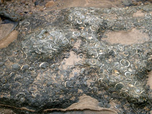 Fossiliferous rocks |
 Passing sun shower |
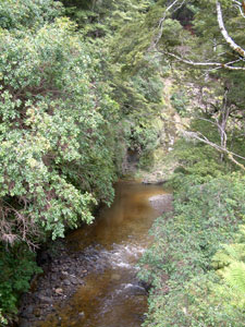
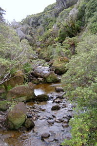 Ohoka Stream |
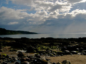
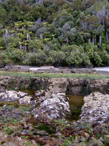 Marine ledges with forest backdrop |
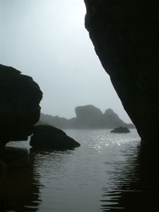
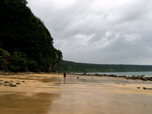
It was a great and varied coastal section, crossing at various times - broad sand and pebble beaches, areas of sand-buried boulders, long sections of sharp wave-eroded sandstone ribs and platforms running parallel to the coast, fossil-filled sedimentary beds and the occasional spill of smooth water-tumbled stones washed out on to the beach by streams cascading down through fern-lined gaps in the cliff. In places the rock platform had been eroded into a series of jagged rock islets, covered in beds of green-lipped mussels that made our mouthes water with thoughts of gastronomic delight. Remember though - only at low tide!! |
 One last look back to Hump Ridge |
|
|
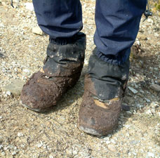 Not really that bad? |