Walk 6: Tongariro Northern Circuit

3D Map
Track Profile
Back to Photodiary


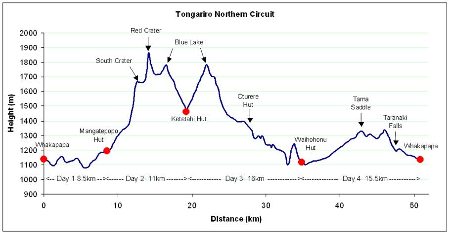
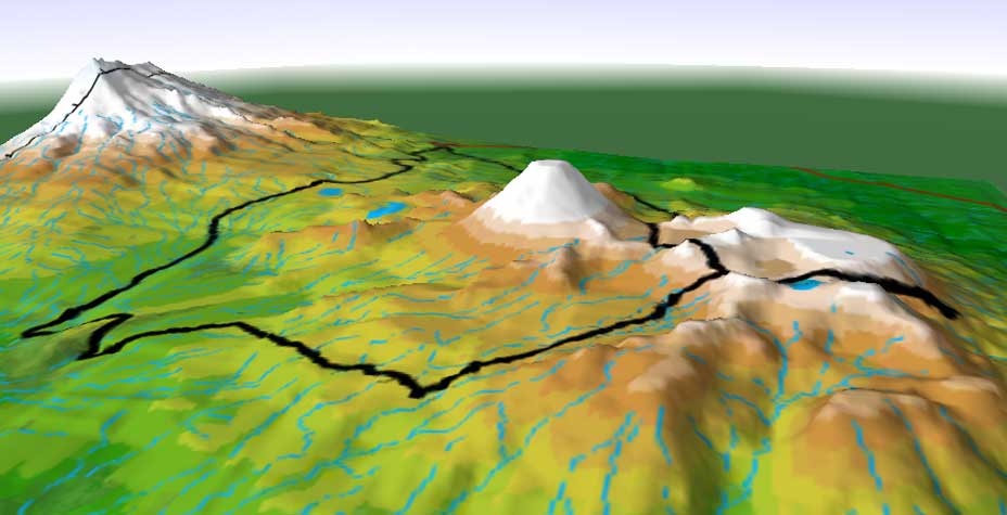
Track in black (clockwise) - overnight stops shown by hut symbol - total length of walk was 51 km


3D Map - Track (in black) starts and ends at 1140m - highest point 1886m on Red Crater - lowest point 1120m at Waihohonu Stream

Back to top .................... Back to Photodiary


Track Profile - Track starts and ends at 1140m - highest point 1886m on Red Crater - lowest point 1120m at Waihohonu Stream - overall climb is 1780m

Back to top .................... Back to Photodiary


Maps created using TUMONZ v2 by Vision Software